Arkansas
| NRHP reference number | Name | Image | Date designated | Locality | County | Notes |
|---|---|---|---|---|---|---|
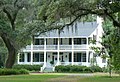
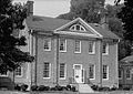
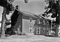
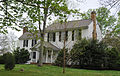
| 75000397 | Dortch Plantation |  | December 6, 1975 | Scott 34°42′55″N92°03′13″W / 34.71528°N 92.05361°W | Lonoke | Built 1904 |
| Florence Plantation | Harwood | Chicot | ||||
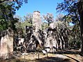
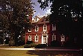
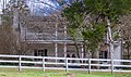
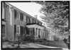
| 72000201 | Frog Level (Bussey, Arkansas) | 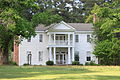 | September 2, 1972 | Bussey 33°16′43″N93°21′1″W / 33.27861°N 93.35028°W | Columbia | Built 1852 |
| Harris Plantation | Ashley | |||||
| Hollywood Plantation | Drew | [4] | ||||
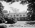
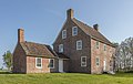
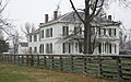
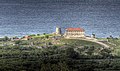
| 74000466 | Lakeport Plantation |  | November 20, 1974 | Shives 33°15′24″N91°09′19″W / 33.25667°N 91.15528°W | Chicot | Built 1850 |
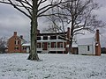
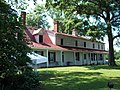
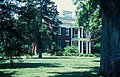
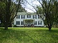
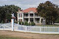
| 99000044 | Land's End Plantation | 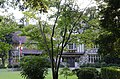 | January 27, 1999 | Scott 34°53′36″N92°07′08″W / 34.89333°N 92.11889°W | Pulaski | Built 1925 |
| 77000254 | Morrison Plantation | December 28, 1977 | Saginaw 34°16′12″N92°56′50″W / 34.27°N 92.94722°W | Hot Spring | Built 1854 | |
| Sunnyside Plantation | Lake Village | Chicot | Built c. 1820–1830 | |||
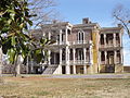
| 03001451 | Rosedale |  | January 21, 2004 | Arkadelphia 34°09′41″N93°06′07″W / 34.161389°N 93.101944°W | Clark | Built 1860 |