"},"founder":{"wt":""},"seat_type":{"wt":""},"seat":{"wt":""},"government_footnotes":{"wt":""},"leader_party":{"wt":""},"leader_title":{"wt":"Reeve"},"leader_name":{"wt":"Brian N. Johnson"},"unit_pref":{"wt":"Metric\n\n"},"area_footnotes":{"wt":""},"area_urban_footnotes":{"wt":""},"area_rural_footnotes":{"wt":""},"area_metro_footnotes":{"wt":""},"area_magnitude":{"wt":""},"area_note":{"wt":""},"area_water_percent":{"wt":""},"area_rank":{"wt":""},"area_blank1_title":{"wt":""},"area_blank2_title":{"wt":""},"area_total_km2":{"wt":"1643.69"},"area_land_km2":{"wt":""},"area_water_km2":{"wt":""},"area_urban_km2":{"wt":""},"area_rural_km2":{"wt":""},"area_metro_km2":{"wt":""},"area_blank1_km2":{"wt":""},"area_blank2_km2":{"wt":""},"area_total_ha":{"wt":""},"area_land_ha":{"wt":""},"area_water_ha":{"wt":""},"area_urban_ha":{"wt":""},"area_rural_ha":{"wt":""},"area_metro_ha":{"wt":""},"area_blank1_ha":{"wt":""},"area_blank2_ha":{"wt":""},"length_km":{"wt":""},"width_km":{"wt":""},"dimensions_footnotes":{"wt":""},"elevation_footnotes":{"wt":""},"elevation_m":{"wt":""},"population_footnotes":{"wt":""},"population_total":{"wt":"3320"},"population_as_of":{"wt":"[[2021 Canadian census|2021]]{{cite web | url=https://www150.statcan.gc.ca/t1/tbl1/en/tv.action?pid=9810000202&geocode=A000246 | title=Population and dwelling counts: Canada, provinces and territories, and census subdivisions (municipalities), Manitoba | publisher=[[Statistics Canada]] | date=February 9, 2022 | access-date=February 20, 2022}}"},"population_density_km2":{"wt":"auto"},"population_demonym":{"wt":""},"population_note":{"wt":""},"timezone1":{"wt":"[[North American Central Time Zone|CST]]"},"utc_offset1":{"wt":"-6"},"timezone1_DST":{"wt":"[[North American Central Time Zone|CDT]]"},"utc_offset1_DST":{"wt":"-5"},"postal_code_type":{"wt":""},"postal_code":{"wt":""},"area_code_type":{"wt":""},"area_code":{"wt":""},"iso_code":{"wt":""},"website":{"wt":"{{URL|bifrostriverton.ca}}"},"footnotes":{"wt":""},"blank_name_sec1":{"wt":"Formerly"},"blank_info_sec1":{"wt":"[[Rural Municipality of Bifrost|RM of Bifrost]] and [[Riverton, Manitoba|Village of Riverton]]"},"leader_name1":{"wt":"[[James Bezan]] ([[Selkirk—Interlake—Eastman]])"},"leader_title1":{"wt":"[[Member of Parliament (Canada)|MP]]"},"leader_name2":{"wt":"[[Derek Johnson (politician)|Derek Johnson]] ([[Interlake-Gimli]])"},"leader_title2":{"wt":"[[Legislative Assembly of Manitoba|MLA]]"}},"i":0}}]}" id="mwCQ">Rural municipality in Manitoba, Canada
Bifrost-Riverton | |
---|---|
Municipality of Bifrost-Riverton | |
Coordinates: 50°54′25″N97°13′16″W / 50.907°N 97.221°W | |
Country | Canada |
Province | Manitoba |
Region | Interlake |
Incorporated (amalgamated) | January 1, 2015 [1] |
Government | |
• Reeve | Brian N. Johnson |
• MP | James Bezan (Selkirk—Interlake—Eastman) |
• MLA | Derek Johnson (Interlake-Gimli) |
Area | |
• Total | 1,643.69 km2 (634.63 sq mi) |
Population | |
• Total | 3,320 |
• Density | 2.0/km2 (5.2/sq mi) |
Time zone | UTC-6 (CST) |
• Summer (DST) | UTC-5 (CDT) |
Formerly | RM of Bifrost and Village of Riverton |
Website | bifrostriverton |
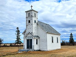
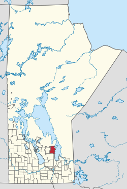
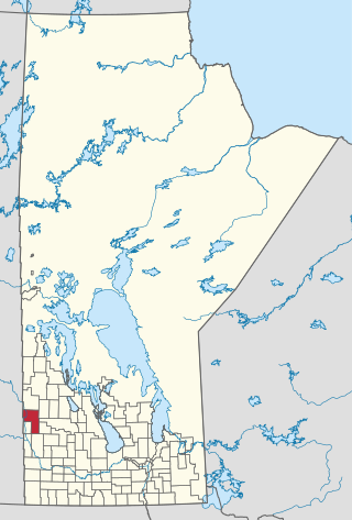
The Municipality of Bifrost-Riverton is a rural municipality (RM) in the Canadian province of Manitoba, and is one of the northernmost rural municipalities in the Interlake Region.
To the west is the Rural Municipality of Fisher and the Rural Municipality of Armstrong is located to the south as well as the Rural Municipality of Gimli. The Town of Arborg is located within the boundaries of Bifrost-Riverton but is not a part of the rural municipality.
Bifrost-Riverton was created out of the former Rural Municipality of Bifrost and Village of Riverton.
In 1875, the Government of Canada set aside Townships 18, 19, 20, 21, 22 and 23 from the shore of Lake Winnipeg to the beginning of Range 2E for Icelandic settlement. A growing population eventually necessitated the establishment of local government. As such, the Rural Municipality of Gimli was established in 1887. [3]
Thirty years later, on December 1, 1907, the Rural Municipality of Bifrost was incorporated out of the northern part of the RM of Gimli. [3] Bifrost took its name from Norse mythology, where Bifröst is the rainbow bridge that connects Midgard (Earth) and Asgard, the home of the gods. [4] [5]
The community of Lundi (Icelandic for 'grove of trees') [6] —later known as Icelandic River for the river that bisects it—was also established. [7] In 1910, the Canadian Pacific Railway (Winnipeg Beach subdivision) was extended to the community of Arborg, followed in 1914 by Lundi, whose name was changed to Riverton with the coming of the railway. [3] [6]
With the railway came another influx of population growth, resulting in the separation of the two large urban areas. On February 5, 1917, the Unincorporated Village District of Arborg was created, followed by its incorporation on January 1, 1964. [3]
On February 1, 1926, the Unincorporated Village District of Riverton was created on February 1, 1926, [3] followed by its incorporation as a village on December 31, 1951. [7]
On January 1, 2015, the RM of Bifrost and the Village of Riverton amalgamated to form the Municipality of Bifrost-Riverton. [1] [8] It was formed as a requirement of The Municipal Amalgamations Act , which mandated that municipalities with a population less than 1,000 amalgamate with one or more neighbouring municipalities by 2015. [9] The Government of Manitoba initiated these amalgamations in order for municipalities to meet the 1997 minimum population requirement of 1,000 to incorporate a municipality. [10] The amalgamation did not include the Town of Arborg, which is surrounded by Bifrost-Riverton.
The Town of Arborg is located within the boundaries of Bifrost-Riverton but is not a part of the rural municipality.
In the 2021 Census of Population conducted by Statistics Canada, Bifrost-Riverton had a population of 3,320 living in 1,200 of its 1,598 total private dwellings, a change of
The Rural Municipality of Bifrost is a former rural municipality (RM) in the Canadian province of Manitoba.
The Interlake Region is an informal geographic region of the Canadian province of Manitoba that lies roughly between Lake Winnipeg and Lake Manitoba in the Canadian province of Manitoba.
Arborg is a town located along the Icelandic River in Manitoba. The community is located 103 kilometres north of Winnipeg, at the junction of Manitoba Highways 7 and 68, in the Interlake Region of Manitoba, Canada. The town is surrounded by the Municipality of Bifrost - Riverton and has a population of 1,279 as of the 2021 Canadian census.
Riverton is an unincorporated urban community in the Municipality of Bifrost-Riverton within the Canadian province of Manitoba.
The Rural Municipality of Mossey River is a rural municipality (RM) in the Parkland Region of Manitoba, Canada, located at the south end of Lake Winnipegosis.
The Rural Municipality of Ellice-Archie is a rural municipality (RM) in the Canadian province of Manitoba.
The Municipality of Glenella – Lansdowne is a rural municipality (RM) in the Canadian province of Manitoba.
Grandview Municipality is a rural municipality (RM) in the Parkland Region of Manitoba, Canada. It is located in a valley between Duck Mountain Provincial Forest & Park and Riding Mountain National Park, which both lie partially within the RM's territory.
The Rural Municipality of Lakeshore is a rural municipality (RM) in the Parkland Region of Manitoba, Canada.
The Municipality of Lorne is a rural municipality (RM) in the Canadian province of Manitoba.
The Municipality of McCreary is a rural municipality (RM) in the Parkland Region of Manitoba, Canada.
The Municipality of Minitonas–Bowsman is a rural municipality (RM) in the Parkland Region of Manitoba, Canada. More precisely, it is located in the Swan Valley area.
The Municipality of Oakland – Wawanesa is a rural municipality (RM) in the Canadian province of Manitoba.
The Rural Municipality of Riding Mountain West is a rural municipality (RM) in the Canadian province of Manitoba. It is located in Manitoba's Parkland region, between Riding Mountain National Park near the province's western border with Saskatchewan.
Rossburn Municipality is a rural municipality (RM) in the Parkland Region of Manitoba, Canada.
The Municipality of Russell – Binscarth is a rural municipality (RM) in the Parkland Region of Manitoba, Canada. It is located in the far western part of the province and shares a border with the neighbouring province of Saskatchewan.
The Municipality of Two Borders is a rural municipality (RM) in the Canadian province of Manitoba. It is located in the extreme south-west corner of the province in the Westman Region.
The Rural Municipality of West Interlake is a rural municipality (RM) in the Canadian province of Manitoba.
Interlake-Gimli is a provincial electoral district in the Interlake region of Manitoba.
The Icelandic River is a river in the Interlake Region of Manitoba. Its headwaters are near the Spruce Lakes system located by Manitoba Highway 68.