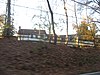
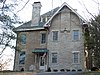
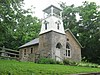
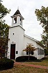
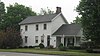
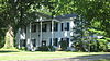
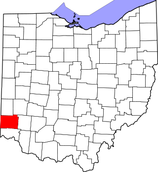
[3] Name on the Register [4] Image Date listed [5] Location City or town Description 1 Arlington School Arlington School December 16, 2022 (# 100008459 607 Carthage Ave. 39°13′05″N 84°27′17″W / 39.2181°N 84.4547°W / 39.2181; -84.4547 (Arlington School ) Arlington Heights 2 Joseph W. Baldwin House Joseph W. Baldwin House August 25, 1986 (# 86001628 217 Springfield Pike 39°13′18″N 84°28′25″W / 39.221667°N 84.473611°W / 39.221667; -84.473611 (Joseph W. Baldwin House ) Wyoming 3 Joseph and Cecilia Bappert House Joseph and Cecilia Bappert House August 29, 2016 (# 16000596 1550 Neeb Rd. 39°07′23″N 84°38′02″W / 39.123056°N 84.633889°W / 39.123056; -84.633889 (Joseph and Cecilia Bappert House ) Green Township 4 James Baxter House James Baxter House July 22, 1994 (# 94000774 2930 Fair Acres Dr. 39°11′33″N 84°25′57″W / 39.192500°N 84.432500°W / 39.192500; -84.432500 (James Baxter House ) Amberley 5 Becker House Becker House July 18, 1974 (# 74001522 179 W. Crescentville Rd. 39°18′06″N 84°28′28″W / 39.301667°N 84.474444°W / 39.301667; -84.474444 (Becker House ) Springdale 6 Benham Mound Benham Mound July 30, 1974 (# 74001508 Section 30 of the original Columbia Township, off Montgomery Rd. [6] 39°11′38″N 84°25′31″W / 39.193889°N 84.425278°W / 39.193889; -84.425278 (Benham Mound ) Amberley 7 George Bennett House George Bennett House May 29, 1975 (# 75001426 10281 Harrison Pike 39°14′45″N 84°46′58″W / 39.245833°N 84.782778°W / 39.245833; -84.782778 (George Bennett House ) Harrison 8 Blair House Blair House November 30, 1982 (# 82001466 7844 Remington Rd (at West St.) 39°13′42″N 84°21′34″W / 39.228333°N 84.359444°W / 39.228333; -84.359444 (Blair House ) Montgomery 9 Cyrus Broadwell House Cyrus Broadwell House May 29, 1975 (# 75001433 Northeast of Newtown at 3882 Mount Carmel Rd. 39°07′58″N 84°18′35″W / 39.132778°N 84.309722°W / 39.132778; -84.309722 (Cyrus Broadwell House ) Anderson Township 10 Jacob Bromwell House Jacob Bromwell House August 25, 1986 (# 86001629 69 Mt. Pleasant Ave. 39°13′24″N 84°28′47″W / 39.223333°N 84.479722°W / 39.223333; -84.479722 (Jacob Bromwell House ) Wyoming 11 Brown-Gorman Farm Brown-Gorman Farm August 1, 2012 (# 12000463 10052 Reading Rd. 39°14′42″N 84°25′28″W / 39.245000°N 84.424444°W / 39.245000; -84.424444 (Brown-Gorman Farm ) Evendale 12 Burchenal Mound Burchenal Mound May 29, 1975 (# 75001437 West of benchmark 659 above Mill Creek [7] : 84 39°15′38″N 84°28′23″W / 39.260694°N 84.473056°W / 39.260694; -84.473056 (Burchenal Mound ) Woodlawn 13 Wesley Butler Archeological District Wesley Butler Archeological District July 24, 1976 (# 76001446 Off U.S. Route 50 southwest of Elizabethtown [7] : 121 39°09′16″N 84°48′48″W / 39.154444°N 84.813333°W / 39.154444; -84.813333 (Wesley Butler Archeological District ) Whitewater Township 14 Hugh Campbell House Hugh Campbell House November 7, 1976 (# 76001448 332 Weathervane Rd. 39°15′03″N 84°48′43″W / 39.250833°N 84.811944°W / 39.250833; -84.811944 (Hugh Campbell House ) Harrison 15 Cheviot Fieldhouse Cheviot Fieldhouse April 1, 2009 (# 09000170 3729 Robb Ave. 39°09′22″N 84°37′12″W / 39.156111°N 84.620000°W / 39.156111; -84.620000 (Cheviot Fieldhouse ) Cheviot 16 Cincinnati and Whitewater Canal Tunnel Cincinnati and Whitewater Canal Tunnel May 25, 2001 (# 01000562 Parallel to Miami Ave., junction of Wamsley and Miami Ave. 39°09′18″N 84°44′58″W / 39.155000°N 84.749444°W / 39.155000; -84.749444 (Cincinnati and Whitewater Canal Tunnel ) Cleves and North Bend 17 Clough Creek and Sand Ridge Archeological District Clough Creek and Sand Ridge Archeological District October 1, 1974 (# 74001509 Along the ridge to the west of the Union Bridge [8] 39°06′46″N 84°23′48″W / 39.112778°N 84.396667°W / 39.112778; -84.396667 (Clough Creek and Sand Ridge Archeological District ) Anderson Township 18 Clovernook Clovernook June 18, 1973 (# 73001454 7000 Hamilton Ave. 39°13′12″N 84°32′56″W / 39.22°N 84.548889°W / 39.22; -84.548889 (Clovernook ) North College Hill 19 Colerain Works Archeological District Colerain Works Archeological District June 18, 1976 (# 76001445 Eastern bank of the Great Miami River , north of the site of Fort Dunlap [9] 39°17′53″N 84°39′36″W / 39.298°N 84.66°W / 39.298; -84.66 (Colerain Works Archeological District ) Colerain Township 20 Conrad Mound Archeological Site Conrad Mound Archeological Site June 20, 1975 (# 75001420 Off Rittenhouse Rd., southwest of Cleves [10] 39°08′49″N 84°46′20″W / 39.146944°N 84.772222°W / 39.146944; -84.772222 (Conrad Mound Archeological Site ) Miami Township 21 Dravo Gravel Site Dravo Gravel Site December 22, 1978 (# 78002083 On a bluff above the Great Miami River , north of Cleves [11] 39°11′28″N 84°45′00″W / 39.191111°N 84.75°W / 39.191111; -84.75 (Dravo Gravel Site ) Miami Township 22 Dunlap Archeological District Dunlap Archeological District October 21, 1975 (# 75001421 Eastern bank of the Great Miami River , near the junction of Dunlap and Great Miami River Rds. [12] 39°17′36″N 84°39′12″W / 39.293333°N 84.653333°W / 39.293333; -84.653333 (Dunlap Archeological District ) Colerain Township Also known as Fort Dunlap [4] 23 William Edwards Farmhouse William Edwards Farmhouse October 4, 1989 (# 89001455 3851 Edwards Rd. 39°07′41″N 84°20′30″W / 39.128056°N 84.341667°W / 39.128056; -84.341667 (William Edwards Farmhouse ) Newtown 24 Eighteen Mile House Eighteen Mile House October 10, 1975 (# 75001427 2 mi (3.2 km) southeast of Harrison at Harrison Pike and Patriot Dr. 39°14′18″N 84°46′06″W / 39.238333°N 84.768333°W / 39.238333; -84.768333 (Eighteen Mile House ) Harrison Township 25 Elliott House Elliott House October 29, 1976 (# 76001451 9352 Given Rd., south of Remington 39°13′23″N 84°19′16″W / 39.223056°N 84.321111°W / 39.223056; -84.321111 (Elliott House ) Indian Hill 26 Charles Fay House Charles Fay House August 25, 1986 (# 86001630 325 Reily Rd. 39°13′41″N 84°28′46″W / 39.228056°N 84.479444°W / 39.228056; -84.479444 (Charles Fay House ) Wyoming 27 Eliphalet Ferris House Eliphalet Ferris House May 29, 1975 (# 75001431 3915 Plainville Rd. 39°08′50″N 84°22′42″W / 39.147222°N 84.378333°W / 39.147222; -84.378333 (Eliphalet Ferris House ) Mariemont 28 Joseph Ferris House Joseph Ferris House June 30, 1975 (# 75001417 5729 Dragon Way 39°08′28″N 84°23′31″W / 39.141111°N 84.391944°W / 39.141111; -84.391944 (Joseph Ferris House ) Fairfax 29 Glendale Historic District Glendale Historic District July 20, 1976 (# 76001447 State Route 747 ; Roughly bounded by OH 4/Springfield Pike, Oak Rd., RR right of way, Coral, Sharon and Morse Aves. 39°16′17″N 84°27′49″W / 39.271389°N 84.463611°W / 39.271389; -84.463611 (Glendale Historic District ) Glendale Second set of addresses represent a boundary alteration approved December 18, 2018 30 Glendale Police Station Glendale Police Station March 27, 1975 (# 75001425 305 E. Sharon Ave. 39°16′18″N 84°27′30″W / 39.271667°N 84.458333°W / 39.271667; -84.458333 (Glendale Police Station ) Glendale 31 Greenhills Historic District Greenhills Historic District January 12, 1989 (# 88003066 Roughly Damon Rd., Enfield St., Farragut Rd., Flanders Ln., Winton Rd., Andover Rd., Burley Cir., and Cromwell Rd. 39°15′50″N 84°31′28″W / 39.263889°N 84.524444°W / 39.263889; -84.524444 (Greenhills Historic District ) Greenhills 32 Hahn Field Archeological District Hahn Field Archeological District October 29, 1974 (# 74001519 Above the Little Miami River in Clear Creek Park, 0.4 miles (0.64 km) north of State Route 32 [13] 39°07′38″N 84°22′47″W / 39.127222°N 84.379722°W / 39.127222; -84.379722 (Hahn Field Archeological District ) Anderson Township 33 William Henry Harrison Tomb State Memorial William Henry Harrison Tomb State Memorial November 10, 1970 (# 70000499 Mount Nebo on State Route 128 39°09′06″N 84°45′08″W / 39.151667°N 84.752222°W / 39.151667; -84.752222 (William Henry Harrison Tomb State Memorial ) North Bend 34 Harrison-Landers House Harrison-Landers House May 29, 1975 (# 75001434 3881 Newtown Rd., north of Newtown 39°08′03″N 84°21′18″W / 39.134167°N 84.355°W / 39.134167; -84.355 (Harrison-Landers House ) Anderson Township 35 Elmer Hess House Elmer Hess House August 25, 1986 (# 86001633 333 Springfield Pike 39°13′27″N 84°28′24″W / 39.224167°N 84.473333°W / 39.224167; -84.473333 (Elmer Hess House ) Wyoming 36 Jediah Hill Covered Bridge Jediah Hill Covered Bridge March 28, 1973 (# 73001460 7 mi (11 km) north of Cincinnati off U.S. Route 127 on Covered Bridge Rd. 39°15′08″N 84°32′44″W / 39.25233°N 84.54546°W / 39.25233; -84.54546 (Jediah Hill Covered Bridge ) Springfield Township 37 Jefferson Schoolhouse Jefferson Schoolhouse March 17, 1976 (# 76001450 Indian Hill and Drake Rds. 39°09′40″N 84°20′49″W / 39.161111°N 84.346944°W / 39.161111; -84.346944 (Jefferson Schoolhouse ) Indian Hill 38 Jehu John House Jehu John House October 31, 1975 (# 75001428 East of Harrison on Stone Dr. 39°15′28″N 84°47′48″W / 39.257778°N 84.796667°W / 39.257778; -84.796667 (Jehu John House ) Harrison 39 Josiah Kirby House Josiah Kirby House August 25, 1986 (# 86001634 65 Oliver Rd. 39°13′54″N 84°28′27″W / 39.231667°N 84.474167°W / 39.231667; -84.474167 (Josiah Kirby House ) Wyoming 40 Gretchen Kroger Barnes Graf House Gretchen Kroger Barnes Graf House February 4, 2011 (# 10001213 9575 Cunningham Rd. 39°11′56″N 84°18′18″W / 39.198889°N 84.305°W / 39.198889; -84.305 (Gretchen Kroger Barnes Graf House ) Indian Hill 41 Othniel Looker House Othniel Looker House June 5, 1975 (# 75001429 10580 Marvin Rd., north of Harrison 39°16′26″N 84°48′11″W / 39.273750°N 84.803056°W / 39.273750; -84.803056 (Othniel Looker House ) Harrison Township 42 Luethstrom-Hurin House Luethstrom-Hurin House August 25, 1986 (# 86001635 30 Reily Rd. 39°13′42″N 84°28′25″W / 39.228333°N 84.473611°W / 39.228333; -84.473611 (Luethstrom-Hurin House ) Wyoming 43 Madeira Railroad Depot Upload image October 11, 2022 (# 100008258 7701 Railroad Ave. 39°11′17″N 84°21′48″W / 39.1881°N 84.3632°W / 39.1881; -84.3632 (Madeira Railroad Depot ) Madeira 44 Main Theatre Main Theatre December 27, 2017 (# 100001934 7428 Hamilton Ave. 39°13′52″N 84°32′54″W / 39.231232°N 84.548293°W / 39.231232; -84.548293 (Main Theatre ) Mt. Healthy 45 Mariemont Embankment and Village Site Mariemont Embankment and Village Site October 16, 1974 (# 74001517 Southern side of Mariemont, above the Little Miami River [14] 39°08′27″N 84°22′45″W / 39.140833°N 84.379167°W / 39.140833; -84.379167 (Mariemont Embankment and Village Site ) Mariemont 46 Mariemont Historic District Mariemont Historic District July 24, 1979 (# 79001862 U.S. Route 50 ; also bordering both sides of U.S. Route 50 , bounded by Westover industrial section, Beech St., Murray and Grove Aves., and the Little Miami River 39°08′35″N 84°22′51″W / 39.143056°N 84.380833°W / 39.143056; -84.380833 (Mariemont Historic District ) Mariemont Declared a National Historic Landmark District on March 29, 2007 under the name of "Village of Mariemont". Second set of boundaries represents the increased boundaries of the National Historic Landmark District. 47 Mater Dei Chapel Upload image March 4, 2024 (# 100010003 Mount St. Joseph University, 395 Neeb Road 39°05′44″N 84°38′16″W / 39.0955°N 84.6379°W / 39.0955; -84.6379 (Mater Dei Chapel ) Delhi Township Incorrectly listed as being in Cincinnati. 48 Mathew Mound Mathew Mound May 29, 1975 (# 75001424 Atop the hill on the northern side of Oak Rd. [7] : 83 39°15′44″N 84°26′34″W / 39.262361°N 84.442639°W / 39.262361; -84.442639 (Mathew Mound ) Glendale 49 Thomas Miller House Thomas Miller House November 2, 2000 (# 00001294 11294 U.S. Route 50 39°09′36″N 84°48′55″W / 39.16°N 84.815278°W / 39.16; -84.815278 (Thomas Miller House ) Whitewater Township 50 Miller-Leuser Log House Miller-Leuser Log House August 30, 1974 (# 74001511 Clough Pike and Newton Rd. in Turpin Hills 39°06′06″N 84°22′07″W / 39.101667°N 84.368611°W / 39.101667; -84.368611 (Miller-Leuser Log House ) Anderson Township 51 Montgomery Saltbox Houses Montgomery Saltbox Houses July 28, 1987 (# 87001254 7789 and 7795 Cooper Rd. 39°13′35″N 84°21′24″W / 39.226444°N 84.356667°W / 39.226444; -84.356667 (Montgomery Saltbox Houses ) Montgomery 52 Charles H. Moore House Charles H. Moore House August 25, 1986 (# 86001636 749 Stout Ave. 39°13′55″N 84°28′11″W / 39.231944°N 84.469722°W / 39.231944; -84.469722 (Charles H. Moore House ) Wyoming 53 Mt. Healthy Public School Mt. Healthy Public School May 2, 1985 (# 85000946 Compton and Harrison Aves. 39°13′58″N 84°33′00″W / 39.232778°N 84.55°W / 39.232778; -84.55 (Mt. Healthy Public School ) Mt. Healthy 54 Mt. Nebo Archeological District Mt. Nebo Archeological District March 3, 1975 (# 75001435 Along the Great Miami River , west of North Bend [14] 39°08′42″N 84°47′31″W / 39.145°N 84.791944°W / 39.145; -84.791944 (Mt. Nebo Archeological District ) Miami Township 55 Norwood Mound Norwood Mound May 2, 1974 (# 74001520 Off Indian Mound Ave. [14] 39°10′04″N 84°26′45″W / 39.167861°N 84.445833°W / 39.167861; -84.445833 (Norwood Mound ) Norwood 56 Norwood Municipal Building Norwood Municipal Building March 11, 1980 (# 80003093 4645 Montgomery Rd. 39°09′42″N 84°27′22″W / 39.161667°N 84.456111°W / 39.161667; -84.456111 (Norwood Municipal Building ) Norwood 57 Nurre-Royston House Nurre-Royston House January 8, 2009 (# 08001295 4330 Errun Ln. 39°09′49″N 84°29′39″W / 39.163611°N 84.494167°W / 39.163611; -84.494167 (Nurre-Royston House ) St. Bernard 58 Odd Fellows' Cemetery Mound Odd Fellows' Cemetery Mound June 18, 1973 (# 73001474 Along Round Bottom Rd. [15] 39°07′49″N 84°21′36″W / 39.130333°N 84.36°W / 39.130333; -84.36 (Odd Fellows' Cemetery Mound ) Newtown 59 Old Gothic Barns Old Gothic Barns July 20, 1976 (# 76001438 6058 Colerain Ave. in White Oak East 39°12′13″N 84°34′49″W / 39.203611°N 84.580278°W / 39.203611; -84.580278 (Old Gothic Barns ) Green Township 60 Professor William Pabodie House Professor William Pabodie House August 25, 1986 (# 86001638 731 Brooks Ave. 39°13′52″N 84°28′35″W / 39.231111°N 84.476389°W / 39.231111; -84.476389 (Professor William Pabodie House ) Wyoming 61 Perin Village Site Perin Village Site March 25, 1977 (# 77001067 0.3 miles (0.48 km) northwest of the Odd Fellows' Cemetery Mound [16] 39°07′49″N 84°21′36″W / 39.130333°N 84.36°W / 39.130333; -84.36 (Perin Village Site ) Newtown 62 Pine Meer Pine Meer November 30, 1982 (# 82001468 5336 Cleves-Warsaw Pike, west of Cincinnati 39°07′13″N 84°37′04″W / 39.120278°N 84.617778°W / 39.120278; -84.617778 (Pine Meer ) Green Township 63 John C. Pollock House John C. Pollock House August 25, 1986 (# 86001639 88 Reily Rd. 39°13′43″N 84°28′35″W / 39.228611°N 84.476389°W / 39.228611; -84.476389 (John C. Pollock House ) Wyoming 64 Frederick and Harriet Rauh House Upload image September 6, 2016 (# 16000597 10068 Leacrest Rd. 39°14′58″N 84°29′18″W / 39.249306°N 84.488333°W / 39.249306; -84.488333 (Frederick and Harriet Rauh House ) Woodlawn 65 Rennert Mound Archeological District Rennert Mound Archeological District March 4, 1975 (# 75001422 Western side of Elizabethtown [14] 39°09′34″N 84°48′30″W / 39.1595°N 84.808444°W / 39.1595; -84.808444 (Rennert Mound Archeological District ) Whitewater Township 66 W.C. Retszch House W.C. Retszch House August 25, 1986 (# 86001642 129 Springfield Pike 39°13′14″N 84°28′26″W / 39.220556°N 84.473889°W / 39.220556; -84.473889 (W.C. Retszch House ) Wyoming 67 Riddle-Friend House Riddle-Friend House August 25, 1986 (# 86001643 507 Springfield Pike 39°13′37″N 84°28′23″W / 39.226944°N 84.473056°W / 39.226944; -84.473056 (Riddle-Friend House ) Wyoming 68 Roudebush Farm Roudebush Farm June 17, 1976 (# 76001449 8643 Kilby Rd., southeast of Harrison 39°14′10″N 84°47′01″W / 39.236111°N 84.783611°W / 39.236111; -84.783611 (Roudebush Farm ) Harrison Township 69 St. Francis Seminary St. Francis Seminary March 5, 1999 (# 99000275 10290 Mill Rd. 39°15′28″N 84°32′32″W / 39.257778°N 84.542222°W / 39.257778; -84.542222 (St. Francis Seminary ) Springfield Township 70 Salem Methodist Church Complex Salem Methodist Church Complex April 29, 1982 (# 82003586 6137 Salem Rd. 39°04′31″N 84°23′29″W / 39.075278°N 84.391389°W / 39.075278; -84.391389 (Salem Methodist Church Complex ) Anderson Township 71 Louis Sawyer House Louis Sawyer House August 25, 1986 (# 86001645 315 Reily Rd. 39°13′41″N 84°28′40″W / 39.228056°N 84.477778°W / 39.228056; -84.477778 (Louis Sawyer House ) Wyoming 72 Shawnee Lookout Archeological District Shawnee Lookout Archeological District December 2, 1974 (# 74001516 In Shawnee Lookout, southwest of Cleves [14] 39°07′30″N 84°47′56″W / 39.125°N 84.798889°W / 39.125; -84.798889 (Shawnee Lookout Archeological District ) Miami Township 73 Edwin M. Shield's House Edwin M. Shield's House April 1, 1982 (# 82003592 220 Riverside Ave. 39°16′01″N 84°15′44″W / 39.266944°N 84.262222°W / 39.266944; -84.262222 (Edwin M. Shield's House ) Loveland 74 Smith-Jessup House Smith-Jessup House August 23, 1984 (# 84003717 1038 W. North Bend Rd. in Finneytown 39°12′07″N 84°31′47″W / 39.201944°N 84.529722°W / 39.201944; -84.529722 (Smith-Jessup House ) Springfield Township 75 State Line Archeological District State Line Archeological District July 24, 1975 (# 75001423 Straddling the Ohio/Indiana border, 2 miles (3.2 km) north of the Ohio River [17] 39°08′15″N 84°49′12″W / 39.1375°N 84.82°W / 39.1375; -84.82 (State Line Archeological District ) Whitewater Township Extends into Dearborn County, Indiana 76 Edward R. Stearns House Edward R. Stearns House August 25, 1986 (# 86001648 333 Oliver Rd. 39°13′54″N 84°28′45″W / 39.231667°N 84.479167°W / 39.231667; -84.479167 (Edward R. Stearns House ) Wyoming 77 William Stearns House William Stearns House August 25, 1986 (# 86001649 320 Reily Rd. 39°13′46″N 84°28′44″W / 39.229444°N 84.478889°W / 39.229444; -84.478889 (William Stearns House ) Wyoming 78 Sunny Knolls-Gordon E. Pape House Sunny Knolls-Gordon E. Pape House June 9, 2006 (# 06000484 8725 Blome Rd. 39°12′55″N 84°20′42″W / 39.215278°N 84.345000°W / 39.215278; -84.345000 (Sunny Knolls-Gordon E. Pape House ) Indian Hill 79 John Tangeman House John Tangeman House August 25, 1986 (# 86001650 550 Larchmont 39°13′39″N 84°28′31″W / 39.2275°N 84.475278°W / 39.2275; -84.475278 (John Tangeman House ) Wyoming 80 Gerald B. and Beverley Tonkens House Gerald B. and Beverley Tonkens House October 3, 1991 (# 91001414 6980 Knoll Rd. 39°11′43″N 84°24′54″W / 39.195278°N 84.415°W / 39.195278; -84.415 (Gerald B. and Beverley Tonkens House ) Amberley 81 Turpin site Turpin site December 27, 1974 (# 74001514 On the old Turpin farmstead at 3295 Turpin Ln. [6] [18] 39°07′23″N 84°22′19″W / 39.123°N 84.372°W / 39.123; -84.372 (Turpin site ) Anderson Township 82 Twelve Mile House Twelve Mile House September 1, 1976 (# 76001452 11006 Reading Rd. 39°16′07″N 84°24′46″W / 39.268611°N 84.412778°W / 39.268611; -84.412778 (Twelve Mile House ) Sharonville 83 Twin Oaks Twin Oaks May 29, 1975 (# 86001640 629 Liddle Lane 39°13′46″N 84°28′53″W / 39.229444°N 84.481389°W / 39.229444; -84.481389 (Twin Oaks ) Wyoming Also known as the Robert Reily House [4] 84 United Brethren in Christ United Brethren in Christ June 13, 1978 (# 78002082 South of Cincinnati off Interstate 275 39°03′12″N 84°22′29″W / 39.053333°N 84.374722°W / 39.053333; -84.374722 (United Brethren in Christ ) Anderson Township 85 United Methodist Church United Methodist Church December 4, 1975 (# 75001432 5125 Drake Rd., northeast of Mariemont 39°09′37″N 84°20′49″W / 39.160278°N 84.346944°W / 39.160278; -84.346944 (United Methodist Church ) Indian Hill 86 United States Playing Card Company Complex United States Playing Card Company Complex June 30, 2015 (# 15000044 4590 Beech St. 39°09′32″N 84°26′33″W / 39.158889°N 84.442500°W / 39.158889; -84.442500 (United States Playing Card Company Complex ) Norwood 87 Universalist Church Historic District Universalist Church Historic District December 2, 1970 (# 70000498 Montgomery Rd. from 9433 north to Remington Ave. 39°13′41″N 84°21′15″W / 39.228056°N 84.354167°W / 39.228056; -84.354167 (Universalist Church Historic District ) Montgomery 88 Village Historic District Village Historic District August 25, 1986 (# 86001626 Roughly bounded by Wentworth Ave., the former B&O railroad tracks, E. Mills Ave., and Springfield Pike 39°13′27″N 84°28′11″W / 39.224167°N 84.469722°W / 39.224167; -84.469722 (Village Historic District ) Wyoming 89 Village of Addyston Historic District Village of Addyston Historic District September 13, 1991 (# 91001388 Roughly along Main, Sekitan, Church, 1st, and 2nd Sts., and the Three Rivers Parkway 39°08′14″N 84°42′47″W / 39.137222°N 84.713056°W / 39.137222; -84.713056 (Village of Addyston Historic District ) Addyston 90 Waldschmidt-Camp Dennison District Waldschmidt-Camp Dennison District March 7, 1973 (# 73001471 7509 and 7567 Glendale-Milford Rd. in Camp Dennison 39°11′28″N 84°17′26″W / 39.191111°N 84.290556°W / 39.191111; -84.290556 (Waldschmidt-Camp Dennison District ) Symmes Township 91 John Aston Warder House John Aston Warder House May 19, 1978 (# 78002084 Between holes 10 and 11 of the Aston Oaks Golf Course, off Shady Lane east of central North Bend [19] 39°09′12″N 84°43′32″W / 39.153333°N 84.725556°W / 39.153333; -84.725556 (John Aston Warder House ) North Bend Warder's gardens, now a golf course, contribute to the historic designation. [4] 92 Washington Heights School Washington Heights School July 30, 1975 (# 75001430 8100 Given Rd. 39°12′11″N 84°19′26″W / 39.203056°N 84.323889°W / 39.203056; -84.323889 (Washington Heights School ) Indian Hill 93 James Whallon House James Whallon House May 17, 1973 (# 73001473 11000 Winton Rd. 39°16′17″N 84°31′20″W / 39.271389°N 84.522222°W / 39.271389; -84.522222 (James Whallon House ) Greenhills 94 Whitewater Shaker Settlement Whitewater Shaker Settlement January 21, 1974 (# 74001518 11813, 11347, and 11081 Oxford Rd., north of New Haven 39°17′40″N 84°44′34″W / 39.294444°N 84.742778°W / 39.294444; -84.742778 (Whitewater Shaker Settlement ) Crosby Township 95 Wilder-Swaim House Wilder-Swaim House May 20, 1981 (# 81000438 7650 Cooper Rd. 39°13′41″N 84°21′36″W / 39.228056°N 84.36°W / 39.228056; -84.36 (Wilder-Swaim House ) Montgomery 96 W. L. Williams House W. L. Williams House March 25, 1977 (# 77001066 280 Anderson Ferry Rd. 39°05′18″N 84°37′06″W / 39.088333°N 84.618333°W / 39.088333; -84.618333 (W. L. Williams House ) Delhi Township 97 Charles Woodruff House Charles Woodruff House August 25, 1986 (# 86001651 411 Springfield Pike 39°13′32″N 84°28′27″W / 39.2255°N 84.47425°W / 39.2255; -84.47425 (Charles Woodruff House ) Wyoming 98 Wyoming Presbyterian Church Wyoming Presbyterian Church March 3, 1980 (# 80003094 Wyoming and Burns Aves. 39°13′36″N 84°28′06″W / 39.226667°N 84.468333°W / 39.226667; -84.468333 (Wyoming Presbyterian Church ) Wyoming 99 Yost Tavern Yost Tavern May 6, 1993 (# 93000406 7872 Cooper Rd. 39°13′36″N 84°21′15″W / 39.226556°N 84.354181°W / 39.226556; -84.354181 (Yost Tavern ) Montgomery