
Upper Arlington, often known by its initials U.A., is a city in Franklin County, Ohio, United States, on the northwest side of the Columbus metropolitan area. The Old Arlington neighborhood is listed on the National Register of Historic Places. As of 2010, the population was estimated to be 33,771.
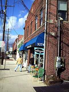
Clintonville is a neighborhood in north-central Columbus, Ohio, United States with around 30,000 residents. Its borders, associated with the Clintonville Area Commission, are the Olentangy River on the west, Glen Echo Creek to the south, a set of railroad tracks to the east, and on the north by the Worthington city limits.

Victorian Village is a neighborhood in Columbus, Ohio, United States, north and near west of downtown. It is an established neighborhood built when a streetcar line first ran along Neil Avenue around 1900 with a fair number of established trees for an urban setting. To preserve, protect and enhance the unique architectural and historical features, the Victorian Village Historic District was established in 1973. Columbus Monthly named this neighborhood the top place to live for Arts and Entertainment, with fun right around the corner in the Short North as its neighborhood hangout.

Hilltop is one of the largest neighborhoods in Columbus, Ohio, which is located west of the Franklinton area. The Greater Hilltop area contains newer and historic neighborhoods, schools, various stores, industrial areas, and recreational facilities. The development pattern is considered a distinct suburb. The majority of the area is predominantly single family residential.

Franklinton is a neighborhood in Columbus, Ohio, just west of its downtown. Settled in 1797, Franklinton is the first American settlement in Franklin County, and was the county seat until 1824. As the city of Columbus grew, the city annexed and incorporated the existing settlement in 1859. Franklinton is bordered by the Scioto River on the north and east, Harmon Avenue on the east, Stimmel Road and Greenlawn Avenue on the south, and Interstate 70 on the west. Its main thoroughfare is West Broad Street, one of the city's two main roads.

The Columbus and Franklin County Metro Parks are a group of 19 metropolitan parks in and around Columbus, Ohio. They are officially organized into the Columbus and Franklin County Metropolitan Park District. The Metro Parks system was organized in 1945 under Ohio Revised Code Section 1545 as a separate political division of the state of Ohio. The Metro Parks are overseen by a Board of Park Commissioners consisting of three citizens appointed to three-year terms without compensation by the Judge of the Probate Court of Franklin County, Ohio. The Board in turn appoints an Executive Director responsible for operations and management of the parks.

Olentangy West is a neighborhood approximately 5 miles (8 km) northwest of downtown Columbus, Ohio, United States. Also called West Olentangy, it is generally bordered by West Henderson Road on the north, the Olentangy River and Clintonville on the east, Kinnear Road on the south, and Upper Arlington on the west. The area is primarily residential, although the large Riverside Methodist Hospital and the headquarters for Chemical Abstracts Service are located within its boundaries. Additionally, the west campus of The Ohio State University is located within the southern boundary of the area.
The Near East Side is a neighborhood located near downtown Columbus, Ohio, made up of several neighborhoods: Mount Vernon, King-Lincoln Bronzeville, Eastgate, Franklin Park, Nelson Park, Olde Towne East, and Woodland Park.
West Columbus, sometimes referred to as westside or the West Side, is a neighborhood in Columbus, Ohio, United States. Unlike other Columbus neighborhoods, it is a broad geographical term used by locals rather than a subdivision or suburb. West Columbus is defined as the entire southwest side of Columbus, bordered on the north by interstates 70 and 670, within Interstate 71 on the east, and on the south and west by the city limits that reach several miles to the outside of the I-270 outerbelt. It covers the ZIP Codes 43223, 43204, 43228, and 43222.
Columbus, the state capital and Ohio's largest city, has numerous neighborhoods within its city limits. Neighborhood names and boundaries are not officially defined. They may vary or change from time to time due to demographic and economic variables.
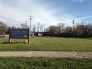
Driving Park is an urban residential area on the Near East Side of Columbus, Ohio just south of Interstate 70. Mainly a middle-class, predominantly African American neighborhood, Driving Park and its surrounding neighborhoods consist of an area of 17,730 residents. Driving Park received its name from its historic past as a large racing complex, first for horses and later for automobiles.

Old North Columbus is a neighborhood located just north of the Ohio State University in Columbus, Ohio. It was founded in 1847 where, at the time, it was a stand-alone city out of the confines of Columbus until it was incorporated into the City of Columbus in 1871. In its early years the city was a popular stagecoach stop with people traveling from Worthington to Columbus. Today Old North Columbus is popular for its local music and its unique "untouched architecture" which is reminiscent of its old roots.

Woodland Park is a residential neighborhood located in the Near East Side of Columbus, Ohio that houses approximately 1,500 residents. The neighborhood was previously home to such figures as artist Emerson Burkhart, cartoonist Billy Ireland, and judge William Brooks. Established in the early 20th century, Woodland Park has grown from its planned neighborhood roots into a modest neighborhood that contains various faith communities, schools, sources of entertainment and recreation, and borders an extension of the Ohio State University medical center.
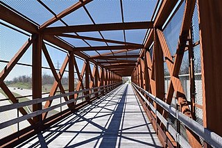
The Camp Chase Trail is a paved multi-use trail in Madison and Franklin counties in the U.S. state of Ohio. It serves as the Southwest Columbus segment of the 326-mile (525 km) Ohio to Erie Trail. The entire length of the Camp Chase Trail is part of U.S. Bicycle Route 21 and U.S. Bicycle Route 50.
Northwest Columbus is a region in Franklin County, Ohio. It has about 45,000 residents, according to the 2010 U.S. census.
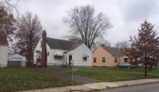
Briggsdale is a neighborhood of Franklin County in the city of Columbus, Ohio. The neighborhood is on the west/southwest side of the city within the Hilltop area. The area was first settled and founded by the family of Joseph M. Briggs, after whom the neighborhood was named. Joseph Briggs was an active figure in the early years of the township and county operations. The Briggsdale Methodist church was founded with his help, and it now exists as the New Horizons Methodist Church. The present day Briggsdale neighborhood is located near the historical Green Lawn Cemetery to the north as well as Briggs High School to the west.

Weinland Park is a neighborhood north of downtown Columbus, Ohio and encompassed by the boundaries of the University District. A development boom in the 1930s and 1940s resulting from new streetcar lines and the blossoming of factories brought working and middle-class families to the neighborhood. Current housing stock consists primarily of single family residential buildings that have been converted to rentals or multifamily housing. Row-homes and apartment buildings are also ubiquitous in the neighborhood. Renters currently outnumber owners. Commercial and entertainment facilities are concentrated on the North High Street corridor, but also pocket the inner part of the neighborhood as well. Weinland Park saw the sapping of its population and wealth with the rise of newer suburbs ringing the outer reaches of the city and the collapse of local industry and streetcar lines. The neighborhood has been plagued with crime and drug problems for decades but has recently seen a flood of new investment that has brought growth and revitalization to this long struggling neighborhood. Investment into the community includes the South Campus Gateway providing retail and residential finished in 2005, and a new food district and employment center.

Franklin Park is a neighborhood located on the Near East Side of Columbus, Ohio. Both the historic neighborhood and landmark, the Franklin Park Conservatory and Botanical Gardens, are named after the 88-acre park.
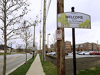
Fifth by Northwest is a neighborhood in Columbus, Ohio. Covering about 700 acres (280 ha), Fifth by Northwest is approximately bound by Glenn Avenue, Wyandotte Road, & Kinnear to the north, Third Avenue to the south, Kenny Road and Olentangy River Road to the east and Northstar Road to the west. Also sometimes referred to as 5XNW or the Tri-Village area, Fifth by Northwest is just north of Grandview Heights, northwest of the Harrison West neighborhood, and west of The Ohio State University.


