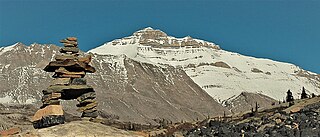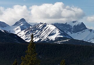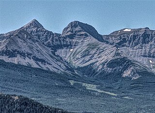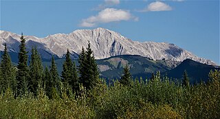
Mount Bogart is a 3,144-metre (10,315-foot) summit located in Kananaskis Country in the Canadian Rockies of Alberta, Canada. Mount Bogart's nearest higher peak is Wind Mountain, 4.7 km (2.9 mi) to the north. Mount Bogart is situated northwest of Mount Kidd, and both can be seen from Highway 40 near the Kananaskis Village junction.

Mount Coulthard is a mountain straddling the border between Alberta and British Columbia in Canada. It is part of the Flathead Range which is a subset of the Canadian Rockies. The mountain is set on the Continental Divide, in Castle Wildland Provincial Park. It is situated in the Crowsnest Pass area and can be seen from Highway 3, the Crowsnest Highway.

Nigel Peak is a 3,211-metre (10,535-foot) mountain summit located on the shared border of Banff National Park and Jasper National Park, in the Canadian Rockies of Alberta, Canada. Nigel has two peaks, the north summit is the highest point. The nearest higher peak is Mount Athabasca, 6.4 km (4.0 mi) to the south-southwest. Nigel Peak is situated immediately north of Sunwapta Pass and can be seen from the Icefields Parkway and from Athabasca Glacier. Topographic relief is significant as the summit rises 1,100 meters (3,610 feet) above the parkway in two kilometers (1.2 mile).

Mount Kidd is a 2,958-metre (9,705-foot) double-summit massif centrally located in Kananaskis Country in the Canadian Rockies of Alberta, Canada. Mount Kidd is situated within Spray Valley Provincial Park, and its nearest higher neighbor is Mount Sparrowhawk, 7.0 km (4.3 mi) to the northwest. Mount Kidd is a landmark that can be seen from Highway 40 in the Kananaskis Village area, and from the Kananaskis Country Golf Course which lies at the eastern base of the mountain.

Mount Nestor is a 2,970-metre (9,740 ft) mountain summit located in Kananaskis Country in the Canadian Rockies of Alberta, Canada. It is named after HMS Nestor, a destroyer sunk in the Battle of Jutland during World War I. Mount Nestor is situated at the south end of the Goat Range along the west shore of Spray Lakes Reservoir. Nestor's east flank is within Spray Valley Provincial Park, while the west aspect is within Banff National Park, with the boundary line between the two parks running roughly north-to-south over its summit. The nearest higher peak is Old Goat Mountain, 2.0 km (1.2 mi) to the north. Mount Nestor can be seen from Alberta Highway 742, the Smith-Dorrien/Spray Trail.

Gap Mountain is a 2,675-metre (8,776-foot) mountain summit located at the southern end of the Opal Range in the Canadian Rockies of Alberta, Canada. The nearest higher neighbor is Elpoca Mountain, 2 km (1.2 mi) to the east. Gap Mountain is situated 5 km (3.1 mi) south of Mount Wintour, within Peter Lougheed Provincial Park. Gap Mountain is a conspicuous peak seen from Alberta Highway 40 at Highwood Pass. It is a popular climbing destination because it offers exposed scrambling on its eastern flanks with excellent summit views of Kananaskis Country.

Mount French is a 3,244-metre (10,643-foot) summit in the Spray Mountains range of the Canadian Rockies in Alberta, Canada. The mountain is situated in Peter Lougheed Provincial Park of Kananaskis Country. French is the second highest point in the Spray Mountains Range. Its nearest higher peak, and highest in the Spray Range, is Mount Sir Douglas, 3.0 km (1.9 mi) to the west. Mount French can be seen from Alberta Highway 742, the Smith-Dorrien/Spray Trail.

Roche Miette is a 2,316-metre (7,598-foot) mountain at the northwestern tip of the Miette Range in Jasper National Park, in the Canadian Rockies of Alberta, Canada. The peak is a prominent landmark in the Athabasca Valley that is situated approximately thirty kilometres north-northeast of the municipality of Jasper, and four kilometres northeast of the Jasper House National Historic Site. It is visible from Highway 16 and the Canadian. Its nearest higher peak is Capitol Mountain, 5.0 km (3.1 mi) to the southeast. Roche Miette translates from French as Crumb Rock.

Mount Romulus is a 2,832-metre (9,291-foot) mountain summit located in the Little Elbow River Valley of Kananaskis Country in the Canadian Rockies of Alberta, Canada. Weather permitting, the peak is visible from highways southwest of Calgary as it is recognizable by its signature band of snow that forms above the broad southeast cliffs. The mountain is named for Romulus, who along with his twin brother Remus were the mythological founders of Ancient Rome. Mount Remus is situated 2.0 km (1.2 mi) to the east-northeast. The name was officially adopted by the Geographical Names Board of Canada in 1940. Mount Romulus' nearest higher peak is Fisher Peak, 4.0 km (2.5 mi) to the northwest.

Mount Smuts is a 2,938-metre (9,639-foot) mountain summit located in the Canadian Rockies of Alberta, Canada. It is set in the Spray Valley near the northern end of the Spray Mountains range. It is situated on the common boundary shared by Peter Lougheed Provincial Park with Banff National Park. Mount Smuts is not visible from any road in Banff Park, however it can be seen from Alberta Highway 742, also known as Smith-Dorrien/Spray Trail in Kananaskis Country. Mount Smuts' nearest higher neighbor is Mount Birdwood, 2.8 km (1.7 mi) to the south-southeast.

Commonwealth Peak is a 2,775-metre (9,104-foot) mountain summit in the Spray Mountains, a sub-range of the Canadian Rockies in Alberta, Canada. The mountain is situated in Peter Lougheed Provincial Park. Its nearest higher peak is Mount Birdwood, 1.0 km (0.62 mi) to the west. Both can be seen from Alberta Highway 742, also known as Smith-Dorrien/Spray Trail in Kananaskis Country.

Mount Murray is a 3,026-metre (9,928-foot) mountain summit in the Spray Mountains range of the Canadian Rockies in Alberta, Canada. The mountain is situated in Peter Lougheed Provincial Park of Kananaskis Country. Its nearest higher peak is Mount French, 2.0 km (1.2 mi) to the south-southwest. Mount Murray can be seen from Alberta Highway 742, the Smith-Dorrien/Spray Trail.

Tombstone Mountain is a 3,002-metre (9,849-foot) double summit mountain located near the southern end of the Opal Range in Kananaskis Country of the Canadian Rockies in Alberta, Canada. Tombstone South is the lower of the two summits, and is labelled as Tombstone Mountain on some maps. It can be reached via scrambling, whereas the true north summit requires technical climbing. Tombstone Mountain is situated within Elbow-Sheep Wildland Provincial Park, and its nearest higher peak is Elpoca Mountain, 4.0 km (2.5 mi) to the south.

Chinook Peak is a 2,591-metre (8,501-foot) mountain summit located in the Canadian Rockies of Alberta, Canada.

Mount Tecumseh is a 2,547-metre-high (8,356 ft) mountain summit located in the Canadian Rockies of Alberta, Canada.

Seven Sisters Mountain is a 2,591-metre-high (8,501 ft) mountain summit located in the Canadian Rockies of Alberta, Canada.

Mount McLaren is a 2,301-metre (7,549-foot) mountain summit located in Alberta, Canada.

Mount Parrish is a 2,530-metre (8,301-foot) mountain summit located in Alberta, Canada.

Mount Head is a 2,782-metre (9,127-foot) mountain summit located in Alberta, Canada.

Holy Cross Mountain is a 2,650-metre (8,694-foot) mountain summit located in Alberta, Canada.


