Willow Creek is a census-designated place (CDP) in Valdez-Cordova Census Area, Alaska, United States. At the 2010 census the population was 191, down from 201 in 2000.

Highland Acres is a census-designated place (CDP) in Kent County, Delaware, United States. It is part of the Dover, Delaware Metropolitan Statistical Area. The population was 3,459 at the 2010 census.
Roosevelt Gardens is a census-designated place (CDP) in Broward County, Florida, United States. The population was 2,456 at the 2010 census.
Sunshine Ranches is a former census-designated place (CDP) in Broward County, Florida, United States. The population was 1,704 at the 2000 census. It was incorporated into the town of Southwest Ranches, Florida in 2000, and now serves as a neighborhood.

Golden Glades is a census-designated place (CDP) in Miami-Dade County, Florida, United States. The population was 33,145 at the 2010 census.
High Point was a census-designated place (CDP) in Palm Beach County, Florida, United States. The population was 2,191 at the 2000 census. The CDP was removed from the 2010 census. Although it is still unincorporated, it is within Delray Beach's "future annexation area."
Schall Circle is a census-designated place (CDP) in Palm Beach County, Florida, United States. The population was 965 at the 2000 census.

Hutchinson Island South is a census-designated place (CDP) on the barrier island of Hutchinson Island in St. Lucie County, Florida, United States. The South in its name refers to its location in the southern part of St. Lucie County, as it is actually in the central part of the island as a whole. The population was 4,846 at the 2000 census. It is part of the Port St. Lucie Metropolitan Statistical Area. Its mail is delivered from Jensen Beach 34957 in nearby Martin County. The Jensen Beach post office has a postal contract substation known as Hutchinson Beach located at 11007 South Ocean Drive, but it offers only post office boxes and counter services.

Hawaiian Acres is a census-designated place (CDP) in Hawaiʻi County, Hawaiʻi, United States located in the District of Puna. The population was 2,700 at the 2010 census, up from 1,776 at the 2000 census.

Coyne Center is a census-designated place (CDP) in Rock Island County, Illinois, United States. The population was 827 at the 2010 census.

Silver Ridge is an unincorporated community and census-designated place (CDP) located within Berkeley Township, in Ocean County, New Jersey, United States. As of the 2010 United States Census, the CDP's population was 1,133.

Myrtle Grove is a census-designated place (CDP) in New Hanover County, North Carolina, United States. The population was 8,875 at the 2010 census. It is part of the Wilmington Metropolitan Statistical Area.

East Rockingham is a census-designated place (CDP) in Richmond County, North Carolina, United States. The population was 3,885 at the 2000 census.

Fernway is a neighborhood in Cranberry Township, Butler County, Pennsylvania, United States. It includes 458 homes on 183 acres and was the first planned housing subdivision in the Township, dating back to the 1950s. Fernway was formerly used as the name of a census-designated place (CDP), but the designation was removed as of TIGER 2013 after Cranberry Township officials pointed out that users of Internet mapping websites frequently misinterpreted the CDP as the name of its parent municipality..

Waller is a census-designated place (CDP) in Columbia County, Pennsylvania, United States. The population was 48 at the 2010 census. It is part of the Bloomsburg–Berwick Micropolitan Statistical Area.

San Carlos is a community and census-designated place (CDP) in Hidalgo County, Texas. The population was 3,130 at the 2010 United States Census. It is part of the McAllen–Edinburg–Mission Metropolitan Statistical Area.

Ramtown is a census-designated place and unincorporated community located within Howell Township, in Monmouth County, New Jersey, United States. As of the 2010 United States Census, the CDP's population was 6,242.

West Brattleboro is a census-designated place (CDP) in the town of Brattleboro, Vermont, United States. The population was 3,222 at the 2000 census.

Opportunity is a locale and former census-designated place in Spokane County, Washington, United States. The population was 25,065 at the 2000 census.

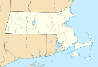
Wilbraham is a census-designated place (CDP) in the town of Wilbraham in Hampden County, Massachusetts, United States. The population was 3,915 at the 2010 census, out of 14,868 in the town as a whole. It is part of the Springfield, Massachusetts Metropolitan Statistical Area.


