Tilton, Illinois

Last updated
Tilton
Village
Vermilion County Illinois Incorporated and Unincorporated areas Tilton Highlighted.svg
Location of Tilton in Vermilion County, Illinois.
Location map of Vermilion County, Illinois.svg
Red pog.svg
Tilton
Tilton's location in Vermilion County
Coordinates: 40°5′48″N87°38′31″W / 40.09667°N 87.64194°W / 40.09667; -87.64194
CountryUnited States
State Illinois
County Vermilion
Township Danville
Area
[1]
  Total3.24 sq mi (8.39 km2)
  Land3.21 sq mi (8.31 km2)
  Water0.03 sq mi (0.08 km2)  0.93%
Elevation
[2]
643 ft (196 m)
Population
 (2010)
  Total3,300
  Estimate 
(2016) [3]
3,300
  Density805.74/sq mi (311.13/km2)
Time zone UTC-6 (CST)
  Summer (DST) UTC-5 (CDT)
ZIP code
61833
Area code 217
FIPS code 17-75276
Website http://www.tiltonil.com/

Tilton is a village in Danville Township, Vermilion County, Illinois, United States. It is part of the Danville, Illinois Metropolitan Statistical Area. The population was 2,976 at the 2000 census, 3,061 in 2009 and 3,300 in 2018.

Contents

It is named after Charles Tilton, a friend of Abraham Lincoln, who worked for the railroads. Lincoln reputedly had Thanksgiving dinner at Tilton's house in the village in the 1850s.

Geography

Tilton is located at 40°5′48″N87°38′31″W / 40.09667°N 87.64194°W / 40.09667; -87.64194 (40.096586, -87.642071). [4]

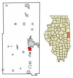
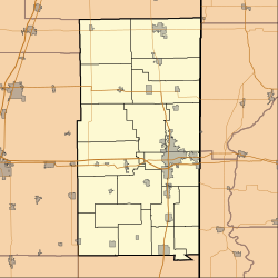
According to the 2010 census, Tilton has a total area of 3.243 square miles (8.40 km2), of which 3.21 square miles (8.31 km2) (or 98.98%) is land and 0.033 square miles (0.09 km2) (or 1.02%) is water. [5]

Demographics

Historical population
CensusPop.Note
1880 297
1890 47459.6%
1900 4740.0%
1910 71049.8%
1920 90928.0%
1930 1,39453.4%
1940 1,4866.6%
1950 1,63810.2%
1960 2,59858.6%
1970 2,544−2.1%
1980 2,405−5.5%
1990 2,72913.5%
2000 2,9769.1%
2010 2,724−8.5%
2016 (est.)2,584 [3] −5.1%
U.S. Decennial Census [6]

As of the census [7] of 2000, there were 2,976 people, 1,322 households, and 823 families residing in the village. The population density was 960.5 people per square mile (370.7/km²). There were 1,412 housing units at an average density of 455.7 per square mile (175.9/km²). The racial makeup of the village was 98.29% White, 0.17% African American, 0.10% Native American, 0.07% Asian, 0.34% from other races, and 1.04% from two or more races. Hispanic or Latino of any race were 1.08% of the population.

There were 1,322 households out of which 23.8% had children under the age of 18 living with them, 47.4% were married couples living together, 11.3% had a female householder with no husband present, and 37.7% were non-families. 32.7% of all households were made up of individuals and 14.2% had someone living alone who was 65 years of age or older. The average household size was 2.25 and the average family size was 2.83.

In the village, the population was spread out with 22.0% under the age of 18, 8.1% from 18 to 24, 25.0% from 25 to 44, 26.9% from 45 to 64, and 18.0% who were 65 years of age or older. The median age was 41 years. For every 100 females, there were 88.2 males. For every 100 females age 18 and over, there were 86.8 males.

The median income for a household in the village was $31,810, and the median income for a family was $37,727. Males had a median income of $35,455 versus $20,988 for females. The per capita income for the village was $16,276. About 6.2% of families and 8.6% of the population were below the poverty line, including 6.7% of those under age 18 and 8.3% of those age 65 or over.

Notable people

Mayors

Police Chiefs

Police

Public works

Office Staff

Fire Department

EMS

Related Research Articles

<span class="mw-page-title-main">Tequesta, Florida</span> Village in Florida, United States

Tequesta is an incorporated village in Palm Beach County, Florida, United States. It is the northernmost municipality in the Miami metropolitan area, which according to the 2020 United States Census, had a total population of 6,138,333 South Florida residents. As of 2020, the US Census had the village's total at 6,158 of the population.

<span class="mw-page-title-main">New Baden, Illinois</span> Village in Illinois, United States

New Baden is a village in Clinton County, Illinois, United States. The population was 3,428 at the 2020 census.

<span class="mw-page-title-main">Stanley, Iowa</span> City in Iowa, United States

Stanley is a city in Buchanan and Fayette counties in the U.S. state of Iowa. The population was 81 at the time of the 2020 census.

<span class="mw-page-title-main">New Portland, Maine</span> Town in the state of Maine, United States

New Portland is a town in Somerset County, Maine, United States. It is perhaps best known for its Wire Bridge, a cable suspension bridge completed in 1866 that is the last remaining bridge of its type in Maine, and possibly the U.S. Much of North New Portland's Main Street burned to the ground in the fire of 1919, including a hotel. The annual town fair draws large crowds from around, and is held in September. The population was 765 at the 2020 census. The town was given to the residents of Falmouth by the Massachusetts legislature to repay them for their loss when the British fleet burned Falmouth in 1775.

<span class="mw-page-title-main">Algonquin, Maryland</span> Census-designated place in Maryland, United States

Algonquin is a census-designated place (CDP) in Dorchester County, Maryland, United States. The population was 1,241 at the 2010 census. The community was named for the Algonquin people, one of the Native American tribes in the East.

<span class="mw-page-title-main">Kennedy, Minnesota</span> City in Minnesota, United States

Kennedy is a city in Kittson County, Minnesota, United States. The population was 176 at the 2020 census.

<span class="mw-page-title-main">Calverton Park, Missouri</span> City in Missouri, United States

Calverton Park is a city in St. Louis County, Missouri, United States. The population was 1,293 at the 2010 census. The Village of Calverton Park incorporated as the City of Calverton Park in 2014.

<span class="mw-page-title-main">Kimberling City, Missouri</span> City in Missouri, United States

Kimberling City is a city in Stone County, Missouri, United States. The population was 2,344 at the 2020 census.

<span class="mw-page-title-main">Tilton, New Hampshire</span> Town in New Hampshire, United States

Tilton is a town on the Winnipesaukee River in Belknap County, New Hampshire, United States. The population was 3,962 at the 2020 census, up from 3,567 at the 2010 census. It includes the villages of Tilton and Lochmere and part of the village of Winnisquam. Tilton is home to the Tilton School, a private preparatory school.

<span class="mw-page-title-main">Northfield, New Hampshire</span> Town in New Hampshire, United States

Northfield is a town in Merrimack County, New Hampshire, United States. The population was 4,872 at the 2020 census.

<span class="mw-page-title-main">West Union, Ohio</span> Village in Ohio, United States

West Union is a village in Adams County, Ohio, United States, about 55 miles (89 km) southeast of Cincinnati. The population was 3,004 at the 2020 census. It is the county seat of Adams County. West Union is served by West Union High School, the Adams County/Ohio Valley School District, and the West Union Public Library, a branch of the Adams County Public Library.

<span class="mw-page-title-main">Cleveland, Oklahoma</span> City in Oklahoma, United States

Cleveland is a city in Pawnee County, Oklahoma, United States. The 2010 census population was 3,251, a decrease of 0.9 percent from the figure of 3,282 recorded in 2000.

<span class="mw-page-title-main">Karthaus Township, Clearfield County, Pennsylvania</span> Township in Pennsylvania, United States

Karthaus Township is a township in Clearfield County, Pennsylvania, United States. The population was 819 at the 2020 census.

<span class="mw-page-title-main">Sullivan Township, Pennsylvania</span> Township in Pennsylvania, United States

Sullivan Township is a township in Tioga County, Pennsylvania, United States. The population was 1,470 at the 2020 census.

<span class="mw-page-title-main">North Bethlehem Township, Pennsylvania</span> Township in Pennsylvania, United States

North Bethlehem Township is a township in Washington County, Pennsylvania, United States. The population was 1,548 at the 2020 census. The residents of the township are part of the Bentworth School District with schools located in nearby Bentleyville and Ellsworth boroughs.

Ulmer is a town in Allendale County, South Carolina, United States. The population was 88 at the 2010 census.

<span class="mw-page-title-main">Caldwell, Texas</span> City in Texas, United States

Caldwell is a city in and the county seat of Burleson County, Texas, United States. The population was 3,993 at the 2020 census. It is part of the Bryan-College Station metropolitan area.

<span class="mw-page-title-main">Ashwaubenon, Wisconsin</span> Village in Wisconsin, United States

Ashwaubenon is a village in Brown County in the U.S. state of Wisconsin. The population was 16,991 at the 2020 census. A suburb of Green Bay, Ashwaubenon is part of the Green Bay Metropolitan Statistical Area and carries a Green Bay mailing address. Part of the Oneida Nation of Wisconsin is in Ashwaubenon.

<span class="mw-page-title-main">Lincoln, Kewaunee County, Wisconsin</span> Town in Wisconsin, United States

Lincoln is a town in Kewaunee County, Wisconsin, United States. The population was 948 at the 2010 census. The unincorporated communities of Lincoln, Gregorville, and Euren are in the town. The unincorporated communities of Rio Creek and Rosiere are also partially in the town.

<span class="mw-page-title-main">Tilton Northfield, New Hampshire</span> Census-designated place in New Hampshire, United States

Tilton Northfield is a census-designated place (CDP) representing two adjacent villages in the towns of Tilton in Belknap County and Northfield in Merrimack County in the U.S. state of New Hampshire. The CDP encompasses the town centers of both Tilton and Northfield, located on either side of the Winnipesaukee River. The population was 3,324 at the 2020 census.

References

  1. "2016 U.S. Gazetteer Files". United States Census Bureau. Retrieved Jun 30, 2017.
  2. "USGS detail on Tilton" . Retrieved 2007-09-26.
  3. 1 2 "Population and Housing Unit Estimates" . Retrieved June 9, 2017.
  4. "US Gazetteer files: 2010, 2000, and 1990". United States Census Bureau. 2011-02-12. Retrieved 2011-04-23.
  5. "G001 - Geographic Identifiers - 2010 Census Summary File 1". United States Census Bureau . Retrieved 2015-12-25.
  6. "Census of Population and Housing". Census.gov. Retrieved June 4, 2015.
  7. "American FactFinder". United States Census Bureau . Retrieved 2008-01-31.