Utopia, West Park, Florida

Last updated
Utopia, Florida
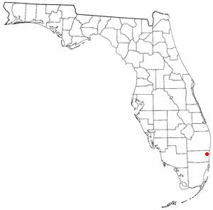
FLMap-doton-Utopia.PNG
Location of Utopia, Florida
Coordinates: 25°59′19″N80°12′12″W / 25.98861°N 80.20333°W / 25.98861; -80.20333
Country Flag of the United States.svg  United States
State Flag of Florida.svg  Florida
County Broward
Area
  Total0.3 sq mi (0.8 km2)
  Land0.3 sq mi (0.8 km2)
  Water0.0 sq mi (0.0 km2)
Population
 (2000)
  Total714
  Density2,326.9/sq mi (898.4/km2)
Time zone UTC-5 (Eastern (EST))
  Summer (DST) UTC-4 (EDT)
FIPS code 12-73442 [1]

Utopia was a census-designated place (CDP) in Broward County, Florida, in the United States. As of the 2000 census, the CDP population was 714. The area is now part of a West Park neighborhood.

Contents

Geography

Utopia is located at 25°59′19″N80°12′12″W / 25.98861°N 80.20333°W / 25.98861; -80.20333 (25.988719, -80.203268). [2] According to the United States Census Bureau, the CDP has a total area of 0.8 km2 (0.31 sq mi), all land.

Demographics

As of the census [1] of 2000, there were 714 people, 262 households, and 175 families residing in the CDP. The population density was 889.3 people/km2 (2,303 people/sq mi). There were 279 housing units at an average density of 347.5 units/km2 (900 units/sq mi). The racial makeup of the CDP was 21.57% White (11.9% were Non-Hispanic White,) [3] 65.97% African American, 0.28% Native American, 0.56% Asian, 9.38% from other races, and 2.24% from two or more races. Hispanic or Latino of any race were 22.83% of the population.

There were 262 households, out of which 37.0% had children under the age of 18 living with them, 30.9% were married couples living together, 28.2% had a female householder with no husband present, and 33.2% were non-families. 27.5% of all households were made up of individuals, and 5.7% had someone living alone who was 65 years of age or older. The average household size was 2.73 and the average family size was 3.32.

In the CDP, the population was spread out, with 32.6% under the age of 18, 9.9% from 18 to 24, 31.1% from 25 to 44, 19.6% from 45 to 64, and 6.7% who were 65 years of age or older. The median age was 31 years. For every 100 females, there were 94.0 males. For every 100 females age 18 and over, there were 91.6 males.

The median income for a household in the CDP was $22,000, and the median income for a family was $24,250. Males had a median income of $21,602 versus $16,058 for females. The per capita income for the CDP was $12,306. About 23.8% of families and 28.4% of the population were below the poverty line, including 34.3% of those under age 18 and 30.2% of those age 65 or over.

As of 2000, before being annexed to West Park, English as a first language accounted for 80.62% of all residents, while Spanish as a mother tongue made up 19.37% of the population. [4]

Related Research Articles

<span class="mw-page-title-main">Broadview-Pompano Park</span> Neighborhood in Broward, Florida, United States

Broadview-Pompano Park is a neighborhood and former census-designated place (CDP) in North Lauderdale, Broward County, Florida, United States. The population was 5,314 at the 2000 census.

Broward Estates was a census-designated place (CDP) in Broward County, Florida, United States. The population was 3,416 at the 2000 census. It now serves as Lauderhill's neighborhood. Residents of this neighborhood often refer to their neighborhood as "Parkway" as well, as it also contains Parkway Middle School.

Chula Vista Isles is a neighborhood of Fort Lauderdale, Florida, United States. It was previously a census-designated place (CDP) in Broward County, Florida, United States. The population was 573 at the 2000 census.

Golden Heights was a census-designated place (CDP) in Broward County, Florida, United States. It is now a neighborhood in the City of Fort Lauderdale. The population was 501 at the 2000 census.

Hillsboro Pines is a census-designated place (CDP) in Broward County, Florida, United States. The population was 496 at the 2020 census.

Lake Forest was a census-designated place (CDP) in Broward County, Florida, United States. The population was 4,994 at the 2000 census. It is now a neighborhood of West Park, Florida.

<span class="mw-page-title-main">Palm Aire</span> Neighborhood in Broward, Florida, United States

Palm Aire, Florida was an unincorporated census-designated place in Broward County, Florida consisting of residential property, commercial businesses, and four golf courses. Palm Aire describes both Palm Aire Village, a collection of single-family houses, and Palm Aire Country Club, a 5,000-acre (20 km2) property with condominiums, villas, estate homes, and four golf courses. It is now part of the cities of Fort Lauderdale and Pompano Beach.

Sunshine Ranches is a former census-designated place (CDP) in Broward County, Florida, United States. The population was 1,704 at the 2000 census. It was incorporated into the town of Southwest Ranches, Florida in 2000, and now serves as a neighborhood.

<span class="mw-page-title-main">Mansfield Center, Massachusetts</span> Census-designated place in Massachusetts, United States

Mansfield Center is a census-designated place (CDP) in the town of Mansfield in Bristol County, Massachusetts, United States. The population was 7,360 at the 2010 census.

<span class="mw-page-title-main">Crystal Lake, Polk County, Florida</span> Census-designated place in Florida, United States

Crystal Lake is a census-designated place (CDP) in Polk County, Florida, United States. The population was 5,341 at the 2000 census, an increase from 5,300 in 1990. The 2010 Census reported a population of 5,514. It is part of the Lakeland–Winter Haven Metropolitan Statistical Area.

<span class="mw-page-title-main">Yardville-Groveville, New Jersey</span> Populated place in Mercer County, New Jersey, US

Yardville-Groveville was an unincorporated community and former census-designated place (CDP) located within Hamilton Township, in Mercer County, in the U.S. state of New Jersey. As of the 2000 United States Census, the CDP's population was 9,208.

<span class="mw-page-title-main">West Brattleboro, Vermont</span> CDP in Vermont, United States

West Brattleboro is a census-designated place (CDP) in the town of Brattleboro, Vermont, United States. The population was 3,222 at the 2000 census.

<span class="mw-page-title-main">Max Meadows, Virginia</span> CDP in Virginia, United States

Max Meadows is a census-designated place (CDP) in Wythe County, Virginia, United States. The population was 562 at the 2010 census.

<span class="mw-page-title-main">Riverbend, Washington</span> Census-designated place in Washington, United States

Riverbend is an unincorporated community and census-designated place (CDP) in King County, Washington, United States. The population was 2,123 at the 2020 census.

<span class="mw-page-title-main">Lochsloy, Washington</span> CDP in Washington, United States

Lochsloy is a census-designated place (CDP) in Snohomish County, Washington, United States. The population was 2,806 at the 2020 census, up from 2,533 at the 2010 census.
<span class="mw-page-title-main">Red Jacket, West Virginia</span> Census-designated place in West Virginia, United States

Red Jacket is a census-designated place (CDP) in Mingo County, West Virginia, United States. The population was 581 at the 2010 census. The community was named for Red Jacket, a Seneca chief.

<span class="mw-page-title-main">Craigsville, West Virginia</span> CDP in West Virginia, United States

Craigsville is a census-designated place (CDP) in Nicholas County, West Virginia, United States. The population was 2,213 at the 2010 census.

<span class="mw-page-title-main">MacArthur, West Virginia</span> Census-designated place in West Virginia, United States

MacArthur is a census-designated place (CDP) in Raleigh County, West Virginia, United States. Originally, it was named Hollywood and renamed MacArthur after General of the Army Douglas MacArthur in 1942. The population was 1,500 at the 2010 census.

<span class="mw-page-title-main">Fairview, Wyoming</span> Census-designated place in Wyoming, United States

Fairview (CDP) is in Lincoln County, Wyoming, United States. The population was 277 at the 2020 census.

Richmond is a census-designated place (CDP) in the town of Richmond in Sagadahoc County, Maine, United States. The population was 1,864 at the 2000 census. It is part of the Portland–South Portland–Biddeford, Maine Metropolitan Statistical Area.
References

  1. 1 2 "U.S. Census website". United States Census Bureau . Retrieved 2008-01-31.
  2. "US Gazetteer files: 2010, 2000, and 1990". United States Census Bureau. 2011-02-12. Retrieved 2011-04-23.
  3. "Demographics of Utopia, FL". MuniNetGuide.com. Retrieved 2007-11-16.
  4. "MLA Data Center Results for Utopia, FL". Modern Language Association . Retrieved 2007-11-16.