Wasatch-Cache National Forest

Last updated
Wasatch-Cache National Forest

Cecret Lake Panorama Albion Basin Alta Utah July 2009.jpg

Cecret Lake in Wasatch-Cache National Forest
Usa edcp relief location map.png
Red pog.svg
Location Utah / Idaho / Wyoming, United States
Nearest city Salt Lake City, UT
Coordinates 41°39′00″N112°00′54″W / 41.650°N 112.015°W / 41.650; -112.015 Coordinates: 41°39′00″N112°00′54″W / 41.650°N 112.015°W / 41.650; -112.015
Area 1,607,177 acres (6,504.01 km2)
Established August 16, 1906
Governing body U.S. Forest Service
Website Uinta-Wasatch-Cache National Forest

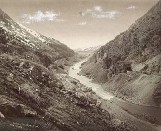
Wasatch-Cache National Forest is a United States National Forest located primarily in northern Utah (81.23%), with smaller parts extending into southeastern Idaho (16.42%) and southwestern Wyoming (2.35%). The name is derived from the Ute word Wasatch for a low place in high mountains, and the French word Cache meaning to hide. [1] The term cache originally referred to fur trappers, the first Europeans to visit the land. The Wasatch-Cache National Forest boundaries include 1,607,177 acres (6,504.01 km2) of land.

United States National Forest classification of federal lands in the United States

National Forest is a classification of protected and managed federal lands in the United States. National Forests are largely forest and woodland areas owned collectively by the American people through the federal government, and managed by the United States Forest Service, a division of the United States Department of Agriculture.

Utah A state of the United States of America

Utah is a state in the western United States. It became the 45th state admitted to the U.S. on January 4, 1896. Utah is the 13th-largest by area, 31st-most-populous, and 10th-least-densely populated of the 50 United States. Utah has a population of more than 3 million according to the Census estimate for July 1, 2016. Urban development is mostly concentrated in two areas: the Wasatch Front in the north-central part of the state, which contains approximately 2.5 million people; and Washington County in Southern Utah, with over 160,000 residents. Utah is bordered by Colorado to the east, Wyoming to the northeast, Idaho to the north, Arizona to the south, and Nevada to the west. It also touches a corner of New Mexico in the southeast.

Idaho State of the United States of America

Idaho is a state in the northwestern region of the United States. It borders the state of Montana to the east and northeast, Wyoming to the east, Nevada and Utah to the south, and Washington and Oregon to the west. To the north, it shares a small portion of the Canadian border with the province of British Columbia. With a population of approximately 1.7 million and an area of 83,569 square miles (216,440 km2), Idaho is the 14th largest, the 12th least populous and the 7th least densely populated of the 50 U.S. states. The state's capital and largest city is Boise.

Contents

The Wasatch-Cache was headquartered in downtown Salt Lake City, Utah until August 2007 when its management was combined with the Uinta National Forest and is currently being managed as the Uinta-Wasatch-Cache National Forest. The merged forest is based out of South Jordan, Utah. The Kamas Ranger District was merged with the Uinta National Forest's Heber Ranger District in Heber City. With the newly included Uinta National Forest the forest will expand to 2,487,896 acres (10,068.16 km2). [2]

Uinta National Forest national forest in Utah, United States

Uinta National Forest is a national forest located in north central Utah, USA. It was originally part of the Uinta Forest Reserve, created by Grover Cleveland on 2 February 1897. The name is derived from the Ute word Yoov-we-teuh which means pine forest. Because of changes to the boundaries over the years, the Uinta Mountains are now located in the Wasatch-Cache National Forest. In August 2007 it was announced that the Uinta National Forest would merge with the Wasatch-Cache National Forest based in Salt Lake City, Utah, 50 miles (80 km) north of Provo, Utah.

South Jordan, Utah City in Utah, United States

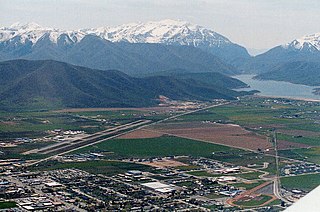
South Jordan is a city in south central Salt Lake County, Utah, 18 miles (29 km) south of Salt Lake City. Part of the Salt Lake City metropolitan area, the city lies in the Salt Lake Valley along the banks of the Jordan River between the 9,000-foot (2,700 m) Oquirrh Mountains and the 12,000-foot (3,700 m) Wasatch Mountains. The city has 3.5 miles (5.6 km) of the Jordan River Parkway that contains fishing ponds, trails, parks, and natural habitats. The Salt Lake County fair grounds and equestrian park, 67-acre (27 ha) Oquirrh Lake, and 27 parks are located inside the city. As of the 2010 Census, its population was 50,418.

Heber City, Utah City in Utah, United States

Heber City is a city in northwestern Wasatch County, Utah, United States.

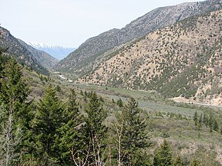
The Cache National Forest portion is located in northern Utah and southern Idaho. It has a land area of 701,453 acres (1,096 sq mi, or 2,838.7 km2). In descending order of land area it is located in parts of Cache, Bear Lake, Franklin, Weber, Rich, Box Elder, Caribou, and Morgan counties. (Bear Lake, Franklin, and Caribou counties are in Idaho, with the rest being in Utah.) There are local ranger district offices located in Logan and Ogden.

Acre unit of area

The acre is a unit of land area used in the imperial and US customary systems. It is traditionally defined as the area of one chain by one furlong, which is exactly equal to 10 square chains, ​1640 of a square mile, or 43,560 square feet, and approximately 4,047 m2, or about 40% of a hectare. Based upon the International yard and pound agreement of 1959, an acre may be declared as exactly 4,046.8564224 square metres. The acre is a statute measure in the United States and was formerly one in the United Kingdom and almost all countries of the former British Empire, although informal use continues.

Cache County, Utah County in the United States

Cache County is a county on the northern edge of Utah, United States. As of the 2010 United States Census the population was 112,656. Its county seat and largest city is Logan.

Bear Lake County, Idaho County in the United States

Bear Lake County is a county in the U.S. state of Idaho. As of the 2010 United States Census the county had a population of 5,986. The county seat is Paris, and Montpelier is the largest city.

The Wasatch National Forest portion is located in northeastern Utah and southwestern Wyoming. It has a land area of 905,724 acres (1,415.2 sq mi, or 3,365.3 km2). In descending order of land area it is located in parts of Summit, Tooele, Salt Lake, Davis, Uinta, Duchesne, Wasatch, Morgan, Utah, Weber, and Juab counties. (Uinta County is in Wyoming, with the rest being in Utah.) There are local ranger district offices located in Evanston and Mountain View in Wyoming, and in Kamas, and Salt Lake City in Utah.

Summit County, Utah County in the United States

Summit County is a county in the U.S. state of Utah, occupying a rugged and mountainous area. As of the 2010 United States Census, the population was 36,324. Its county seat is Coalville, and the largest city is Park City.

Tooele County, Utah county in Utah, United States

Tooele County is a county in the U.S. state of Utah. As of the 2010 United States Census, the population was 58,218. Its county seat and largest city is Tooele. The county was created in 1850 and organized the following year.

Salt Lake County, Utah County in the United States

Salt Lake County is a county in the U.S. state of Utah. As of the 2010 United States Census, the population was 1,029,655, making it the most populous county in Utah. Its county seat and largest city is Salt Lake City, the state capital. The county was created in 1850.

Wilderness areas

Map of wilderness areas in the Wasatch-Cache National Forest WCNF Wilderness Map.jpg
Map of wilderness areas in the Wasatch-Cache National Forest

There are seven designated wilderness areas in the Wasatch-Cache National Forest, totalling approximately 309,000 acres (1,250 km2) and comprising approximately 25% of the Forest's total acreage. [3]

Logan District

Mount Naomi Wilderness wilderness area in the Wasatch-Cache National Forest in Cache County, Utah, Untied States

Mount Naomi Wilderness is a 44,523-acre (180.18 km2) wilderness area located within the Uinta-Wasatch-Cache National Forest in the U.S. state of Utah. It lies between the Logan River and the Utah-Idaho state line northeast of Logan, Utah.

Kamas, Evanston and Mountain View Districts

Salt Lake District

See also

Hansen Pond HansenPond WasatchCacheNF.jpg
Hansen Pond

Related Research Articles

Wasatch Range Mountain range in Utah, United States

The Wasatch Range is a mountain range that stretches approximately 160 miles (260 km) from the Utah-Idaho border, south through central Utah in the western United States. It is the western edge of the greater Rocky Mountains, and the eastern edge of the Great Basin region. The northern extension of the Wasatch Range, the Bear River Mountains, extends just into Idaho, constituting all of the Wasatch Range in that state.

Bear River (Great Salt Lake) river in southwestern Wyoming, southeastern Idaho, and northern Utah

The Bear River is the largest tributary of the Great Salt Lake, draining a mountainous area and farming valleys northeast of the lake and southeast of the Snake River Plain. It flows through southwestern Wyoming, southeastern Idaho, and northern Utah, in the United States. Approximately 350 miles (560 km) long it is the largest river in North America that does not ultimately reach the sea.

Uinta Mountains mountain range

The Uinta Mountains are an east-west trending chain of mountains in northeastern Utah extending slightly into southern Wyoming in the United States. As a subrange of the Rocky Mountains, they are unusual for being the highest range in the contiguous United States running east to west, and lie approximately 100 miles (160 km) east of Salt Lake City. The range has peaks ranging from 11,000–13,528 feet (3,353–4,123 m), with the highest point being Kings Peak, also the highest point in Utah. The Mirror Lake Highway crosses the western half of the Uintas on its way to Wyoming.

Caribou-Targhee National Forest

Caribou-Targhee National Forest is located in the states of Idaho and Wyoming, with a small section in Utah in the United States. The forest is broken into several separate sections and extends over 2.63 million acres (10,600 km2). To the east the forest borders Yellowstone National Park, Grand Teton National Park and Bridger-Teton National Forest. Most of the forest is a part of the 20-million-acre (81,000 km2) Greater Yellowstone Ecosystem.

Ashley National Forest national Forest in Utah and Wyoming, United States

Ashley National Forest is a National Forest located in northeastern Utah and southwestern Wyoming. Within the Forest's bounds are 1,382,346 acres (5,594 km2) of vast forests, lakes, and mountains, with elevations ranging from 6,000 to 13,500 feet. The Forest covers portions of Daggett, Duchesne, Summit, Uintah, and Utah counties in Utah and Sweetwater County in Wyoming. Some of the most popular landmarks located in the Forest include the Flaming Gorge National Recreation Area and the Uinta Mountains, which contains the highest mountain peak in Utah. The Forest also includes 276,175 acres (1,117.64 km2), or about 60.5%, of the High Uintas Wilderness. The headquarters for the Ashley National Forest are located in Vernal, Utah with ranger district offices in Vernal; Duchesne, Utah; Roosevelt, Utah; Manila, Utah; and Green River, Wyoming.

Manti-La Sal National Forest national forest in Utah and Colorado, United States

The Manti-La Sal National Forest covers more than 1.2 million acres (4,900 km2) and is located in the central and southeastern parts of the U.S. state of Utah and the extreme western part of Colorado. The forest is headquartered in Price, with ranger district offices in Price, Ferron, Ephraim, Moab and Monticello. The maximum elevation is Mount Peale in the La Sal Mountains, reaching 12,721 feet (3,877 m) above sea level. The La Sal Mountains are the second highest mountain range in Utah after the Uintas. Parts of the forest are included in the Bears Ears National Monument.

Deseret Peak Wilderness

The Deseret Peak Wilderness is located in the Stansbury Mountains of Tooele County, Utah, United States near the towns of Tooele and Grantsville, not far from the Great Salt Lake. It is part of the Wasatch-Cache National Forest. This semi-arid wilderness is part of the Great Basin ecosystem. Elevations range from about 6,000 feet to the top of Deseret Peak's limestone escarpment at 11,031 feet (3,362 m). In this high country, with barren Skull Valley to the west, you'll find some springs and intermittent creeks, despite the general dryness of the area.

Cache National Forest

Cache National Forest is a 533,840-acre area of National Forest System land in Idaho and Utah which was established on July 1, 1908 by the U.S. Forest Service. The majority of its area is in Utah, and was initially created when the Bear River National Forest was disbanded. On July 1, 1915, all of Pocatello National Forest was added. In 1973 the Idaho portion was transferred to the administration of Caribou National Forest, while the Utah portion was combined administratively with Wasatch National Forest, creating the Wasatch-Cache National Forest. In descending order of forestland area, the Cache National Forest portion is located in Cache, Bear Lake, Franklin, Weber, Rich, Box Elder, Caribou, and Morgan counties. The forest has a current area of 701,453 acres (2,838.68 km2), which comprises 43.56% of the combined Wasatch-Cache's total acreage. The forest is administered from Salt Lake City, Utah as part of the Wasatch-Cache National Forest, but there are local ranger district offices in Logan and Ogden. From circa 1911 until August 1923, the area was roamed by Old Ephraim.

Lone Peak Wilderness

The Lone Peak Wilderness is a 30,088-acre (121.76 km2) wilderness area located within the Uinta and the Wasatch-Cache National Forest in the U.S. state of Utah.

Wasatch National Forest

Wasatch National Forest was established as the Wasatch Forest Reserve by the U.S. Forest Service in Utah on August 16, 1906 with 86,440 acres (349.8 km2) to the east of Salt Lake City and Provo. It became a National Forest on March 4, 1907. On July 1, 1908 Grantsville National Forest and Salt Lake National Forest were added. In 1973 Wasatch was combined administratively with Cache National Forest, creating Wasatch-Cache National Forest. In descending order of acreage, the Wasatch National Forest portion is located in Summit, Tooele, Salt Lake, Davis, Uinta (Wyoming), Duchesne, Wasatch, Morgan, Utah, Weber, and Juab counties in Utah except Uinta, which is in southwestern Wyoming. Its total area was 908,731 acres (3,677.50 km2), comprising 56.44% of the combined Wasatch-Cache's 1,610,184 acres (6,516.18 km2) as of 2008. There are local ranger district offices in Kamas and Salt Lake City in Utah, and in Evanston and Mountain View in Wyoming. Administrative headquarters reside with the combined Uinta-Wasatch-Cache National Forest in South Jordan, Utah.

Utah State Route 150 highway in Utah

State Route 150, also known as the Mirror Lake Highway, is a state highway in the U.S. state of Utah. It is named for Mirror Lake, a picturesque lake that the highway passes along the way. It is also a USDA Forest Service Scenic Byway.

High Uintas Wilderness

The High Uintas Wilderness is a wilderness area located in northeastern Utah, United States. The wilderness covers the Uinta Mountains, encompassing parts of Duchesne and Summit counties. Designated as a wilderness in 1984, the area is located within parts of Ashley National Forest and Uinta-Wasatch-Cache National Forest, managed by the U.S. Forest Service. The highest peak in Utah, Kings Peak, lies within the wilderness area along with some of Utah's highest peaks, particularly those over 13,000 feet.

Mount Timpanogos Wilderness

Mount Timpanogos Wilderness is a 10,518-acre (42.56 km2) wilderness area protecting Mount Timpanogos and the surrounding area. It is located in the front range of the Wasatch Mountain Range, between American Fork Canyon on the north and Provo Canyon on the south, within the Uinta-Wasatch-Cache National Forest on the north eastern edge of Utah County, Utah, United States. The wilderness area receives fairly heavy use due to its proximity to the heavily populated cities of Provo and Salt Lake City. It is bordered on the north by the Lone Peak Wilderness.

Big Cottonwood Creek river in the United States of America

Big Cottonwood Creek is one of the largest streams entering Salt Lake Valley from the east from the Wasatch Mountains. The creek flows through the Big Cottonwood Canyon in a westerly direction until it emerges into Salt Lake Valley about eighteen miles (29 km) from its highest source. Thence its course is northwesterly through Cottonwood Heights, Holladay, and Murray, Utah until it empties into the Jordan River about five miles (8.0 km) south of Salt Lake City. In the summer its waters are all used for irrigation purposes. From its source to its original outlet into the Jordan River is a distance of about twenty six miles.

Humpy Peak mountain in United States of America

Humpy Peak is a peak located in the Uinta Mountain Range in northern Utah. It is approximately 27.56 miles (44 km) south of Evanston, Wyoming and 21.29 miles (34 km) east of Coalville, Utah. The summit has an elevation of 10,875 feet (3,315 m).

Stansbury Mountains

The Stansbury Mountains are a 28-mile (45 km) long mountain range located in eastern Tooele County, Utah. The north end of the range borders the southwest of the Great Salt Lake at Stansbury Bay.

Twin Peaks Wilderness

Twin Peaks Wilderness is a 11,396 acres (46.12 km2) wilderness area in the Wasatch Range of Uinta-Wasatch-Cache National Forest in Salt Lake County, Utah, United States. The Mount Olympus Wilderness is directly north of the Twin Peaks Wilderness and separated by Utah State Route 190. The Lone Peak Wilderness is directly to the south and separated by Utah State Route 210. Elevations in the wilderness range from under 5,000 feet (1,500 m) to 11,330 feet (3,450 m) on Twin Peaks.

Currant Creek may refer to:

References