Boondall

Last updated

Boondall
Brisbane,  Queensland

Boondall Wetlands (6968543386).jpg

Boondall Wetlands, 2012
Population 9,217 (2016 census) [1]
 • Density 846/km2 (2,190/sq mi)
Postcode(s) 4034
Area 10.9 km2 (4.2 sq mi)
Location 17 km (11 mi) from Brisbane CBD
LGA(s) City of Brisbane
(Deagon Ward) [2]
State electorate(s) Nudgee
Federal Division(s) Lilley
Suburbs around Boondall:
Taigum Deagon Sandgate
Shorncliffe
Zillmere Boondall Nudgee Beach
Geebung Virginia
Banyo
Nudgee

Boondall is a northern suburb of the City of Brisbane, Queensland, Australia, formerly known as Cabbage Tree Creek (after the creek that flows through the area). [3]

Suburbs and localities are the names of geographic subdivisions in Australia, used mainly for address purposes. The term locality is used in rural areas, while the term suburb is used in urban areas. Australian postcodes closely align with the boundaries of localities and suburbs.

City of Brisbane Local government area in Queensland, Australia

The City of Brisbane is a local government area that has jurisdiction over the inner portion of the metropolitan area of Brisbane, the capital of Queensland, Australia. Brisbane is located in the county of Stanley and is the largest city followed by Ipswich with bounds in part of the county. Unlike LGAs in the other mainland state capitals, which are generally responsible only for the central business districts and inner neighbourhoods of those cities, the City of Brisbane administers a significant portion of the Brisbane metropolitan area, serving almost half of the population of the Brisbane Greater Capital City Statistical Area. As such, it has a larger population than any other local government area in Australia. The City of Brisbane was the first Australian LGA to reach a population of more than one million. Its population is roughly equivalent to the populations of Tasmania, the Australian Capital Territory and the Northern Territory combined. In 2016–2017, the council administers a budget of over $3 billion, by far the largest budget of any LGA in Australia.

Queensland North-east state of Australia

Queensland is the second-largest and third-most populous state in the Commonwealth of Australia. Situated in the north-east of the country, it is bordered by the Northern Territory, South Australia and New South Wales to the west, south-west and south respectively. To the east, Queensland is bordered by the Coral Sea and Pacific Ocean. To its north is the Torres Strait, with Papua New Guinea located less than 200 km across it from the mainland. The state is the world's sixth-largest sub-national entity, with an area of 1,852,642 square kilometres (715,309 sq mi).

Contents

Geography

Situated approximately 13.5 kilometres (8.4 mi) north of Brisbane near Moreton Bay, almost halfway between Brisbane and the coastal city of Redcliffe. Bounded on the north by Deagon, Sandgate and Shorncliffe, on the east by Nudgee and Nudgee Beach, on the south by Banyo, Geebung and Virginia and on the west by Taigum and Zillmere.

Moreton Bay bay in Queensland, Australia

The Moreton Bay is a bay located on the eastern coast of Australia 14 kilometres (8.7 mi) from central Brisbane, Queensland. It is one of Queensland's most important coastal resources. The waters of Moreton Bay are a popular destination for recreational anglers and are used by commercial operators who provide seafood to market.

Brisbane capital city of Queensland, Australia

Brisbane is the capital of and the most populated city in the Australian state of Queensland, and the third most populous city in Australia. Brisbane's metropolitan area has a population of 2.5 million, and the South East Queensland region, centred on Brisbane, encompasses a population of more than 3.5 million. The Brisbane central business district stands on the historic European settlement and is situated inside a peninsula of the Brisbane River, about 15 kilometres from its mouth at Moreton Bay. The metropolitan area extends in all directions along the floodplain of the Brisbane River Valley between Moreton Bay and the Great Dividing Range, sprawling across several of Australia's most populous local government areas (LGAs)—most centrally the City of Brisbane, which is by far the most populous LGA in the nation. The demonym of Brisbane is "Brisbanite".

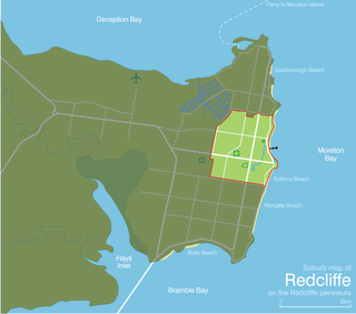
Redcliffe, Queensland Suburb of Moreton Bay Region, Queensland, Australia

Redcliffe is a residential suburb of the Moreton Bay Region in the east north-east of the Redcliffe peninsula, approximately 28 kilometres (17 mi) north-north-east of the Brisbane CBD. It serves as the Central Business District for the Redcliffe Peninsula and its surrounding suburbs.

The Boondall Wetlands are located in the east of the suburb. These internationally significant wetlands contain more than 1000 hectares of protected area that provide habitat to a wide range of animals including more than 190 species of birds. [4]

Boondall Wetlands

The Boondall Wetlands lie on the edge of Moreton Bay in the Brisbane suburb of Boondall between Nudgee Beach and Shorncliffe, in south-east Queensland, Australia. The wetlands are preserved within the Boondall Wetlands Reserve which was preserved in 1990 and covers more than 1100 hectares of internationally significant wetlands.

A residential zone, Boondall is home to a mix of young and established families and retirees.

Demographics

In the 2011 census, Boondall recorded a population of 8,748 people, 48.3% female and 51.7% male.

The median age of the Boondall population was 36 years of age, 1 year below the Australian median.

69.8% of people living in Boondall were born in Australia, compared to the national average of 69.8%; the next most common countries of birth were New Zealand 4.9%, England 2.5%, India 2.4%, Philippines 2%, China 1.3%.

78.1% of people spoke only English at home; the next most popular languages were 1.5% Cantonese, 1.5% Italian, 1.2% Punjabi, 1.1% Samoan, 1.1% Mandarin.

History

New classroom and teachers room, Boondall State School, April 1951 Queensland State Archives 1613 Boondall State School New Classroom and Teachers Room April 1951.png
New classroom and teachers room, Boondall State School, April 1951

Boondall State School opened on 6 April 1925. [5]

Facilities

Brisbane Entertainment Centre, 2001 Boondall-Entertainment-Centre.jpg
Brisbane Entertainment Centre, 2001

Close to the Boondall railway station is the Brisbane Entertainment Centre, where many live entertainment shows are held. One of the shows at the Brisbane Entertainment Centre was the popular musical theatre production The Man from Snowy River: Arena Spectacular.

Boondall railway station railway station in Brisbane, Queensland, Australia

Boondall railway station is located on the Shorncliffe line in Queensland, Australia. It is one of two stations serving the Brisbane suburb of Boondall, the other being North Boondall station. The station is within walking distance of the Brisbane Entertainment Centre.

Brisbane Entertainment Centre

The Brisbane Entertainment Centre is a multi-purpose arena located in the Brisbane suburb of Boondall, Queensland, Australia. The centre is managed by AEG Ogden.

<i>The Man from Snowy River: Arena Spectacular</i> musical

The Man from Snowy River: Arena Spectacular, based on Banjo Paterson's poem The Man from Snowy River, was a popular musical theatre production which toured Australian capital cities twice during 2002. Kevin Jacobsen and David Atkins were the executive producers for the show. David Atkins and Ignatius Jones were co-directors and co-writers. Extra dialogue was written for the show by Jonathan Biggins and Phillip Scott.

The suburb is also home to the Ice World Boondall, where the Brisbane Blue Tongues of the AIHL used to play before relocating to Bundall Iceland on the Gold Coast. [6]

Iceworld Boondall is an ice sports and public ice skating centre, located approximately 20 km north of Brisbane, Queensland. It hosts a number of major ice hockey games, including Australian Women's Ice Hockey League games. The venue offers a wide variety of activities including ice skating lessons, birthday parties, figure skating, speed skating, curling, synchronised skating, public skating sessions, and it is also the home venue of the Brisbane Goannas. The venue has been operating in Brisbane for over 30 years. Iceworld Boondall is also a host venue for the Duke Trophy, an annual inter-state short track speed skating competition in Australia.

Australian Ice Hockey League

The Australian Ice Hockey League (AIHL) is Australia's top-level ice hockey league. It is sanctioned by Ice Hockey Australia and it is run by its own board of directors. AIHL players are amateurs. Players are not paid to play in the AIHL, but receive other benefits such as the use of a car, and accommodation during the season. The AIHL has attracted players up to and including NHL players. AIHL games are shorter than typical hockey games, consisting of two 15-minute periods and a 20-minute 3rd, instead of three 20-minute periods that are usually played under normal North American and IIHF hockey regulations. The current champions are the CBR Brave.

Education

Dumbbell drill on the front lawn of Nudgee College, 1898 StateLibQld 2 184803 Dumbell drill on the front lawn of Nudgee College, Brisbane, 1898.jpg
Dumbbell drill on the front lawn of Nudgee College, 1898

Its local school is Boondall State School that has received numerous awards for their educational programs (e.g. ELF Literacy Program). The Internationally recognised and acclaimed St Joseph's College, Nudgee that has produced seven Rhodes scholars is situated in the southern part of Boondall (it was originally within the boundaries of the neighbouring suburb of Nudgee).

Heritage listings

Boondall has a number of heritage-listed sites, including:

Related Research Articles

North Boondall railway station railway station in Brisbane, Queensland, Australia

North Boondall railway station is located on the Shorncliffe line in Queensland, Australia. It is one of two stations serving the Brisbane suburb of Boondall, the other being Boondall station.

Sandgate, Queensland Suburb of Brisbane, Queensland, Australia

Sandgate is a coastal suburb in Brisbane, Australia, 16 kilometres (10 mi) north of the Brisbane CBD. The town became a popular escape for the people of Brisbane in the early 20th century. At the 2016 Australian Census the suburb recorded a population of 4,909.
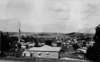
Albion, Queensland Suburb of Brisbane, Queensland, Australia

Albion is an inner north-eastern suburb of the City of Brisbane, the state capital of Queensland, Australia.

Geebung is a suburb of northern Brisbane, Australia. It is centred on its railway station on the Caboolture railway line. The suburb is named after the Geebung tree of the genus Persoonia which used to be known as the Geebong. The name change came about due to handwritten addresses on letters being incorrectly sent to Geelong.

Bald Hills, Queensland Suburb of Brisbane, Queensland, Australia

Bald Hills is the northernmost suburb of the City of Brisbane, Queensland, Australia. At the 2016 census the suburb recorded a population of 6,502.

Division of Lilley Australian federal electoral division

The Division of Lilley is an Australian Electoral Division in Queensland. The division was first proclaimed in 1913. The division is named after Sir Charles Lilley, a former Premier of Queensland and a former Chief Justice in the Supreme Court of Queensland.

Bracken Ridge, Queensland Suburb of Brisbane, Queensland, Australia

Bracken Ridge is a northern suburb of Brisbane, the capital city of Queensland, Australia. Its local government area is the City of Brisbane, in which it has its own ward.

Clayfield, Queensland Suburb of Brisbane, Queensland, Australia


.Clayfield is an inner northern suburb in the City of Brisbane, Queensland, Australia. It is approximately 7 kilometres (4 mi) from the Brisbane CBD. Clayfield is bordered to the north by Nundah, to the east by Ascot and Hendra, to the west by Wooloowin and to the south by Albion.
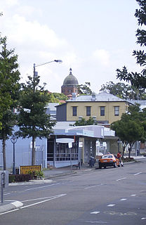
Nundah, Queensland Suburb of Brisbane, Queensland, Australia

Nundah is an inner suburb in the city of Brisbane, Australia, approximately 8 kilometres north-east of the Brisbane central business district, in the local government area of the City of Brisbane.
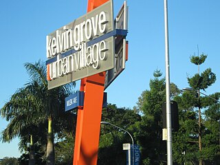
Kelvin Grove, Queensland Suburb of Brisbane, Queensland, Australia

Kelvin Grove is an inner northern suburb of Brisbane, Queensland, Australia approximately 3 kilometres (1.9 mi) from the CBD. This hilly suburb takes its name from Kelvingrove Park in Glasgow, Scotland. It is primarily residential with tree-lined streets and some commercial and light industrial activities along its main thoroughfare, Kelvin Grove Road. La Boite Theatre Company, Queensland's second largest theatre company, operates from the Roundhouse Theatre on the Kelvin Grove campus of the Queensland University of Technology.

Brighton, Queensland Suburb of Brisbane, Queensland, Australia

Brighton is the northernmost suburb of Brisbane City, Australia, located 19 kilometres (12 mi) north of the Brisbane CBD. The Nashville locality makes up much of the southwest of the suburb.

Shorncliffe, Queensland Suburb of Brisbane, Queensland, Australia

Shorncliffe is a suburb of Brisbane, Australia. It is situated northeast of Brisbane and is the neighbouring suburb of Sandgate. The suburb comes under the jurisdiction of the Brisbane City Council. At the 2016 Australian Census, the suburb recorded a population of 1,870.

Banyo, Queensland Suburb of Brisbane, Queensland, Australia

Banyo is a northern suburb of the City of Brisbane, Queensland, Australia. It is a community split between residential and industrial land usage, the latter being attracted by the accessibility of local transport, including the Gateway Motorway.

Virginia, Queensland Suburb of Brisbane, Queensland, Australia

Virginia is a suburb in Brisbane, Queensland, Australia. It is located 10 kilometres (6.2 mi) north of the Brisbane central business district. It is primarily a residential suburb with many timber and tin Queenslander style housing. The suburb was named after the Virginia Brick Company, founded in 1897, near the Virginia Railway Station, which the station opened in 1888.

Shorncliffe pier

Shorncliffe Pier is a historic pier in Shorncliffe, Queensland, Australia, situated near Saint Patrick's College and lower Moora Park. The pier with its white faded timber railings, colonial street lamps spaced out along the stretch of pier, and resting shelter towards the end was a much visited attraction for families, residents and tourists to the area. Reaching 351.5 metres out into Bramble Bay it is the largest timber pier in Brisbane and one of the longest recreational piers in Australia. The renewed pier was reopened to the public in March 2016.

Nudgee Beach, Queensland Suburb of Brisbane, Queensland, Australia

Nudgee Beach is an outer suburb of Brisbane, Australia and also the name of the beach located in the suburb. It is 18 kilometres (11 mi) north of the Brisbane central business district where Schulz Canal enters Moreton Bay and is the closest beach to the Brisbane CBD. Directly to the south is Brisbane Airport.

Deagon, Queensland Suburb of Brisbane, Queensland, Australia

Deagon is an outer suburb of Brisbane, Australia. It is 16 kilometres (9.9 mi) north of the CBD.

St Joseph's Nudgee College is a private, Roman Catholic, day and boarding school for boys, located in Boondall, a northern suburb of Brisbane, Queensland, Australia. Some of the buildings of the school were listed in the Queensland Heritage Register in 2006.
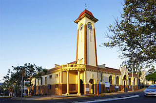
Town of Sandgate

The Town of Sandgate is a former local government area of Queensland, Australia, located in northern Brisbane adjacent to Moreton Bay.

References

  1. ↑ Australian Bureau of Statistics (27 June 2017). "Boondall". 2016 Census QuickStats. Retrieved 25 October 2013. Blue pencil.svg
  2. ↑ "Deagon Ward". Brisbane City Council. Brisbane City Council. Retrieved 12 March 2017.
  3. ↑ "Boondall (entry 41700)". Queensland Place Names. Queensland Government . Retrieved 28 April 2014.
  4. ↑ "Birds of Boondall Wetlands Checklist". Brisbane City Council. Archived from the original on 15 March 2011. Retrieved 30 November 2010.
  5. ↑ "Agency ID10934, Boondall State School". Queensland State Archives . Retrieved 28 April 2014.
  6. ↑ Lizard Insider [ permanent dead link ]. Retrieved 4 February 2008.
  7. ↑ "St Joseph's Nudgee College (entry 601771)". Queensland Heritage Register . Queensland Heritage Council. Retrieved 6 July 2013.

Coordinates: 27°20′55″S153°03′37″E / 27.3486°S 153.0602°E / -27.3486; 153.0602