Lake Muir is a rural locality of the Shire of Manjimup in the South West region of Western Australia. The South Western Highway forms the south-western border of the locality while the Muir Highway forms its northern one. Parts of Shannon National Park as well as most of Lake Muir National Park and all of Lake Muir and Boyndaminup National Park are located in the locality of Lake Muir.

The Shire of Manjimup is a local government area in the South West region of Western Australia, about 320 kilometres (200 mi) south of the state capital, Perth. The Shire covers an area of 7,027 square kilometres (2,713 sq mi), and its seat of government is the town of Manjimup.
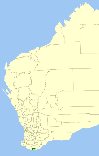
The Shire of Denmark is a local government area in the Great Southern region of Western Australia, about 55 kilometres (34 mi) west of Albany and about 420 kilometres (261 mi) south-southeast of the state capital, Perth. The Shire of Denmark covers an area of 1,860 square kilometres (718 sq mi), and its seat of government is located in the townsite and locality of Denmark.
Ocean Beach is a coastal locality of the Shire of Denmark in the Great Southern region of Western Australia. The South Coast Highway forms the northern, the Southern Ocean its southern and the Wilson Inlet the eastern border of Ocean Beach. The beach of the same name lies in the east of the locality.

Diamond Tree is a rural locality of the Shire of Manjimup in the South West region of Western Australia. The South Western Highway forms the eastern border of the locality while the Vasse Highway forms its south-eastern one. Parts of the Sir James Mitchell National Park is also located within Diamond Tree.

Beedelup is a predominantly forested rural locality of the Shire of Manjimup in the South West region of Western Australia. The Vasse Highway forms the western and south-western border of the locality. Most of the Greater Beedelup National Park is located within Beedelup.
Callcup is a rural locality of the Shire of Manjimup in the South West region of Western Australia, on the coastline of the Southern Ocean. The Warren River forms much of the north-western boundary of the locality and its mouth is just on the other side of the border in Yeagarup. The south-western part of the locality is predominantly covered by the D'Entrecasteaux National Park while, in the north-east, parts of the Greater Hawke National Park are located.
Channybearup is a rural locality of the Shire of Manjimup in the South West region of Western Australia. The locality is predominantly covered by state forest but a small section of the Greater Beedelup National Park also stretches into the north-west of Channybearup.
Collins is a rural locality of the Shire of Manjimup in the South West region of Western Australia. The South Western Highway forms the north-eastern border of the locality while the Vasse Highway runs along its north-western one. The Warren River forms the entire eastern and southern border of Collins. Small sections of the Sir James Mitchell and Gloucester National Park are also located within the locality.
Crowea is a rural locality of the Shire of Manjimup, located near Northcliffe, in the South West region of Western Australia. The South Western Highway forms the eastern border of the locality while the Warren River forms most of its northern border. Parts of the Greater Hawke National Park, in the west, and Greater Dordagup National Park, in the east, are located in Crowea while a small section of Jane National Park penetrates into the south of the locality.
Middlesex is a rural locality of the Shire of Manjimup in the South West region of Western Australia. The locality's western border is formed by the South Western Highway while the Muir Highway forms its eastern border. A small section of the Sir James Mitchell National Park is also located within Middlesex.
North Walpole is a rural locality of the Shire of Manjimup in the South West region of Western Australia. The South Western Highway forms the western and southern border of the locality while the Frankland River forms its eastern boundary. North Walpole contains all of Mount Frankland North National Park and a substantial part of both the Mount Frankland National Park and Mount Frankland South National Park. A small section of the Lake Muir National Park is also located within the north of North Walpole, a section of the Walpole-Nornalup National Park is located within the south-west, and a section of the Mount Roe National Park in the north-east of the locality.
Perup is a rural locality of the Shire of Manjimup in the South West region of Western Australia. The Muir Highway forms the southern border of the locality while the Perup River runs through Perup from north to south. The south-eastern corner of Greater Kingston National Park sticks into the north of the locality.
Quinninup is a rural locality of the Shire of Manjimup in the South West region of Western Australia. The South Western Highway forms much of its eastern border, as does the Warren River to the north. The eastern parts of Greater Dordagup National Park are located within Quinninup.
Ringbark is a rural locality of the Shire of Manjimup in the South West region of Western Australia, with the South Western Highway forming the eastern border of the locality.
Shannon is a rural locality of the Shire of Manjimup in the South West region of Western Australia. The South Western Highway forms the entirety of the eastern border of the locality. The majority of Shannon National Park is located within Shannon, as are parts of D'Entrecasteaux National Park, Jane National Park and Mount Frankland National Park. The Shannon River also flows through the locality.
Upper Warren is a rural locality of the Shire of Manjimup in the South West region of Western Australia. Its northern and eastern borders are formed by the Muir Highway, while it borders the South Western Highway at its far south-western corner. The Warren River runs from through the locality from east to west while, in places, also forming its border.
Wilgarrup is a rural locality of the Shire of Manjimup in the South West region of Western Australia. The South Western Highway runs through the locality from north to south, as does the Wilgarrup River, a tributary of the Warren River.
Yanmah is a rural locality and town of the Shire of Manjimup in the South West region of Western Australia. The Yanmah Brook flows through the locality and the Yanmah State Forest is located in Yanmah as well.

Yeagarup is a rural locality and town of the Shire of Manjimup in the South West region of Western Australia, on the coastline of the Southern Ocean. The Vasse Highway forms the northern border of the locality while the Warren River forms its southern and the Donnelly River some of its western border. The D'Entrecasteaux National Park runs along the entire coastline of the locality. Much of the Greater Hawke National Park and all of Warren National Park are also located within Yeagarup.

