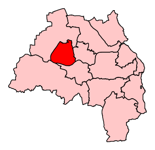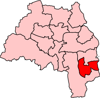
Carley Hill is a suburb of Sunderland, Tyne and Wear in North East England. [1]

Carley Hill is a suburb of Sunderland, Tyne and Wear in North East England. [1]
Carley Hill is bordered by Witherwack to the north west, Marley Pots to the south west and High Southwick to the direct south. [2]
Carley Hill is part of the Southwick ward, and is currently represented on Sunderland City Council by three Labour Party councillors.
The area is part of the Sunderland Central constituency represented in the House of Commons of the United Kingdom by Labour Party MP Lewis Atkinson. [3]

Arundel and South Downs is a constituency in West Sussex created in 1997 and represented in the House of Commons of the UK Parliament by Andrew Griffith, a Conservative, since 2019.

Newcastle upon Tyne Central was a constituency represented in the House of Commons of the UK Parliament from 2010 until its abolition for the 2024 general election by Chi Onwurah of the Labour Party. As with all constituencies since 1950, the constituency elected one Member of Parliament (MP) by the first past the post system of election at least every five years.

Sunderland North was a borough constituency represented in the House of Commons of the Parliament of the United Kingdom from 1950 to 2010. It elected one Member of Parliament (MP) by the first past the post system of election.

Sunderland South was, from 1950 until 2010, a constituency represented in the House of Commons of the Parliament of the United Kingdom. It elected one Member of Parliament (MP) by the first past the post system of election.

Easington is a constituency created in 1950 represented in the House of Commons of the UK Parliament since 2010 by Grahame Morris of the Labour Party.

Darlington is the parliamentary constituency for the eponymous market town in County Durham in the North East of England. It is currently represented in the House of Commons of the UK Parliament by Lola McEvoy of the Labour Party, who was first elected in 2024.

Streatham was a constituency represented in the House of Commons of the UK Parliament.

Twickenham is a constituency in Greater London represented in the House of Commons of the UK Parliament since 2019 by Munira Wilson of the Liberal Democrats.

Bracknell is a constituency in Berkshire represented in the House of Commons of the UK Parliament since 2024 by Peter Swallow, from the Labour Party. It was created for the 1997 general election, largely replacing the abolished county constituency of East Berkshire.

Knowsley is a constituency represented in the House of Commons of the UK Parliament since its 2010 creation, it has been represented by the Labour Party. It is currently represented by Anneliese Midgley.

South West Wiltshire is a constituency in Wiltshire, England. The constituency has been represented in the House of Commons of the UK Parliament by Andrew Murrison, a Conservative, since its inauguration in 2010.

Washington and Sunderland West was a constituency in Tyne and Wear represented in the House of Commons of the UK Parliament since its 2010 creation until its abolition for the 2024 general election by Sharon Hodgson, a member of the Labour Party.

Houghton and Sunderland South is a constituency in Tyne and Wear represented in the House of Commons of the Parliament of the United Kingdom. Since its creation in 2010, the seat has been represented by Bridget Phillipson of the Labour Party, who currently serves as Secretary of State for Education under the government of Keir Starmer.

Sunderland Central is a constituency in the House of Commons of the UK Parliament. It is represented by the Labour Party MP Lewis Atkinson, who has held the seat since 2024.

Sunderland City Council is the local authority of Sunderland, a metropolitan borough with city status in the ceremonial county of Tyne and Wear in North East England. It is one of five such councils in Tyne and Wear and one of 36 in England. It provides the majority of local government services in Sunderland.
Sunderland was a borough constituency in the House of Commons of the United Kingdom, created by the Reform Act 1832 for the 1832 general election. It elected two Members of Parliament (MPs) by the bloc vote system of election. It was split into the single-member seats of Sunderland North and Sunderland South for the 1950 general election.

Southwick is a former village and now a suburb on the north banks of the River Wear in Sunderland, in the county of Tyne and Wear, England, historically in County Durham. From 1894 to 1928, Southwick was administered by the Southwick-on-Wear Urban District Council, before being absorbed by Sunderland.
Witherwack is a suburb in the north of Sunderland, Tyne and Wear, England, situated between Red House to the west, Carley Hill to the east and Marley Pots to the south. The origin of the name Witherwack is unknown. The spelling of the name has changed since the Ordnance Survey maps of 1862 on which it was spelled Whitherwhack.

The 1973 Tyne and Wear County Council election was held on 12 April 1973 as part of the first elections to the new local authorities established by the Local Government Act 1972 in England and Wales. 104 councillors were elected from 95 electoral divisions across the region's five boroughs. Each division returned either one or two county councillors each by First-past-the-post voting for a four-year term of office. The election took place ahead of the elections to the area's metropolitan borough councils, which followed on 10 May 1973.
54°55′41″N1°24′11″W / 54.928°N 1.403°W