Heaton, Newcastle upon Tyne

Last updated

Heaton
Chillinham Rd shops.jpg
Chillingham Road, Heaton's main commercial street
Tyne and Wear UK location map.svg
Red pog.svg
Heaton
Location within Tyne and Wear
OS grid reference NZ273660
  London 242 mi (389 km)
Metropolitan borough
Metropolitan county
Region
Country England
Sovereign state United Kingdom
Post town NEWCASTLE UPON TYNE
Postcode district NE6-7
Dialling code 0191
Police Northumbria
Fire Tyne and Wear
Ambulance North East
UK Parliament
Councillors
List of places
UK
England
Tyne and Wear
54°59′17″N1°34′30″W / 54.988°N 1.575°W / 54.988; -1.575

Heaton is a district and suburb [1] in the city of Newcastle upon Tyne, in Tyne and Wear, England, two miles (three kilometres) east of the city centre. It is bordered by the neighbouring areas of Walkergate to the east, Jesmond to the north west, Byker to the south, and Sandyford to the west. The name Heaton means high town, referring to the area "being situated on hills above the Ouseburn, a tributary of the River Tyne." The area is divided into South Heaton, and High Heaton, representing the north, respectively. For city council elections, the area is split between three wards: Heaton, Manor Park and Ouseburn. [2] Until 1974 it was in Northumberland.

Contents

History

In the 12th century Heaton became part of the Barony of Ellingham granted by Henry I to Nicholas de Grenville. King John is claimed to have stayed in the castle at Heaton (the remains of which can still be seen in Heaton Park) on a number of occasions[ citation needed ]. In the 17th century the Heaton estate was purchased by Henry Babington who was knighted at Heaton Hall by James I on 1 May 1617. [3]

By the 18th century, Heaton was a coal mining area [4] with many of its collieries owned by Matthew White and Richard Ridley, then by his son Matthew Ridley. The Heaton estate was broken up in 1835 when the area became part of Newcastle upon Tyne. In 1841 much of the land in Heaton was owned by Armorer Donkin, who on his death in 1851 bequeathed it to his business partner, the industrialist Sir William Armstrong. [5]

In 1879, the corporation acquired part of the Heaton Hall estate, which was then laid out as Heaton Park, and Sir William Armstrong donated Armstrong Park and Jesmond Dene to the city. [4] The three parks run into each other to form a green corridor through east Newcastle.

Geography

A distinction is often made between High Heaton, and the rest of Heaton, although both technically fall within Heaton. The rest of Heaton is sometimes referred to as South Heaton, although the term has not been seen used in official city council documents.

Notable landmarks in Heaton include the Wills Building, which was originally constructed in 1946–1950 as a cigarette factory [6] and was redeveloped in 1999 as luxury apartments.

Governance

For the purposes of city council elections, Heaton was divided into two electoral wards, North Heaton and South Heaton.

However, boundary changes to all wards in Newcastle upon Tyne were implemented at the city council elections in May 2018, with the majority of Heaton now falling in the Heaton ward, and High Heaton in the Manor Park ward. A small part of Heaton, close to Shields Road, falls within the Ouseburn ward. All city council wards are represented by three councillors. [7]

For Parliamentary elections, Heaton is within the Newcastle East constitutency.

Heaton was formerly a township in the parish of Newcastle-All Saints, [8] in 1866 Heaton became a separate civil parish, on 1 April 1914 the parish was abolished to form Newcastle upon Tyne. [9] In 1911 the parish had a population of 21,912. [10] In 1974 it became part of the metropolitan district of Newcastle upon Tyne.

Demography

Heaton is a mixed working class and middle class area. In recent years it has become a popular residence for many students [11] attending the city's two universities, Newcastle University and Northumbria University. Rent and property prices are generally lower than in the neighbouring areas of Jesmond and Sandyford, but higher than in Byker.

Flats seen from Heaton Park Flats, from Heaton Park - geograph.org.uk - 1249658.jpg
Flats seen from Heaton Park

Economy

During the 19th century, the building of the railways saw a line pass through Heaton, now the East Coast Main Line. Heaton also has a major rail depot. Heaton became the location of Sir Charles Parsons engineering works producing turbines which was founded in 1889. [12]

Third Avenue was the birthplace of the Ringtons Tea business. [13]

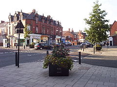
The main commercial street in Heaton is Chillingham Road which benefits from local amenities including two small supermarkets, a number of small shops and newsagents, hairdressers, takeaways, cafes, restaurants and public houses. Heaton Road is also becoming a notable commercial street. [14]

Education

Heaton has a large secondary school, Heaton Manor School, recently renamed Jesmond Park Academy, although many children in Heaton attend Benfield School, located on the Heaton/Walkergate boundary. There are also a number of primary schools spread over the area: Ravenswood Primary School, Chillingham Road Primary School, Hotspur Primary School and St. Teresa's Primary School. [15]

Despite austerity, Heaton retains an autism-friendly library in High Heaton with 3-hour computer access and a range of fiction and non-fiction books available. [16]

In 1932, Henderson Hall was opened as halls of residence for Newcastle University. [17]

High Heaton Library High Heaton Library, Newcastle upon Tyne.jpg
High Heaton Library

Sport

Heaton was home to Newcastle United under their previous name, Newcastle East End F.C., between 1886 and 1892. East End played at the Heaton Junction Ground on Chillingham Road before moving to St James' Park. [4]

Two Northern League football clubs play in areas neighboring Heaton. Heaton Stannington F.C. play in High Heaton, while Newcastle Benfield F.C. play next door to Benfield School.

Heaton is also home to amateur rugby football club Medicals RFC, based in Cartington Terrace.

Religion

St Teresa's Church Heaton, St Theresa's Church - geograph.org.uk - 245221.jpg
St Teresa's Church

Heaton is home to RC and CofE churches, and the Heaton Mosque and Islamic Centre. [18]

Transport

Heaton was originally served by Heaton railway station, which was on the main line from Newcastle Central to Edinburgh Waverley. The station was closed on 11 August 1980, when the Tyne & Wear Metro system opened. [19] Heaton is now served by the Chillingham Road Metro station, and Byker Metro station which is closer for some in South Heaton. Heaton is also served by a variety of bus routes, including routes 1, 62 and 63, which link Heaton to Newcastle City Centre and areas in the west of Newcastle.

Healthcare

Heaton Road Surgery was graded 'outstanding' in 2015 by the Care Quality Commission. [20] The Freeman Hospital, Newcastle's second largest major hospital, is in High Heaton.

Notable people

Related Research Articles

<span class="mw-page-title-main">Newcastle upon Tyne</span> City in England

Newcastle upon Tyne, or simply Newcastle, is a city and metropolitan borough in Tyne and Wear, England. It is England's northernmost metropolitan borough, located on the River Tyne's northern bank opposite Gateshead to the south. It is the most populous settlement in the Tyneside conurbation and North East England.

<span class="mw-page-title-main">Newcastle upon Tyne East and Wallsend (UK Parliament constituency)</span> Parliamentary constituency in the United Kingdom, 1997–2010 & 2024 onwards

Newcastle upon Tyne East and Wallsend is a constituency represented in the House of Commons of the Parliament of the United Kingdom. It elects one Member of Parliament (MP) by the first past the post system of election.

<span class="mw-page-title-main">Walker, Newcastle upon Tyne</span> Suburb of Newcastle upon Tyne, England

Walker is a residential suburb and electoral ward in the south-east of Newcastle upon Tyne, England.

<span class="mw-page-title-main">Walkergate</span> Human settlement in England

Walkergate is an area and electoral ward in the city of Newcastle upon Tyne, England. It is in the east of the city, north of Walker proper, east of the Heaton area and west of Wallsend. Areas within the Walkergate ward include Daisy Hill, Eastfield, Walkerdene and Walkerville. Walkergate Metro station which was opened in 1982 serves the area. This replaced the previous railway station on the same site which was originally known as Walker station from 1839 to 1889 when it was renamed Walker Gate station.

<span class="mw-page-title-main">Newcastle City Council</span> Local government body in England

Newcastle City Council is the local authority for the city of Newcastle upon Tyne the ceremonial county of Tyne and Wear in North East England. Newcastle has had a council from medieval times, which has been reformed on numerous occasions. Since 1974 the council has been a metropolitan borough council. It has been under Labour majority control since 2011. In 2024 the council became a member of the North East Combined Authority. The council is based at Newcastle Civic Centre.

<span class="mw-page-title-main">Byker</span> Human settlement in England

Byker is a district in the east of the city and metropolitan borough of Newcastle upon Tyne, in the county of Tyne and Wear, England. Home to the Byker Wall estate, made famous by TV series Byker Grove, Byker's population was recorded at 12,206 in the 2011 census. Byker is bordered by Heaton to the north and by Shieldfield to the north east. Until 1974 it was in Northumberland.

<span class="mw-page-title-main">Newcastle upon Tyne East (UK Parliament constituency)</span> Parliamentary constituency in the United Kingdom, 1885–1983 & 2010–2024

Newcastle upon Tyne East was a constituency of the House of Commons of the UK Parliament. It was held by Nick Brown, an independent formerly of the Labour Party, from its recreation in 2010 until its abolition for the 2024 general election.

<span class="mw-page-title-main">Ouseburn</span> River in Newcastle upon Tyne, England

The Ouseburn is a small river in Newcastle upon Tyne, England that flows through the city into the River Tyne. It gives its name to the Ouseburn Valley and the Ouseburn electoral ward for Newcastle City Council elections.

Dene is an electoral ward of Newcastle upon Tyne in North East England. The ward takes its name from the nearby gorge at Jesmond Dene. Contained within the ward are government offices of the Department for Work and Pensions and the Freeman Hospital. The population of the ward is 9,554, increasing to 9,667 at the 2011 Census, 3.7% of the total population of Newcastle upon Tyne. Car ownership in the area is 74.8% much higher than the city average of 54.7%.
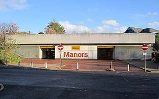
<span class="mw-page-title-main">Manors Metro station</span> Tyne and Wear Metro station in Newcastle upon Tyne

Manors is a Tyne and Wear Metro station, serving the Shieldfield area in Newcastle upon Tyne. It joined the network on 14 November 1982, following the opening of the fourth phase of the network, between Tynemouth and St James via Wallsend. The station is located near to Manors National Rail station, which is on the East Coast Main Line. However, the stations are not directly connected.

East Gosforth also known as Gosforth East is a former electoral ward in Newcastle upon Tyne, Tyne and Wear, UK. It was created in 2004. The population of the ward is 8,981, increasing to 10,145 at the 2011 Census, 3.5% of the total population of Newcastle upon Tyne. Car ownership in the area is 68.8%, higher than the city average of 54.7%. It was formerly one half of Gosforth's wards, along with the West Gosforth ward.

<span class="mw-page-title-main">Benfield School</span> Academy in Newcastle upon Tyne, Tyne and Wear, England

Benfield School is a coeducational secondary school and sixth form located in Walkergate, Newcastle upon Tyne, England. There is an ongoing consultation to close Benfield Sixth Form from September 2023.

<span class="mw-page-title-main">Jesmond</span> Suburb of Newcastle upon Tyne, England

Jesmond is a suburb of Newcastle upon Tyne, Tyne and Wear, England, situated north of the city centre and to the east of the Town Moor. Jesmond is considered to be one of the most affluent suburbs of Newcastle upon Tyne, with higher average house prices than most other areas of the city.

<span class="mw-page-title-main">Jesmond Vale</span> Area in Newcastle upon Tyne, England, United Kingdom

Jesmond Vale is a town located in Newcastle upon Tyne, England. situated in the Ouseburn Valley, an area with diverse fauna, mature trees, and a rich history of industrial archeology. The surrounding areas are commonly used for entertainment and outdoor activities.

<span class="mw-page-title-main">2016 Newcastle City Council election</span> 2016 UK local government election

The 2016 Newcastle City Council Council elections took place on 5 May 2016 to elect one third of the members of Newcastle City Council in England. The elections took place on the same day as other local elections.

<span class="mw-page-title-main">Byker Viaduct</span> Railway bridge in Newcastle upon Tyne

The Byker Viaduct is a 2,674 ft (815 m) curved S-shaped light railway bridge, which carries the Tyne and Wear Metro over the River Ouseburn in Newcastle upon Tyne. It carries the line from Manors Metro station in the city centre to the west, to Byker Metro station in the area of Byker to the east, over the lower Ouseburn valley, with the river emptying into the north side of the River Tyne, to the south. It was one of two major bridges built specifically for the Tyne and Wear Metro, the other being the Queen Elizabeth II Bridge crossing the River Tyne.
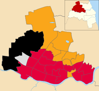
<span class="mw-page-title-main">2019 Newcastle City Council election</span> 2019 UK local government election

The 2019 Newcastle City Council elections took place on 2 May 2019, on the same day as other local elections across the United Kingdom.

<span class="mw-page-title-main">2021 Newcastle City Council election</span> 2021 UK local government election

The 2021 Newcastle City Council election took place on 6 May 2021 to elect members of Newcastle City Council in England. This was on the same day as other local elections across the United Kingdom.
References

  1. "Heaton - Visiting Newcastle upon Tyne". Newcastle Tourism Board. Retrieved 27 February 2022.
  2. "Your Councillors - Newcastle City Council". www.newcastle.gov.uk.
  3. John Nichols, Progresses of James the First, vol. 3 (London, 1828), p. 281.
  4. 1 2 3 Morton, David (15 October 2014). "Remember When: Heaton Road in Newcastle in 1901 - then and now". Chroniclelive.co.uk. Retrieved 6 May 2021.
  5. Morgan, Alan (2012). Heaton from farms to foundries. Tyne Bridge Publishing. p. 9. ISBN   978-1-857952-06-3.
  6. Pearson, Lynn F. (1996). Northern City - An Architectural History of Newcastle upon Tyne. Newcastle City Libraries. p. 50. ISBN   1-85795-087-9.
  7. "Electoral Review of Newcastle". Newcastle City Council. Retrieved 5 May 2018.
  8. "History of Heaton, in Newcastle upon Tyne and Northumberland". A Vision of Britain through Time . Retrieved 9 May 2024.
  9. "Relationships and changes Heaton CP/Tn through time". A Vision of Britain through Time. Retrieved 9 May 2024.
  10. "Population statistics Heaton CP/Tn through time". A Vision of Britain through Time. Retrieved 9 May 2024.
  11. "Life in Heaton: Newcastle's 'trendy' suburb". 11 May 2017.
  12. "CA Parsons: The Tyneside factory that powered nation". Chroniclelive.co.uk. 25 March 2013. Retrieved 6 May 2021.
  13. "Going potty over tea company exhibition". The Northern Echo . Retrieved 6 May 2021.
  14. Walton Robinson. "What's it like to live in Heaton?" . Retrieved 31 August 2012.
  15. Meechan, Simon (11 May 2017). "Life in Heaton: Newcastle's 'trendy' suburb". Chroniclelive.co.uk. Retrieved 6 May 2021.
  16. "High Heaton Library". Newcastle City Council. Retrieved 27 February 2022.
  17. PA, Tom Wilkinson (9 June 2023). "Major fire destroys listed halls of residence". The Irish News. Retrieved 10 June 2023.
  18. Goodwin, Nicole (8 January 2020). "What members of Heaton Mosque want you to understand about Islam". ChronicleLive.
  19. "Disused Stations: Heaton (2nd) Station". Disused-stations.org.uk. Retrieved 6 May 2021.
  20. "Heaton Road Surgery". heatonroadsurgery.nhs.uk.
  21. "Sir Ove Arup: engineer and philosopher". Heatonhistorygroup.org. 20 February 2018. Retrieved 6 May 2021.
  22. "Jack Common". Heatonhistorygroup.org. 29 September 2013. Retrieved 6 May 2021.
  23. Morton, David (18 September 2015). "How Jimi Hendrix rocked Newcastle and South Shields in 1967". Chroniclelive.co.uk. Retrieved 6 May 2021.
  24. "Ten interesting facts about Heaton". Chroniclelive.co.uk. 1 January 2012. Retrieved 7 October 2020.