Dodge County is a county located in the U.S. state of Wisconsin. As of the 2020 census, the population was 89,396. Its county seat is Juneau. The county was created from the Wisconsin Territory in 1836 and organized in 1844.

Columbia County is a county located in the U.S. state of Wisconsin. As of the 2020 census, the population was 58,490. Its county seat and largest city is Portage. The county was created in 1846 as part of Wisconsin Territory.

Harris is a city in Chisago County, Minnesota, United States. The population was 1,132 at the 2010 census. There is a restaurant, a post office, a bar and grill, and tattoo shop, among other businesses. Interstate 35 serves as a main route for the community.

Calamus is a town in Dodge County, Wisconsin, United States. The population was 1,005 at the 2000 census. The unincorporated community of South Beaver Dam is located in the town. The unincorporated community of Lost Lake is also located partially in the town.

Horicon is a city in Dodge County, Wisconsin, United States. The population was 3,767 at the 2020 census.

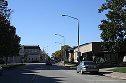
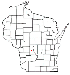
Iron Ridge is a village in Dodge County, Wisconsin, United States. The population was 904 at the 2010 census. The village was founded on a railroad line, named for the iron mined in the area. Its ZIP code is 53035.

Portland is a town in Dodge County, Wisconsin, United States. The population was 1,106 at the 2000 census. The unincorporated community of Portland is located partially in the town.

Camp Douglas is a village in Juneau County, Wisconsin, United States. The population was 647 at the 2020 census, up from 601 at the 2010 census. Camp Douglas is home to Volk Field Air National Guard Base.

Cutler is a town in Juneau County, Wisconsin, United States. The population was 282 at the 2000 census. The town was named in honor of Charles "Fred" Cutler, who had been the Juneau County clerk for thirty years.

Elroy is a city in Juneau County, Wisconsin, United States, along the Baraboo River and at the east end of the Elroy-Sparta State Trail. The population was 1,356 at the 2020 census.

The Town of Germantown is in Juneau County, Wisconsin, in the United States. At the 2000 census, the town population was 1,174.

Kildare is a town in Juneau County, Wisconsin, United States. The population was 557 at the 2000 census.

Lemonweir is a town in Juneau County, Wisconsin, United States. The population was 1,763 at the 2000 census. The unincorporated community of Lemonweir is located in the town.
Lisbon is a town in Juneau County, Wisconsin, United States. The population was 1,020 at the 2000 census.

Mauston is a city in and the county seat of Juneau County, Wisconsin, United States. The population was 4,347 as of the 2020 census. It is approximately 70 miles northwest from the state capital, Madison.

Randolph is a village in Columbia and Dodge counties in the U.S. state of Wisconsin. The population was 1,796 at the 2020 census. Of this, 1,338 were in Dodge County, and 458 were in Columbia County. The village is located at the southeast corner of the Town of Randolph in Columbia County, although only a tiny portion of the village lies within the town. Most of the village lies within the Town of Westford in Dodge County. Small portions also lie within the Town of Fox Lake to the north and the Town of Courtland in Columbia County.

Clyman is a village in Dodge County, Wisconsin, United States. The population was 397 at the 2020 census. The village is surrounded by the Town of Clyman.

Fox Lake is a city in Dodge County, Wisconsin, United States. The population was 1,604 at the 2020 census. The city is located within the Town of Fox Lake.

Lowell is a village in Dodge County, Wisconsin, United States, along the Beaver Dam River. The population was 309 at the 2020 census. The village is located within the Town of Lowell.

Theresa is a village in Dodge County, Wisconsin, United States. The population was 1,255 at the 2020 census. The village is surrounded by the Town of Theresa.