Lake Lucerne, Florida

Last updated

Lake Lucerne
Neighborhood of Miami Gardens
FLMap-doton-LakeLucerne.PNG
Location in the state of Florida
Coordinates: 25°57′56″N80°15′14″W / 25.96556°N 80.25389°W / 25.96556; -80.25389
Country United States
State Florida
County Miami-Dade
City Miami Gardens
Area
  Total
2.6 sq mi (6.8 km2)
  Land2.6 sq mi (6.8 km2)
  Water0.0 sq mi (0.0 km2)
Population
 (2000)
  Total
9,132
  Density3,492.3/sq mi (1,348.4/km2)
Time zone UTC-5 (Eastern (EST))
  Summer (DST) UTC-4 (EDT)
FIPS code 12-38300 [1]

Lake Lucerne is a neighborhood in Miami Gardens, Florida. It is formerly a census-designated place. The population was 9,132 at the time of the 2000 United States census.

Contents

Geography

Lake Lucerne is located at 25°57′56″N80°15′14″W / 25.96556°N 80.25389°W / 25.96556; -80.25389 (25.965420, -80.253858). [2]

According to the United States Census Bureau, the CDP has a total area of 6.8 km2 (2.6 sq mi). 6.8 km2 (2.6 sq mi) of it is land and 0.38% is water.

Demographics

Historical population
CensusPop.Note
1980 9,762
1990 9,478−2.9%
2000 9,132−3.7%
source: [3]
Lake Lucerne CDP, Florida – Racial and ethnic composition
Note: the US Census treats Hispanic/Latino as an ethnic category. This table excludes Latinos from the racial categories and assigns them to a separate category. Hispanics/Latinos may be of any race.
Race / Ethnicity (NH = Non-Hispanic)Pop 2000 [4] % 2000
White alone (NH)1411.54%
Black or African American alone (NH)7,50982.23%
Native American or Alaska Native alone (NH)110.12%
Asian alone (NH)150.16%
Pacific Islander alone (NH)00.00%
Other race alone (NH)130.14%
Mixed race or Multiracial (NH)900.99%
Hispanic or Latino (any race)1,35314.82%
Total9,132100.00%

As of the census [1] of 2000, there were 9,132 people, 2,631 households, and 2,117 families residing in the CDP. The population density was 1,350.9 people/km2 (3,499 people/sq mi). There were 2,835 housing units at an average density of 419.4 units/km2 (1,086 units/sq mi). The racial makeup of the CDP was 11.09% White (1.5% were Non-Hispanic White,) [5] 83.75% African American, 0.19% Native American, 0.16% Asian, 0.01% Pacific Islander, 2.54% from other races, and 2.26% from two or more races. Hispanic or Latino of any race were 14.82% of the population.

There were 2,631 households, out of which 39.3% had children under the age of 18 living with them, 39.6% were married couples living together, 33.8% had a female householder with no husband present, and 19.5% were non-families. 15.0% of all households were made up of individuals, and 3.5% had someone living alone who was 65 years of age or older. The average household size was 3.47 and the average family size was 3.83.

In the CDP, the population was spread out, with 33.5% under the age of 18, 10.8% from 18 to 24, 28.0% from 25 to 44, 20.8% from 45 to 64, and 7.0% who were 65 years of age or older. The median age was 29 years. For every 100 females, there were 88.4 males. For every 100 females age 18 and over, there were 80.8 males.

The median income for a household in the CDP was $35,166, and the median income for a family was $37,027. Males had a median income of $25,281 versus $22,031 for females. The per capita income for the CDP was $13,482. About 15.8% of families and 16.5% of the population were below the poverty line, including 22.1% of those under age 18 and 17.7% of those age 65 or over.

As of 2000, before being annexed to Miami Gardens, English as a first language accounted for 82.27% of all residents, while Spanish accounted for 14.16%, French Creole was at 2.55%, and French as a mother tongue made up 1.00% of the population. [6]

Education

The Miami-Dade County Public Schools operate area public schools. Those in the former CDP include: [7]

Religion

Antioch Mission Baptist Church of Miami Gardens is in the former CDP. [7] [10]

Recreation

Calder Casino is in the former Lake Lucerne CDP. [7] [11]

Related Research Articles

<span class="mw-page-title-main">Andover, Florida</span> Neighborhood of Miami Gardens in Miami-Dade, Florida, United States

Andover is a neighborhood in Miami Gardens, Florida. It was formerly a census-designated place. The population was 8,489 at the 2000 census. Transmitters for several Miami television stations are located in Andover.

<span class="mw-page-title-main">Bunche Park, Florida</span> Neighborhood of Miami Gardens in Miami-Dade, Florida, United States

Bunche Park is a neighborhood in Miami Gardens, Florida, United States. It was formerly a census-designated place.

<span class="mw-page-title-main">Carol City, Florida</span> Neighborhood of Miami Gardens in Miami-Dade, Florida, United States

Carol City is a neighborhood in Miami Gardens, Florida, United States. It was formerly listed as a census-designated place in the 2000 U.S. Census.

<span class="mw-page-title-main">Country Club, Florida</span> Census-designated place in Florida

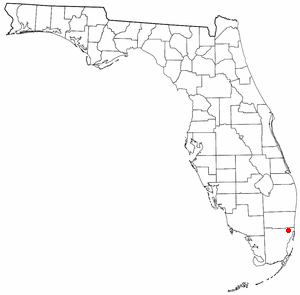
Country Club is a suburban census-designated place located in northwest Miami-Dade County, Florida, United States. It is located in the Miami metropolitan area of South Florida. The CDP is named after the Country Club of Miami, which was established in 1961 in what was then an unpopulated and undeveloped section of the county. The population was 49,967 at the 2020 census, up from 3,408 in 1990.

<span class="mw-page-title-main">Gladeview, Florida</span> Census-designated place in Florida

Gladeview is a census-designated place (CDP) in Miami-Dade County, Florida, United States. It is part of the Miami metropolitan area of South Florida. The population was 14,927 at the 2020 census, up from 11,535 in 2010.

<span class="mw-page-title-main">Biscayne Gardens, Florida</span> Census-designated place in Florida

Biscayne Gardens is a census-designated place (CDP) in Miami-Dade County, Florida, United States. It is part of the Miami metropolitan area of South Florida. The population was 32,499 at the 2020 US census.

<span class="mw-page-title-main">Kendall West, Florida</span> Census-designated place in Florida

Kendall West is a census-designated place and unincorporated community in Miami-Dade County, Florida, west of the Florida Turnpike. It is located in the Miami metropolitan area of South Florida. The population was 36,536 at the 2020 census.

Norland, also known as Norwood, is a former census-designated place located in northern Miami-Dade County, Florida. The population was 22,995 at the 2000 census. The latest estimated population stands at 23,500. In 2003 the majority of this CDP was incorporated into the city of Miami Gardens, and it now serves as one of the city's neighborhoods.

<span class="mw-page-title-main">Olympia Heights, Florida</span> Census-designated place in Florida

Olympia Heights is a census-designated place in Miami-Dade County, Florida, United States. It is located in the Miami metropolitan area of South Florida. The population was 12,873 at the 2020 census.

<span class="mw-page-title-main">Opa-locka North, Florida</span> Neighborhood of Miami Gardens in Miami-Dade, Florida, United States

Opa-locka North is a neighborhood in Miami Gardens, Florida, United States. It was formerly a census-designated place. The population was 6,224 at the 2000 census.

<span class="mw-page-title-main">Palm Springs North, Florida</span> Census-designated place in Florida

Palm Springs North is an unincorporated community and census-designated place (CDP) in Miami-Dade County, Florida, United States. It is part of the Miami metropolitan area of South Florida. The population was 5,030 at the 2020 census.

<span class="mw-page-title-main">Richmond Heights, Florida</span> Census-designated place in Florida

Richmond Heights is a census-designated place (CDP) in Miami-Dade County, Florida, United States. It is part of the Miami metropolitan area of South Florida. The population was 8,944 at the 2020 census.

<span class="mw-page-title-main">Scott Lake, Florida</span> Neighborhood of Miami Gardens in Miami-Dade, Florida, United States

Scott Lake is a neighborhood in Miami Gardens, Florida. It was formerly its own census-designated place. The population was 14,401 at the 2000 census.

<span class="mw-page-title-main">Tamiami, Florida</span> Census-designated place in Florida

Tamiami is a census-designated place (CDP) in Miami-Dade County, Florida, United States. It is part of the Miami metropolitan area of South Florida. The population was 54,212 at the 2020 census.

<span class="mw-page-title-main">The Crossings, Florida</span> CDP in Florida

The Crossings is a census-designated place (CDP) and suburb of Miami in Miami-Dade County, Florida, United States. It is part of the Miami metropolitan area of South Florida. The CDP includes the neighborhoods of The Crossings, Devon Aire, and Calusa. The population was 23,276 at the 2020 census.

<span class="mw-page-title-main">The Hammocks, Florida</span> Census-designated place in Florida

The Hammocks is a planned community and census-designated place in Miami-Dade County, Florida, United States. It is part of the Miami metropolitan area of South Florida. The population was 59,480 at the 2020 census, up from 51,003 in 2010.

<span class="mw-page-title-main">West Little River, Florida</span> CDP in Miami-Dade County, Florida, US

West Little River is a census-designated place (CDP) in Miami-Dade County, Florida, United States. It is part of the Miami metropolitan area of South Florida. The population was 34,128 at the 2020 census.

<span class="mw-page-title-main">Westchester, Florida</span> Census-designated place in Florida

Westchester is a census-designated place (CDP) and neighborhood in Miami-Dade County, Florida. It is part of the Miami metropolitan area of South Florida. Prior to the 2020 U.S. Census, the neighboring University Park CDP was merged into Westchester CDP, effectively doubling its geography and population. Per the 2020 census, the population was 56,384.

<span class="mw-page-title-main">Westwood Lakes, Florida</span> Census-designated place in Florida

Westwood Lakes is a census-designated place and unincorporated community of Miami-Dade County, Florida, United States. It is part of the Miami metropolitan area of South Florida. The population was 11,373 at the 2020 census.

<span class="mw-page-title-main">South Miami Heights, Florida</span> Census-designated place in Florida

South Miami Heights is a census-designated place (CDP), originally known as Eureka, in Miami-Dade County, Florida. It is part of the Miami metropolitan area of South Florida. The population was 36,770 as of the 2020 census.

References

  1. 1 2 "U.S. Census website". United States Census Bureau . Retrieved 2008-01-31.
  2. "US Gazetteer files: 2010, 2000, and 1990". United States Census Bureau. 2011-02-12. Retrieved 2011-04-23.
  3. "CENSUS OF POPULATION AND HOUSING (1790-2000)". U.S. Census Bureau . Retrieved 2010-07-17.
  4. "P004 Hispanic or Latino, and Not Hispanic or Latino by Race – 2000: DEC Summary File 1 – Lake Lucerne CDP, Florida". United States Census Bureau .
  5. "Demographics of Lake Lucerne, FL". MuniNetGuide.com. Archived from the original on 2009-08-25. Retrieved 2007-12-15.
  6. "MLA Data Center Results for Lake Lucerne, Florida". Modern Language Association . Retrieved 2007-12-15.
  7. 1 2 3 "2000 Census Block Map: Lake Lucerne CDP" (PDF). U.S. Census Bureau. - Pages 1 and 2 - Compare this map to the addresses of places.
  8. "North County K-8 Center". Miami-Dade County Public Schools . Retrieved 2020-05-11. 3250 NW 207TH STREET MIAMI GARDENS, FL 33056
  9. "Robert Renick Education Center". National Center for Education Statistics . Retrieved 2020-05-11. 2201 NW 207TH ST MIAMI GARDENS, FL 33056-1684
  10. "Home". Antioch Mission Baptist Church of Miami Gardens. Retrieved 2020-05-12. MIAMI GARDENS CAMPUS 21311 N.W. 34th Ave. Miami Gardens, FL 33056
  11. "Home". Calder Casino . Retrieved 2020-05-12. 21001 NW 27th Avenue, Miami Gardens, FL 33056 - Compare with the CDP map.

Further reading