
Bunche Park is a neighborhood in Miami Gardens, Florida, United States. It was formerly a census-designated place.

Carol City is a neighborhood in Miami Gardens, Florida, United States. It was formerly listed as a census-designated place in the 2000 U.S. Census.
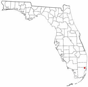
Cutler was a pioneer town in Miami-Dade County, Florida that existed from 1883 to 1915, when most of it was absorbed into the Charles Deering Estate. The area adjoining the western border of the estate later became the Cutler census-designated place (CDP) through the time of the 2000 census, after which it was incorporated into the Village of Palmetto Bay. The population was 17,390 at the 2000 census.
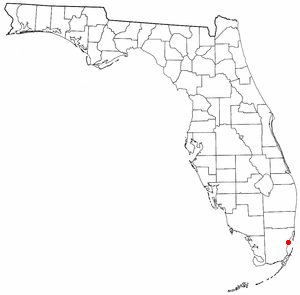
East Perrine was a census-designated place in Miami-Dade County, Florida at the time of the 2000 census. In the 1990 census it was part of Perrine census-designated place. It has since been incorporated into the Village of Palmetto Bay. The population was 7,079 at the 2000 census.

Biscayne Gardens is a census-designated place (CDP) in Miami-Dade County, Florida, United States. It is part of the Miami metropolitan area of South Florida. The population was 32,499 at the 2020 US census.

Goulds is an unincorporated community and census-designated place (CDP) in Miami-Dade County, Florida, United States. The area was originally populated as the result of a stop on the Florida East Coast Railroad. The railroad depot was located near the current Southwest 224th Street. The community was named after its operator, Lyman Gould, who cut trees for railroad ties. It is part of the Miami metropolitan area of South Florida. As of the 2020 US census, the population stood at 11,446, up from 10,103 in 2010 US census.

Homestead Base is a census-designated place (CDP) in Miami-Dade County, Florida, United States. The CDP comprises the extent of Homestead Air Reserve Base plus some surrounding land. It is part of the Miami metropolitan area of South Florida. The population was 999 at the 2020 census.

Ives Estates is a census-designated place (CDP) in Miami-Dade County, Florida. It is part of the Miami metropolitan area of South Florida. The population was 25,005 at the 2020 census, up from 19,525 in 2010.

Lake Lucerne is a neighborhood in Miami Gardens, Florida. It is formerly a census-designated place. The population was 9,132 at the time of the 2000 United States census.
Norland, also known as Norwood, is a former census-designated place located in northern Miami-Dade County, Florida. The population was 22,995 at the 2000 census. The latest estimated population stands at 23,500. In 2003 the majority of this CDP was incorporated into the city of Miami Gardens, and it now serves as one of the city's neighborhoods.
Opa-locka North is a neighborhood in Miami Gardens, Florida, United States. It was formerly a census-designated place. The population was 6,224 at the 2000 census.
Scott Lake is a neighborhood in Miami Gardens, Florida. It was formerly its own census-designated place. The population was 14,401 at the 2000 census.

Tamiami is a census-designated place (CDP) in Miami-Dade County, Florida, United States. It is part of the Miami metropolitan area of South Florida. The population was 54,212 at the 2020 census.

The Crossings is a census-designated place (CDP) and suburb of Miami in Miami-Dade County, Florida, United States. It is part of the Miami metropolitan area of South Florida. The CDP includes the neighborhoods of The Crossings, Devon Aire, and Calusa. The population was 23,276 at the 2020 census.

The Hammocks is a planned community and census-designated place in Miami-Dade County, Florida, United States. It is part of the Miami metropolitan area of South Florida. The population was 59,480 at the 2020 census, up from 51,003 in 2010.

West Little River is a census-designated place (CDP) in Miami-Dade County, Florida, United States. It is part of the Miami metropolitan area of South Florida. The population was 34,128 at the 2020 census.

Westchester is a census-designated place (CDP) and neighborhood in Miami-Dade County, Florida. It is part of the Miami metropolitan area of South Florida. Prior to the 2020 U.S. Census, the neighboring University Park CDP was merged into Westchester CDP, effectively doubling its geography and population. Per the 2020 census, the population was 56,384.

Westwood Lakes is a census-designated place and unincorporated community of Miami-Dade County, Florida, United States. It is part of the Miami metropolitan area of South Florida. The population was 11,373 at the 2020 census.
Meadow Woods is a census-designated place (CDP) and an unincorporated suburban development area located in southern Orange County, Florida, United States, between Orlando International Airport and Kissimmee. It is part of the Orlando–Kissimmee–Sanford, Florida Metropolitan Statistical Area. As of 2020, the population was 43,790.

South Miami Heights is a census-designated place (CDP), originally known as Eureka, in Miami-Dade County, Florida. It is part of the Miami metropolitan area of South Florida. The population was 36,770 as of the 2020 census.

