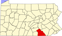
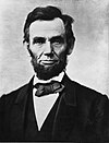
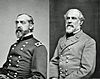
Marker title Image Date dedicated Location Marker type Topics Abraham Lincoln September 14, 1954 PA 94 (Carlisle St.) & Park Ave., Hanover 39°48′10″N 76°59′09″W / 39.80283°N 76.98579°W / 39.80283; -76.98579 (Abraham Lincoln ) City Abraham Lincoln, Government & Politics, Government & Politics 19th Century Amanda Berry Smith October 2, 1993 108 S. Main St., Grace U.M. Church, Shrewsbury 39°46′01″N 76°40′47″W / 39.76704°N 76.67964°W / 39.76704; -76.67964 (Amanda Berry Smith ) Roadside African American, Education, Music & Theater, Publishing, Religion, Women America's First Iron Steamboat October 23, 1947 Pa. 462 (old U.S. 30), .3 mile W of Wrightsville 40°01′18″N 76°32′54″W / 40.02154°N 76.54821°W / 40.02154; -76.54821 (America's First Iron Steamboat ) Roadside Business & Industry, Transportation Articles of Confederation December 19, 2001 NE Corner of Continental Square (Market & George Sts.), York 39°57′46″N 76°43′39″W / 39.962671°N 76.72756°W / 39.962671; -76.72756 (Articles of Confederation ) City Government & Politics, Government & Politics 18th Century Battle of Hanover September 14, 1954 SW section of square, Hanover 39°48′02″N 76°59′01″W / 39.80052°N 76.98354°W / 39.80052; -76.98354 (Battle of Hanover ) City American Civil War, Military Black Horse Tavern December 15, 1949 NW section of square, York 39°57′46″N 76°43′41″W / 39.96269°N 76.72818°W / 39.96269; -76.72818 (Black Horse Tavern ) City Business & Industry, Inns & Taverns, William Penn Bob Hoffman (promoter) November 9, 1998 3300 Board Rd. (SR 1031) W of Emigsville, just off I-83 exit, York 40°01′24″N 76°44′29″W / 40.02343°N 76.74147°W / 40.02343; -76.74147 (Bob Hoffman ) Roadside Government & Politics, Sports Camp Security July 17, 1947 E Market St (PA 462/old US 30), 3 miles E of York at Stonybrook 39°59′02″N 76°38′54″W / 39.98382°N 76.64833°W / 39.98382; -76.64833 (Camp Security ) Roadside American Revolution, Military Captain Thomas Cresap (1703-1790) (PLAQUE) September 27, 1942 PA 624 at Bank Hill Rd., 2.4 NE of Craley 39°58′23″N 76°30′00″W / 39.97296°N 76.49993°W / 39.97296; -76.49993 (Captain Thomas Cresap - PLAQUE ) Plaque Early Settlement, Government & Politics 17th Century, Houses & Homesteads, Military, Native American Codorus Furnace August 12, 1954 PA 24 at SR 1008, Starview 40°02′54″N 76°41′18″W / 40.04842°N 76.68839°W / 40.04842; -76.68839 (Codorus Furnace ) Roadside Business & Industry, Coal, Furnaces, Iron Colonel Thomas Hartley December 14, 1949 W. Market St. between Beaver & George Sts., York 39°57′43″N 76°43′44″W / 39.96196°N 76.72888°W / 39.96196; -76.72888 (Colonel Thomas Hartley ) City Government & Politics, Government & Politics 18th Century Cresap's Fort June 6, 1960 Pa. 624, 2.4 miles NE of Craley 39°58′25″N 76°29′39″W / 39.97359°N 76.49425°W / 39.97359; -76.49425 (Cresap's Fort ) Roadside Buildings, Forts First Pinchot Road May 25, 1963 PA 177 (Rossville Rd.) & Bull Rd., 1.5 miles S of Lewisberry 40°06′58″N 76°52′02″W / 40.116114°N 76.86717°W / 40.116114; -76.86717 (First Pinchot Road ) Roadside Roads, Transportation Gen. Horatio Gates December 14, 1949 W. Market St. between Pershing Ave. & Beaver St., York 39°57′40″N 76°43′53″W / 39.961144°N 76.73135°W / 39.961144; -76.73135 (Gen. Horatio Gates ) City American Revolution, George Washington, Military Gen. Wayne Headquarters December 14, 1949 NW corner, Market & Beaver Sts., York 39°57′42″N 76°43′47″W / 39.96175°N 76.72975°W / 39.96175; -76.72975 (Gen. Wayne Headquarters ) City American Revolution, Military Gettysburg Campaign November 12, 1947 PA 74 (Carlisle Rd.) & Davidsburg Rd., Weiglestown, S of Dover 39°59′02″N 76°49′26″W / 39.98382°N 76.82382°W / 39.98382; -76.82382 (Gettysburg Campaign ) Roadside Civil War, Military, Roads Gettysburg Campaign October 8, 1947 PA 462 (old US 30), John & W Market Sts., W of York 39°56′55″N 76°46′47″W / 39.94873°N 76.77977°W / 39.94873; -76.77977 (Gettysburg Campaign ) Roadside Civil War, Military Gettysburg Campaign November 11, 1947 PA 116 near PA 216, just E of Hanover (at Snyder's of Hanover) 39°48′11″N 76°57′10″W / 39.80301°N 76.95273°W / 39.80301; -76.95273 (Gettysburg Campaign ) Roadside Civil War, Military Gettysburg Campaign November 11, 1947 PA 194, just SW of Hanover 39°47′36″N 76°59′29″W / 39.793384°N 76.99142°W / 39.793384; -76.99142 (Gettysburg Campaign ) Roadside Civil War, Military Gettysburg Campaign November 12, 1947 PA 462 (old US 30) at Susquehanna River Bridge, Wrightsville 39°56′51″N 76°46′51″W / 39.94744°N 76.78095°W / 39.94744; -76.78095 (Gettysburg Campaign ) Roadside Civil War, Military Gettysburg Campaign - Raid on Jefferson June 27, 2009 Town Sq. @ York St. (SR 3041) & Baltimore St. (Rt. 516), Jefferson 39°49′02″N 76°50′30″W / 39.8171°N 76.8416°W / 39.8171; -76.8416 (Gettysburg Campaign - Raid on Jefferson ) Roadside Cities & Towns, Civil War, Military Globe Inn December 15, 1949 SW section of Square, York 39°57′44″N 76°43′41″W / 39.96235°N 76.72807°W / 39.96235; -76.72807 (Globe Inn ) City Buildings, Business & Industry, Inns & Taverns Golden Plough Tavern June 23, 1967 462 (W Market St.), just E of Pershing Ave., York 39°57′41″N 76°43′53″W / 39.96129°N 76.73148°W / 39.96129; -76.73148 (Golden Plough Tavern ) City Buildings, Business & Industry, Inns & Taverns Hall & Sellers Press December 14, 1949 SW corner, Market & Beaver Sts., York 39°57′43″N 76°43′48″W / 39.96186°N 76.72992°W / 39.96186; -76.72992 (Hall & Sellers Press ) City Business & Industry Hanover Junction Railroad Station May 31, 1953 PA 616, 4 miles S of New Salem at Hanover Junction (off rd. at train station/museum) 39°50′36″N 76°46′37″W / 39.84329°N 76.77706°W / 39.84329; -76.77706 (Hanover Junction ) Roadside Abraham Lincoln, Civil War, Military, Railroads, Transportation Jacob L. Devers June 26, 1999 254 Roosevelt Avenue, York 39°57′47″N 76°44′29″W / 39.963°N 76.74134°W / 39.963; -76.74134 (Jacob L. Devers ) City Military, Military Post-Civil War James Smallwood Schoolhouse May 4, 2002 200 Block of South Pershing Avenue, York 39°57′27″N 76°43′47″W / 39.95749°N 76.72982°W / 39.95749; -76.72982 (James Smallwood Schoolhouse ) City African American, Civil Rights, Education James Smith December 14, 1949 E. Market St., Presbyterian churchyard, York 39°57′50″N 76°43′24″W / 39.96386°N 76.72331°W / 39.96386; -76.72331 (James Smith ) City Government & Politics, Government & Politics 18th Century, Iron, Professions & Vocations Kilpatrick Headquarters September 14, 1954 NW section of Square, Hanover 39°48′02″N 76°59′02″W / 39.80047°N 76.98377°W / 39.80047; -76.98377 (Kilpatrick Headquarters ) City Civil War, Military Major John Clark December 6, 1949 S. Beaver St. near W. Market St., York 39°57′41″N 76°43′48″W / 39.96149°N 76.72989°W / 39.96149; -76.72989 (Major John Clark ) City American Revolution, Military Market House September 14, 1954 NE section of Square, Rt. 94 (Baltimore St.) & Frederick St./Broadway, Hanover 39°48′02″N 76°58′58″W / 39.80046°N 76.98284°W / 39.80046; -76.98284 (Market House ) City Buildings, Business & Industry, Houses & Homesteads, Police and Safety Mason–Dixon line May 27, 1970 Rt. 94 at state line 39°43′14″N 76°54′57″W / 39.72042°N 76.91578°W / 39.72042; -76.91578 (Mason–Dixon line ) Roadside Early Settlement, Government & Politics 18th Century Mason–Dixon line May 27, 1970 PA 74 (MD 165) at State Line 39°55′19″N 76°20′35″W / 39.92182°N 76.34297°W / 39.92182; -76.34297 (Mason–Dixon line ) Roadside Government & Politics, Government & Politics 18th Century McAllister Tavern October 6, 1954 Baltimore (PA 94) & Middle Sts., Hanover 39°47′22″N 76°47′53″W / 39.78949°N 76.79809°W / 39.78949; -76.79809 (McAllister Tavern ) City Buildings, Business & Industry, Inns & Taverns McClean House December 15, 1949 NE section of Square, George & Market Sts., York 39°57′46″N 76°43′39″W / 39.96269°N 76.72763°W / 39.96269; -76.72763 (McClean House ) City Buildings, Government & Politics, Government & Politics 18th Century, Houses & Homesteads, Professions & Vocations Penn Common December 6, 1949 College Ave. at Penn Park, York (MISSING) City Government & Politics, Government & Politics 19th Century, William Penn Philip Livingston December 14, 1949 N. George St. (Bus. I83) at Prospect Hill Cemetery, York 39°58′23″N 76°43′55″W / 39.97297°N 76.73182°W / 39.97297; -76.73182 (Philip Livingston ) City Government & Politics, Government & Politics 18th Century Phineas Davis December 6, 1949 NW corner, King & Newberry Sts., York 39°57′32″N 76°44′03″W / 39.95887°N 76.73416°W / 39.95887; -76.73416 (Phineas Davis ) City Business & Industry, Transportation Provincial Courthouse December 15, 1949 Market & George Sts., SE section of Square, York 39°57′44″N 76°43′39″W / 39.9623°N 76.7274°W / 39.9623; -76.7274 (Provincial Courthouse ) City American Revolution, Government & Politics, Government & Politics 18th Century Springetsbury Manor November 20, 1950 PA 624, .1 mile S of Wrightsville 40°01′29″N 76°31′37″W / 40.02468°N 76.52708°W / 40.02468; -76.52708 (Springetsbury Manor ) Roadside Buildings, Government & Politics 17th Century, Mansions & Manors, William Penn Spurgeon Milton Keeny (1893-1988) July 17, 1993 155 South Main St., Shrewsbury 39°45′55″N 76°40′45″W / 39.76524°N 76.67917°W / 39.76524; -76.67917 (Spurgeon Milton Keeny (1893-1988) ) City Ethnic & Immigration, Government & Politics, Government & Politics 20th Century Susquehanna and Tidewater Canal April 2, 1948 Long Level Rd.(PA 624), .1 mile S of Wrightsville 40°01′28″N 76°31′36″W / 40.02457°N 76.5267°W / 40.02457; -76.5267 (Susquehanna and Tidewater Canal ) Roadside Canals, Navigation, Railroads, Transportation Susquehanna and Tidewater Canal April 2, 1948 Furnace Rd. (PA 425) at York Furnace 39°50′42″N 76°22′55″W / 39.84501°N 76.38181°W / 39.84501; -76.38181 (Susquehanna and Tidewater Canal ) Roadside Canals, Navigation, Railroads, Transportation Susquehanna and Tidewater Canal April 2, 1948 PA 624, 1.8 miles NE of Craley 39°57′57″N 76°29′25″W / 39.96592°N 76.49015°W / 39.96592; -76.49015 (Susquehanna and Tidewater Canal ) Roadside Canals, Navigation, Railroads, Transportation Susquehanna Canal April 2, 1948 PA 624, 1.8 miles NE of Craley 39°57′57″N 76°29′25″W / 39.96592°N 76.4903°W / 39.96592; -76.4903 (Susquehanna Canal ) Roadside Canals, Navigation, Transportation Susquehanna Canal April 5, 1948 Long Level Rd. (PA 624), .1 mile S of Wrightsville (MISSING) Roadside Canals, Navigation, Transportation Susquehanna Canal April 5, 1948 Furnace Rd. (PA 425) at York Furnace 39°52′31″N 76°22′56″W / 39.87516°N 76.38225°W / 39.87516; -76.38225 (Susquehanna Canal ) Roadside Canals, Navigation, Transportation Warrington Meetinghouse July 17, 1947 York St. / Carlisle Rd. (PA 74) at Quaker Meeting Rd., E of Wellsville 40°03′11″N 76°55′48″W / 40.05317°N 76.93008°W / 40.05317; -76.93008 (Warrington Meetinghouse ) Roadside Houses & Homesteads, Religion William C. Goodridge December 17, 1987 123 E. Philadelphia St. (PA 74 & 462), York 39°57′52″N 76°43′33″W / 39.96458°N 76.72583°W / 39.96458; -76.72583 (William C. Goodridge ) City African American, Business & Industry, Professions & Vocations, Underground Railroad York July 17, 1947 1415 E Market St. (PA 462), just W of I-83, York (MISSING) 39°50′36″N 76°46′37″W / 39.84324°N 76.77706°W / 39.84324; -76.77706 (York ) Roadside Cities & Towns, Government & Politics 18th Century York July 17, 1947 US 30 (westbound), just west of I-83, York Roadside Cities & Towns, Government & Politics 18th Century York July 17, 1947 PA 462 (W Market St.), W of York (MISSING) Roadside Cities & Towns, Government & Politics 18th Century York July 17, 1947 US 111 (S George St.) & Rathton St., at hospital, York 39°56′43″N 76°43′15″W / 39.9452°N 76.72095°W / 39.9452; -76.72095 (York ) Roadside Cities & Towns, Early Settlement, Government & Politics, Government & Politics 18th Century York County August 19, 1982 Colonial Courthouse, 205 W. Market St., York 39°57′41″N 76°43′54″W / 39.96131°N 76.73176°W / 39.96131; -76.73176 (York County ) City Government & Politics, Government & Politics 18th Century York County Academy September 16, 1949 N. Beaver St. at building (Missing) Roadside Education, Religion York County Prison December 6, 1949 NE corner, King & George Sts., York 39°57′32″N 76°20′30″W / 39.95887°N 76.3416°W / 39.95887; -76.3416 (York County Prison ) City American Revolution, Government & Politics, Government & Politics 18th Century, Military York House July 25, 1967 225 E. Market St., York 39°57′50″N 76°43′23″W / 39.96397°N 76.72299°W / 39.96397; -76.72299 (York House ) City Buildings, Houses & Homesteads, Mansions & Manors, Railroads York Imperial Apple April 5, 1948 S. George St. (SR 3001 / old US 111), just S of intersection w/ Old Baltimore Pk. & Monument Rd., ~2 miles S of York 39°55′24″N 76°43′06″W / 39.92337°N 76.71844°W / 39.92337; -76.71844 (York Imperial Apple ) Roadside Agriculture, Business & Industry York Inter-State Fair September 10, 1978 Pa. 462 (W. Market St.) at fairgrounds, York 39°57′15″N 76°45′17″W / 39.95424°N 76.75471°W / 39.95424; -76.75471 (York Inter-State Fair ) Roadside Agriculture, Business & Industry, Sports York Iron Company Mine n/a Hoff Rd., N of Green Valley Rd. (SR 3041) between Seven Valleys & Jefferson, at mine entrance 39°50′54″N 76°48′44″W / 39.84841°N 76.81222°W / 39.84841; -76.81222 (York Iron Company Mine ) Roadside Business & Industry, Ethnic & Immigration, Iron, Labor York Liberty Bell December 6, 1949 N. Beaver St. near W Gay Ave., in Episcopal Churchyard, York 39°58′09″N 76°43′51″W / 39.96919°N 76.73095°W / 39.96919; -76.73095 (York Liberty Bell ) City Government & Politics, Government & Politics 18th Century York Meeting October 3, 1953 135 W Philadelphia St. (Rts. 74/462) near N Pershing Ave., at meetinghouse, York 39°57′47″N 76°43′54″W / 39.96293°N 76.73164°W / 39.96293; -76.73164 (York Meeting ) City Buildings, Religion