List of United Kingdom locations: Mar-Md

Last updated

The United Kingdom Uk-map.svg
The United Kingdom

This is part of the list of United Kingdom locations: a gazetteer of place names in the United Kingdom showing each place's locality and geographical coordinates.

Contents

Ma (continued)

Mar

LocationLocality Coordinates
(links to map & photo sources)
OS grid
reference
Màraig or MaaruigWestern Isles 57°57′N6°44′W / 57.95°N 06.73°W / 57.95; -06.73 NB2006
Marazanvose Cornwall 50°18′N5°05′W / 50.30°N 05.09°W / 50.30; -05.09 SW8050
Marazion Cornwall 50°07′N5°29′W / 50.11°N 05.48°W / 50.11; -05.48 SW5130
Marbhig Western Isles 58°04′N6°23′W / 58.07°N 06.39°W / 58.07; -06.39 NB4118
Marbury Cheshire 53°00′N2°40′W / 53.00°N 02.67°W / 53.00; -02.67 SJ5545
March Cambridgeshire 52°32′N0°04′E / 52.54°N 00.07°E / 52.54; 00.07 TL4196
March South Lanarkshire 55°25′N3°35′W / 55.41°N 03.59°W / 55.41; -03.59 NS9914
Marcham Oxfordshire 51°40′N1°21′W / 51.66°N 01.35°W / 51.66; -01.35 SU4596
Marchamley Shropshire 52°51′N2°37′W / 52.85°N 02.61°W / 52.85; -02.61 SJ5929
Marchamley Wood Shropshire 52°52′N2°37′W / 52.87°N 02.61°W / 52.87; -02.61 SJ5931
Marchington Staffordshire 52°52′N1°48′W / 52.86°N 01.80°W / 52.86; -01.80 SK1330
Marchington Woodlands Staffordshire 52°50′N1°50′W / 52.84°N 01.83°W / 52.84; -01.83 SK1128
Marchwiel Wrexham 53°01′N2°58′W / 53.01°N 02.97°W / 53.01; -02.97 SJ3547
Marchwood Hampshire 50°53′N1°28′W / 50.88°N 01.46°W / 50.88; -01.46 SU3810
Marcross The Vale Of Glamorgan 51°24′N3°33′W / 51.40°N 03.55°W / 51.40; -03.55 SS9269
Marcus Angus 56°42′N2°48′W / 56.70°N 02.80°W / 56.70; -02.80 NO5157
Marden Kent 51°10′N0°29′E / 51.16°N 00.48°E / 51.16; 00.48 TQ7444
Marden Herefordshire 52°07′N2°42′W / 52.11°N 02.70°W / 52.11; -02.70 SO5247
Marden Wiltshire 51°19′N1°53′W / 51.31°N 01.88°W / 51.31; -01.88 SU0857
Marden North Tyneside 55°01′N1°27′W / 55.02°N 01.45°W / 55.02; -01.45 NZ3570
Marden Ash Essex 51°41′N0°14′E / 51.69°N 00.24°E / 51.69; 00.24 TL5502
Marden Beech Kent 51°10′N0°28′E / 51.16°N 00.47°E / 51.16; 00.47 TQ7343
Marden's Hill East Sussex 51°04′N0°08′E / 51.06°N 00.13°E / 51.06; 00.13
Marden Thorn Kent 51°09′N0°30′E / 51.15°N 00.50°E / 51.15; 00.50 TQ7542
Mardleybury Hertfordshire 51°50′N0°10′W / 51.84°N 00.17°W / 51.84; -00.17 TL2618
Mardu Shropshire 52°26′N3°05′W / 52.44°N 03.09°W / 52.44; -03.09 SO2684
Mardy Monmouthshire 51°49′N3°01′W / 51.82°N 03.01°W / 51.82; -03.01 SO3015
Mardy Shropshire 52°53′N3°04′W / 52.88°N 03.07°W / 52.88; -03.07 SJ2833
Marefield Leicestershire 52°39′N0°54′W / 52.65°N 00.90°W / 52.65; -00.90 SK7407
Mareham le Fen Lincolnshire 53°08′N0°06′W / 53.13°N 00.10°W / 53.13; -00.10 TF2761
Mareham on the Hill Lincolnshire 53°11′N0°05′W / 53.19°N 00.08°W / 53.19; -00.08 TF2868
Marehay Derbyshire 53°01′N1°25′W / 53.02°N 01.41°W / 53.02; -01.41 SK3948
Marehill West Sussex 50°57′N0°29′W / 50.95°N 00.49°W / 50.95; -00.49 TQ0618
Maresfield East Sussex 50°59′N0°04′E / 50.99°N 00.07°E / 50.99; 00.07 TQ4624
Maresfield Park East Sussex 50°59′N0°04′E / 50.99°N 00.07°E / 50.99; 00.07 TQ4624
Marfleet City of Kingston upon Hull 53°44′N0°17′W / 53.74°N 00.28°W / 53.74; -00.28 TA1329
Marford Wrexham 53°05′N2°57′W / 53.09°N 02.95°W / 53.09; -02.95 SJ3656
Margam Neath Port Talbot 51°34′N3°46′W / 51.56°N 03.76°W / 51.56; -03.76 SS7887
Margaret Marsh Dorset 50°58′N2°15′W / 50.96°N 02.25°W / 50.96; -02.25 ST8218
Margaret Roding Essex 51°47′N0°18′E / 51.78°N 00.30°E / 51.78; 00.30 TL5912
Margaretting Essex 51°41′N0°25′E / 51.68°N 00.41°E / 51.68; 00.41 TL6701
Margaretting Tye Essex 51°40′N0°26′E / 51.67°N 00.43°E / 51.67; 00.43 TL6800
Margate Kent 51°23′N1°22′E / 51.38°N 01.37°E / 51.38; 01.37 TR3570
Margery Surrey 51°15′N0°13′W / 51.25°N 00.21°W / 51.25; -00.21 TQ2552
Margnaheglish (north Arran)North Ayrshire 55°32′N5°07′W / 55.53°N 05.12°W / 55.53; -05.12 NS0331
Margnaheglish (west Arran)North Ayrshire 55°41′N5°17′W / 55.69°N 05.29°W / 55.69; -05.29 NR9349
Margrove Park Redcar and Cleveland 54°31′N0°59′W / 54.52°N 00.99°W / 54.52; -00.99 NZ6515
Marham Norfolk 52°39′N0°31′E / 52.65°N 00.51°E / 52.65; 00.51 TF7009
Marhamchurch Cornwall 50°47′N4°31′W / 50.79°N 04.52°W / 50.79; -04.52 SS2203
Marholm Cambridgeshire 52°36′N0°19′W / 52.60°N 00.31°W / 52.60; -00.31 TF1402
Marian Flintshire 53°18′N3°22′W / 53.30°N 03.36°W / 53.30; -03.36 SJ0979
Marian Cwm Denbighshire 53°17′N3°23′W / 53.28°N 03.39°W / 53.28; -03.39 SJ0777
Mariandyrys Isle of Anglesey 53°18′N4°06′W / 53.30°N 04.10°W / 53.30; -04.10 SH6081
Marian-glas or MarianglasIsle of Anglesey 53°20′N4°15′W / 53.33°N 04.25°W / 53.33; -04.25 SH5084
Mariansleigh Devon 50°59′N3°47′W / 50.98°N 03.79°W / 50.98; -03.79 SS7422
Marian-y-de (South Beach)Gwynedd 52°52′N4°25′W / 52.87°N 04.42°W / 52.87; -04.42 SH3734
Marian-y-mor (West End)Gwynedd 52°52′N4°26′W / 52.87°N 04.43°W / 52.87; -04.43 SH3634
Marine Town Kent 51°26′N0°46′E / 51.43°N 00.76°E / 51.43; 00.76 TQ9274
Marionburgh Aberdeenshire 57°08′N2°29′W / 57.14°N 02.49°W / 57.14; -02.49 NJ7006
Marishader Highland 57°35′N6°12′W / 57.58°N 06.20°W / 57.58; -06.20 NG4963
Marjoriebanks Dumfries and Galloway 55°08′N3°26′W / 55.13°N 03.44°W / 55.13; -03.44 NY0883
Mark Somerset 51°13′N2°53′W / 51.21°N 02.88°W / 51.21; -02.88 ST3847
Markbeech Kent 51°09′N0°06′E / 51.15°N 00.10°E / 51.15; 00.10 TQ4742
Markby Lincolnshire 53°16′N0°13′E / 53.27°N 00.21°E / 53.27; 00.21 TF4878
Mark Causeway Somerset 51°13′N2°55′W / 51.21°N 02.91°W / 51.21; -02.91 ST3647
Mark Cross (Rotherfield)East Sussex 51°03′N0°15′E / 51.05°N 00.25°E / 51.05; 00.25 TQ5831
Mark Cross (Chalvington with Ripe / Laughton)East Sussex 50°52′N0°08′E / 50.87°N 00.13°E / 50.87; 00.13 TQ5010
Markeaton City of Derby 52°55′N1°31′W / 52.92°N 01.51°W / 52.92; -01.51 SK3337
Market Bosworth Leicestershire 52°37′N1°25′W / 52.62°N 01.41°W / 52.62; -01.41 SK4003
Market Deeping Lincolnshire 52°40′N0°19′W / 52.67°N 00.32°W / 52.67; -00.32 TF1310
Market Drayton Shropshire 52°54′N2°29′W / 52.90°N 02.49°W / 52.90; -02.49 SJ6734
Market Harborough Leicestershire 52°28′N0°55′W / 52.47°N 00.92°W / 52.47; -00.92 SP7387
Markethill Perth and Kinross 56°32′N3°16′W / 56.53°N 03.27°W / 56.53; -03.27 NO2239
Market Lavington Wiltshire 51°17′N1°59′W / 51.28°N 01.98°W / 51.28; -01.98 SU0154
Market Overton Rutland 52°44′N0°41′W / 52.73°N 00.69°W / 52.73; -00.69 SK8816
Market Rasen Lincolnshire 53°23′N0°20′W / 53.38°N 00.34°W / 53.38; -00.34 TF1089
Market Stainton Lincolnshire 53°17′N0°10′W / 53.29°N 00.17°W / 53.29; -00.17 TF2279
Market Warsop Nottinghamshire 53°11′N1°10′W / 53.19°N 01.16°W / 53.19; -01.16 SK5667
Market Weighton East Riding of Yorkshire 53°51′N0°40′W / 53.85°N 00.67°W / 53.85; -00.67 SE8741
Market Weston Suffolk 52°21′N0°54′E / 52.35°N 00.90°E / 52.35; 00.90 TL9877
Markfield Leicestershire 52°41′N1°17′W / 52.68°N 01.29°W / 52.68; -01.29 SK4810
Mark Hall North Essex 51°46′N0°07′E / 51.77°N 00.11°E / 51.77; 00.11 TL4611
Mark Hall South Essex 51°46′N0°07′E / 51.76°N 00.11°E / 51.76; 00.11 TL4610
Markham Caerphilly 51°42′N3°13′W / 51.70°N 03.21°W / 51.70; -03.21 SO1601
Markham Moor Nottinghamshire 53°14′N0°56′W / 53.24°N 00.93°W / 53.24; -00.93 SK7173
Markinch Fife 56°11′N3°08′W / 56.19°N 03.14°W / 56.19; -03.14 NO2901
Markington North Yorkshire 54°05′N1°33′W / 54.08°N 01.55°W / 54.08; -01.55 SE2965
Markland Hill Bolton 53°34′N2°29′W / 53.57°N 02.48°W / 53.57; -02.48 SD6809
Markle East Lothian 55°59′N2°41′W / 55.98°N 02.69°W / 55.98; -02.69 NT5777
Marksbury Bath and North East Somerset 51°21′N2°29′W / 51.35°N 02.48°W / 51.35; -02.48 ST6662
Mark's Corner Isle of Wight 50°43′N1°20′W / 50.72°N 01.34°W / 50.72; -01.34 SZ4692
Marks Gate Barking and Dagenham 51°35′N0°08′E / 51.58°N 00.13°E / 51.58; 00.13 TQ4890
Marks Tey Essex 51°52′N0°46′E / 51.87°N 00.77°E / 51.87; 00.77 TL9123
Markyate Hertfordshire 51°50′N0°28′W / 51.83°N 00.46°W / 51.83; -00.46 TL0616
Marland Rochdale 53°35′N2°11′W / 53.59°N 02.19°W / 53.59; -02.19 SD8711
Marlas Herefordshire 51°57′N2°49′W / 51.95°N 02.81°W / 51.95; -02.81 SO4429
Marl Bank Herefordshire 52°03′N2°19′W / 52.05°N 02.32°W / 52.05; -02.32 SO7840
Marlborough Wiltshire 51°25′N1°44′W / 51.41°N 01.74°W / 51.41; -01.74 SU1869
Marlbrook Worcestershire 52°22′N2°02′W / 52.36°N 02.04°W / 52.36; -02.04 SO9774
Marlbrook Herefordshire 52°11′N2°44′W / 52.18°N 02.73°W / 52.18; -02.73 SO5054
Marlcliff Warwickshire 52°08′N1°52′W / 52.14°N 01.86°W / 52.14; -01.86 SP0950
Marldon Devon 50°27′N3°36′W / 50.45°N 03.60°W / 50.45; -03.60 SX8663
Marle Green East Sussex 50°55′N0°14′E / 50.92°N 00.24°E / 50.92; 00.24 TQ5816
Marle Hill Gloucestershire 51°54′N2°04′W / 51.90°N 02.07°W / 51.90; -02.07 SO9523
Marlesford Suffolk 52°10′N1°23′E / 52.17°N 01.39°E / 52.17; 01.39 TM3258
Marley (Maidstone)Kent 51°12′N1°07′E / 51.20°N 01.11°E / 51.20; 01.11 TR1850
Marley (Deal)Kent 51°13′N1°20′E / 51.22°N 01.33°E / 51.22; 01.33 TR3353
Marley Green Cheshire 53°00′N2°38′W / 53.00°N 02.64°W / 53.00; -02.64 SJ5745
Marley Heights West Sussex 51°04′N0°44′W / 51.06°N 00.73°W / 51.06; -00.73 SU8930
Marley Hill Gateshead 54°55′N1°41′W / 54.91°N 01.68°W / 54.91; -01.68 NZ2058
Marley Pots Sunderland 54°55′N1°25′W / 54.92°N 01.42°W / 54.92; -01.42 NZ3759
Marlingford Norfolk 52°38′N1°08′E / 52.63°N 01.13°E / 52.63; 01.13 TG1209
Marloes Pembrokeshire 51°43′N5°12′W / 51.72°N 05.20°W / 51.72; -05.20 SM7908
Marlow Herefordshire 52°22′N2°53′W / 52.37°N 02.89°W / 52.37; -02.89 SO3976
Marlow Buckinghamshire 51°34′N0°46′W / 51.56°N 00.77°W / 51.56; -00.77 SU8586
Marlow Bottom Buckinghamshire 51°35′N0°47′W / 51.58°N 00.78°W / 51.58; -00.78 SU8488
Marlow Common Buckinghamshire 51°34′N0°49′W / 51.56°N 00.81°W / 51.56; -00.81 SU8286
Marlpit Hill Kent 51°12′N0°04′E / 51.20°N 00.06°E / 51.20; 00.06 TQ4447
Marlpits East Sussex 50°53′N0°25′E / 50.89°N 00.41°E / 50.89; 00.41 TQ7013
Marlpool Derbyshire 53°00′N1°22′W / 53.00°N 01.36°W / 53.00; -01.36 SK4345
Marnhull Dorset 50°58′N2°19′W / 50.96°N 02.32°W / 50.96; -02.32 ST7718
Marnoch Aberdeenshire 57°32′N2°41′W / 57.53°N 02.68°W / 57.53; -02.68 NJ5950
Marnoch or MarnockNorth Lanarkshire 55°53′N4°04′W / 55.88°N 04.06°W / 55.88; -04.06 NS7168
Marple Stockport 53°23′N2°04′W / 53.38°N 02.07°W / 53.38; -02.07 SJ9588
Marple Bridge Stockport 53°23′N2°04′W / 53.39°N 02.06°W / 53.39; -02.06 SJ9689
Marpleridge Stockport 53°23′N2°04′W / 53.38°N 02.07°W / 53.38; -02.07 SJ9587
Marr Doncaster 53°32′N1°14′W / 53.53°N 01.23°W / 53.53; -01.23 SE5105
Marrel Highland 58°08′N3°41′W / 58.13°N 03.68°W / 58.13; -03.68 ND0117
Marr Green Wiltshire 51°20′N1°41′W / 51.33°N 01.68°W / 51.33; -01.68 SU2260
Marrick North Yorkshire 54°22′N1°53′W / 54.37°N 01.89°W / 54.37; -01.89 SE0798
Marrister Shetland Islands 60°21′N1°01′W / 60.35°N 01.02°W / 60.35; -01.02 HU5464
Marros Carmarthenshire 51°44′N4°36′W / 51.74°N 04.60°W / 51.74; -04.60 SN2008
Marsden South Tyneside 54°58′N1°23′W / 54.96°N 01.39°W / 54.96; -01.39 NZ3964
Marsden Kirklees 53°35′N1°56′W / 53.59°N 01.94°W / 53.59; -01.94 SE0411
Marsden Height Lancashire 53°49′N2°13′W / 53.82°N 02.21°W / 53.82; -02.21 SD8636
Marsett North Yorkshire 54°16′N2°09′W / 54.27°N 02.15°W / 54.27; -02.15 SD9086
Marsh Devon 50°53′N3°04′W / 50.88°N 03.06°W / 50.88; -03.06 ST2510
Marsh Buckinghamshire 51°46′N0°49′W / 51.77°N 00.82°W / 51.77; -00.82 SP8109
Marsh Bradford 53°49′N1°58′W / 53.81°N 01.97°W / 53.81; -01.97 SE0235
Marsh Kirklees 53°38′N1°49′W / 53.64°N 01.81°W / 53.64; -01.81 SE1217
Marshall Meadows Northumberland 55°47′N2°02′W / 55.79°N 02.04°W / 55.79; -02.04 NT9756
Marshall's Cross St Helens 53°25′N2°44′W / 53.42°N 02.73°W / 53.42; -02.73 SJ5192
Marshall's Elm Somerset 51°06′N2°44′W / 51.10°N 02.74°W / 51.10; -02.74 ST4834
Marshalls Heath Hertfordshire 51°49′N0°19′W / 51.82°N 00.31°W / 51.82; -00.31 TL1615
Marshalsea Dorset 50°47′N2°53′W / 50.79°N 02.88°W / 50.79; -02.88 ST3800
Marshalswick Hertfordshire 51°45′N0°19′W / 51.75°N 00.32°W / 51.75; -00.32 TL1608
Marsham Norfolk 52°46′N1°14′E / 52.76°N 01.24°E / 52.76; 01.24 TG1924
Marsh Baldon Oxfordshire 51°41′N1°11′W / 51.68°N 01.19°W / 51.68; -01.19 SU5699
Marsh Benham Berkshire 51°24′N1°23′W / 51.40°N 01.39°W / 51.40; -01.39 SU4267
Marshborough Kent 51°16′N1°17′E / 51.26°N 01.29°E / 51.26; 01.29 TR3057
Marshbrook Shropshire 52°29′N2°50′W / 52.49°N 02.84°W / 52.49; -02.84 SO4389
Marshchapel Lincolnshire 53°28′N0°02′E / 53.47°N 00.03°E / 53.47; 00.03 TF3599
Marsh Common South Gloucestershire 51°32′N2°38′W / 51.54°N 02.63°W / 51.54; -02.63 ST5683
Marsh End Worcestershire 52°01′N2°16′W / 52.01°N 02.27°W / 52.01; -02.27 SO8135
Marshfield City of Newport 51°32′N3°05′W / 51.53°N 03.08°W / 51.53; -03.08 ST2582
Marshfield South Gloucestershire 51°27′N2°20′W / 51.45°N 02.33°W / 51.45; -02.33 ST7773
Marshfield Bank Cheshire 53°05′N2°29′W / 53.09°N 02.49°W / 53.09; -02.49 SJ6755
Marshgate Cornwall 50°41′N4°37′W / 50.68°N 04.62°W / 50.68; -04.62 SX1591
Marsh Gate Berkshire 51°25′N1°32′W / 51.41°N 01.54°W / 51.41; -01.54 SU3268
Marsh Gibbon Buckinghamshire 51°54′N1°04′W / 51.90°N 01.07°W / 51.90; -01.07 SP6423
Marsh Green Kent 51°10′N0°03′E / 51.17°N 00.05°E / 51.17; 00.05 TQ4444
Marsh Green Devon 50°43′N3°22′W / 50.72°N 03.36°W / 50.72; -03.36 SY0493
Marsh Green Cheshire 53°17′N2°44′W / 53.28°N 02.73°W / 53.28; -02.73 SJ5177
Marsh Green Wigan 53°32′N2°41′W / 53.54°N 02.68°W / 53.54; -02.68 SD5506
Marsh Green Staffordshire 53°07′N2°11′W / 53.12°N 02.18°W / 53.12; -02.18 SJ8859
Marsh Green Shropshire 52°43′N2°35′W / 52.72°N 02.59°W / 52.72; -02.59 SJ6014
Marsh Houses Lancashire 53°57′N2°50′W / 53.95°N 02.83°W / 53.95; -02.83 SD4551
Marshland St James Norfolk 52°39′N0°14′E / 52.65°N 00.23°E / 52.65; 00.23 TF5109
Marsh Lane Gloucestershire 51°46′N2°37′W / 51.76°N 02.61°W / 51.76; -02.61 SO5807
Marsh Lane Derbyshire 53°18′N1°24′W / 53.30°N 01.40°W / 53.30; -01.40 SK4079
Marsh Mills Somerset 51°08′N3°09′W / 51.13°N 03.15°W / 51.13; -03.15 ST1938
Marshmoor Hertfordshire 51°44′N0°13′W / 51.73°N 00.21°W / 51.73; -00.21 TL2306
Marshside Kent 51°20′N1°11′E / 51.34°N 01.18°E / 51.34; 01.18 TR2266
Marshside Sefton 53°40′N2°58′W / 53.66°N 02.97°W / 53.66; -02.97 SD3619
Marsh Side Norfolk 52°58′N0°38′E / 52.96°N 00.63°E / 52.96; 00.63 TF7744
Marsh Street Somerset 51°11′N3°26′W / 51.18°N 03.44°W / 51.18; -03.44 SS9944
Marshwood Dorset 50°47′N2°53′W / 50.78°N 02.88°W / 50.78; -02.88 SY3899
Marske North Yorkshire 54°23′N1°50′W / 54.39°N 01.84°W / 54.39; -01.84 NZ1000
Marske-By-The-Sea Redcar and Cleveland 54°35′N1°01′W / 54.58°N 01.02°W / 54.58; -01.02 NZ6322
Marston (Wolston)Warwickshire 52°23′N1°23′W / 52.38°N 01.38°W / 52.38; -01.38 SP4276
Marston (Lea Marston)Warwickshire 52°32′N1°42′W / 52.54°N 01.70°W / 52.54; -01.70 SP2094
Marston Herefordshire 52°12′N2°56′W / 52.20°N 02.93°W / 52.20; -02.93 SO3657
Marston Oxfordshire 51°46′N1°14′W / 51.76°N 01.24°W / 51.76; -01.24 SP5208
Marston Wiltshire 51°18′N2°03′W / 51.30°N 02.05°W / 51.30; -02.05 ST9656
Marston Cheshire 53°16′N2°31′W / 53.27°N 02.51°W / 53.27; -02.51 SJ6675
Marston Lincolnshire 52°58′N0°40′W / 52.97°N 00.67°W / 52.97; -00.67 SK8943
Marston (near Stafford)Staffordshire 52°50′N2°07′W / 52.84°N 02.12°W / 52.84; -02.12 SJ9227
Marston (near Brewood)Staffordshire 52°43′N2°15′W / 52.72°N 02.25°W / 52.72; -02.25 SJ8314
Marston Bigot Somerset 51°11′N2°21′W / 51.19°N 02.35°W / 51.19; -02.35 ST7544
Marston Doles Warwickshire 52°13′N1°19′W / 52.21°N 01.32°W / 52.21; -01.32 SP4658
Marston Gate Somerset 51°13′N2°20′W / 51.21°N 02.34°W / 51.21; -02.34 ST7646
Marston Green Solihull 52°28′N1°45′W / 52.46°N 01.75°W / 52.46; -01.75 SP1785
Marston Hill Wiltshire 51°41′N1°49′W / 51.68°N 01.81°W / 51.68; -01.81 SU1399
Marston Jabbett Warwickshire 52°29′N1°27′W / 52.48°N 01.45°W / 52.48; -01.45 SP3788
Marston Magna Somerset 50°59′N2°35′W / 50.99°N 02.58°W / 50.99; -02.58 ST5922
Marston Meysey Wiltshire 51°40′N1°49′W / 51.67°N 01.82°W / 51.67; -01.82 SU1297
Marston Montgomery Derbyshire 52°56′N1°48′W / 52.93°N 01.80°W / 52.93; -01.80 SK1337
Marston Moretaine or Marston MoreteyneBedfordshire 52°03′N0°33′W / 52.05°N 00.55°W / 52.05; -00.55 SP9941
Marston on Dove Derbyshire 52°51′N1°39′W / 52.85°N 01.65°W / 52.85; -01.65 SK2329
Marston Stannett Herefordshire 52°11′N2°38′W / 52.19°N 02.64°W / 52.19; -02.64 SO5655
Marston St Lawrence Northamptonshire 52°04′N1°13′W / 52.07°N 01.22°W / 52.07; -01.22 SP5342
Marston Trussell Northamptonshire 52°27′N0°59′W / 52.45°N 00.98°W / 52.45; -00.98 SP6985
Marstow Herefordshire 51°52′N2°39′W / 51.86°N 02.65°W / 51.86; -02.65 SO5519
Marsworth Buckinghamshire 51°49′N0°40′W / 51.81°N 00.66°W / 51.81; -00.66 SP9214
Marten Wiltshire 51°20′N1°35′W / 51.33°N 01.59°W / 51.33; -01.59 SU2860
Marthall Cheshire 53°16′N2°18′W / 53.27°N 02.30°W / 53.27; -02.30 SJ8075
Martham Norfolk 52°42′N1°38′E / 52.70°N 01.63°E / 52.70; 01.63 TG4518
Marthwaite Cumbria 54°19′N2°33′W / 54.31°N 02.55°W / 54.31; -02.55 SD6491
Martin Kent 51°10′N1°20′E / 51.17°N 01.33°E / 51.17; 01.33 TR3347
Martin Hampshire 50°58′N1°55′W / 50.97°N 01.91°W / 50.97; -01.91 SU0619
Martin (North Kesteven)Lincolnshire 53°07′N0°19′W / 53.11°N 00.32°W / 53.11; -00.32 TF1259
Martin (East Lindsey)Lincolnshire 53°10′N0°10′W / 53.17°N 00.16°W / 53.17; -00.16 TF2366
Martindale Cumbria 54°34′N2°53′W / 54.56°N 02.88°W / 54.56; -02.88 NY4319
Martin Dales Lincolnshire 53°08′N0°15′W / 53.13°N 00.25°W / 53.13; -00.25 TF1761
Martin Drove End Hampshire 50°59′N1°56′W / 50.98°N 01.93°W / 50.98; -01.93 SU0521
Martinhoe Devon 51°13′N3°55′W / 51.21°N 03.92°W / 51.21; -03.92 SS6648
Martinhoe Cross Devon 51°11′N3°53′W / 51.19°N 03.89°W / 51.19; -03.89 SS6846
Martin Hussingtree Worcestershire 52°14′N2°10′W / 52.23°N 02.17°W / 52.23; -02.17 SO8860
Martin Mill Kent 51°10′N1°20′E / 51.16°N 01.34°E / 51.16; 01.34 TR3446
Martin Moor Lincolnshire 53°09′N0°11′W / 53.15°N 00.19°W / 53.15; -00.19 TF2164
Martinscroft Cheshire 53°23′N2°31′W / 53.39°N 02.52°W / 53.39; -02.52 SJ6589
Martin's Moss Cheshire 53°08′N2°18′W / 53.13°N 02.30°W / 53.13; -02.30 SJ8060
Martinstown (Winterborne St Martin)Dorset 50°41′N2°31′W / 50.69°N 02.51°W / 50.69; -02.51 SY6488
Martlesham Suffolk 52°04′N1°17′E / 52.07°N 01.28°E / 52.07; 01.28 TM2547
Martlesham Heath Suffolk 52°03′N1°16′E / 52.05°N 01.26°E / 52.05; 01.26 TM2445
Martletwy Pembrokeshire 51°45′N4°51′W / 51.75°N 04.85°W / 51.75; -04.85 SN0310
Martley Worcestershire 52°13′N2°22′W / 52.22°N 02.36°W / 52.22; -02.36 SO7559
Martock Somerset 50°58′N2°46′W / 50.96°N 02.77°W / 50.96; -02.77 ST4619
Marton Cheshire 53°12′N2°13′W / 53.20°N 02.22°W / 53.20; -02.22 SJ8568
Marton Cumbria 54°11′N3°10′W / 54.18°N 03.16°W / 54.18; -03.16 SD2477
Marton (Burton Constable)East Riding of Yorkshire 53°50′N0°13′W / 53.83°N 00.22°W / 53.83; -00.22 TA1739
Marton (Bridlington)East Riding of Yorkshire 54°07′N0°10′W / 54.11°N 00.16°W / 54.11; -00.16 TA2069
Marton Lincolnshire 53°19′N0°45′W / 53.31°N 00.75°W / 53.31; -00.75 SK8381
Marton Middlesbrough 54°31′N1°13′W / 54.52°N 01.21°W / 54.52; -01.21 NZ5115
Marton (Harrogate)North Yorkshire 54°03′N1°22′W / 54.05°N 01.37°W / 54.05; -01.37 SE4162
Marton (Ryedale)North Yorkshire 54°14′N0°53′W / 54.23°N 00.88°W / 54.23; -00.88 SE7383
Marton (Myddle, Broughton and Harmer Hill)Shropshire 52°48′N2°50′W / 52.80°N 02.83°W / 52.80; -02.83 SJ4423
Marton (Marton-in-Chirbury)Shropshire 52°37′N3°04′W / 52.61°N 03.06°W / 52.61; -03.06 SJ2802
Marton Warwickshire 52°18′N1°25′W / 52.30°N 01.41°W / 52.30; -01.41 SP4068
Marton Green Cheshire 53°11′N2°35′W / 53.19°N 02.58°W / 53.19; -02.58 SJ6167
Marton Grove Middlesbrough 54°33′N1°14′W / 54.55°N 01.24°W / 54.55; -01.24 NZ4918
Marton-in-the-Forest North Yorkshire 54°06′N1°05′W / 54.10°N 01.09°W / 54.10; -01.09 SE5968
Marton-le-Moor North Yorkshire 54°07′N1°26′W / 54.12°N 01.43°W / 54.12; -01.43 SE3770
Marton Moor Warwickshire 52°18′N1°25′W / 52.30°N 01.41°W / 52.30; -01.41 SP4068
Marton Moss Side Lancashire 53°47′N3°01′W / 53.78°N 03.01°W / 53.78; -03.01 SD3333
Martyr's Green Surrey 51°18′N0°26′W / 51.30°N 00.43°W / 51.30; -00.43 TQ0957
Martyr Worthy Hampshire 51°05′N1°16′W / 51.08°N 01.27°W / 51.08; -01.27 SU5132
Marwick Orkney Islands 59°05′N3°20′W / 59.09°N 03.34°W / 59.09; -03.34 HY2324
Marwood Devon 51°07′N4°05′W / 51.11°N 04.08°W / 51.11; -04.08 SS5437
Marybank (Easter Ross)Highland 57°45′N4°07′W / 57.75°N 04.11°W / 57.75; -04.11 NH7476
Marybank (Ross-shire)Highland 57°32′N4°32′W / 57.54°N 04.54°W / 57.54; -04.54 NH4853
Marybank Western Isles 58°13′N6°25′W / 58.21°N 06.41°W / 58.21; -06.41 NB405339
Maryburgh Highland 57°34′N4°26′W / 57.57°N 04.44°W / 57.57; -04.44 NH5456
Maryburgh Perth and Kinross 56°09′N3°23′W / 56.15°N 03.39°W / 56.15; -03.39 NT1396
Maryfield Cornwall 50°22′N4°13′W / 50.37°N 04.22°W / 50.37; -04.22 SX4255
Maryhill City of Glasgow 55°53′N4°18′W / 55.88°N 04.30°W / 55.88; -04.30 NS5668
Marykirk Aberdeenshire 56°46′N2°31′W / 56.77°N 02.52°W / 56.77; -02.52 NO6865
Maryland Monmouthshire 51°44′N2°43′W / 51.74°N 02.71°W / 51.74; -02.71 SO5105
Marylebone City of Westminster 51°31′N0°09′W / 51.51°N 00.15°W / 51.51; -00.15 TQ2881
Marylebone Wigan 53°33′N2°38′W / 53.55°N 02.63°W / 53.55; -02.63 SD5807
Marypark Moray 57°25′N3°21′W / 57.42°N 03.35°W / 57.42; -03.35 NJ1938
Maryport Cumbria 54°43′N3°30′W / 54.71°N 03.50°W / 54.71; -03.50 NY0336
Mary Tavy Devon 50°35′N4°07′W / 50.59°N 04.12°W / 50.59; -04.12 SX5079
Maryton (near Montrose)Angus 56°41′N2°31′W / 56.69°N 02.52°W / 56.69; -02.52 NO6856
Maryton (Kirriemuir)Angus 56°40′N2°59′W / 56.66°N 02.99°W / 56.66; -02.99 NO3953
Marywell Angus 56°35′N2°34′W / 56.58°N 02.57°W / 56.58; -02.57 NO6544
Marywell (Kincardineshire coast)Aberdeenshire 57°03′N2°41′W / 57.05°N 02.69°W / 57.05; -02.69 NO5896
Marywell (Lower Deeside)Aberdeenshire 57°05′N2°08′W / 57.08°N 02.13°W / 57.08; -02.13 NO9299

Mas–Maz

LocationLocality Coordinates
(links to map & photo sources)
OS grid
reference
Masbrough Rotherham 53°25′N1°23′W / 53.42°N 01.38°W / 53.42; -01.38 SK4192
Mascle Bridge Pembrokeshire 51°42′N4°58′W / 51.70°N 04.96°W / 51.70; -04.96 SM9505
Masham North Yorkshire 54°13′N1°40′W / 54.21°N 01.66°W / 54.21; -01.66 SE2280
Mashbury Essex 51°46′N0°23′E / 51.77°N 00.39°E / 51.77; 00.39 TL6511
Mason Newcastle upon Tyne 55°03′N1°41′W / 55.05°N 01.68°W / 55.05; -01.68 NZ2073
Masongill North Yorkshire 54°10′N2°31′W / 54.17°N 02.52°W / 54.17; -02.52 SD6675
Masonhill South Ayrshire 55°27′N4°37′W / 55.45°N 04.61°W / 55.45; -04.61 NS3521
Mastin Moor Derbyshire 53°16′N1°19′W / 53.27°N 01.32°W / 53.27; -01.32 SK4575
Mastrick City of Aberdeen 57°08′N2°10′W / 57.14°N 02.16°W / 57.14; -02.16 NJ9006
Matchborough Worcestershire 52°17′N1°53′W / 52.29°N 01.89°W / 52.29; -01.89 SP0766
Matching Essex 51°46′N0°12′E / 51.77°N 00.20°E / 51.77; 00.20 TL5211
Matching Green Essex 51°46′N0°13′E / 51.76°N 00.21°E / 51.76; 00.21 TL5310
Matching Tye Essex 51°46′N0°11′E / 51.77°N 00.18°E / 51.77; 00.18 TL5111
Matfen Northumberland 55°02′N1°57′W / 55.03°N 01.95°W / 55.03; -01.95 NZ0371
Matfield Kent 51°08′N0°21′E / 51.14°N 00.35°E / 51.14; 00.35 TQ6541
Mathern Monmouthshire 51°37′N2°41′W / 51.61°N 02.69°W / 51.61; -02.69 ST5291
Mathon Herefordshire 52°06′N2°23′W / 52.10°N 02.39°W / 52.10; -02.39 SO7345
Mathry Pembrokeshire 51°56′N5°06′W / 51.93°N 05.10°W / 51.93; -05.10 SM8731
Matlaske Norfolk 52°52′N1°11′E / 52.86°N 01.19°E / 52.86; 01.19 TG1534
Matley Tameside 53°28′N2°02′W / 53.46°N 02.03°W / 53.46; -02.03 SJ9896
Matlock Derbyshire 53°07′N1°34′W / 53.12°N 01.56°W / 53.12; -01.56 SK2959
Matlock Bank Derbyshire 53°08′N1°34′W / 53.13°N 01.56°W / 53.13; -01.56 SK2960
Matlock Bath Derbyshire 53°07′N1°34′W / 53.11°N 01.56°W / 53.11; -01.56 SK2958
Matlock Bridge Derbyshire 53°07′N1°34′W / 53.12°N 01.56°W / 53.12; -01.56 SK2959
Matlock Cliff Derbyshire 53°07′N1°32′W / 53.12°N 01.53°W / 53.12; -01.53 SK3159
Matlock Dale Derbyshire 53°07′N1°34′W / 53.11°N 01.56°W / 53.11; -01.56 SK2958
Matshead Lancashire 53°51′N2°44′W / 53.85°N 02.74°W / 53.85; -02.74 SD5140
Matson Gloucestershire 51°50′N2°13′W / 51.83°N 02.21°W / 51.83; -02.21 SO8515
Matterdale End Cumbria 54°35′N2°56′W / 54.59°N 02.94°W / 54.59; -02.94 NY3923
Mattersey Nottinghamshire 53°23′N0°58′W / 53.39°N 00.97°W / 53.39; -00.97 SK6889
Mattersey Thorpe Nottinghamshire 53°24′N0°59′W / 53.40°N 00.99°W / 53.40; -00.99 SK6790
Matthewsgreen Berkshire 51°25′N0°51′W / 51.41°N 00.85°W / 51.41; -00.85 SU8069
Mattingley Hampshire 51°18′N0°57′W / 51.30°N 00.95°W / 51.30; -00.95 SU7357
Mattishall Norfolk 52°39′N1°02′E / 52.65°N 01.03°E / 52.65; 01.03 TG0511
Mattishall Burgh Norfolk 52°39′N1°02′E / 52.65°N 01.03°E / 52.65; 01.03 TG0511
Mauchline East Ayrshire 55°31′N4°23′W / 55.51°N 04.39°W / 55.51; -04.39 NS4927
Maud Aberdeenshire 57°31′N2°08′W / 57.51°N 02.13°W / 57.51; -02.13 NJ9247
Maudlin West Sussex 50°50′N0°45′W / 50.84°N 00.75°W / 50.84; -00.75 SU8806
Maudlin Dorset 50°50′N2°53′W / 50.84°N 02.88°W / 50.84; -02.88 ST3805
Maudlin Cornwall 50°25′N4°42′W / 50.42°N 04.70°W / 50.42; -04.70 SX0862
Maudlin Cross Dorset 50°50′N2°53′W / 50.84°N 02.88°W / 50.84; -02.88 ST3805
Maugersbury Gloucestershire 51°55′N1°43′W / 51.92°N 01.71°W / 51.92; -01.71 SP2025
Maughold Isle of Man 54°17′N4°19′W / 54.29°N 04.32°W / 54.29; -04.32 SC4991
Maughold Head Isle of Man 54°17′N4°19′W / 54.29°N 04.31°W / 54.29; -04.31 SC494913
Maulden Bedfordshire 52°02′N0°28′W / 52.03°N 00.47°W / 52.03; -00.47 TL0538
Maulds Meaburn Cumbria 54°32′N2°35′W / 54.53°N 02.58°W / 54.53; -02.58 NY6216
Maunby North Yorkshire 54°16′N1°28′W / 54.26°N 01.46°W / 54.26; -01.46 SE3586
Maund Bryan Herefordshire 52°08′N2°38′W / 52.14°N 02.64°W / 52.14; -02.64 SO5650
Maundown Somerset 51°02′N3°20′W / 51.04°N 03.34°W / 51.04; -03.34 ST0628
Mauricewood Midlothian 55°50′N3°14′W / 55.83°N 03.23°W / 55.83; -03.23 NT2361
Mautby Norfolk 52°38′N1°40′E / 52.64°N 01.66°E / 52.64; 01.66 TG4812
Mavesyn Ridware Staffordshire 52°44′N1°53′W / 52.74°N 01.88°W / 52.74; -01.88 SK0816
Mavis Enderby Lincolnshire 53°10′N0°02′E / 53.17°N 00.03°E / 53.17; 00.03 TF3666
Mawbray Cumbria 54°48′N3°26′W / 54.80°N 03.43°W / 54.80; -03.43 NY0846
Mawdesley Lancashire 53°37′N2°46′W / 53.62°N 02.77°W / 53.62; -02.77 SD4914
Mawdlam Bridgend 51°31′N3°44′W / 51.51°N 03.73°W / 51.51; -03.73 SS8081
Mawgan or Mawgan-in-MeneageCornwall 50°05′N5°13′W / 50.08°N 05.21°W / 50.08; -05.21 SW7025
Mawgan Porth Cornwall 50°28′N5°02′W / 50.46°N 05.03°W / 50.46; -05.03 SW8567
Maw Green Cheshire 53°06′N2°26′W / 53.10°N 02.43°W / 53.10; -02.43 SJ7157
Mawla Cornwall 50°16′N5°13′W / 50.26°N 05.22°W / 50.26; -05.22 SW7045
Mawnan Cornwall 50°06′N5°06′W / 50.10°N 05.10°W / 50.10; -05.10 SW7827
Mawnan Smith Cornwall 50°07′N5°07′W / 50.11°N 05.12°W / 50.11; -05.12 SW7728
Mawson Green Doncaster 53°38′N1°02′W / 53.63°N 01.03°W / 53.63; -01.03 SE6416
Mawthorpe Lincolnshire 53°13′N0°10′E / 53.22°N 00.17°E / 53.22; 00.17 TF4572
Maxey Cambridgeshire 52°39′N0°20′W / 52.65°N 00.34°W / 52.65; -00.34 TF1208
Maxstoke Warwickshire 52°28′N1°40′W / 52.47°N 01.66°W / 52.47; -01.66 SP2386
Maxted Street Kent 51°09′N1°02′E / 51.15°N 01.03°E / 51.15; 01.03 TR1244
Maxton Kent 51°07′N1°17′E / 51.11°N 01.28°E / 51.11; 01.28 TR3040
Maxton Scottish Borders 55°34′N2°37′W / 55.56°N 02.61°W / 55.56; -02.61 NT6130
Maxwelltown Dumfries and Galloway 55°03′N3°37′W / 55.05°N 03.62°W / 55.05; -03.62 NX9675
Maxworthy Cornwall 50°42′N4°28′W / 50.70°N 04.47°W / 50.70; -04.47 SX2592
Mayals Swansea 51°35′N4°01′W / 51.59°N 04.02°W / 51.59; -04.02 SS6090
May Bank Staffordshire 53°01′N2°13′W / 53.02°N 02.22°W / 53.02; -02.22 SJ8547
Maybole South Ayrshire 55°20′N4°41′W / 55.34°N 04.69°W / 55.34; -04.69 NS2909
Maybury Surrey 51°19′N0°33′W / 51.31°N 00.55°W / 51.31; -00.55 TQ0158
Maybush City of Southampton 50°55′N1°28′W / 50.92°N 01.46°W / 50.92; -01.46 SU3814
Mayer's Green Sandwell 52°31′N1°59′W / 52.51°N 01.98°W / 52.51; -01.98 SP0191
Mayes Green Surrey 51°08′N0°24′W / 51.13°N 00.40°W / 51.13; -00.40 TQ1239
Mayeston Pembrokeshire 51°41′N4°53′W / 51.69°N 04.88°W / 51.69; -04.88 SN0103
Mayfair City of Westminster 51°30′N0°09′W / 51.50°N 00.15°W / 51.50; -00.15 TQ2880
Mayfield East Sussex 51°01′N0°15′E / 51.01°N 00.25°E / 51.01; 00.25 TQ5826
Mayfield Highland 58°34′N3°29′W / 58.57°N 03.48°W / 58.57; -03.48 ND1466
Mayfield Northumberland 55°04′N1°34′W / 55.07°N 01.57°W / 55.07; -01.57 NZ2776
Mayfield Staffordshire 53°00′N1°46′W / 53.00°N 01.77°W / 53.00; -01.77 SK1545
Mayfield Midlothian 55°52′N3°02′W / 55.86°N 03.04°W / 55.86; -03.04 NT3564
Mayfield West Lothian 55°53′N3°43′W / 55.89°N 03.71°W / 55.89; -03.71 NS9368
Mayford Surrey 51°17′N0°35′W / 51.29°N 00.58°W / 51.29; -00.58 SU9956
May Hill Monmouthshire 51°48′N2°43′W / 51.80°N 02.71°W / 51.80; -02.71 SO5112
Mayhill Swansea 51°37′N3°58′W / 51.62°N 03.96°W / 51.62; -03.96 SS6494
Mayland Essex 51°40′N0°46′E / 51.67°N 00.76°E / 51.67; 00.76 TL9101
Maylandsea Essex 51°41′N0°44′E / 51.68°N 00.74°E / 51.68; 00.74 TL9002
Maynard's Green East Sussex 50°56′46″N0°15′01″E / 50.94600°N 0.25022°E / 50.94600; 0.25022 TQ5818
Mayon Cornwall 50°04′N5°42′W / 50.06°N 05.70°W / 50.06; -05.70 SW3525
Mayplace Bexley 51°27′32″N0°09′58″E / 51.459°N 00.166°E / 51.459; 00.166 TQ506756
Maypole Isles of Scilly 49°55′N6°17′W / 49.91°N 06.29°W / 49.91; -06.29 SV9211
Maypole Monmouthshire 51°50′N2°46′W / 51.84°N 02.77°W / 51.84; -02.77 SO4716
Maypole London Borough of Bromley 51°20′N0°08′E / 51.34°N 00.13°E / 51.34; 00.13 TQ4963
Maypole (Dartford)Kent 51°26′N0°10′E / 51.43°N 00.17°E / 51.43; 00.17 TQ5173
Maypole (Canterbury)Kent 51°20′N1°09′E / 51.33°N 01.15°E / 51.33; 01.15 TR2064
Maypole Green Norfolk 52°29′N1°32′E / 52.49°N 01.54°E / 52.49; 01.54 TM4195
Maypole Green (Dennington)Suffolk 52°15′N1°20′E / 52.25°N 01.33°E / 52.25; 01.33 TM2767
Maypole Green (Bradfield St George)Suffolk 52°11′N0°47′E / 52.19°N 00.79°E / 52.19; 00.79 TL9159
Maypole Green Essex 51°52′N0°52′E / 51.86°N 00.87°E / 51.86; 00.87 TL9822
May's Green Surrey 51°18′N0°26′W / 51.30°N 00.43°W / 51.30; -00.43 TQ0957
May's Green North Somerset 51°22′N2°52′W / 51.36°N 02.87°W / 51.36; -02.87 ST3963
Mays Green Oxfordshire 51°31′N0°56′W / 51.51°N 00.93°W / 51.51; -00.93 SU7480
Mayshill South Gloucestershire 51°31′N2°28′W / 51.52°N 02.46°W / 51.52; -02.46 ST6881
Maythorn Barnsley 53°32′N1°43′W / 53.54°N 01.72°W / 53.54; -01.72 SE1805
Maythorne Nottinghamshire 53°05′N0°58′W / 53.08°N 00.97°W / 53.08; -00.97 SK6955
Maywick Shetland Islands 60°00′N1°20′W / 60.00°N 01.33°W / 60.00; -01.33 HU3724
Maze Hill Greenwich 51°28′52″N0°00′14″E / 51.481°N 0.004°E / 51.481; 0.004 TQ402780

Mc

LocationLocality Coordinates
(links to map & photo sources)
OS grid
reference
McArthur's Head Argyll and Bute 55°45′N6°04′W / 55.75°N 06.06°W / 55.75; -06.06 NR453592

Related Research Articles

Britain most often refers to:

<span class="mw-page-title-main">Parliament of the United Kingdom</span> Legislative body in the United Kingdom

The Parliament of the United Kingdom is the supreme legislative body of the United Kingdom, the Crown Dependencies and the British Overseas Territories. It meets at the Palace of Westminster, London. It alone possesses legislative supremacy and thereby ultimate power over all other political bodies in the UK and the overseas territories. Parliament is bicameral but has three parts, consisting of the sovereign (King-in-Parliament), the House of Lords, and the House of Commons. In theory, power is officially vested in the King-in-Parliament. However, the Crown normally acts on the advice of the prime minister, and the powers of the House of Lords are limited to only delaying legislation; thus power is de facto vested in the House of Commons.

June is the sixth month of the year in the Julian and Gregorian calendars and is the second of four months to have a length of 30 days, and the third of five months to have a length of less than 31 days. June contains the summer solstice in the Northern Hemisphere, the day with the most daylight hours, and the winter solstice in the Southern Hemisphere, the day with the fewest daylight hours. June in the Northern Hemisphere is the seasonal equivalent to December in the Southern Hemisphere and vice versa. In the Northern Hemisphere, the beginning of the traditional astronomical summer is 21 June. In the Southern Hemisphere, meteorological winter begins on 1 June.

<span class="mw-page-title-main">Northern Ireland</span> UK constituent country

Northern Ireland is a part of the United Kingdom, situated in the north-east of the island of Ireland, that is variously described as a country, province or region. Northern Ireland shares an open border to the south and west with the Republic of Ireland. In 2021, its population was 1,903,100, making up about 27% of Ireland's population and about 3% of the UK's population. The Northern Ireland Assembly, established by the Northern Ireland Act 1998, holds responsibility for a range of devolved policy matters, while other areas are reserved for the UK Government. The government of Northern Ireland cooperates with the government of the Republic of Ireland in several areas agreed under the terms of the Belfast Agreement. The Republic of Ireland also has a consultative role on non-devolved governmental matters through the British-Irish Governmental Conference (BIIG).

<span class="mw-page-title-main">Prime Minister of the United Kingdom</span> Head of Government in the United Kingdom

The prime minister of the United Kingdom is the head of government of the United Kingdom. The prime minister advises the sovereign on the exercise of much of the royal prerogative, chairs the Cabinet and selects its ministers. As modern prime ministers hold office by virtue of their ability to command the confidence of the House of Commons, they sit as members of Parliament.

<span class="mw-page-title-main">Primary school</span> School for children

A primary school, elementary school or grade school is a school for primary education of children who are four to eleven years of age. Primary schooling follows pre-school and precedes secondary schooling.
<span class="mw-page-title-main">United Kingdom</span> Country in north-west Europe

The United Kingdom of Great Britain and Northern Ireland, commonly known as the United Kingdom (UK) or Britain, is a sovereign state and country in Europe, off the north-western coast of the continental mainland. It comprises England, Scotland, Wales and Northern Ireland. The United Kingdom includes the island of Great Britain, the north-eastern part of the island of Ireland, and many smaller islands within the British Isles. Northern Ireland shares a land border with the Republic of Ireland; otherwise, the United Kingdom is surrounded by the Atlantic Ocean, the North Sea, the English Channel, the Celtic Sea and the Irish Sea. The total area of the United Kingdom is 242,495 square kilometres (93,628 sq mi), with an estimated 2020 population of more than 67 million people.

The Peerage of Ireland consists of those titles of nobility created by the English monarchs in their capacity as Lord or King of Ireland, or later by monarchs of the United Kingdom of Great Britain and Ireland. It is one of the five divisions of Peerages in the United Kingdom. The creation of such titles came to an end in the 19th century. The ranks of the Irish peerage are duke, marquess, earl, viscount and baron. As of 2016, there were 135 titles in the Peerage of Ireland extant: two dukedoms, ten marquessates, 43 earldoms, 28 viscountcies, and 52 baronies. The Crown of the United Kingdom of Great Britain and Northern Ireland continues to exercise jurisdiction over the Peerage of Ireland, including those peers whose titles derive from places located in what is now the Republic of Ireland. Article 40.2 of the Constitution of Ireland forbids the state conferring titles of nobility and an Irish citizen may not accept titles of nobility or honour except with the prior approval of the Irish government. This issue has not arisen in respect of the Peerage of Ireland because no creation of titles in it has been made since the constitution came into force.
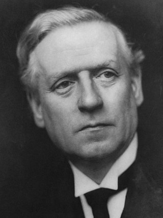
<span class="mw-page-title-main">December 1910 United Kingdom general election</span>

The December 1910 United Kingdom general election was held from 3 to 19 December. It was the last general election to be held over several days and the last to be held before the First World War.

<span class="mw-page-title-main">Lists of places in Wales</span>

This is a list of lists of places in Wales.

<span class="mw-page-title-main">United Kingdom of Portugal, Brazil and the Algarves</span> Pluricontinental monarchy

The United Kingdom of Portugal, Brazil and the Algarves was a pluricontinental monarchy formed by the elevation of the Portuguese colony named State of Brazil to the status of a kingdom and by the simultaneous union of that Kingdom of Brazil with the Kingdom of Portugal and the Kingdom of the Algarves, constituting a single state consisting of three kingdoms.

<span class="mw-page-title-main">Kingdom of Portugal</span> Kingdom in Southwestern Europe (1139–1910)

The Kingdom of Portugal was a monarchy in the western Iberian Peninsula and the predecessor of the modern Portuguese Republic. Existing to various extents between 1139 and 1910, it was also known as the Kingdom of Portugal and the Algarves after 1415, and as the United Kingdom of Portugal, Brazil and the Algarves between 1815 and 1822. The name is also often applied to the Portuguese Empire, the realm's overseas colonies.

The World Figure Skating Championships is an annual figure skating competition sanctioned by the International Skating Union in which figure skaters compete for the title of World Champion.

The World Figure Skating Championships is an annual figure skating competition sanctioned by the International Skating Union in which figure skaters compete for the title of World Champion.

<span class="mw-page-title-main">United Kingdom in the Eurovision Song Contest</span> Overview of the United Kingdom in Eurovision

The United Kingdom has participated in the Eurovision Song Contest 64 times. It first took part in the second contest in 1957 and has entered every year since 1959. Along with Sweden and the Netherlands, the UK is one of only three countries with Eurovision victories in four different decades. It is one of the "Big Five" countries, along with France, Germany, Italy and Spain, that are automatically prequalified for the final each year as they are the biggest financial contributors to the European Broadcasting Union (EBU). The British national broadcaster, the BBC, broadcasts the event and has, on multiple occasions, organised different national selection processes to choose the British entry. The United Kingdom has won the Eurovision Song Contest five times, and has finished as runner-up on a record sixteen occasions. The UK has hosted the contest a record eight times, four times in London and once each in Edinburgh (1972), Brighton (1974), Harrogate (1982) and Birmingham (1998), and will host the contest for a ninth time in 2023 in Liverpool.

<span class="mw-page-title-main">Countries of the United Kingdom</span> Component parts of the UK since 1922

Since 1922, the United Kingdom comprises four constituent countries: England, Scotland, and Wales, as well as Northern Ireland. The UK Prime Minister's website has used the phrase "countries within a country" to describe the United Kingdom. Some statistical summaries, such as those for the twelve NUTS 1 regions of the UK, refer to Northern Ireland, Scotland, and Wales as "regions". With regard to Northern Ireland, Scotland and Wales particularly, the descriptive name one uses "can be controversial, with the choice often revealing one's political preferences".

The World Figure Skating Championships is an annual figure skating competition sanctioned by the International Skating Union in which figure skaters compete for the title of World Champion.