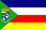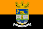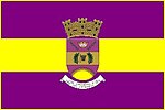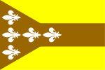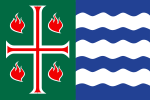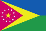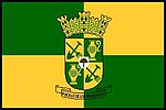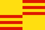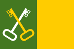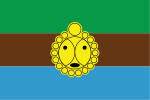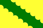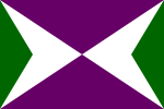
Caguas is a city and municipality of Puerto Rico located in the Central Mountain Range of Puerto Rico, south of San Juan and Trujillo Alto, west of Gurabo and San Lorenzo, and east of Aguas Buenas, Cidra, and Cayey. Caguas was founded in 1775.

Humacao is a city and municipality in Puerto Rico located in the eastern coast of the island, north of Yabucoa; south of Naguabo; east of Las Piedras; and west of Vieques Passage. Humacao is spread over 12 barrios and Humacao Pueblo. It is part of the San Juan-Caguas-Guaynabo Metropolitan Statistical Area.
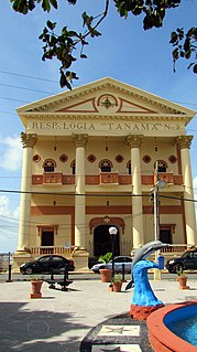
Arecibo is a city and municipality on the northern coast of Puerto Rico, on the shores of the Atlantic Ocean, located north of Utuado and Ciales; east of Hatillo; and west of Barceloneta and Florida. It is about 50 miles (80 km) west of San Juan, the capital city. Arecibo is the largest municipality in Puerto Rico by area, and is part of the San Juan, Caguas and Guaynabo Metropolitan Statistical Area. It is spread over 18 barrios and Arecibo Pueblo. Its population in 2020 was 87,754.

Canóvanas is a town and municipality in Puerto Rico, located in the northeastern region, north of Juncos and Las Piedras; south of Loíza; east of Carolina; and west of Río Grande. Canóvanas is spread over 6 barrios and Canóvanas Pueblo. It is part of the San Juan-Caguas-Guaynabo Metropolitan Statistical Area.

Barranquitas is a small mountain town and municipality located in the Cordillera Central region of Puerto Rico, south of Corozal and Naranjito; north of Coamo and Aibonito; west of Comerío and Cidra; and east of Orocovis. Barranquitas is spread over 6 barrios and Barranquitas Pueblo. It is part of the San Juan-Caguas-Guaynabo Metropolitan Statistical Area.

Corozal is a town and municipality of Puerto Rico located in the central-eastern region, north of Orocovis and Barranquitas; south of Vega Alta; southwest of Toa Alta; east of Morovis and Orocovis; and west of Naranjito. Corozal is spread over 12 barrios and Corozal Pueblo. It is part of the San Juan-Caguas-Guaynabo Metropolitan Statistical Area.
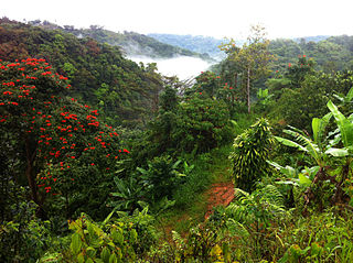
Jayuya is a town and municipality of Puerto Rico located in the mountainous center region of the island, north of Ponce; east of Utuado; and west of Ciales. Jayuya is spread over 10 barrios and Jayuya Pueblo. It is the principal city of the Jayuya Micropolitan Statistical Area.
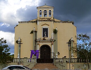
Toa Alta is a town and municipality of Puerto Rico located in the northern coast of the island, north of Naranjito; south of Dorado and Toa Baja; east of Vega Alta and Corozal; and west of Bayamón. Toa Alta is spread over eight barrios and Toa Alta Pueblo. It is part of the San Juan-Caguas-Guaynabo metropolitan statistical area. There are nine barrios in Toa Alta and altogether in 2020 had a population of 66,852. Río de la Plata, is a large river that runs through Toa Alta. Toa Alta celebrates its patron saint festival in May.
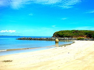
Toa Baja is a town and municipality of Puerto Rico located in the northern coast, north of Toa Alta and Bayamón; east of Dorado; and west of Cataño. Toa Baja is spread over five barrios, including Toa Baja Pueblo. Toa Baja is part of the San Juan-Caguas-Guaynabo Metropolitan Statistical Area. Toa Baja is located fifteen minutes by car from San Juan and two hours from Ponce.

Utuado is a town and municipality of Puerto Rico located in the central mountainous region of the island known as La Cordillera Central. It is located north of Adjuntas and Ponce; south of Hatillo and Arecibo; east of Lares; and west of Ciales and Jayuya. In land area it is the third-largest municipality in Puerto Rico. According to the 2020 US Census, the city has a population of 28,287 spread over 24 barrios and Utuado pueblo. The name Utuado derives from the Taíno word otoao, meaning between mountains. The municipality is known as Ciudad del Viví, derived from the Viví River which runs through Utuado: one river branch comes from Adjuntas and the other from Jayuya. These two rivers then meet near the Fernando L. Ribas Dominicci Avenue and continue the journey to Lago Dos Bocas.
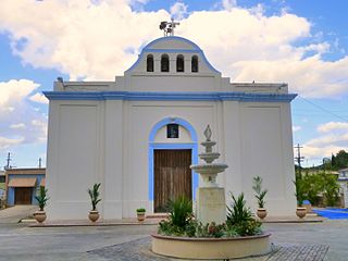
Vega Alta is a town and municipality of Puerto Rico. Vega Alta is on the northern coast of the island, north of Morovis and Corozal; east of Vega Baja; and west of Dorado with an area of 28 square miles (73 km2). Vega Alta is subdivided into seven barrios and Vega Alta barrio-pueblo. It is part of the San Juan-Caguas-Guaynabo Metropolitan Statistical Area.

Vega Baja is a town and municipality located on the coast of north central Puerto Rico. It is north of Morovis, east of Manatí, and west of Vega Alta. Vega Baja is spread over 12 barrios and Vega Baja Pueblo. It is part of the San Juan–Caguas–Guaynabo metropolitan statistical area.

The Catholic Church in Puerto Rico is part of the worldwide Catholic Church in communion with the Pope in Rome. The 78 municipalities in Puerto Rico have a Catholic Church which is located in the downtown area, normally across from the central plaza.

The San Juan metropolitan area is a United States Census Bureau defined metropolitan statistical area (MSA) in northeastern Puerto Rico centered around the city of San Juan. A July 1, 2009, Census Bureau estimate placed the population at 2,617,089, a 4.31% increase over the 2000 census figure of 2,509,007.

The Puerto Rico Firefighters Corps (PRFC); is the statewide fire department that provides fire protection, rescue, and protection from other hazards in the U.S. Commonwealth of Puerto Rico. It was established in 1942 under the Puerto Rico Fire Services. In addition, it offers fire protection services to all the airports under the authority of the Puerto Rico Ports Authority, Rafael Hernández Airport, and Mercedita Airport and they serve as crash rescue divisions. A separate agency, the Puerto Rico Medical Emergency Corps, provides emergency medical services to all Puerto Rico.

The Intentona de Yauco of March 1897 was the second and final major revolt against Spanish colonial rule in Puerto Rico, staged by the island's pro-independence movement in the second half of the nineteenth century.

Yokahu Lodge 506 is the Order of the Arrow Lodge of the Puerto Rico Council of the Boy Scouts of America. As of December 2021, Yokahu Lodge is part of the new Eastern Region, Section E17 of the Order of the Arrow. The Lodge's totem is the Three-Point Taíno Cemí.
The 2010 Moca earthquake, also referred to as the 2010 Puerto Rico earthquake, occurred on May 16 at 1:16 a.m. local time in Moca, Puerto Rico. The earthquake measured 5.8 on the moment magnitude scale and had a maximum Mercalli intensity of VI (Strong). This was the largest earthquake to strike Puerto Rico since the 1943 Puerto Rico earthquake which measured 7.7 on the Richter scale. This was also the first moderate to major earthquake in recorded history to originate on land in Puerto Rico, as earthquakes in the region usually have their epicenter in the ocean; another earthquake with an epicenter on land would occur later in December of the same year.
Pueblo is a term primarily used in Puerto Rico to refer to the municipal district (barrio) that serves as the administrative, historic and cultural center of a municipality. The concept of pueblo is often used locally as analogous to the concept of downtown in U.S. cities. Pueblos are officially called barrio-pueblo by the United States Census since 1990.


