Mount McLaren

Last updated
Mount McLaren
Mount McLaren, Alberta.jpg
Mount McLaren centered, from ENE
(Mount Parrish left, Chinook Peak right)
Highest point
Elevation 2,301 m (7,549 ft) [1] [2]
Prominence 220 m (722 ft) [1]
Parent peak Mount Ptolemy (2,813 m) [1]
Isolation 1.38 km (0.86 mi) [1]
Listing Mountains of Alberta
Coordinates 49°34′59″N114°34′05″W / 49.58306°N 114.56806°W / 49.58306; -114.56806 Coordinates: 49°34′59″N114°34′05″W / 49.58306°N 114.56806°W / 49.58306; -114.56806 [3]
Naming
Etymology Peter McLaren
Geography
Canada Alberta relief location map - transverse mercator proj.svg
Red triangle with thick white border.svg
Mount McLaren
Location of Mount McLaren in Alberta
Canada relief map 2.svg
Red triangle with thick white border.svg
Mount McLaren
Mount McLaren (Canada)
Location Castle Wildland Provincial Park
Alberta, Canada
Parent range Flathead Range [4]
Canadian Rockies
Topo map NTS 82G10 Alberta [3]
Geology
Mountain type Fault block
Type of rock Limestone [5]
Climbing
Easiest route Scrambling via SW Ridge [5]

Mount McLaren is a 2,301-metre (7,549-foot) mountain summit located in Alberta, Canada.

Contents

Description

Mount McLaren is situated six kilometers southwest of the town of Coleman in the Crowsnest Pass area and can be seen from the Crowsnest Highway (Highway 3). [2] It is part of the Flathead Range which is a subset of the Canadian Rockies. The peak is set two kilometers east of the Continental Divide, in Castle Wildland Provincial Park. Precipitation runoff from the mountain drains into Star and North York creeks which are tributaries of the nearby Crowsnest River. Topographic relief is significant as the summit rises over 945 meters (3,100 feet) above the river in 5 kilometers (3.1 miles). Chinook Peak is 3.0 km (1.9 mi) to the west of Mt. McLaren and the nearest higher neighbor is Mount Parrish, 1.4 km (0.87 mi) to the southwest. [1]

History

Peter McLaren (1906) PeterMcLarenSenator.jpg
Peter McLaren (1906)

Mount McLaren is named after Peter McLaren (1833–1919), a Canadian politician and Senator from Perth, Ontario. [6] Senator Peter McLaren was involved in the timber trade and operated a sawmill on Mill Creek (west of Pincher Creek) which provided railroad ties for the construction of the Crowsnest Pass Railway in 1897 and 1898. His loggers hewed the trees ahead of track layers. The mountain's toponym was officially adopted March 15, 1962, by the Geographical Names Board of Canada. [3]

On January 19, 1946, a Royal Canadian Air Force DC-3 struck Mount Ptolemy and crashed into the North York Creek valley below Mount McLaren. [2] All seven crewmembers perished in the accident. Some wreckage of the aircraft is still present.

Geology

Mount McLaren is composed of limestone which is a sedimentary rock laid down during the Precambrian to Jurassic periods. Formed in shallow seas, this sedimentary rock was pushed east and over the top of younger Cretaceous period rock during the Laramide orogeny. [7]

Climate

Based on the Köppen climate classification, Mount McLaren has an alpine subarctic climate with cold, snowy winters, and mild summers. [8] Temperatures can drop below −20 °C with wind chill factors below −30 °C.

See also

Related Research Articles

<span class="mw-page-title-main">Mount Columbia (Canada)</span> Highest mountain in Alberta, Canada

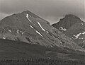
Mount Columbia is a mountain located in the Winston Churchill Range of the Rocky Mountains. It is the highest point in Alberta, Canada, and is second only to Mount Robson for height and topographical prominence in the Canadian Rockies. It is located on the border between Alberta and British Columbia on the northern edge of the Columbia Icefield. Its highest point, however, lies within Jasper National Park in Alberta.

<span class="mw-page-title-main">Mount Lyell (Canada)</span> Mountain in Alberta and British Columbia, Canada

Mount Lyell is a mountain on the Alberta–British Columbia border in western Canada. Comprising five distinct summits, Mount Lyell reaches a height of 3,498 m (11,476 ft). The mountain was named by James Hector in 1858 in recognition of Scottish geologist Sir Charles Lyell.

<span class="mw-page-title-main">Mount Engadine</span>

Mount Engadine is a 2,972-metre (9,751-foot) mountain summit located in the Spray River Valley of Kananaskis Country, in the Canadian Rockies of Alberta, Canada. It was named in 1917 after HMS Engadine, a seaplane tender of the Royal Navy present at the Battle of Jutland during World War I. The mountain is located in the Kananaskis Range in Alberta.

Andy Good Peak is located on the Canadian provincial boundary between Alberta and British Columbia on the Continental Divide. It was named in 1916 after Andy Good, a hotel owner in nearby Crowsnest Pass whose bar straddled the provincial border.

<span class="mw-page-title-main">Mount Coulthard</span>


Mount Coulthard is a summit that straddles the border between Alberta and British Columbia in Canada.

<span class="mw-page-title-main">Mount Morrison (Alberta)</span> Mountain in Banff NP, Alberta, Canada

Mount Morrison is a 2,765-metre (9,072-foot) mountain summit located in the upper Spray River Valley of southern Banff National Park, in the Canadian Rockies of Alberta, Canada. Mount Morrison in not visible from any road in Banff Park, however, it can be seen from Alberta Highway 742, also known as the Smith-Dorrien/Spray Trail in Kananaskis Country. Mount Morrison's nearest higher peak is Mount Turner, 1.8 km (1.1 mi) to the north.

<span class="mw-page-title-main">Bertha Peak</span>

Bertha Peak is a 2,454-metre (8,051-foot) mountain summit located in Waterton Lakes National Park, in the Canadian Rockies of Alberta, Canada. It is situated behind the Waterton townsite. Its nearest higher peak is Mount Alderson, 2.0 km (1.2 mi) to the southwest. Bertha Lake lies at the southern foot of the peak, with Mount Richards on the opposite side of the lake. Mount Crandell lies to the north.

<span class="mw-page-title-main">Mount Tekarra</span>

Mount Tekarra is a 2,694 metres mountain summit located in the Athabasca River valley of Jasper National Park, in the Canadian Rockies of Alberta, Canada. It is situated at the northwest end of the Maligne Range and is visible from Jasper and the Icefields Parkway. Its nearest higher neighbor is The Watchtower, 7.0 km (4.3 mi) to the east.

<span class="mw-page-title-main">Mount Loudon</span>

Mount Loudon is a 3,221-metre (10,568 ft) mountain summit located in the North Saskatchewan River valley of Alberta, Canada. Mount Loudon is situated in the Siffleur Wilderness Area of the Canadian Rockies. Its nearest higher peak is Mount Murchison, 15 km (9.3 mi) to the west. Siffleur Mountain is located immediately northeast, and Mount Peskett immediately north. Mount Loudon can be seen from Highway 11, the David Thompson Highway. Precipitation runoff from the mountain flows north via Loudon Creek and Porcupine Creek, which are both tributaries of the North Saskatchewan River.

<span class="mw-page-title-main">Manx Peak</span>

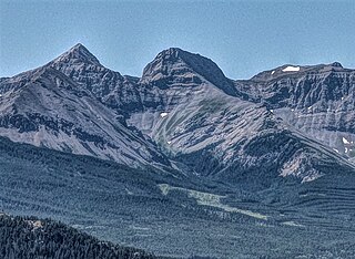
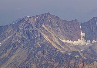
Manx Peak is a 3,044-metre (9,987 ft) mountain summit located in Jasper National Park, in the Trident Range of the Canadian Rockies of Alberta, Canada. The town of Jasper is situated 14 kilometres (8.7 mi) to the north-northeast. Circus Valley lies at the south side of the mountain, and the northeast aspect towers above the head of the valley of Whistlers Creek. Its nearest higher peak is Mount Estella, 1.8 km (1.1 mi) to the southwest, and Terminal Mountain lies 2.0 km (1.2 mi) to the east. The peak is composed of sedimentary rock laid down from the Precambrian to the Jurassic periods and pushed east and over the top of younger rock during the Laramide orogeny.

<span class="mw-page-title-main">Chinook Peak (Alberta)</span>

Chinook Peak is a 2,591-metre (8,501-foot) mountain summit located in the Canadian Rockies of Alberta, Canada.

<span class="mw-page-title-main">Mount Tecumseh (Alberta)</span>

Mount Tecumseh is a 2,547-metre-high (8,356 ft) mountain summit located in the Canadian Rockies of Alberta, Canada.

<span class="mw-page-title-main">Seven Sisters Mountain</span>

Seven Sisters Mountain is a 2,591-metre-high (8,501 ft) mountain summit located in the Canadian Rockies of Alberta, Canada.

<span class="mw-page-title-main">Sentry Mountain</span>

Sentry Mountain is a 2,435-metre (7,989-foot) summit located in the Canadian Rockies of Alberta, Canada.

<span class="mw-page-title-main">Mount Wardle</span>

Mount Wardle is a 2,805-metre (9,203-foot) mountain summit located in British Columbia, Canada.

<span class="mw-page-title-main">Mount Verendrye</span> Mountain in British Columbia, Canada

Mount Verendrye is a 3,086-metre (10,125-foot) mountain summit located in British Columbia, Canada.

<span class="mw-page-title-main">Limestone Peak (British Columbia)</span> Mountain in British Columbia, Canada

Limestone Peak is a 2,878-metre (9,442-foot) mountain summit located in British Columbia, Canada.

<span class="mw-page-title-main">Mystic Peak</span>

Mystic Peak is a mountain summit in the Canadian Rockies of Alberta, Canada.

<span class="mw-page-title-main">Association Peak</span> Mountain in Alberta, Canada

Association Peak is a 2,362-meter-elevation (7,749-foot) mountain summit located in Alberta, Canada.

<span class="mw-page-title-main">Mount Parrish</span>

Mount Parrish is a 2,530-metre (8,301-foot) mountain summit located in Alberta, Canada.

References

  1. 1 2 3 4 5 "Mount McLaren, Peakvisor.com" . Retrieved November 2, 2022.
  2. 1 2 3 "Mount McLaren". PeakFinder.com. Retrieved 2022-11-02.
  3. 1 2 3 "Mount McLaren". Geographical Names Data Base . Natural Resources Canada . Retrieved 2022-11-02.
  4. "Flathead Range". Geographical Names Data Base . Natural Resources Canada . Retrieved 2022-11-02.
  5. 1 2 Andrew Nugara (2014), More Scrambles in the Canadian Rockies Second Edition, Rocky Mountain Books, ISBN   9781771600170, p. 184
  6. Dave Birrell (2000), 50 Roadside Panoramas in the Canadian Rockies, Rocky Mountain Books, ISBN   9780921102656, p. 139
  7. Gadd, Ben (2008), Geology of the Rocky Mountains and Columbias
  8. Peel, M. C.; Finlayson, B. L.; McMahon, T. A. (2007). "Updated world map of the Köppen−Geiger climate classification". Hydrol. Earth Syst. Sci. 11: 1633–1644. ISSN   1027-5606.