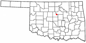
Arcadia, Oklahoma

Last updated

Arcadia, Oklahoma
Town
Arcadia Round Barn (NRHP).jpg
Arcadia's Round Barn, a Route 66 icon
Motto: 
"Unity - Pride - Commitment"
Oklahoma County Oklahoma Incorporated and Unincorporated areas Arcadia highlighted.svg
Location in Oklahoma County and the state of Oklahoma.
Coordinates: 35°39′56″N97°19′32″W / 35.66556°N 97.32556°W / 35.66556; -97.32556
Country Flag of the United States.svg  United States
State Flag of Oklahoma.svg  Oklahoma
County Oklahoma
Area
[1]
  Total1.52 sq mi (3.93 km2)
  Land1.52 sq mi (3.93 km2)
  Water0.00 sq mi (0.00 km2)
Elevation
[2]
961 ft (293 m)
Population
 (2020)
  Total169
  Density111.33/sq mi (42.99/km2)
Time zone UTC-6 (Central (CST))
  Summer (DST) UTC-5 (CDT)
ZIP code
73007
Area code 405
FIPS code 40-02550 [3]
GNIS feature ID2412375 [2]
Website www.travelok.com/Arcadia

Arcadia is a town in Oklahoma County, Oklahoma, United States, and a part of the Oklahoma City metropolitan area. The population was 247 at the 2010 census, a decrease of 11.5 percent from the figure of 279 in 2000. [4]

Contents

History

Arcadia was established soon after the Land Rush of 1889 and drew both white and African American cotton farmers, who named the land after the Greek town of Arcadia. A post office was established in 1890. The Missouri, Kansas and Texas Railroad constructed a line in 1902-3 from Bartlesville to Oklahoma City, passing immediately south of Arcadia. [5]

The town thrived as an agricultural community in the early 20th century. Located near the Deep Fork River, the soil was well suited to producing cotton. The local newspaper, the Arcadia Star, claimed Arcadia had a population of 800 in 1904. However, the U.S. census of 1900 counted only 706 in Deep Fork Township, which included Arcadia. The census at statehood in 1907 registered 994 persons in Arcadia. [5]

In June 1924, fire destroyed most of the business district. One building, Tulon's Drugstore, survived and is now listed in the National Register of Historic Places. [5]

Voters resisted incorporation attempts in the 1930s and again in 1980. Sentiment changed after Edmond, Oklahoma attempted to annex the community in 1984-85, and Arcadia finally incorporated in 1987.

Geography

Arcadia is located approximately 17 miles (27 km) northeast of Oklahoma City. [5]

According to the United States Census Bureau, the town has a total area of 1.5 square miles (3.9 km2), all land.

Demographics

Historical population
CensusPop.Note
1990 320
2000 279−12.8%
2010 247−11.5%
2020 169−31.6%
U.S. Decennial Census [6]

As of the census of 2010, there were 247 people living in the town. [7] The population density was 185 inhabitants per square mile (71/km2). There were 113 housing units at an average density of 81.9 per square mile (31.6/km2). The racial makeup of the town was 57.89% African American, 23.89% White, 7.29% Native American, 0.81% from other races, and 10.12% from two or more races. Hispanic or Latino of any race were 2.43% of the population.

There were 108 households, out of which 23.1% had children under the age of 18 living with them, 51.7% were married couples living together, 18.5% had a female householder with no husband present, and 35.2% were non-families. 30.6% of all households were made up of individuals, and 13.0% had someone living alone who was 65 years of age or older. The average household size was 2.31 and the average family size was 2.90.

In the town, the population was spread out, with 28.3% under the age of 18, 6.5% from 18 to 24, 20.4% from 25 to 44, 28.3% from 45 to 64, and 16.5% who were 65 years of age or older. The median age was 42 years. For every 100 females, there were 111.4 males. For every 100 females age 18 and over, there were 98.0 males.

The median income for a household in the town was $24,359, and the median income for a family was $27,083. Males had a median income of $22,500 versus $25,625 for females. The per capita income for the town was $15,722. About 10.9% of families and 29.8% of the population were below the poverty line, including 26.8% of those under the age of eighteen and 20.5% of those 65 or over.

Pops Restaurant, Route 66, Arcadia Pops Restaurant, Route 66, Arcadia, Oklahoma, 04404a.jpg
Pops Restaurant, Route 66, Arcadia

Economy

Residents who are still employed generally commute to other communities for work, primarily in Oklahoma City. [5]

Education

Most of Arcadia is in Edmond Public Schools, while a portion is in Luther Public Schools. [8]

Related Research Articles

<span class="mw-page-title-main">Creek County, Oklahoma</span> County in Oklahoma, United States

Creek County is a county located in the U.S. state of Oklahoma. As of the 2020 census, the population was 71,754. Its county seat is Sapulpa.

<span class="mw-page-title-main">Arcadia, Missouri</span> City in Missouri, United States

Arcadia is a city in Iron County, Missouri, United States. The population was 618 at the 2020 census.

<span class="mw-page-title-main">Centerville, Missouri</span> City in Missouri, United States

Centerville is a city in Reynolds County, Missouri, United States, situated along the West Fork of the Black River. The population was 167 at the 2020 census. It is the county seat of Reynolds County.

<span class="mw-page-title-main">Union City, Oklahoma</span> Town in Oklahoma, United States

Union City is a town in Canadian County, Oklahoma, United States. The population was 1,645 at the 2010 census, a 19.6 percent increase from 1,375 in 2000. It is part of the Oklahoma City metropolitan statistical area.

<span class="mw-page-title-main">Slick, Oklahoma</span> Town in Oklahoma, United States

Slick is a town in Creek County, Oklahoma, United States. The population was 151 at the 2020 census, a 15.3% increase over the population in 2010.

<span class="mw-page-title-main">Covington, Oklahoma</span> Town in Oklahoma, United States

Covington is a town in Garfield County, Oklahoma, United States. The population was 477 at the 2020 census.

<span class="mw-page-title-main">Ninnekah, Oklahoma</span> Town in Oklahoma, United States

Ninnekah is a town in Grady County, Oklahoma, United States. The population was 775 at the 2020 census, a 22.7% decrease from 2010.

<span class="mw-page-title-main">Tonkawa, Oklahoma</span> City in Oklahoma, United States

Tonkawa is a city in Kay County, Oklahoma, United States, along the Salt Fork Arkansas River. The population was 3,015 as of the 2020 United States census.

<span class="mw-page-title-main">Kendrick, Oklahoma</span> Town in Oklahoma, United States

Kendrick is a town in Lincoln County, Oklahoma, United States. The population was 139 at the 2010 census.

<span class="mw-page-title-main">Warwick, Oklahoma</span> Town in Oklahoma, United States

Warwick is a town in Lincoln County, Oklahoma, United States. The population was 184 at the 2020 census, up from 148 in 2010.

<span class="mw-page-title-main">Cimarron City, Oklahoma</span> Town in Oklahoma, United States

Cimarron City is a town in Logan County, Oklahoma, United States. The population was 150 at the 2010 census, a 39.4 percent gain over the figure of 110 in 2000. It is part of the Oklahoma City Metropolitan Statistical Area. Cimarron City is a combination bedroom and retirement community.

<span class="mw-page-title-main">Forest Park, Oklahoma</span> Town in Oklahoma, United States

Forest Park is a town in Oklahoma County, Oklahoma, United States, and a part of the Oklahoma City metropolitan area. The population was 998 at the 2010 census.

<span class="mw-page-title-main">Lake Aluma, Oklahoma</span> Town in Oklahoma, United States

Lake Aluma is a town in Oklahoma County, Oklahoma, United States, and a part of the Oklahoma City Metropolitan Area. The population was 88 at the 2010 census.

<span class="mw-page-title-main">Luther, Oklahoma</span> Town in Oklahoma, United States

Luther is a town in Oklahoma County, Oklahoma, United States, and a part of the Oklahoma City Metropolitan Area. The population was 1,221 at the 2010 census. Sperling Best Places lists the population of 4073 for the 73054 Luther zip code, which includes the town and immediate surrounding area of rural residents.

<span class="mw-page-title-main">Valley Brook, Oklahoma</span> Town in Oklahoma, United States

Valley Brook is a town in Oklahoma County, Oklahoma, United States, and is part of the Oklahoma City Metropolitan Area. The population was 765 at the 2010 census.

<span class="mw-page-title-main">Morris, Oklahoma</span> City in Oklahoma, United States

Morris is a city in Okmulgee County, Oklahoma, United States. The population was 1,299 at the 2020 census.

<span class="mw-page-title-main">Cleveland, Oklahoma</span> City in Oklahoma, United States

Cleveland is a city in Pawnee County, Oklahoma, United States. The 2010 census population was 3,251, a decrease of 0.9 percent from the figure of 3,282 recorded in 2000.

<span class="mw-page-title-main">Canadian, Oklahoma</span> Town in Oklahoma, United States

Canadian is a town in Pittsburg County, Oklahoma, United States. The population was 239 at the 2000 census.

<span class="mw-page-title-main">Durbin, West Virginia</span> Town in West Virginia, United States

Durbin is a town in Pocahontas County, West Virginia, United States. The population was 235 at the 2020 census.

<span class="mw-page-title-main">Maud, Oklahoma</span> Town in Oklahoma, United States

Maud is a city on the boundary between Pottawatomie and Seminole counties in the U.S. state of Oklahoma. The population was 867 by the 2020 United States census. The locale was named for Maud Stearns, a sister to the wives of two men who owned the first general store.

References

  1. "ArcGIS REST Services Directory". United States Census Bureau. Retrieved September 20, 2022.
  2. 1 2 U.S. Geological Survey Geographic Names Information System: Arcadia, Oklahoma
  3. "U.S. Census website". United States Census Bureau . Retrieved October 31, 2008.
  4. CensusViewer:Arcadia, Oklahoma Population. Retrieved October 17, 2013.
  5. 1 2 3 4 5 Everett, Diana. "Arcadia." Encyclopedia of Oklahoma History and Culture. Retrieved September 17, 2009.
  6. "Census of Population and Housing". Census.gov. Retrieved June 4, 2015.
  7. "2010 City Population and Housing Occupancy Status". U.S. Census Bureau. Retrieved October 18, 2013.[ dead link ]
  8. "2020 CENSUS - SCHOOL DISTRICT REFERENCE MAP: Oklahoma County, OK" (PDF). U.S. Census Bureau . Retrieved January 28, 2024.