Export, Pennsylvania | |
---|---|
Borough | |
Coordinates: 40°24′59″N79°37′25″W / 40.41639°N 79.62361°W | |
Country | United States |
State | Pennsylvania |
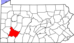
County | Westmoreland |
Incorporated | November 11, 1911 |
Government | |
• Type | Borough council |
Area | |
• Total | 0.40 sq mi (1.04 km2) |
• Land | 0.40 sq mi (1.04 km2) |
• Water | 0.00 sq mi (0.00 km2) |
Elevation | 1,027 ft (313 m) |
Population | |
• Total | 894 |
• Density | 2,218.36/sq mi (855.66/km2) |
Time zone | UTC−5 (Eastern (EST)) |
• Summer (DST) | UTC−4 (EDT) |
ZIP Code | 15632 |
Area code(s) | 724, 878 |
FIPS code | 42-24432 |
Website | exportpennsylvania |
Export is a borough in Westmoreland County, Pennsylvania, United States, surrounded entirely by the municipality of Murrysville. The population was 893 at the 2020 census. [3]
A post office called Export has been in operation since 1892. [4] The borough was so named because coal was once mined in and exported from the town. [5]
The remains of Westmoreland Coal Company's South (#2) mine are still visible behind the District Court building in Export. A 2018 project unearthed three entrances. A fourth entrance was discovered in January 2019 by Michael Mance and Lou Corsi. [6]
Export is located at 40°24′59″N79°37′25″W / 40.41639°N 79.62361°W (40.416251, -79.623679). [7]
According to the United States Census Bureau, the borough has a total area of 0.4 square miles (1.0 km2), all land.
Export is within the Franklin Regional School District. The district consists of two elementary schools (Intermediate and Primary), Franklin Regional Middle School, and Franklin Regional High School. Export is also home to Free Gospel Bible Institute, an international Ministerial and Missionary College for Holiness Pentecostals founded in 1958.
Census | Pop. | Note | %± |
---|---|---|---|
1920 | 2,596 | — | |
1930 | 2,184 | −15.9% | |
1940 | 1,990 | −8.9% | |
1950 | 1,690 | −15.1% | |
1960 | 1,518 | −10.2% | |
1970 | 1,371 | −9.7% | |
1980 | 1,143 | −16.6% | |
1990 | 981 | −14.2% | |
2000 | 895 | −8.8% | |
2010 | 917 | 2.5% | |
2020 | 893 | −2.6% | |
2021 (est.) | 886 | [3] | −0.8% |
Sources: [8] [9] [10] [2] |
As of the census [9] of 2000, there were 895 people, 455 households, and 232 families living in the borough. The population density was 2,346.5 inhabitants per square mile (906.0/km2). There were 513 housing units at an average density of 1,345.0 units per square mile (519.3 units/km2). The racial makeup of the borough was 98.44% White, 0.11% African American, 0.67% Asian, and 0.78% from two or more races. Hispanic or Latino of any race were 0.56% of the population.
There were 455 households, out of which 22.0% had children under the age of 18 living with them, 32.1% were married couples living together, 12.1% had a female householder with no husband present, and 49.0% were non-families. 43.7% of all households were made up of individuals, and 21.1% had someone living alone who was 65 years of age or older. The average household size was 1.97 and the average family size was 2.74.
In the borough the age distribution of the population shows 18.8% under the age of 18, 6.0% from 18 to 24, 33.2% from 25 to 44, 18.8% from 45 to 64, and 23.2% who were 65 years of age or older. The median age was 41 years. For every 100 females, there were 90.4 males. For every 100 females age 18 and over, there were 85.9 males.
The median income for a household in the borough was $28,350, and the median income for a family was $36,591. Males had a median income of $30,677 versus $22,031 for females. The per capita income for the borough was $20,170. About 3.1% of families and 7.6% of the population were below the poverty line, including 2.2% of those under age 18 and 6.9% of those age 65 or over.
The following are the remains of Westmoreland Coal Company's South (#2) mine in Export.
South Versailles Township is a township in Allegheny County, Pennsylvania, United States. The population was 351 at the 2010 census. It contains the village of Coulter, also called Coulterville or Coulters. The U.S. Post Office in the village is called Coulters.
West Elizabeth is a borough in Allegheny County, Pennsylvania, United States. The population was 403 at the 2020 census.
Jefferson Township is a township in Fayette County, Pennsylvania, United States. The population was 2,007 at the 2020 census, a decline from the figure of 2,008 tabulated in 2010. It is named for former president Thomas Jefferson, and many of the township's streets are named after other U.S. presidents. Frazier School District serves the area.
Ernest is a borough in Indiana County, Pennsylvania, United States. The population was 422 at the 2020 census.
Marianna is a borough in Washington County, Pennsylvania, United States. The population was 399 at the 2020 census.
Bolivar is a borough in Westmoreland County, Pennsylvania, United States. The population was 436 at the 2020 census.
Calumet-Norvelt was a census-designated place (CDP) in Westmoreland County, Pennsylvania, United States. The community was divided into the two separate communities of Calumet and Norvelt for the 2010 census. Although the US Census treats Calumet and Norvelt as a single community, they are in reality two very different communities, each reflecting a different chapter in how the Great Depression affected rural Pennsylvanians. Calumet was a typical "patch town", built by a single company to house its miners as cheaply as possible. The closing of the Calumet mine during the Great Depression caused enormous hardship in an era when unemployment compensation and welfare payments were non-existent. On the other hand, Norvelt was created during the depression by the US federal government as a model community, intended to increase the standard of living of laid-off coal miners.
Crabtree is a census-designated place (CDP) and former coal town in Salem Township, Westmoreland County, Pennsylvania, United States. The population was 277 at the 2010 census. It has its own post office, with postal code 15624.
Donegal Township is a township in Westmoreland County, Pennsylvania, United States. The population was 2,192 at the 2020 census, a decrease of 9% compared to 2010.
East Vandergrift is a borough in Westmoreland County in the U.S. state of Pennsylvania. The population was 601 at the 2020 census.
Herminie is a census-designated place (CDP) in Sewickley Township, Westmoreland County, Pennsylvania, United States. The population was 856 at the 2000 census.
Hyde Park is a borough in Westmoreland County, Pennsylvania, United States. The population was 509 at the 2020 census.
Loyalhanna is a census-designated place (CDP) in Derry Township, Westmoreland County, Pennsylvania, United States. The population was 3,415 at the 2000 census, at which time it was listed as McChesneytown-Loyalhanna. The CDP name was changed to Loyalhanna for the 2010 census. As of the 2020 census the population was 3,409 residents.
Mount Pleasant Township is a township in Westmoreland County, Pennsylvania, United States. As of the 2020 census, the township population was 10,119. Mount Pleasant Township should not be confused with the Borough of Mount Pleasant, which is a separate municipality and comprises the town of that name.
Murrysville is a home rule municipality in Westmoreland County, Pennsylvania, United States. The population was 21,006 at the 2020 census. It is part of the Pittsburgh metropolitan area.
South Greensburg is a borough in Westmoreland County, Pennsylvania, United States. The population was 2,117 at the 2010 census.
Southwest Greensburg is a borough in Westmoreland County, Pennsylvania, United States. The population was 2,155 as of the 2010 census.
Unity Township is a township in Westmoreland County, Pennsylvania, United States. The population was 21,724 at the 2020 census, a decline of approximately 4% compared to the 2010 census.
Youngwood is a borough in Westmoreland County, Pennsylvania, United States.
Trafford is a borough in Allegheny and Westmoreland counties in the U.S. state of Pennsylvania. Located near Pittsburgh in western Pennsylvania, the borough lies primarily in Westmoreland County; only a small portion extends into Allegheny County. It was incorporated in 1904 from the northernmost corner of North Huntingdon Township, and was named by George Westinghouse for Trafford near Manchester, England. Westinghouse purchased the land in 1902, and the Trafford Foundry began operations on October 3, 1903. The population was 3,317 at the 2020 census. Of this, 3,113 were in Westmoreland County, and only 61 were in Allegheny County.