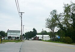
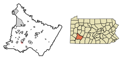
Hunker, Pennsylvania

Last updated

Hunker, Pennsylvania
Hunker Pennsylvania 2010.jpg
Bridge Street
Westmoreland County Pennsylvania Incorporated and Unincorporated areas Hunker Highlighted.svg
Location of Hunker in Westmoreland County, Pennsylvania.
USA Pennsylvania location map.svg
Red pog.svg
Hunker, Pennsylvania
Coordinates: 40°12′16″N79°36′58″W / 40.20444°N 79.61611°W / 40.20444; -79.61611
Country United States
State Pennsylvania
County Westmoreland
Settled1903
Incorporated1929
Government
  TypeBorough Council
Area
[1]
  Total
0.25 sq mi (0.66 km2)
  Land0.25 sq mi (0.66 km2)
  Water0 sq mi (0.00 km2)
Elevation
994 ft (303 m)
Population
 (2020) [2]
  Total
310
  Density1,224.9/sq mi (472.92/km2)
Time zone UTC-5 (Eastern (EST))
  Summer (DST) UTC-4 (EDT)
Zip code
15639
FIPS code 42-36288
Website https://hunkerborough.com/

Hunker is a borough which is located in Westmoreland County, Pennsylvania, United States. It has been part of the Pittsburgh metropolitan area since 1950.

Contents

The population was 307 at the time of the 2020 census. [3]

Geography

Hunker is located at 40°12′16″N79°36′58″W / 40.20444°N 79.61611°W / 40.20444; -79.61611 (40.204462, −79.616218). [4]

According to the United States Census Bureau, the borough has a total area of 0.4 square miles (1.0 km2), all land.

Demographics

Historical population
CensusPop.Note
1930 378
1940 348−7.9%
1950 40416.1%
1960 380−5.9%
1970 375−1.3%
1980 359−4.3%
1990 328−8.6%
2000 3290.3%
2010 291−11.6%
2020 3106.5%
2021 (est.)305 [3] −1.6%
Sources: [5] [6] [7] [2]

At the time of the 2000 census, there were 329 people, 136 households, and 102 families living in the borough.

The population density was 886.8 inhabitants per square mile (342.4/km2). There were 138 housing units at an average density of 372.0 per square mile (143.6/km2).

The racial makeup of the borough was 96.35% White, 0.61% African American, 0.30% Native American, 0.91% Asian, and 1.82% from two or more races. [6]

Of the 136 households, 25.0% had children under the age of eighteen living with them; 67.6% were married couples living together, 6.6% had a female householder with no husband present, and 24.3% were non-families. 21.3% of households were one person households and 11.8% were households with one person who was aged sixty-five or older.

The average household size was 2.42 and the average family size was 2.83.

The age distribution was 17.0% who were under the age of eighteen, 6.4% aged eighteen to twenty-four, 28.0% aged twenty-five to forty-four, 33.4% aged forty-five to sixty-four, and 15.2% who were sixty-five years of age or older. The median age was forty-four years.

For every one hundred females, there were 101.8 males. For every 100 females who were aged eighteen or older, there were 100.7 males.

The median household income was $40,313 and the median family income was $43,750. Males had a median income of $32,396 compared with that of $15,833 for females.

The per capita income for the borough was $22,045.

Roughly 7.6% of families and 6.1% of the population were living below the poverty line, including 7.0% of those who were under the age of eighteen and 12.5% of those who were aged sixty-five or older.

Notable people

References

  1. "ArcGIS REST Services Directory". United States Census Bureau. Retrieved October 12, 2022.
  2. 1 2 "Census Population API". United States Census Bureau. Retrieved October 12, 2022.
  3. 1 2 "City and Town Population Totals: 2020—2021". US Census Bureau. Retrieved July 26, 2022.
  4. "US Gazetteer files: 2010, 2000, and 1990". United States Census Bureau. February 12, 2011. Retrieved April 23, 2011.
  5. "Census of Population and Housing". U.S. Census Bureau. Retrieved December 11, 2013.
  6. 1 2 "U.S. Census website". United States Census Bureau . Retrieved January 31, 2008.
  7. "Incorporated Places and Minor Civil Divisions Datasets: Subcounty Resident Population Estimates: April 1, 2010 to July 1, 2012". Population Estimates. U.S. Census Bureau. Archived from the original on June 11, 2013. Retrieved December 11, 2013.