
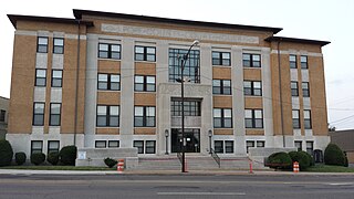
St. Francis County is a county in the U.S. state of Arkansas. As of the 2010 census, the population was 28,258. The county seat is Forrest City.
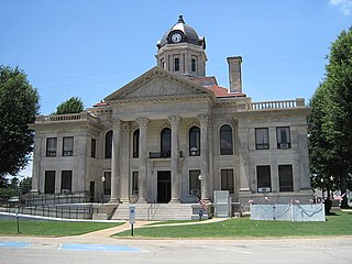
Pope County is a county in the U.S. state of Arkansas. As of the 2010 census, the population was 61,754. The county seat is Russellville. The county was formed on November 2, 1829, from a portion of Crawford County and named for John Pope, the third governor of the Arkansas Territory. It is an alcohol prohibition or dry county.

Polk County is a county located in the U.S. state of Arkansas. As of the 2010 census, the population was 20,662. The county seat is Mena. Polk County is Arkansas's 48th county, formed on November 30, 1844, and named for James Polk, President of the United States. It is an alcohol prohibition or dry county.
Poinsett County is a county located in the U.S. state of Arkansas. As of the 2010 census, the population was 24,583. The county seat is Harrisburg.

Phillips County is a county located in the eastern part of the U.S. state of Arkansas, in what is known as the Arkansas Delta along the Mississippi River. As of the 2010 census, the population was 21,757. The county seat is Helena-West Helena. Phillips County is Arkansas's seventh (7th) county, formed on May 1, 1820, and named for Sylvanus Phillips, the area's first-known white settler and representative to the first Territorial Legislature of the Arkansas Territory. This lowland area was developed for cotton plantations in the antebellum area and is still largely rural.

Madison County is a county located in the U.S. state of Arkansas. As of the 2010 census, the population was 15,717. The county seat is Huntsville. The county was formed on September 30, 1836, and named for James Madison, fourth President of the United States.

Lee County is a county located in the U.S. state of Arkansas. With its eastern border formed by the Mississippi River, it is considered to be part of the Arkansas Delta. As of the 2010 census, the population was 10,424. The county seat is Marianna.

Howard County is a county located in the U.S. state of Arkansas. As of the 2010 census, the population was 13,789. The county seat is Nashville. Howard County is Arkansas's 74th county, formed on April 17, 1873, and named for James Howard, a state senator. It is a dry county.

Greene County is a county located in the U.S. state of Arkansas. As of the 2010 census, the population was 42,090. The county seat is Paragould, which sits atop Crowley's Ridge.

Columbia County is a county located in the U.S. state of Arkansas. As of the 2010 census, the population was 24,552. The county seat is Magnolia. The county was formed on December 17, 1852, and was named for Christopher Columbus. The Magnolia, AR Micropolitan Statistical Area includes all of Columbia County.
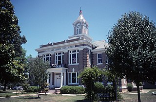
Cleveland County is a county located in the U.S. state of Arkansas. Its population was 8,689 at the 2010 U.S. census. The county seat is Rison.

Horseshoe Lake is a town in Crittenden County, Arkansas, United States. The population was 292 at the 2010 census.

Helena is the eastern portion of Helena–West Helena, Arkansas, a city in Phillips County, Arkansas. It was founded in 1833 by Nicholas Rightor and is named after the daughter of Sylvanus Phillips, an early settler of Phillips County and the namesake of Phillips County. As of the 2000 census, this portion of the city population was 6,323. Helena was the county seat of Phillips County until January 1, 2006, when it merged its government and city limits with neighboring West Helena.

West Helena is the western portion of Helena-West Helena, Arkansas, a city in Phillips County, Arkansas, United States. As of the 2000 census, this portion of the city population was 8,689.

U.S. Route 49 is a north–south United States highway. The highway's northern terminus is in Piggott, Arkansas, at an intersection with US Route 62/Highway 1/Highway 139 (US 62/AR 1/AR 139). Its southern terminus is in Gulfport, Mississippi, at an intersection with U.S. Route 90. US 49 is approximately 516 miles (830 km) in length.

Arkansas Highway 90 is an east–west state highway in northeast Arkansas. The route of 81.93 miles (131.85 km) runs from Main Street in Ravenden to Route 84 at the Missouri state line. The route is an entirely undivided surface highway that passes through rich cotton country.

Arkansas Highway 304 is an east–west state highway in Arkansas. The route of 14.72 miles (23.69 km) runs from US Route 67 (US 67) and Highway 90 in south Pocahontas east to Highway 34/Highway 90 in Delaplaine.

Highway 34 is an east–west state highway in the Upper Arkansas Delta. The route of 40.18 miles (64.66 km) begins at US Highway 412 (US 412) and U.S. Route 67 Business (US 67B). The route is maintained by the Arkansas State Highway and Transportation Department (AHTD).

Highway 135 is a north–south state highway in northeast Arkansas. The route of 69.67 miles (112.12 km) runs from US Route 63 (US 63) near Tyronza north through Paragould to US 62.
Lehi is an unincorporated community in Crittenden County, Arkansas, United States, located at the intersection of I-40/US-79/US-63 and AR 147. It is the location of a former NASCAR track, the Memphis-Arkansas Speedway.
