Missouri is a landlocked state in the Midwestern region of the United States. Ranking 21st in land area, it borders Iowa to the north, Illinois, Kentucky and Tennessee to the east, Arkansas to the south and Oklahoma, Kansas, and Nebraska to the west. In the south are the Ozarks, a forested highland, providing timber, minerals, and recreation. The Missouri River, after which the state is named, flows through the center and into the Mississippi River, which makes up the eastern border. With over six million residents, it is the 18th-most populous state of the country. The largest urban areas are St. Louis, Kansas City, Springfield, and Columbia; the capital is Jefferson City.

St. Louis is an independent city in the U.S. state of Missouri. It is located near the confluence of the Mississippi and the Missouri rivers. In 2020, the city proper had a population of 301,578, while its metropolitan area, which extends into Illinois, had an estimated population of over 2.8 million. It is the largest metropolitan area in Missouri and the second-largest in Illinois. The city's combined statistical area is the 20th-largest in the United States.

St. Louis County is located in the eastern-central portion of Missouri. It is bounded by the City of St. Louis and the Mississippi River to the east, the Missouri River to the north, and the Meramec River to the south. At the 2020 census, the total population was 1,004,125, making it the most populous county in Missouri. Its county seat is Clayton. The county is included in the St. Louis, MO–IL metropolitan statistical area.

Hancock County is the southernmost county of the U.S. state of Mississippi and is named for Founding Father John Hancock. As of the 2020 census, the population was 46,053. Its county seat is Bay St. Louis.

St. Louis County is a county located in the Arrowhead Region of the U.S. state of Minnesota. As of the 2020 census, the population was 200,231. Its county seat is Duluth. It is the largest county in Minnesota by land area, and the largest in the United States by total area east of the Mississippi River. St. Louis County is included in the Duluth, MN–Superior, WI Metropolitan Statistical Area.

St. Clair County is the ninth most populous county in Illinois. Located directly east of St. Louis, the county is part of the Metro East region of the Greater St. Louis metropolitan area in southern Illinois. As of the 2020 United States census, St. Clair County had a population of 257,400, making it the third most populous county in Illinois outside the Chicago metropolitan area. Belleville is the county’s seat and largest city.Cahokia Village was founded in 1697 by French settlers and served as a Jesuit mission to convert tribes of the Illinois Confederation to Christianity. Prior to the establishment of Illinois as a state, the government of the Northwest Territory created St. Clair County in 1790 out of the western half of Knox County. In 1809, the county became the administrative center of the Illinois Territory and one of the two original counties of Illinois, alongside Randolph County. In 1970, the United States Census Bureau placed the mean center of U.S. population in St. Clair County.

Monroe County is a county located in the U.S. state of Illinois. According to the 2020 census, it had a population of 34,962. Its county seat and largest city is Waterloo.

Madison County is a county in the U.S. state of Illinois. It is a part of the Metro East in southern Illinois. According to the 2020 census, it had a population of 264,776, making it the eighth-most populous county in Illinois and the most populous in the southern portion of the state. The county seat is Edwardsville, and the largest city is Granite City.
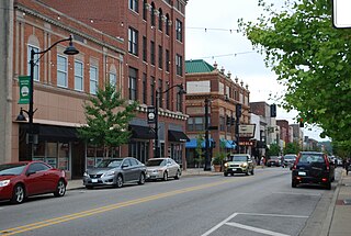
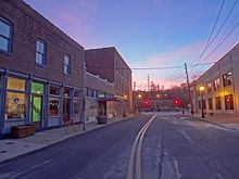
Belleville is a city in and the county seat of St. Clair County, Illinois, United States. The population was 42,404 at the 2020 census, making it the most populated city in the Metro East region of Greater St. Louis, and in all of Southern Illinois. Due to its proximity to Scott Air Force Base, the city has a significant population of military and federal civilian personnel. It is the seat of the Roman Catholic Diocese of Belleville and home to the National Shrine of Our Lady of the Snows.
Bay St. Louis is a city in and the county seat of Hancock County, Mississippi, in the United States. Located on the Gulf Coast on the west side of the Bay of St. Louis, it is part of the Gulfport–Biloxi Metropolitan Statistical Area. The population was 9,284 at the 2020 census, up from 9,260 at the 2010 census.

Creve Coeur is a city located in mid St. Louis County, Missouri, United States, a part of Greater St. Louis. Its population was 18,834 at the 2020 census. Creve Coeur borders and shares a ZIP code (63141) with the neighboring city of Town and Country. It is home to the headquarters of Drury Hotels, and was the home of Monsanto until its acquisition by Bayer in 2018.

Florissant is a city in St. Louis County, Missouri, within Greater St. Louis. It is a middle-class, second-ring northern suburb of St. Louis. Based on the 2020 United States census, the city had a total population of 52,533. It is the largest city in St. Louis County.

Maryland Heights is a second-ring northwest suburb of St. Louis, located in St. Louis County, Missouri, United States. The population was 27,472 at the 2010 census. The city was incorporated in 1985. Edwin L. Dirck was appointed the city's first mayor by then County Executive Gene McNary. Mark M. Levin served as City Administrator from August 1985 to 2015.

Chesterfield is a city in St. Louis County, Missouri, United States. It is a western suburb of St. Louis. As of the 2020 census, the population was 49,999, making it the state's 14th most populous city. The broader valley of Chesterfield was originally referred to as "Gumbo Flats", derived from its soil, which though very rich and silty, resembled gumbo when wet.

Clayton is a city in and the county seat of St. Louis County, Missouri, and borders the independent city of St. Louis. The population was 17,355 at the 2020 census. Organized in 1877, the city was named after Ralph Clayton, a former slave owner, who donated the land for the St. Louis County courthouse.

St. Charles County is a county in the central eastern part of the U.S. state of Missouri. As of the 2020 census, the population was 405,262, making it Missouri's third-most populous county. Its county seat is St. Charles. The county was organized October 1, 1812, and named for Saint Charles Borromeo, an Italian cardinal.

Greater St. Louis is the 21st-largest metropolitan statistical area (MSA) in the United States, the largest in Missouri, and the second-largest in Illinois. Its core city—St. Louis, Missouri—sits in the geographic center of the metro area, on the west bank of the Mississippi River. The river bisects the metro area geographically between Illinois and Missouri, although the latter portion is much more populous. The MSA includes St. Louis County, which is independent of the City of St. Louis; their two populations are generally tabulated separately.
The Metro East is an urban area in Southern Illinois, United States that contains the eastern and northern suburbs and exurbs of St. Louis, Missouri. It encompasses eight counties in the Greater St. Louis area and constitutes the second-most populous urban area in Illinois. The region's most populated city is Belleville, with 42,404 residents.

Old Jamestown is an unincorporated community and census-designated place (CDP) in St. Louis County, Missouri, United States. The population was 19,184 at the 2010 census. Old Jamestown is northwest of the city of St. Louis and borders the Missouri River.