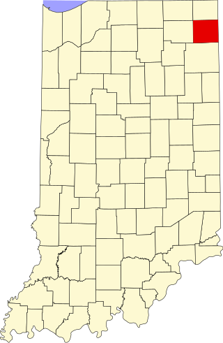
[3] Name on the Register [4] Image Date listed [5] Location City or town Description 1 John H. and Mary Abercrombie House John H. and Mary Abercrombie House June 25, 2013 (# 13000418 3130 Parnell Ave. 41°06′16″N 85°07′42″W / 41.104444°N 85.128333°W / 41.104444; -85.128333 (John H. and Mary Abercrombie House ) Fort Wayne 2 Allen County Courthouse Allen County Courthouse May 28, 1976 (# 76000031 715 S. Calhoun St. 41°04′47″N 85°08′22″W / 41.079724°N 85.139444°W / 41.079724; -85.139444 (Allen County Courthouse ) Fort Wayne 3 John H. Bass Mansion John H. Bass Mansion June 2, 1982 (# 82000056 2701 Spring St. 41°05′15″N 85°10′33″W / 41.087500°N 85.175833°W / 41.087500; -85.175833 (John H. Bass Mansion ) Fort Wayne 4 Becker House Becker House November 17, 2022 (# 100008406 425 West Williams St. 41°04′02″N 85°08′38″W / 41.0672°N 85.1438°W / 41.0672; -85.1438 (Becker House ) Fort Wayne 5 Beechwood Historic District Upload image November 16, 2021 (# 100007177 Roughly bounded by Fairfield and South Wayne Aves., Pierce and Beechwood Drs. 41°03′42″N 85°08′48″W / 41.0618°N 85.1467°W / 41.0618; -85.1467 (Beechwood Historic District ) Fort Wayne 6 Blackstone Building Blackstone Building August 24, 1988 (# 88001219 112 W. Washington 41°04′22″N 85°08′01″W / 41.072778°N 85.133611°W / 41.072778; -85.133611 (Blackstone Building ) Fort Wayne 7 Martin Blume Jr. Farm Martin Blume Jr. Farm September 20, 2006 (# 06000847 7311 Flutter Rd., northeast of Fort Wayne 41°09′53″N 85°03′02″W / 41.164722°N 85.050556°W / 41.164722; -85.050556 (Martin Blume Jr. Farm ) St. Joseph Township 8 Brookview-Irvington Park Historic District Brookview-Irvington Park Historic District March 21, 2011 (# 11000121 Roughly bounded by Norfolk Ave. to the north, Lima Rd., Spy Run Ave. Extended, and N. Clinton St. to the east, Jacobs St. to the south, and the former Penn Central right-of-way to the west 41°06′04″N 85°08′27″W / 41.101111°N 85.140833°W / 41.101111; -85.140833 (Brookview-Irvington Park Historic District ) Fort Wayne 9 John Brown Stone Warehouse John Brown Stone Warehouse December 15, 1997 (# 97001542 114 W. Superior St. 41°04′56″N 85°08′23″W / 41.082222°N 85.139722°W / 41.082222; -85.139722 (John Brown Stone Warehouse ) Fort Wayne 10 Calvary United Brethren-Turner Chapel AME Church Upload image February 9, 2022 (# 100007447 836 East Jefferson Blvd. 41°04′40″N 85°07′35″W / 41.0778°N 85.1263°W / 41.0778; -85.1263 (Calvary United Brethren-Turner Chapel AME Church ) Fort Wayne 11 Cathedral of the Immaculate Conception Cathedral of the Immaculate Conception October 23, 1980 (# 80000048 Jefferson and Calhoun St. 41°04′33″N 85°08′16″W / 41.075833°N 85.137778°W / 41.075833; -85.137778 (Cathedral of the Immaculate Conception ) Fort Wayne 12 Chief Jean Baptiste de Richardville House Chief Jean Baptiste de Richardville House June 27, 1997 (# 97000595 5705 Bluffton Rd. 41°01′53″N 85°09′52″W / 41.031389°N 85.164444°W / 41.031389; -85.164444 (Chief Jean Baptiste de Richardville House ) Fort Wayne Designated a National Historic Landmark on March 2, 2012 as "Akima Pinsiwa Awiiki (Chief Jean-Baptiste de Richardville House)" 13 Coca-Cola Bottling Plant Upload image August 23, 2021 (# 100006841 1631 Pontiac St. 41°03′39″N 85°06′56″W / 41.0608°N 85.1155°W / 41.0608; -85.1155 (Coca-Cola Bottling Plant ) Fort Wayne vicinity 14 Colman-Doctor Farm Upload image March 6, 2019 (# 100003499 5910 Maples Rd. 41°00′14″N 85°03′45″W / 41.0040°N 85.0624°W / 41.0040; -85.0624 (Colman-Doctor Farm ) Fort Wayne vicinity 15 Driving Park-Seven States Historic District Upload image March 3, 2021 (# 100006201 Roughly bounded by Vermont Ave., Crescent Ave. Florida Dr., State Blvd., West and East Drs., Curdes, and Dodge Aves. Ave 41°05′58″N 85°07′08″W / 41.0995°N 85.1190°W / 41.0995; -85.1190 (Driving Park-Seven States Historic District ) Fort Wayne 16 Dutch Ridge Historic District Dutch Ridge Historic District September 14, 1995 (# 95001110 17915 and 17819 Old Auburn Rd. and adjacent cemetery, northeast of Huntertown 41°15′04″N 85°05′48″W / 41.2511°N 85.0967°W / 41.2511; -85.0967 (Dutch Ridge Historic District ) Perry Township 17 William S. Edsall House William S. Edsall House October 8, 1976 (# 76000032 305 W. Main St. 41°04′46″N 85°08′38″W / 41.0794°N 85.1439°W / 41.0794; -85.1439 (William S. Edsall House ) Fort Wayne 18 Embassy Theater and Indiana Hotel Embassy Theater and Indiana Hotel September 5, 1975 (# 75000041 121 W. Jefferson St. 41°04′32″N 85°08′24″W / 41.0756°N 85.14°W / 41.0756; -85.14 (Embassy Theater and Indiana Hotel ) Fort Wayne 19 Engine House No. 3 Engine House No. 3 July 27, 1979 (# 79003772 226 W. Washington Boulevard 41°04′38″N 85°08′30″W / 41.0772°N 85.1417°W / 41.0772; -85.1417 (Engine House No. 3 ) Fort Wayne 20 Fairfield Manor Fairfield Manor June 16, 1983 (# 83000047 2301 Fairfield Ave. 41°03′50″N 85°08′41″W / 41.0639°N 85.1447°W / 41.0639; -85.1447 (Fairfield Manor ) Fort Wayne 21 Robert M. Feustel House Robert M. Feustel House November 7, 1980 (# 80000049 4101 W. Taylor St. 41°03′52″N 85°11′38″W / 41.0644°N 85.1939°W / 41.0644; -85.1939 (Robert M. Feustel House ) Fort Wayne 22 Forest Park Boulevard Historic District Forest Park Boulevard Historic District March 30, 2007 (# 07000212 Roughly bounded by Dodge Ave., the alley between Forest Park and Anthony Boulevards, Lake Ave., and the alley 41°05′43″N 85°07′03″W / 41.0954°N 85.1175°W / 41.0954; -85.1175 (Forest Park Boulevard Historic District ) Fort Wayne 23 Fort Wayne City Hall Fort Wayne City Hall June 4, 1973 (# 73000027 308 E. Berry St. 41°04′46″N 85°08′10″W / 41.0794°N 85.1361°W / 41.0794; -85.1361 (Fort Wayne City Hall ) Fort Wayne 24 Fort Wayne Park and Boulevard System Historic District Fort Wayne Park and Boulevard System Historic District December 28, 2010 (# 10001099 Roughly including the following parks and adjacent rights-of-way: Franke, McCormick, McCulloch, McMillen, Memorial, Nuckols, Old Fort, Reservoir, Rockhill, Weisser, and Williams 41°03′51″N 85°05′26″W / 41.064167°N 85.090556°W / 41.064167; -85.090556 (Fort Wayne Park and Boulevard System Historic District ) Fort Wayne 25 Fort Wayne Printing Company Building Fort Wayne Printing Company Building August 24, 1988 (# 88001220 114 W. Washington St. 41°04′38″N 85°08′23″W / 41.077222°N 85.139722°W / 41.077222; -85.139722 (Fort Wayne Printing Company Building ) Fort Wayne 26 Foster Park Neighborhood Historic District Foster Park Neighborhood Historic District September 25, 2013 (# 13000755 Roughly bounded by Old Mill Rd., Rudisell Boulevard, Kimmel Dr., and Lexington Ave. 41°02′52″N 85°09′20″W / 41.047778°N 85.155556°W / 41.047778; -85.155556 (Foster Park Neighborhood Historic District ) Fort Wayne 27 General Electric Fort Wayne Electric Works Historic District Upload image February 27, 2023 (# 100008658 1635 Broadway and 1030 Swinney Ave. 41°04′17″N 85°08′56″W / 41.0714°N 85.1489°W / 41.0714; -85.1489 (General Electric Fort Wayne Electric Works Historic District ) Fort Wayne 28 William C. and Clara Hagerman House William C. and Clara Hagerman House March 17, 2015 (# 15000076 2105 N. Anthony Boulevard 41°05′43″N 85°06′57″W / 41.095278°N 85.115833°W / 41.095278; -85.115833 (William C. and Clara Hagerman House ) Fort Wayne 29 Harrison Hill Historic District Upload image August 25, 2021 (# 100006844 Roughly bounded by West Rudisill Blvd., South Calhoun St., South Cornell Cir., Pasadena Dr., Hoagland Ave., and Webster St. 41°02′41″N 85°08′25″W / 41.0448°N 85.1404°W / 41.0448; -85.1404 (Harrison Hill Historic District ) Fort Wayne 30 John and Dorothy Haynes House John and Dorothy Haynes House June 22, 2004 (# 04000635 3901 N. Washington Rd. [6] 41°04′14″N 85°11′27″W / 41.070556°N 85.190833°W / 41.070556; -85.190833 (John and Dorothy Haynes House ) Fort Wayne 31 Illsley Place-West Rudisill Historic District Illsley Place-West Rudisill Historic District April 20, 2006 (# 06000310 Roughly bounded by Broadway, W. Rudisill Boulevard, Beaver Ave., and the alley north of Illsley Dr. 41°03′03″N 85°09′15″W / 41.050861°N 85.154167°W / 41.050861; -85.154167 (Illsley Place-West Rudisill Historic District ) Fort Wayne 32 Indian Village Historic District Indian Village Historic District December 22, 2009 (# 09001125 Roughly bounded by Nuttman Ave. on the north, Bluffton Rd. on the east, Eagle Rd. on the south, and the Norfolk Southern railway line on the west 41°02′54″N 85°10′21″W / 41.048381°N 85.172472°W / 41.048381; -85.172472 (Indian Village Historic District ) Fort Wayne 33 Johnny Appleseed Memorial Park Johnny Appleseed Memorial Park January 17, 1973 (# 73000028 Swanson Boulevard at Parnell Ave. along Old Feeder Canal 41°06′44″N 85°07′25″W / 41.112222°N 85.123611°W / 41.112222; -85.123611 (Johnny Appleseed Memorial Park ) Fort Wayne 34 Journal-Gazette Building Journal-Gazette Building December 27, 1982 (# 82000057 701 S. Clinton St. 41°04′49″N 85°08′17″W / 41.080278°N 85.138056°W / 41.080278; -85.138056 (Journal-Gazette Building ) Fort Wayne 35 Kensington Boulevard Historic District Kensington Boulevard Historic District September 3, 2019 (# 100004368 Roughly bounded by East State Blvd., North Anthony Blvd., Niagara Dr., and Pemberton Dr. 41°05′23″N 85°06′50″W / 41.0897°N 85.1138°W / 41.0897; -85.1138 (Kensington Boulevard Historic District ) Fort Wayne 36 Harry A. Keplinger House Harry A. Keplinger House September 1, 1983 (# 83000048 235 W. Creighton Ave. 41°03′51″N 85°08′26″W / 41.064028°N 85.140417°W / 41.064028; -85.140417 (Harry A. Keplinger House ) Fort Wayne 37 Kresge-Groth Building Kresge-Groth Building August 25, 1988 (# 88001223 914 S. Calhoun St. 41°04′41″N 85°08′22″W / 41.078056°N 85.139444°W / 41.078056; -85.139444 (Kresge-Groth Building ) Fort Wayne 38 Lafayette Place Historic District Lafayette Place Historic District January 9, 2013 (# 12001147 Roughly bounded by S. Calhoun and Lafayette Sts., and McKinnie and Pettit Aves. 41°02′40″N 85°08′00″W / 41.044444°N 85.133333°W / 41.044444; -85.133333 (Lafayette Place Historic District ) Fort Wayne 39 Lakeside Historic District Lakeside Historic District December 8, 2017 (# 100001879 Roughly bounded by St. Joe Blvd., Edgewater, Tennessee, Crescent & California Aves. 41°05′10″N 85°07′35″W / 41.086069°N 85.126426°W / 41.086069; -85.126426 (Lakeside Historic District ) Fort Wayne 40 The Landing Historic District The Landing Historic District September 16, 1993 (# 93000953 Roughly bounded by Calhoun, Harrison, Dock, and Pearl Sts., and the alley between Columbia and Main Sts. 41°04′52″N 85°08′29″W / 41.081111°N 85.141389°W / 41.081111; -85.141389 (The Landing Historic District ) Fort Wayne 41 Lindenwood Cemetery Lindenwood Cemetery February 17, 1978 (# 78000043 2324 W. Main St. 41°04′47″N 85°10′32″W / 41.079722°N 85.175556°W / 41.079722; -85.175556 (Lindenwood Cemetery ) Fort Wayne 42 Masonic Temple Masonic Temple March 14, 1991 (# 91000273 206 E. Washington Boulevard 41°04′39″N 85°08′55″W / 41.0775°N 85.148611°W / 41.0775; -85.148611 (Masonic Temple ) Fort Wayne 43 McColloch-Weatherhogg Double House McColloch-Weatherhogg Double House December 7, 2001 (# 01001350 334-336 E. Berry St. 41°04′54″N 85°08′07″W / 41.081667°N 85.135278°W / 41.081667; -85.135278 (McColloch-Weatherhogg Double House ) Fort Wayne 44 Hugh McCulloch House Hugh McCulloch House October 23, 1980 (# 80000050 616 W. Superior St. 41°04′51″N 85°08′50″W / 41.080833°N 85.147222°W / 41.080833; -85.147222 (Hugh McCulloch House ) Fort Wayne 45 Louis Mohr Block Louis Mohr Block August 26, 1988 (# 88001222 119 W. Wayne St. 41°04′41″N 85°08′24″W / 41.078056°N 85.14°W / 41.078056; -85.14 (Louis Mohr Block ) Fort Wayne 46 New York Chicago and St. Louis Railroad Steam Locomotive No. 765 New York Chicago and St. Louis Railroad Steam Locomotive No. 765 September 12, 1996 (# 96001010 15808 Edgerton Rd., east of New Haven 41°05′16″N 84°56′14″W / 41.0878°N 84.9372°W / 41.0878; -84.9372 (New York Chicago and St. Louis Railroad Steam Locomotive No. 765 ) Jefferson Township 47 Ninde-Mead-Farnsworth House Ninde-Mead-Farnsworth House March 20, 2013 (# 13000082 734 E. State Boulevard 41°05′47″N 85°07′49″W / 41.0964°N 85.1303°W / 41.0964; -85.1303 (Ninde-Mead-Farnsworth House ) Fort Wayne 48 North Anthony Boulevard Historic District North Anthony Boulevard Historic District September 30, 2014 (# 14000800 Roughly N. Anthony Boulevard between Vance and Lake Aves. 41°06′00″N 85°06′56″W / 41.1000°N 85.1156°W / 41.1000; -85.1156 (North Anthony Boulevard Historic District ) Fort Wayne 49 Oakdale Historic District Oakdale Historic District September 22, 2000 (# 00001132 Roughly along Oakdale Dr. from Harrison St. to Broadway 41°03′06″N 85°08′52″W / 41.0517°N 85.1478°W / 41.0517; -85.1478 (Oakdale Historic District ) Fort Wayne 50 Pennsylvania Railroad Station Pennsylvania Railroad Station August 14, 1998 (# 98001056 221 W. Baker St. 41°04′20″N 85°08′26″W / 41.0722°N 85.1406°W / 41.0722; -85.1406 (Pennsylvania Railroad Station ) Fort Wayne 51 John Claus Peters House John Claus Peters House September 17, 1980 (# 80000051 832 W. Wayne St. 41°04′36″N 85°09′03″W / 41.0767°N 85.1508°W / 41.0767; -85.1508 (John Claus Peters House ) Fort Wayne 52 Randall Building Randall Building December 7, 1990 (# 90001786 616 and 618 S. Harrison St. 41°04′52″N 85°08′33″W / 41.0811°N 85.1425°W / 41.0811; -85.1425 (Randall Building ) Fort Wayne 53 Alexander Taylor Rankin House Alexander Taylor Rankin House December 6, 2004 (# 04001317 818 S. Lafayette St. 41°04′53″N 85°08′05″W / 41.0814°N 85.1347°W / 41.0814; -85.1347 (Alexander Taylor Rankin House ) Fort Wayne 54 Horney Robinson House Horney Robinson House March 21, 1985 (# 85000604 7320 Lower Huntington Rd., southwest of Fort Wayne 41°00′19″N 85°14′13″W / 41.0053°N 85.2369°W / 41.0053; -85.2369 (Horney Robinson House ) Wayne Township 55 St. Louis, Besancon, Historic District St. Louis, Besancon, Historic District September 22, 1995 (# 95001112 15529-15535 E. Lincoln Highway, southeast of New Haven 41°03′03″N 84°56′15″W / 41.0508°N 84.9375°W / 41.0508; -84.9375 (St. Louis, Besancon, Historic District ) Jefferson Township 56 Saint Paul's Evangelical Lutheran Church Saint Paul's Evangelical Lutheran Church March 1, 1982 (# 82000058 1126 S. Barr St. 41°04′32″N 85°08′08″W / 41.0756°N 85.1356°W / 41.0756; -85.1356 (Saint Paul's Evangelical Lutheran Church ) Fort Wayne 57 St. Peter's Square St. Peter's Square March 20, 1991 (# 91000259 Roughly bounded by St. Martin, Hanna, E. Dewald, and Warsaw Sts., including 518 E. Dewald St. 41°03′56″N 85°07′46″W / 41.0656°N 85.1294°W / 41.0656; -85.1294 (St. Peter's Square ) Fort Wayne 58 St. Rose de Lima Roman Catholic Church and Rectory Upload image August 27, 2020 (# 100005514 209 Mulberry St. and 206 Summit St. 40°58′20″N 84°52′05″W / 40.9721°N 84.8681°W / 40.9721; -84.8681 (St. Rose de Lima Roman Catholic Church and Rectory ) Monroeville 59 St. Vincent Villa Historic District St. Vincent Villa Historic District June 10, 1994 (# 94000587 2000 N. Wells St. 41°05′35″N 85°08′39″W / 41.0931°N 85.1442°W / 41.0931; -85.1442 (St. Vincent Villa Historic District ) Fort Wayne 60 Schmitz Block Schmitz Block August 26, 1988 (# 88001224 926-930 S. Calhoun St. 41°04′39″N 85°08′21″W / 41.0775°N 85.1392°W / 41.0775; -85.1392 (Schmitz Block ) Fort Wayne 61 Shawnee Place Historic District Upload image August 27, 2024 (# 100010747 Roughly bounded by Killea Street, Kinnaird Avenue, Webster Street, and the second alley west of Hoagland Avenue 41°03′25″N 85°08′29″W / 41.0570°N 85.1413°W / 41.0570; -85.1413 (Shawnee Place Historic District ) Fort Wayne 62 Smith Field Smith Field March 26, 2003 (# 02001495 426 W. Ludwig Rd. 41°08′36″N 85°09′10″W / 41.1433°N 85.1528°W / 41.1433; -85.1528 (Smith Field ) Fort Wayne 63 South Wayne Historic District South Wayne Historic District September 4, 1992 (# 92001146 Roughly bounded by W. Wildwood Ave., S. Wayne Ave., Packard Ave., and Beaver Ave. 41°03′22″N 85°08′59″W / 41.0561°N 85.1497°W / 41.0561; -85.1497 (South Wayne Historic District ) Fort Wayne 64 Southwood Park Historic District Southwood Park Historic District December 22, 2009 (# 09001126 Bounded by W. Pettit Ave., Stratford Rd., W. Sherwood Terrace, Hartman Rd., Lexington Ave., and Indiana Ave. 41°02′32″N 85°08′57″W / 41.0421°N 85.1492°W / 41.0421; -85.1492 (Southwood Park Historic District ) Fort Wayne 65 Christian G. Strunz House Christian G. Strunz House October 4, 1979 (# 79000030 333 E. Berry St. 41°04′49″N 85°08′07″W / 41.0803°N 85.1353°W / 41.0803; -85.1353 (Christian G. Strunz House ) Fort Wayne 66 Thomas W. Swinney House Thomas W. Swinney House April 27, 1981 (# 81000026 1424 W. Jefferson St. 41°04′24″N 85°09′27″W / 41.0733°N 85.1575°W / 41.0733; -85.1575 (Thomas W. Swinney House ) Fort Wayne 67 Trinity Episcopal Church Trinity Episcopal Church September 13, 1978 (# 78000044 611 W. Berry St. 41°04′40″N 85°08′52″W / 41.0778°N 85.1478°W / 41.0778; -85.1478 (Trinity Episcopal Church ) Fort Wayne 68 US Post Office and Courthouse US Post Office and Courthouse March 15, 2006 (# 06000125 1300 W. Harrison St. 41°04′26″N 85°08′26″W / 41.0739°N 85.1406°W / 41.0739; -85.1406 (US Post Office and Courthouse ) Fort Wayne 69 Vermilyea Inn Historic District Vermilyea Inn Historic District December 6, 2005 (# 05001365 13501 Redding Dr., southwest of Fort Wayne 41°00′46″N 85°19′04″W / 41.0128°N 85.3178°W / 41.0128; -85.3178 (Vermilyea Inn Historic District ) Aboite Township 70 Wabash Railroad Depot Wabash Railroad Depot March 26, 2003 (# 03000146 530 State St. 41°04′18″N 85°01′20″W / 41.0717°N 85.0222°W / 41.0717; -85.0222 (Wabash Railroad Depot ) New Haven 71 Wells Street Bridge Wells Street Bridge September 15, 1988 (# 88001575 Wells St. at the St. Marys River 41°05′13″N 85°08′27″W / 41.0869°N 85.1408°W / 41.0869; -85.1408 (Wells Street Bridge ) Fort Wayne 72 West End Historic District West End Historic District November 15, 1984 (# 84000352 Roughly bounded by Main, Webster, Jefferson, Broadway, Jones, and the St. Marys River 41°04′32″N 85°08′59″W / 41.0756°N 85.1497°W / 41.0756; -85.1497 (West End Historic District ) Fort Wayne 73 Fisher West Farm Fisher West Farm June 6, 1985 (# 85001193 17935 West Rd., northeast of Huntertown 41°15′05″N 85°09′11″W / 41.2514°N 85.1531°W / 41.2514; -85.1531 (Fisher West Farm ) Perry Township 74 Wildwood Park Historic District Wildwood Park Historic District September 18, 2013 (# 13000720 Roughly bounded by Freeman St., Illinois Rd., W. Jefferson and Portage Boulevards, and Lindenwood and Ardmore Aves. 41°04′16″N 85°11′10″W / 41.0711°N 85.1861°W / 41.0711; -85.1861 (Wildwood Park Historic District ) Fort Wayne 75 Williams–Woodland Park Historic District Williams–Woodland Park Historic District March 14, 1991 (# 91000258 Roughly bounded by Hoagland and Creighton Aves. and Harrison and Pontiac Sts. 41°03′45″N 85°08′28″W / 41.0625°N 85.1411°W / 41.0625; -85.1411 (Williams–Woodland Park Historic District ) Fort Wayne