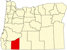
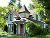
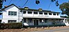
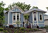
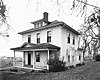
[5] Name on the Register Image Date listed [6] Location City or town Description 1 Nils Ahlstrom House Nils Ahlstrom House February 15, 1980 (# 80003315 248 5th St. 42°11′50″N 122°42′21″W / 42.19717778°N 122.7058389°W / 42.19717778; -122.7058389 (Nils Ahlstrom House ) Ashland 2 Thomas N. Anderson House Thomas N. Anderson House June 1, 1990 (# 90000845 719 Second Ave. 42°25′56″N 123°03′06″W / 42.432222°N 123.051667°W / 42.432222; -123.051667 (Thomas N. Anderson House ) Gold Hill 3 Antelope Creek Covered Bridge Antelope Creek Covered Bridge December 26, 2012 (# 12001091 Little Butte Creek, 35 feet (11 m) east of Main Street 42°28′20″N 122°48′01″W / 42.472126°N 122.800225°W / 42.472126; -122.800225 (Antelope Creek Covered Bridge ) Eagle Point 4 Ashland Cemetery Ashland Cemetery June 8, 1995 (# 95000687 Junction of E. Main and Morton Sts. 42°11′37″N 122°42′18″W / 42.19366111°N 122.7050056°W / 42.19366111; -122.7050056 (Ashland Cemetery ) Ashland 5 Ashland Depot Hotel, South Wing Ashland Depot Hotel, South Wing February 19, 1991 (# 91000047 624 A St. 42°11′52″N 122°42′20″W / 42.19775833°N 122.7056583°W / 42.19775833; -122.7056583 (Ashland Depot Hotel, South Wing ) Ashland 6 Ashland Downtown Historic District Ashland Downtown Historic District May 5, 2000 (# 00000446 Roughly bounded by Lithia Way/C St., Church, Lithia Park/Hargadine, and Gresham Sts. 42°11′46″N 122°42′47″W / 42.196245°N 122.713096°W / 42.196245; -122.713096 (Ashland Downtown Historic District ) Ashland 7 Ashland Masonic Lodge Building Ashland Masonic Lodge Building June 4, 1992 (# 92000663 25 N. Main St. 42°11′49″N 122°42′57″W / 42.197063°N 122.715800°W / 42.197063; -122.715800 (Ashland Masonic Lodge Building ) Ashland 8 Ashland Municipal Powerhouse Ashland Municipal Powerhouse September 10, 1987 (# 87001563 Ashland Creek Canyon 42°10′09″N 122°42′46″W / 42.169167°N 122.712778°W / 42.169167; -122.712778 (Ashland Municipal Powerhouse ) Ashland 9 Ashland Oregon National Guard Armory Ashland Oregon National Guard Armory September 10, 1987 (# 87001564 208 Oak St. 42°11′55″N 122°42′48″W / 42.19865278°N 122.7132611°W / 42.19865278; -122.7132611 (Ashland Oregon National Guard Armory ) Ashland 10 Ashland Railroad Addition Historic District Ashland Railroad Addition Historic District May 5, 1999 (# 99000533 Roughly bounded by Lithia Way, East Main, Oak St., A St. and 8th Sts. 42°11′48″N 122°42′22″W / 42.196667°N 122.706111°W / 42.196667; -122.706111 (Ashland Railroad Addition Historic District ) Ashland 11 W. H. Atkinson House W. H. Atkinson House October 16, 1979 (# 79002063 125 N. Main St. 42°11′57″N 122°43′02″W / 42.199184°N 122.717131°W / 42.199184; -122.717131 (W. H. Atkinson House ) Ashland 12 Sophenia Ish Baker House Sophenia Ish Baker House September 9, 1993 (# 93000924 902 W. McAndrews Rd. 42°19′52″N 122°53′35″W / 42.331228°N 122.893047°W / 42.331228; -122.893047 (Sophenia Ish Baker House ) Medford 13 Barclay–Klum House Barclay–Klum House June 1, 1990 (# 90000835 1023 E. Main St. 42°11′39″N 122°42′04″W / 42.19417222°N 122.7012444°W / 42.19417222; -122.7012444 (Barclay–Klum House ) Ashland 14 Barnum Hotel Barnum Hotel March 22, 1984 (# 84003009 204 N. Front St. 42°19′41″N 122°52′28″W / 42.32799444°N 122.8744778°W / 42.32799444; -122.8744778 (Barnum Hotel ) Medford 15 Baldwin Beach House Baldwin Beach House March 28, 1979 (# 79002064 348 Hargadine St. 42°11′39″N 122°42′41″W / 42.194165°N 122.711479°W / 42.194165; -122.711479 (Baldwin Beach House ) Ashland 16 Robert Vinton Beall House Robert Vinton Beall House October 18, 1979 (# 79002069 1253 Beall Lane 42°21′44″N 122°54′36″W / 42.362291°N 122.909953°W / 42.362291; -122.909953 (Robert Vinton Beall House ) Central Point 17 Beeson–Foss Ranch Beeson–Foss Ranch January 27, 1999 (# 99000067 6371 Wagner Creek Rd. 42°14′00″N 122°47′30″W / 42.233333°N 122.791667°W / 42.233333; -122.791667 (Beeson–Foss Ranch ) Talent 18 Big Elk Guard Station Big Elk Guard Station December 29, 2000 (# 00000462 FS Rd. 3706 approximately 5 miles (8.0 km) north of Dead Indian Memorial Rd. 42°21′32″N 122°21′28″W / 42.359021°N 122.357824°W / 42.359021; -122.357824 (Big Elk Guard Station ) Ashland vicinity 19 Boslough–Claycomb House Boslough–Claycomb House December 9, 1981 (# 81000486 1 Hillcrest St. 42°11′36″N 122°42′46″W / 42.193352°N 122.712691°W / 42.193352; -122.712691 (Boslough–Claycomb House ) Ashland 20 Walter Bowne House Walter Bowne House February 23, 1990 (# 90000279 1845 Old Stage Rd. 42°20′35″N 122°57′11″W / 42.343067°N 122.952938°W / 42.343067; -122.952938 (Walter Bowne House ) Jacksonville 21 BPOE Lodge No. 1168 BPOE Lodge No. 1168 November 28, 1980 (# 80003323 202 N. Central Ave. 42°19′43″N 122°52′25″W / 42.32853611°N 122.8736889°W / 42.32853611; -122.8736889 (BPOE Lodge No. 1168 ) Medford 22 Britt Gardens Site 35JA789 Upload image March 6, 2020 (# 100005020 Address restricted [7] Jacksonville vicinity 23 Buckhorn Mineral Springs Resort Upload image March 3, 1989 (# 89000064 2200 Buckhorn Springs Rd. 42°06′20″N 122°31′46″W / 42.105556°N 122.529444°W / 42.105556; -122.529444 (Buckhorn Mineral Springs Resort ) Ashland 24 Victor and Bertha Bursell House Victor and Bertha Bursell House April 29, 1982 (# 82003725 3075 Hanley Rd. 42°21′39″N 122°55′49″W / 42.36086111°N 122.9302417°W / 42.36086111; -122.9302417 (Victor and Bertha Bursell House ) Central Point 25 Butte Falls Ranger Station Butte Falls Ranger Station April 11, 1986 (# 86000824 Rogue River National Forest 42°32′26″N 122°33′53″W / 42.540539°N 122.564779°W / 42.540539; -122.564779 (Butte Falls Ranger Station ) Butte Falls 26 Frank E. Bybee House Frank E. Bybee House December 9, 1981 (# 81000492 4491 Jacksonville Hwy. 42°19′30″N 122°56′36″W / 42.32496667°N 122.9433639°W / 42.32496667; -122.9433639 (Frank E. Bybee House ) Jacksonville 27 William Bybee House William Bybee House February 15, 1977 (# 77001102 883 Old Stage Rd. 42°19′45″N 122°57′45″W / 42.329202°N 122.962418°W / 42.329202; -122.962418 (William Bybee House ) Jacksonville 28 Camp White Station Hospital Administration Building Camp White Station Hospital Administration Building December 20, 2016 (# 16000881 8495 Crater Lake Highway 42°26′27″N 122°50′25″W / 42.440802°N 122.840254°W / 42.440802; -122.840254 (Camp White Station Hospital Administration Building ) White City 29 Richard Posey Campbell House Richard Posey Campbell House February 12, 1980 (# 80003316 94 Bush St. 42°11′58″N 122°43′07″W / 42.199397°N 122.718511°W / 42.199397; -122.718511 (Richard Posey Campbell House ) Ashland Also known as Orlando Coolidge Rental House. 30 A. S. V. and Helen Bundy Carpenter House Upload image December 23, 2005 (# 05001456 1677 Old Stage Rd. 42°20′29″N 122°57′40″W / 42.341403°N 122.961095°W / 42.341403; -122.961095 (A. S. V. and Helen Bundy Carpenter House ) Central Point 31 E. V. Carter House E. V. Carter House March 7, 1979 (# 79002065 505 Siskiyou Blvd. 42°11′37″N 122°42′28″W / 42.19371944°N 122.7078083°W / 42.19371944; -122.7078083 (E. V. Carter House ) Ashland 32 H. B. Carter House H. B. Carter House November 2, 1977 (# 77001101 91 Gresham St. 42°11′35″N 122°42′38″W / 42.192993°N 122.710545°W / 42.192993; -122.710545 (H. B. Carter House ) Ashland 33 Carter–Fortmiller House Carter–Fortmiller House December 21, 1981 (# 81000487 514 Siskiyou Blvd. 42°11′36″N 122°42′29″W / 42.193208°N 122.708027°W / 42.193208; -122.708027 (Carter–Fortmiller House ) Ashland 34 Central Point Public School Central Point Public School December 3, 1980 (# 80003321 450 S. 4th St. 42°22′17″N 122°54′39″W / 42.371389°N 122.910833°W / 42.371389; -122.910833 (Central Point Public School ) Central Point 35 Chappell–Swedenburg House Chappell–Swedenburg House November 30, 1982 (# 82001503 990 Siskiyou Blvd. 42°11′19″N 122°41′52″W / 42.188611°N 122.697778°W / 42.188611; -122.697778 (Chappell–Swedenburg House ) Ashland 36 Chavner Family House Chavner Family House May 31, 1996 (# 96000628 12162 Blackwell Rd. 42°25′50″N 123°02′03″W / 42.430556°N 123.034167°W / 42.430556; -123.034167 (Chavner Family House ) Gold Hill 37 Citizen's Banking & Trust Co. Building Citizen's Banking & Trust Co. Building February 28, 1985 (# 85000364 232–242 E. Main St. 42°11′44″N 122°42′45″W / 42.195621°N 122.712371°W / 42.195621; -122.712371 (Citizen's Banking & Trust Co. Building ) Ashland 38 Frank Chamberlain Clark House Frank Chamberlain Clark House October 29, 1982 (# 82001504 1917 E. Main St. 42°19′43″N 122°50′49″W / 42.328511°N 122.847012°W / 42.328511; -122.847012 (Frank Chamberlain Clark House ) Medford 39 Cooley–Neff Warehouse Cooley–Neff Warehouse September 6, 2007 (# 07000923 340 N. Fir St. 42°19′43″N 122°52′37″W / 42.32870278°N 122.8770056°W / 42.32870278; -122.8770056 (Cooley–Neff Warehouse ) Medford 40 Orlando Coolidge House Orlando Coolidge House February 12, 1980 (# 80003317 137 N. Main St. 42°11′58″N 122°43′03″W / 42.199531°N 122.717408°W / 42.199531; -122.717408 (Orlando Coolidge House ) Ashland 41 Corning Court Ensemble Corning Court Ensemble February 19, 1991 (# 91000043 5–16 Corning Ct. 42°19′39″N 122°51′53″W / 42.327385°N 122.864762°W / 42.327385; -122.864762 (Corning Court Ensemble ) Medford 42 Dead Indian Soda Springs Shelter Dead Indian Soda Springs Shelter December 29, 2000 (# 00000498 Near end of S. Fork Little Butte Cr. Rd. 42°20′17″N 122°27′01″W / 42.338056°N 122.450278°W / 42.338056; -122.450278 (Dead Indian Soda Springs Shelter ) Eagle Point 43 E. Raymond Driver House E. Raymond Driver House March 9, 1990 (# 90000372 4140 Old Stage Rd. 42°22′39″N 122°57′19″W / 42.3775°N 122.955278°W / 42.3775; -122.955278 (E. Raymond Driver House ) Central Point 44 Patrick Dunn Ranch Patrick Dunn Ranch March 8, 1978 (# 78002287 Southeast of Ashland on OR 66 42°09′56″N 122°38′28″W / 42.165556°N 122.641111°W / 42.165556; -122.641111 (Patrick Dunn Ranch ) Ashland 45 Dutchman Peak Lookout Dutchman Peak Lookout December 29, 2000 (# 00000509 FS Rd. 20 approximately 25 miles (40 km) southwest of Ashland 42°02′37″N 122°53′23″W / 42.043611°N 122.889722°W / 42.043611; -122.889722 (Dutchman Peak Lookout ) Ashland 46 Eagle Point National Cemetery Eagle Point National Cemetery September 13, 2016 (# 16000626 2763 Riley Road 42°27′51″N 122°47′12″W / 42.464242°N 122.786596°W / 42.464242; -122.786596 (Eagle Point National Cemetery ) Eagle Point 47 Eddings–Provost House Eddings–Provost House November 6, 1980 (# 80003318 364 Vista St. 42°11′35″N 122°42′40″W / 42.192991°N 122.711123°W / 42.192991; -122.711123 (Eddings–Provost House ) Ashland 48 Eden Valley Orchard Eden Valley Orchard July 14, 2000 (# 00000802 2488 Voorhies Rd. 42°17′19″N 122°50′48″W / 42.288611°N 122.846667°W / 42.288611; -122.846667 (Eden Valley Orchard ) Medford 49 H. Chandler and Alice B. Egan House Upload image February 21, 1997 (# 97000126 2620 Foothill Rd. 42°21′11″N 122°49′21″W / 42.353058°N 122.822414°W / 42.353058; -122.822414 (H. Chandler and Alice B. Egan House ) Medford Champion golfer and noted golf course architect Chandler Egan (1884–1936) designed this house in the Arts and Crafts style when he settled in Oregon. Built in 1911 during Medford's "Orchard Boom", it served both as family residence and headquarters for the surrounding Egan orchard venture. [8] 50 Enders Building Enders Building October 23, 1986 (# 86002902 250–300 E. Main St. 42°11′44″N 122°42′44″W / 42.195485°N 122.712141°W / 42.195485; -122.712141 (Enders Building ) Ashland 51 Edward Charles Faber House Edward Charles Faber House February 21, 1997 (# 97000138 445 Manzanita St. 42°22′37″N 122°54′49″W / 42.376944°N 122.913611°W / 42.376944; -122.913611 (Edward Charles Faber House ) Central Point 52 First Baptist Church First Baptist Church March 28, 1979 (# 79002066 241 Hargadine St. 42°11′42″N 122°42′46″W / 42.195044°N 122.712862°W / 42.195044; -122.712862 (First Baptist Church ) Ashland 53 First National Bank, Vaupel Store and Oregon Hotel Buildings First National Bank, Vaupel Store and Oregon Hotel Buildings February 29, 1980 (# 80003319 15 S. Pioneer St. and 70 E. Main St. 42°11′48″N 122°42′51″W / 42.196615°N 122.714271°W / 42.196615; -122.714271 (First National Bank, Vaupel Store and Oregon Hotel Buildings ) Ashland 54 Fish Lake Shelter Fish Lake Shelter December 29, 2000 (# 00000503 Fish Lake , south of Oregon Route 140 , approximately 25 miles (40 km) northeast of Ashland 42°23′37″N 122°19′04″W / 42.393637°N 122.317905°W / 42.393637; -122.317905 (Fish Lake Shelter ) Ashland vicinity 55 Fluhrer Bakery Building Fluhrer Bakery Building May 16, 1983 (# 83002152 29 N. Holly St. 42°19′30″N 122°52′36″W / 42.32502222°N 122.8766861°W / 42.32502222; -122.8766861 (Fluhrer Bakery Building ) Medford 56 Fort Lane Military Post Site Fort Lane Military Post Site September 20, 1988 (# 88001121 Address restricted [7] Central Point 57 Andrew J. Fredenburg House Andrew J. Fredenburg House June 17, 1982 (# 82003726 243 S. Holly St. 42°19′21″N 122°52′25″W / 42.32236944°N 122.8735833°W / 42.32236944; -122.8735833 (Andrew J. Fredenburg House ) Medford 58 Frederic E. Furry House Frederic E. Furry House February 29, 1980 (# 80003324 1720 N. Phoenix Rd. 42°18′19″N 122°49′12″W / 42.305345°N 122.819952°W / 42.305345; -122.819952 (Frederic E. Furry House ) Medford 59 C. E. "Pop" Gates House C. E. "Pop" Gates House February 19, 1991 (# 91000042 1307 Queen Anne Ave. 42°19′50″N 122°51′20″W / 42.330556°N 122.855556°W / 42.330556; -122.855556 (C. E. "Pop" Gates House ) Medford 60 Glenview Orchard Ensemble Glenview Orchard Ensemble October 23, 1986 (# 86002925 1395 Carpenter Hill Rd. 42°16′46″N 122°52′08″W / 42.279444°N 122.868889°W / 42.279444; -122.868889 (Glenview Orchard Ensemble ) Phoenix 61 Gold Hill High School Gold Hill High School February 20, 1991 (# 91000046 806 6th Ave. 42°26′04″N 123°03′17″W / 42.434519°N 123.054732°W / 42.434519; -123.054732 (Gold Hill High School ) Gold Hill 62 G. M. and Kate Grainger House G. M. and Kate Grainger House February 23, 1990 (# 90000289 35 Granite St. 42°11′50″N 122°43′02″W / 42.197244°N 122.717284°W / 42.197244; -122.717284 (G. M. and Kate Grainger House ) Ashland 63 Edgar F. Hafer House Edgar F. Hafer House September 1, 1983 (# 83002153 426 W. 6th St. 42°19′30″N 122°52′42″W / 42.32497778°N 122.8784306°W / 42.32497778; -122.8784306 (Edgar F. Hafer House ) Medford 64 Michael Hanley Farmstead Michael Hanley Farmstead November 25, 1983 (# 83004172 1053 Hanley Rd. 42°20′08″N 122°55′54″W / 42.335556°N 122.931667°W / 42.335556; -122.931667 (Michael Hanley Farmstead ) Medford 65 Hanscom Hall Hanscom Hall June 3, 1996 (# 96000626 201 Talent Ave. 42°14′39″N 122°47′11″W / 42.244144°N 122.786275°W / 42.244144; -122.786275 (Hanscom Hall ) Talent 66 Hargadine Cemetery Hargadine Cemetery June 3, 1998 (# 98000627 Sheridan and Walnut Sts. 42°12′35″N 122°43′34″W / 42.209722°N 122.726111°W / 42.209722; -122.726111 (Hargadine Cemetery ) Ashland 67 Charles and Elizabeth Hatch House Charles and Elizabeth Hatch House June 23, 2011 (# 11000404 199 1st St. 42°26′07″N 123°10′09″W / 42.435234°N 123.169033°W / 42.435234; -123.169033 (Charles and Elizabeth Hatch House ) Rogue River 68 Hillcrest Orchard Historic District Hillcrest Orchard Historic District February 16, 1984 (# 84003013 3285 Hillcrest Rd. 42°19′53″N 122°49′18″W / 42.331375°N 122.821623°W / 42.331375; -122.821623 (Hillcrest Orchard Historic District ) Medford 69 Harry and Eleanor Holmes House Upload image June 22, 2021 (# 100006685 217 S. Modoc Ave. 42°19′29″N 122°50′23″W / 42.324735°N 122.839854°W / 42.324735; -122.839854 (Harry and Eleanor Holmes House ) Medford 70 George A. Hover House George A. Hover House September 8, 1980 (# 80003325 4192 Coleman Creek Rd. 42°15′49″N 122°50′28″W / 42.26374722°N 122.8410944°W / 42.26374722; -122.8410944 (George A. Hover House ) Medford 71 Imnaha Guard Station Imnaha Guard Station April 11, 1986 (# 86000835 Rogue River National Forest 42°42′13″N 122°19′53″W / 42.703611°N 122.331389°W / 42.703611; -122.331389 (Imnaha Guard Station ) Butte Falls 72 IOOF Building IOOF Building February 17, 1978 (# 78002288 49–57 N. Main St. 42°11′52″N 122°42′57″W / 42.197699°N 122.715837°W / 42.197699; -122.715837 (IOOF Building ) Ashland 73 Jackson County Courthouse Jackson County Courthouse October 23, 1986 (# 86002921 S. Oakdale Ave. at Eighth St. 42°19′23″N 122°52′40″W / 42.32316389°N 122.8777167°W / 42.32316389; -122.8777167 (Jackson County Courthouse ) Medford 74 Jacksonville Historic District Jacksonville Historic District November 13, 1966 (# 66000950 Jacksonville city limits 42°18′45″N 122°58′00″W / 42.3125°N 122.966667°W / 42.3125; -122.966667 (Jacksonville Historic District ) Jacksonville Founded in 1852 as a mining town, Jacksonville became the principal financial and commercial center of southern Oregon until it was bypassed by the railroad . The town's unusual state of preservation and completeness make it a uniquely intact example of a mid-19th century inland commercial town. [9] 75 Jacksonville-to-Fort Klamath Military Wagon Road Jacksonville-to-Fort Klamath Military Wagon Road May 16, 1979 (# 79002068 South of Butte Falls 42°28′46″N 122°26′57″W / 42.479444°N 122.449167°W / 42.479444; -122.449167 (Jacksonville-to-Fort Klamath Military Wagon Road ) Butte Falls 76 E. C. Kane House E. C. Kane House November 6, 1986 (# 86002964 386 B St. 42°11′50″N 122°42′33″W / 42.19713889°N 122.7092556°W / 42.19713889; -122.7092556 (E. C. Kane House ) Ashland 77 Liberty Building Liberty Building March 14, 1978 (# 78002292 201 W. Main St. 42°19′29″N 122°52′30″W / 42.324725°N 122.8750389°W / 42.324725; -122.8750389 (Liberty Building ) Medford 78 Lithia Park Lithia Park November 22, 1982 (# 82001505 59 Winburn Way 42°11′36″N 122°43′03″W / 42.193215°N 122.717618°W / 42.193215; -122.717618 (Lithia Park ) Ashland 79 Lithia Springs Hotel Lithia Springs Hotel March 14, 1978 (# 78002289 212 E. Main St. 42°11′45″N 122°42′46″W / 42.195809°N 122.712725°W / 42.195809; -122.712725 (Lithia Springs Hotel ) Ashland 80 Lodgepole Guard Station Lodgepole Guard Station March 6, 1991 (# 91000164 Butte Falls Ranger District, Rogue River National Forest 42°39′13″N 122°22′44″W / 42.653512°N 122.378938°W / 42.653512; -122.378938 (Lodgepole Guard Station ) Butte Falls vicinity 81 Lost Creek Bridge Lost Creek Bridge November 29, 1979 (# 79002070 Southeast of Lake Creek 42°25′21″N 122°44′56″W / 42.4225°N 122.748889°W / 42.4225; -122.748889 (Lost Creek Bridge ) Lake Creek 82 Robert and Ruth Lucas House and Mary E. Rose House Robert and Ruth Lucas House and Mary E. Rose House July 21, 1988 (# 88001115 59, 77 Sixth St. 42°11′41″N 122°42′21″W / 42.19485278°N 122.7057972°W / 42.19485278; -122.7057972 (Robert and Ruth Lucas House and Mary E. Rose House ) Ashland 83 Madden–McCaskey House Madden–McCaskey House January 21, 1994 (# 93001506 3347 Old Stage Rd. 42°21′53″N 122°56′56″W / 42.364722°N 122.948889°W / 42.364722; -122.948889 (Madden–McCaskey House ) Central Point 84 John McCall House John McCall House December 9, 1981 (# 81000488 153 Oak St. 42°11′53″N 122°42′51″W / 42.19817222°N 122.7142944°W / 42.19817222; -122.7142944 (John McCall House ) Ashland 85 William McCredie House William McCredie House September 17, 1980 (# 80003326 2685 Old Stage Rd. 42°21′21″N 122°56′44″W / 42.35596944°N 122.9455972°W / 42.35596944; -122.9455972 (William McCredie House ) Central Point 86 McKee Bridge McKee Bridge November 29, 1979 (# 79002074 South of Ruch 42°07′34″N 123°04′19″W / 42.126111°N 123.071944°W / 42.126111; -123.071944 (McKee Bridge ) Ruch 87 McKee Bridge Campground McKee Bridge Campground December 29, 2000 (# 00000516 Upper Applegate Rd. approximately 7 miles (11 km) south of OR 238 42°07′42″N 123°04′14″W / 42.128333°N 123.070556°W / 42.128333; -123.070556 (McKee Bridge Campground ) Jacksonville 88 Patrick F. McManus House Patrick F. McManus House March 8, 1978 (# 78002293 117 W. 1st St. 42°16′23″N 122°48′58″W / 42.273114°N 122.816227°W / 42.273114; -122.816227 (Patrick F. McManus House ) Phoenix 89 Medford Carnegie Library Medford Carnegie Library July 30, 1981 (# 81000493 413 W. Main St. 42°19′25″N 122°52′36″W / 42.32360556°N 122.8767611°W / 42.32360556; -122.8767611 (Medford Carnegie Library ) Medford 90 Medford Central Firehall Medford Central Firehall February 23, 1996 (# 96000172 110 E. 6th St. 42°19′37″N 122°52′25″W / 42.32693333°N 122.8735222°W / 42.32693333; -122.8735222 (Medford Central Firehall ) Medford 91 Medford Downtown Historic District Medford Downtown Historic District August 14, 1998 (# 98000949 Roughly between Fourth and Ninth Sts., Oakdale and Riverside Aves. 42°19′36″N 122°52′23″W / 42.326667°N 122.873056°W / 42.326667; -122.873056 (Medford Downtown Historic District ) Medford 92 Medford Geneva–Minnesota Historic District Medford Geneva–Minnesota Historic District January 21, 1994 (# 93001508 Geneva and Minnesota Sts., from E. Main to Crater Lake Ave. 42°19′46″N 122°51′49″W / 42.329444°N 122.863611°W / 42.329444; -122.863611 (Medford Geneva–Minnesota Historic District ) Medford 93 Medford Grocery Company Warehouse Medford Grocery Company Warehouse June 20, 2002 (# 02000659 40 E. 10th St. 42°19′24″N 122°52′15″W / 42.32335278°N 122.8706972°W / 42.32335278; -122.8706972 (Medford Grocery Company Warehouse ) Medford 94 Medford IOOF Cemetery Medford IOOF Cemetery March 16, 1989 (# 89000205 Siskiyou Blvd. at Highland Dr. 42°19′16″N 122°51′00″W / 42.321122°N 122.850075°W / 42.321122; -122.850075 (Medford IOOF Cemetery ) Medford 95 Medford Plaza Apartments Medford Plaza Apartments June 16, 2004 (# 04000614 235 S. Oakdale Ave. 42°19′18″N 122°52′31″W / 42.32160278°N 122.87525°W / 42.32160278; -122.87525 (Medford Plaza Apartments ) Medford 96 Medford Southern Pacific Railroad Passenger Depot Medford Southern Pacific Railroad Passenger Depot June 3, 1996 (# 96000629 147 N. Front St. 42°19′39″N 122°52′29″W / 42.327525°N 122.8747028°W / 42.327525; -122.8747028 (Medford Southern Pacific Railroad Passenger Depot ) Medford 97 John W. Merritt House and Store John W. Merritt House and Store March 9, 1992 (# 92000129 117 E. Pine St. 42°22′29″N 122°54′57″W / 42.374722°N 122.915833°W / 42.374722; -122.915833 (John W. Merritt House and Store ) Central Point 98 Mountain House Mountain House January 21, 2004 (# 03001479 1148 Old Highway 99 South 42°07′33″N 122°36′30″W / 42.125833°N 122.608333°W / 42.125833; -122.608333 (Mountain House ) Ashland 99 Mountain View Cemetery Mountain View Cemetery June 8, 1995 (# 95000688 Junction of Normal Ave. and OR 66 42°11′08″N 122°40′53″W / 42.185556°N 122.681389°W / 42.185556; -122.681389 (Mountain View Cemetery ) Ashland 100 Mt. Stella Lookout Upload image December 29, 2000 (# 00000511 Approximately 2.5 miles (4.0 km) north of Union Cr. 42°56′15″N 122°26′05″W / 42.937536°N 122.434770°W / 42.937536; -122.434770 (Mt. Stella Lookout ) Prospect 101 Amos and Vera Nininger House Amos and Vera Nininger House October 29, 1982 (# 82001506 80 Hargadine St. 42°11′43″N 122°42′53″W / 42.195404°N 122.714814°W / 42.195404; -122.714814 (Amos and Vera Nininger House ) Ashland 102 John Orth House John Orth House April 11, 1972 (# 72001080 105 W. Main St. 42°18′48″N 122°58′06″W / 42.313436°N 122.968431°W / 42.313436; -122.968431 (John Orth House ) Jacksonville 103 Parker Meadows Shelter Parker Meadows Shelter December 29, 2000 (# 00000466 Near Forest Rd. 37 approximately 15 miles (24 km) northeast of Butte Falls 42°36′04″N 122°19′30″W / 42.601102°N 122.325120°W / 42.601102; -122.325120 (Parker Meadows Shelter ) Butte Falls vicinity 104 Reginald Parsons Dead Indian Lodge Reginald Parsons Dead Indian Lodge June 13, 1997 (# 97000588 4011 Hyatt Prairie Rd. 42°13′34″N 122°24′56″W / 42.226105°N 122.415528°W / 42.226105; -122.415528 (Reginald Parsons Dead Indian Lodge ) Ashland vicinity 105 Hamilton and Edith Patton House Hamilton and Edith Patton House September 9, 1993 (# 93000923 245 Valley View Dr. 42°19′57″N 122°50′35″W / 42.332515°N 122.843111°W / 42.332515; -122.843111 (Hamilton and Edith Patton House ) Medford 106 S. and Sarah J. Pedigrift House S. and Sarah J. Pedigrift House February 20, 1992 (# 92000063 407 Scenic Ave. 42°12′13″N 122°43′24″W / 42.203734°N 122.723275°W / 42.203734; -122.723275 (S. and Sarah J. Pedigrift House ) Ashland 107 Peerless Rooms Building Peerless Rooms Building October 8, 1992 (# 92001328 243–249 Fourth St. 42°11′51″N 122°42′28″W / 42.19753889°N 122.7076833°W / 42.19753889; -122.7076833 (Peerless Rooms Building ) Ashland Also known as Ganiard Building. 108 Emil and Alice Applegate Peil House Emil and Alice Applegate Peil House February 20, 1992 (# 92000062 52 Granite St. 42°11′47″N 122°43′01″W / 42.196440°N 122.717061°W / 42.196440; -122.717061 (Emil and Alice Applegate Peil House ) Ashland 109 John and Charlotte Pelton House John and Charlotte Pelton House September 9, 1993 (# 93000922 228 B St. 42°11′51″N 122°42′41″W / 42.19757778°N 122.7113778°W / 42.19757778; -122.7113778 (John and Charlotte Pelton House ) Ashland 110 Domingo Perozzi House Domingo Perozzi House February 12, 1980 (# 80003320 88 Granite St. 42°11′44″N 122°43′03″W / 42.195528°N 122.717513°W / 42.195528; -122.717513 (Domingo Perozzi House ) Ashland 111 Dr. E. B. Pickel Rental House Dr. E. B. Pickel Rental House October 29, 1982 (# 82001507 815 W. Main St. 42°19′25″N 122°52′52″W / 42.32351944°N 122.8811583°W / 42.32351944; -122.8811583 (Dr. E. B. Pickel Rental House ) Medford 112 Humboldt Pracht House Humboldt Pracht House December 23, 1981 (# 81000489 234 Vista St. 42°11′39″N 122°42′49″W / 42.194031°N 122.713670°W / 42.194031; -122.713670 (Humboldt Pracht House ) Ashland 113 Prospect Hotel Prospect Hotel February 12, 1980 (# 80003327 39 Mill Creek Dr. 42°45′04″N 122°29′12″W / 42.751111°N 122.486667°W / 42.751111; -122.486667 (Prospect Hotel ) Prospect Also known by historic name A.H. Boothby House. 114 Putnam–Neff House Putnam–Neff House April 25, 2008 (# 08000337 227 N. Berkeley Wy. 42°19′51″N 122°51′01″W / 42.33088889°N 122.8502556°W / 42.33088889; -122.8502556 (Putnam–Neff House ) Medford 115 Alfred Evan Reames House Alfred Evan Reames House February 20, 1991 (# 91000049 816 W. 10th St. 42°19′17″N 122°52′48″W / 42.32144167°N 122.8800944°W / 42.32144167; -122.8800944 (Alfred Evan Reames House ) Medford 116 Dr. John F. and Mary Reddy House Dr. John F. and Mary Reddy House September 10, 1987 (# 87001538 122 Oregon Terr. 42°19′49″N 122°51′11″W / 42.330278°N 122.853056°W / 42.330278; -122.853056 (Dr. John F. and Mary Reddy House ) Medford 117 Rich Gulch Diggings Rich Gulch Diggings March 23, 2000 (# 00000288 0.75 miles (1.21 km) southwest of Jacksonville 42°18′33″N 122°58′46″W / 42.309167°N 122.979444°W / 42.309167; -122.979444 (Rich Gulch Diggings ) Jacksonville 118 Rock Point Hotel Rock Point Hotel September 4, 1980 (# 80003322 40 N. River Rd. 42°25′59″N 123°05′30″W / 42.433142°N 123.091710°W / 42.433142; -123.091710 (Rock Point Hotel ) Gold Hill 119 Rogue Elk Hotel Rogue Elk Hotel February 22, 1980 (# 80003329 27390 OR 62 42°39′44″N 122°45′25″W / 42.662222°N 122.756944°W / 42.662222; -122.756944 (Rogue Elk Hotel ) Trail 120 Root–Banks House Root–Banks House August 5, 1994 (# 94000807 11 N. Peach St. 42°19′26″N 122°52′58″W / 42.32397222°N 122.882725°W / 42.32397222; -122.882725 (Root–Banks House ) Medford 121 Fordyce Roper House – Southern Oregon Hospital Fordyce Roper House – Southern Oregon Hospital December 2, 1985 (# 85003075 35 S. Second St. 42°11′41″N 122°42′44″W / 42.194819°N 122.712134°W / 42.194819; -122.712134 (Fordyce Roper House – Southern Oregon Hospital ) Ashland 122 Schuler Apartment Building Schuler Apartment Building June 19, 1991 (# 91000800 38 N. Oakdale Ave. 42°19′28″N 122°52′41″W / 42.32443611°N 122.8780722°W / 42.32443611; -122.8780722 (Schuler Apartment Building ) Medford 123 Shone–Charley House Shone–Charley House October 25, 1984 (# 84000131 305 N. Grape St. 42°19′39″N 122°52′40″W / 42.32753056°N 122.8777639°W / 42.32753056; -122.8777639 (Shone–Charley House ) Medford 124 Col. William H. Silsby House Col. William H. Silsby House February 28, 1985 (# 85000365 111 3rd St. 42°11′47″N 122°42′35″W / 42.19626111°N 122.7096278°W / 42.19626111; -122.7096278 (Col. William H. Silsby House ) Ashland 125 Siskiyou–Hargadine Historic District Siskiyou–Hargadine Historic District September 14, 2002 (# 02001008 Roughly bounded by East Main, Morse, Beach, Iowa, and Pioneer Sts. 42°11′30″N 122°42′25″W / 42.191667°N 122.706944°W / 42.191667; -122.706944 (Siskiyou–Hargadine Historic District ) Ashland 126 Skidmore Academy Historic District Skidmore Academy Historic District August 14, 2001 (# 01000832 Roughly bounded by the railroad right-of-way, Granite, Scenic, and Maple Sts. 42°11′59″N 122°43′04″W / 42.199722°N 122.717778°W / 42.199722; -122.717778 (Skidmore Academy Historic District ) Ashland 127 Snowy Butte Flour Mill Snowy Butte Flour Mill September 1, 1976 (# 76001581 402 N. Royal Avenue 42°28′27″N 122°47′54″W / 42.474175°N 122.798280°W / 42.474175; -122.798280 (Snowy Butte Flour Mill ) Eagle Point Damaged severely by fire, Christmas Day 2015. [10] The Butte Creek Foundation is nearing completion of a historically-based restoration that will return the mill to operation, with the original Buhr stones and gearing, in 2020. 128 South Oakdale Historic District South Oakdale Historic District March 15, 1979 (# 79002072 Irregular pattern along S. Oakdale Ave. from Stewart Ave. to W. 10th St. 42°18′58″N 122°52′28″W / 42.316212°N 122.874438°W / 42.316212; -122.874438 (South Oakdale Historic District ) Medford Development of this well-preserved residential neighborhood began in 1890 and continued until around 1940. It became one of the city's grand neighborhoods, with many residents prominent in Medford. The district exhibits a wide range of architectural styles, notably including several works by Frank Chamberlain Clark . [11] 129 Sparta Building Sparta Building October 8, 1992 (# 92001329 12 N. Riverside Ave. 42°19′40″N 122°52′14″W / 42.32766944°N 122.8704861°W / 42.32766944; -122.8704861 (Sparta Building ) Medford 130 Squaw Peak Lookout Squaw Peak Lookout December 29, 2000 (# 00000512 Approximately 8 miles (13 km) south of FS Rd. 20, 25 miles (40 km) south of Jacksonville 42°04′10″N 123°00′40″W / 42.069444°N 123.011111°W / 42.069444; -123.011111 (Squaw Peak Lookout ) Jacksonville vicinity 131 Star Ranger Station Star Ranger Station March 6, 1991 (# 91000168 East of Applegate R., Rogue R. NF 42°09′02″N 123°03′31″W / 42.150556°N 123.058611°W / 42.150556; -123.058611 (Star Ranger Station ) Ruch 132 Star Ranger Station Building, Old Star Ranger Station Building, Old December 29, 2000 (# 00000460 6941 Upper Applegate Rd. 42°09′01″N 123°03′29″W / 42.150278°N 123.058056°W / 42.150278; -123.058056 (Star Ranger Station Building, Old ) Jacksonville 133 Dr. Charles T. and Mary Sweeney House Dr. Charles T. and Mary Sweeney House June 4, 1992 (# 92000664 2336 Table Rock Rd. 42°21′09″N 122°53′02″W / 42.3525°N 122.883889°W / 42.3525; -122.883889 (Dr. Charles T. and Mary Sweeney House ) Medford 134 Talent Elementary School Talent Elementary School March 7, 2012 (# 12000080 206 Main Street 42°14′41″N 122°47′18″W / 42.244799°N 122.788434°W / 42.244799; -122.788434 (Talent Elementary School ) Talent 135 George Taverner House George Taverner House November 7, 1978 (# 78002290 912 Siskiyou Blvd. 42°11′20″N 122°41′58″W / 42.188889°N 122.699444°W / 42.188889; -122.699444 (George Taverner House ) Ashland 136 Tayler–Phipps Building Tayler–Phipps Building February 23, 1990 (# 90000280 221–225 E. Main St. 42°19′37″N 122°52′19″W / 42.32699444°N 122.8718417°W / 42.32699444; -122.8718417 (Tayler–Phipps Building ) Medford 137 Trinity Episcopal Church Trinity Episcopal Church April 5, 1984 (# 84003015 44 N. 2nd St. 42°11′45″N 122°42′38″W / 42.19570833°N 122.710625°W / 42.19570833; -122.710625 (Trinity Episcopal Church ) Ashland 138 U.S. Post Office and Courthouse U.S. Post Office and Courthouse April 30, 1979 (# 79002073 310 W. 6th St. 42°19′32″N 122°52′38″W / 42.32546944°N 122.8771472°W / 42.32546944; -122.8771472 (U.S. Post Office and Courthouse ) Medford 139 Union Creek Historic District Union Creek Historic District October 29, 1980 (# 80003328 Oregon Route 62 42°54′26″N 122°26′41″W / 42.907196°N 122.444643°W / 42.907196; -122.444643 (Union Creek Historic District ) Prospect vicinity 140 Henry Van Hoevenberg Jr. House Henry Van Hoevenberg Jr. House December 10, 1981 (# 81000491 9130 Ramsey Canyon Rd. 42°30′19″N 122°59′41″W / 42.505156°N 122.994861°W / 42.505156; -122.994861 (Henry Van Hoevenberg Jr. House ) Gold Hill 141 Wagner Creek School Wagner Creek School October 8, 1992 (# 92001331 8448 Wagner Creek Rd. 42°12′44″N 122°47′31″W / 42.212291°N 122.791879°W / 42.212291; -122.791879 (Wagner Creek School ) Talent 142 John P. Walker House John P. Walker House March 14, 1978 (# 78002291 1521 E. Main St. 42°11′45″N 122°41′22″W / 42.195787°N 122.689429°W / 42.195787; -122.689429 (John P. Walker House ) Ashland 143 Washington Elementary School Washington Elementary School October 31, 2012 (# 12000899 610 S. Peach St. 42°19′02″N 122°52′58″W / 42.317257°N 122.882715°W / 42.317257; -122.882715 (Washington Elementary School ) Medford 144 Mathias Welch House Mathias Welch House June 4, 1998 (# 98000625 162 N. Second St. 42°22′35″N 122°54′59″W / 42.376389°N 122.916389°W / 42.376389; -122.916389 (Mathias Welch House ) Central Point 145 West Side Feed and Sale Stable West Side Feed and Sale Stable December 21, 1981 (# 81000494 29 S. Grape St. 42°19′29″N 122°52′28″W / 42.32466111°N 122.8744361°W / 42.32466111; -122.8744361 (West Side Feed and Sale Stable ) Medford 146 John B. White House John B. White House November 2, 1978 (# 78002294 86 N. River Rd. 42°25′59″N 123°05′32″W / 42.433068°N 123.092131°W / 42.433068; -123.092131 (John B. White House ) Gold Hill 147 Harry L. Whited House Harry L. Whited House June 3, 1998 (# 98000626 321 N. Main St. 42°12′09″N 122°43′11″W / 42.202484°N 122.719716°W / 42.202484; -122.719716 (Harry L. Whited House ) Ashland 148 Whittle Garage Building Whittle Garage Building March 7, 1997 (# 97000142 101 Oak St. 42°11′51″N 122°42′52″W / 42.1976°N 122.7144778°W / 42.1976; -122.7144778 (Whittle Garage Building ) Ashland 149 Wilkinson–Swem Building Wilkinson–Swem Building August 26, 1982 (# 82003727 217 E. Main St. 42°19′37″N 122°52′19″W / 42.32693611°N 122.87195°W / 42.32693611; -122.87195 (Wilkinson–Swem Building ) Medford 150 Willow Prairie Cabin Willow Prairie Cabin December 29, 2000 (# 00000469 FS Rd. 37 approximately 1.5 miles (2.4 km) north of Butte Falls 42°24′23″N 122°23′30″W / 42.406389°N 122.391667°W / 42.406389; -122.391667 (Willow Prairie Cabin ) Butte Falls 151 Women's Civic Improvement Clubhouse Women's Civic Improvement Clubhouse June 16, 1989 (# 89000513 59 Winburn Way 42°11′45″N 122°43′00″W / 42.195904°N 122.716746°W / 42.195904; -122.716746 (Women's Civic Improvement Clubhouse ) Ashland 152 Isaac Woolen House Isaac Woolen House October 16, 1979 (# 79002067 131 N. Main St. 42°11′58″N 122°43′02″W / 42.199369°N 122.717282°W / 42.199369; -122.717282 (Isaac Woolen House ) Ashland 153 Wrangle Gap Shelter Wrangle Gap Shelter December 29, 2000 (# 00000505 FS Rd. 20 approximately 25 miles (40 km) southwest of Ashland 42°03′02″N 122°51′18″W / 42.050556°N 122.855°W / 42.050556; -122.855 (Wrangle Gap Shelter ) Ashland