


 Kayaker at North Brother Island, with the Caretaker's House in disrepair in the background.
 Ruins of the ferry dock at North Brother Island.
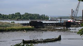
 Old Plant at North Brother Island.
 The remains of Riverside Hospital on North Brother Island, 2006. | |
 North and South Brother Islands  North and South Brother Islands | |
| Geography | |
|---|---|
| Location | East River, New York City |
| Coordinates | 40°47′54″N73°53′54″W / 40.798266°N 73.898424°W Coordinates: 40°47′54″N73°53′54″W / 40.798266°N 73.898424°W |
| Total islands | 2 |
| Administration | |
| State | New York |
| borough | The Bronx, formerly Queens County |
North and South Brother Islands are a pair of small islands located in New York City's East River between the mainland Bronx and Rikers Island. North Brother Island was once the site of a hospital, but is now uninhabited and designated as a bird sanctuary. [1] Until 1964, South Brother Island was part of Queens County, having been incorporated into Long Island City in 1870, [2] but it is now part of Bronx County. [3] It had long been privately owned, but it was purchased by the city in 2007.

The City of New York, usually called either New York City (NYC) or simply New York (NY), is the most populous city in the United States. With an estimated 2018 population of 8,398,748 distributed over a land area of about 302.6 square miles (784 km2), New York is also the most densely populated major city in the United States. Located at the southern tip of the state of New York, the city is the center of the New York metropolitan area, the largest metropolitan area in the world by urban landmass and one of the world's most populous megacities, with an estimated 19,979,477 people in its 2018 Metropolitan Statistical Area and 22,679,948 residents in its Combined Statistical Area. A global power city, New York City has been described as the cultural, financial, and media capital of the world, and exerts a significant impact upon commerce, entertainment, research, technology, education, politics, tourism, art, fashion, and sports. The city's fast pace has inspired the term New York minute. Home to the headquarters of the United Nations, New York is an important center for international diplomacy.
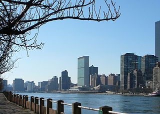
The East River is a salt water tidal estuary in New York City. The waterway, which is actually not a river despite its name, connects Upper New York Bay on its south end to Long Island Sound on its north end. It separates the borough of Queens on Long Island from the Bronx on the North American mainland, and also divides Manhattan from Queens and Brooklyn, which are also on Long Island. Because of its connection to Long Island Sound, it was once also known as the Sound River. The tidal strait changes its direction of flow frequently, and is subject to strong fluctuations in its current, which are accentuated by its narrowness and variety of depths. The waterway is navigable for its entire length of 16 miles (26 km), and was historically the center of maritime activities in the city, although that is no longer the case.

The Bronx is the northernmost of the five boroughs of New York City, in the U.S. state of New York. It is south of Westchester County; northeast and east of Manhattan, across the Harlem River; and north of Queens, across the East River. Since 1914, the borough has had the same boundaries as Bronx County, the third-most densely populated county in the United States.
Contents
- History
- North Brother Island
- South Brother Island
- Wildlife
- In popular culture
- See also
- References
- External links
According to the New York City Parks Department, which oversees the islands, North Brother Island has about 20 acres (8.1 ha) of land, [4] and South Brother Island about 6 acres (2.4 ha). [5]