
The Town of Dillon is a home rule municipality located in Summit County, Colorado, United States. The town population was 1,064 at the 2020 United States Census, a +17.70% increase since the 2010 United States Census.

The Town of Silverthorne is a home rule municipality in Summit County, Colorado. According to the 2020 Census, the population of the city is 4,402.

The Blue River is a tributary of the Colorado River, approximately 65 miles (105 km) long, in the U.S. state of Colorado.

White River National Forest is a National Forest in northwest Colorado. It is named after the White River that passes through its northern section. It is the most visited National Forest in the United States, primarily from users of the twelve ski areas within its boundaries.

The Cargo Muchacho Mountains are located in the southeast Colorado Desert in the Lower Colorado River Valley, in Imperial County, California in the United States. Much of the range's geology was described by the geologist John T. Dillon.

John T. Dillon was an American actor of the silent era. He appeared in more than 130 films between 1908 and 1936. He died in Los Angeles, California from pneumonia.
The Tenderfoot's Money is a 1913 American silent Western film featuring Harry Carey.
Schaffenaker Mountain is a forested mountain ridge of the Ridge-and-valley Appalachians in Hampshire County in the U.S. state of West Virginia. The ridge runs southwest northeast between Edwards Run and Dillons Run. Schaffenaker Mountain takes its name from the Schaffenaker family that settled in the immediate area. The Northwestern Turnpike climbs Schaffenaker Mountain to the west of the town of Capon Bridge offering a bird's eye view of the community and of the Cacapon River. Until recently, the mountain had remained mostly undeveloped but its views and proximity to Capon Bridge have made it a prime location for real estate development by companies such as the North American Land Corporation.

Areas of Critical Environmental Concern (ACEC) is a conservation ecology program in the Western United States, managed by the Bureau of Land Management (BLM). The ACEC program was conceived in the 1976 Federal Lands Policy and Management Act (FLPMA), which established the first conservation ecology mandate for the BLM. The FLPMA mandate directs the BLM to protect important riparian corridors, threatened and endangered species habitats, cultural and archeological resources, as well as unique scenic landscapes that the agency assesses as in need of special management attention.
Dollar Lake is a small tarn located on Aneroid Mountain in the Eagle Cap Wilderness of Northeastern Oregon, United States. It is between Aneroid Lake and Bonny Lakes and lies 1 mile (1.6 km) southwest of Aneroid Peak. It likely received its name because of its size and its almost perfectly round shape, much like that of a silver dollar. It is the third-highest lake in the Eagle Cap Wilderness.

Bonny Lakes are two small, shallow, mountain ponds located in the Eagle Cap Wilderness of Northeastern Oregon, United States. They are positioned in a large meadow on Aneroid Mountain known as Bonny Lakes basin, which is about two miles east of Dollar Lake. Together they are listed as the 13th highest lake in the Eagle Cap Wilderness at 7,840 ft.

This is a list of the National Register of Historic Places listings in Dillon County, South Carolina.

Dillon is an unincorporated community in Raleigh County, West Virginia, United States. It was also known as Irish Mountain and is the location of St. Colman's Roman Catholic Church and Cemetery, which is on the National Register of Historic Places.

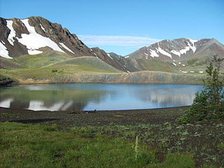
Ptarmigan Peak is the highest summit of the South Williams Fork Mountains range in the Rocky Mountains of North America. The peak is north of Dillon, CO in the White River National Forest.
Square Butte is a name used for 11 buttes in Montana. Two of the most prominent buttes are located in a) Cascade County, Montana, about 22 miles (35 km) due west of Great Falls and in b) Chouteau County, Montana, about 50 miles (80 km) due east of Great Falls and about 15 miles (24 km) due east of the Highwood Mountains. Charles Marion Russell, the noted Montana western artist used both features as background in his paintings of Montana.

Summit Lake is located on Canyon Creek in the Chugach National Forest, Alaska, United States and is situated along the Seward Highway (AK-1) 10 miles (16 km) north-northeast of Moose Pass and about 23 miles (37 km) southwest of the Portage area of Anchorage. The lake is fed by Canyon Creek from the southwest and Tenderfoot Creek from the east. The lake empties into Canyon Creek on the northeast, which flows through Lower Summit Lake, into Six Mile Creek, and eventually into the Turnagain Arm of the Cook Inlet.
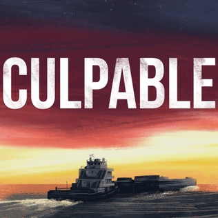
Culpable is an investigative true crime podcast hosted by Dennis Cooper that covers the 2014 death of 21-year-old Christian Andreacchio. It is produced by Dennis Cooper, Mark Minnery, Donald Albright, and Jacob Bozarth as a partnership of Black Mountain Media, Tenderfoot TV, Resonate Recordings, and Cadence13. In September 2019, the podcast was the #2 true-crime podcast and #3 podcast overall on Apple Podcasts. The podcast brought national attention to Andreacchio's case. Tenderfoot TV and Black Mountain Media offered a $100,000 reward for information leading to a conviction.
Maverick Mountain is a census-designated place (CDP) in Beaverhead County, Montana, United States, consisting of residences in the valley of Grasshopper Creek at the base of Maverick Mountain Ski Area. It is in the northern part of the county, along the Pioneer Mountains Scenic Byway, 4 miles (6 km) north of Polaris, the nearest post office, and 35 miles (56 km) northwest of Interstate 15 at Dillon, the Beaverhead county seat. Maverick Mountain, for which the CDP and the ski area are named, rises to a summit elevation of 8,722 feet (2,658 m) to the northwest. The scenic byway continues north 34 miles (55 km) to the town of Wise River in the Big Hole River valley.

The McCully Basin is a geologic structural basin in the northern boundary of Eagle Cap Wilderness in northeast Oregon. The basin is the topographic drainage of McCully Creek. Several Alpine Huts and campsite are located throughout the McCully Basin, which are used as a base camp in the winter for telemark skiing.

Mount Nebo is a 8,261-foot (2,518 m) mountain in the Eagle Cap Wilderness of Oregon, in the United States. Named after the biblical Mount Nebo overlooking Israel, which is said to be the place of Moses' death. It is the centerpiece of the Imnaha Divide, inside the Wallowa–Whitman National Forest. Mount Nebo is one of the important areas where sheep and cattle graze throughout Eagle Cap Wilderness.
