Related Research Articles

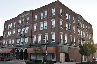
Jackson County is located in the U.S. state of Michigan. The population of the county was 160,366 as of the 2020 Census. Its seat of government is the city of Jackson. The county was set off in 1829 and organized in 1832. It is named for U.S. President Andrew Jackson and considered to be one of Michigan's "Cabinet counties", named for members of Jackson's Cabinet. Jackson County comprises the Jackson, MI Metropolitan Statistical Area. The Jackson County Courthouse was designed by Claire Allen, a prominent southern Michigan architect. Jackson County is also home to the Michigan Whitetail Hall of Fame.
Oelwein is a city in Fayette County, Iowa, United States. The population was 5,920 at the time of the 2020 census, a decrease of 11.5% from the 2000 census. The largest community in Fayette County, it is located at the junction of State Highways 3 and 150.

Brentwood is a city in Williamson County, Tennessee, United States. The population was 45,373 as of the 2020 United States census. It is a suburb of Nashville and included in the Nashville metropolitan area.

Bellaire is a city in southwestern Harris County, Texas, United States, within the Houston–Sugar Land–Baytown metropolitan area. As of the 2020 U.S. census, the city population was 17,202. It is surrounded by the cities of Houston and West University Place. Bellaire is known as the "City of Homes", owing to its mostly residential character; but it has offices along the I-610 Loop within the city limits.

Pasadena is a city in the U.S. state of Texas, located in Harris County. It is part of the Houston–The Woodlands–Sugar Land metropolitan area. As of the 2020 U.S. census, the city's population was 151,950, making it the 23rd most populous city in Texas and the second most populous in Harris County, after Houston. The area was founded in 1893 by John H. Burnett of Galveston, who named the area after Pasadena, California, because of the perceived lush vegetation.

Stafford is a city in the U.S. state of Texas, in the Houston–The Woodlands–Sugar Land metropolitan area. The city is mostly in Fort Bend County, with a small part in Harris County. As of the 2020 census, Stafford's population was 17,666, down from 17,693 at the 2010 census.

St. Peters is a city in St. Charles County, Missouri, United States. The population was 57,732 at the 2020 census, making it the eleventh-largest city in Missouri. It is a northwestern suburb of St. Louis.

Kingwood is a 14,000-acre (57 km2) master-planned community located in northeast Houston, Texas, United States. The majority of the community is located in Harris County with a small portion in Montgomery County. Known as the "Livable Forest," it is the largest master-planned community in Harris County and second-largest within the 10-county Houston-The Woodlands-Sugar Land metropolitan area. It was classified as a "census-designated place" during the 1990 census, when the population recorded was 37,397. It is on the east fork of the San Jacinto River.

Clear Lake City is a master-planned community located in southeast Harris County, Texas, within the Bay Area of Greater Houston. It is the second-largest master-planned community in Houston – behind Kingwood. The majority of the community lies in the corporate limits of Houston, and a small eastern portion within the city limits of Taylor Lake Village.

Piedmont Park is an urban park in Atlanta, Georgia, United States, located about 1 mile (1.6 km) northeast of Downtown, between the Midtown and Virginia Highland neighborhoods. Originally the land was owned by Dr. Benjamin Walker, who used it as his out-of-town gentleman's farm and residence. He sold the land in 1887 to the Gentlemen's Driving Club, who wanted to establish an exclusive club and racing ground for horse enthusiasts. The Driving Club entered an agreement with the Piedmont Exposition Company, headed by prominent Atlantan Charles A. Collier, to use the land for fairs and expositions and later gave the park its name.
The Albany Parks & Recreation is a city agency in Albany, Oregon, United States responsible for maintaining the local city parks as well as organizing cultural events. Its headquarters are at City Hall, 333 Broadalbin Street SW. One goal of the City of Albany is to have all residents live within 2 miles (3 km) of a park.

Garfield Park is a 128-acre (52 ha) urban park in Indianapolis, Indiana, United States. Established in the late 19th century, it is the oldest city park in Indianapolis and is on the National Register of Historic Places. The park is located at the confluence of Pleasant Run and Bean Creeks on the near Southside of Indianapolis. The 10,000-square-foot (930 m2) Conservatory and Sunken Gardens are located in the eastern portion of the park. The noted landscape architect George Edward Kessler designed the Sunken Gardens along with many of the other features of the park as part of his Park and Boulevard Plan for the city.

Lake Balboa is a neighborhood in the San Fernando Valley region of Los Angeles, California. The area was previously part of Van Nuys.

Hermann Park is a 445-acre (180-hectare) urban park in Houston, Texas, situated at the southern end of the Museum District. The park is located to the immediate north end of the MD Anderson Cancer Center at Texas Medical Center and Brays Bayou, east of Rice University, and slightly west of the Third Ward. Hermann Park is home to numerous cultural institutions including the Houston Zoo, Miller Outdoor Theatre, the Houston Museum of Natural Science, and the Hermann Park Golf Course, which became one of the first desegregated public golf courses in the United States in 1954. The park also features the Mary Gibbs and Jesse H. Jones Reflection Pool, numerous gardens, picnic areas, and McGovern Lake, an 8-acre (32,000 m2) recreational lake.
Huffman is an unincorporated community of northeastern Harris County, Texas, United States, within the Greater Houston metropolitan area.

Greater Greenspoint, also referred to as the North Houston District, is a 7-square-mile (18 km2) business district and a suburban neighborhood in northern Harris County, Texas, United States, located mostly within the city limits of Houston. Centered around the junction of Interstate 45 and Texas State Highway Beltway 8 near George Bush Intercontinental Airport, the area is a classic example of a planned edge city. The initial 2,000-acre (8.1 km2) retail and office development centered around Greenspoint Mall was a project of the Friendswood Development Company during the 1970s and early 1980s.

Houston, the most populous city in the Southern United States, is located along the upper Texas Gulf Coast, approximately 50 miles (80 km) northwest of the Gulf of Mexico at Galveston. The city, which is the ninth-largest in the United States by area, covers 601.7 square miles (1,558 km2), of which 579.4 square miles (1,501 km2), or 96.3%, is land and 22.3 square miles (58 km2), or 3.7%, is water.

Clairemont is a community in San Diego, California, United States. It has a population of about 81,600 residents and an area of roughly 13.3 square miles (34 km2). Clairemont is bordered by Interstate 805 on the east, Interstate 5 to the west, State Route 52 to the north, and the community of Linda Vista to the south. The community of Clairemont can be subdivided into the neighborhoods of North Clairemont, Clairemont Mesa East, Clairemont Mesa West, Bay Park, and Bay Ho.
Metropolitan Park is a 32-acre (130,000 m2) urban waterfront park and concert venue located on the north bank of the St. Johns River in Downtown Jacksonville, Florida. It is projected to be the eastern terminus of the northbank Jacksonville Riverwalk.
References
- ↑ Clear Lake Patrol Division
- ↑ Fire Station 71 Archived August 6, 2007, at the Wayback Machine
- ↑ Falcon Pass Elementary School Archived September 27, 2007, at the Wayback Machine
Space Center Intermediate School Archived September 27, 2007, at the Wayback Machine

| Large cities |  | |
|---|---|---|
| Other cities | ||
| CDPs and non- municipalities | ||
| Counties | ||
| Subregions | ||
| Bodies of water | ||
| Major ports | ||
| Nature preserves | ||