| Primary statistical area | Core-based statistical area | Incorporated city |
|---|
| 2011 rank | PSA name | 2011 population | 2011 rank | CBSA name | 2011 population | 2011 rank | City & state | 2011 population |
|---|
| 1 | New York-Newark-Bridgeport, NY-NJ-CT-PA CSA | 22,214,083 | 1 | New York-Northern New Jersey-Long Island, NY-NJ-PA MSA | 19,015,900 | 1 | New York, New York [10] | 8,244,910 |
| 69 | Newark, New Jersey | 277,540 |
| 76 | Jersey City, New Jersey | 250,323 |
| 57 | Bridgeport-Stamford-Norwalk, CT MSA | 925,899 |
| 61 | New Haven-Milford, CT MSA | 861,113 |
| 80 | Poughkeepsie-Newburgh-Middletown, NY MSA | 672,871 |
| 2 | Los Angeles-Long Beach-Riverside, CA CSA | 18,081,569 | 2 | Los Angeles-Long Beach-Santa Ana, CA MSA | 12,944,801 | 2 | Los Angeles, California | 3,819,702 |
| 36 | Long Beach, California | 465,576 |
| 55 | Anaheim, California | 341,361 |
| 58 | Santa Ana, California | 329,427 |
| 97 | Irvine, California | 215,529 |
| 12 | Riverside-San Bernardino-Ontario, CA MSA | 4,304,997 | 60 | Riverside, California | 310,651 |
| 98 | San Bernardino, California | 213,012 |
| 64 | Oxnard-Thousand Oaks-Ventura, CA MSA | 831,771 |
| 3 | Chicago-Naperville-Michigan City, IL-IN-WI CSA | 9,729,825 | 3 | Chicago-Joliet-Naperville, IL-IN-WI MSA | 9,504,753 | 3 | Chicago, Illinois | 2,707,120 |
| 4 | Washington-Baltimore-Northern Virginia, DC-MD-VA-WV CSA | 8,718,083 | 7 | Washington-Arlington-Alexandria, DC-VA-MD-WV MSA | 5,703,948 | 25 | Washington, District of Columbia [16] | 617,996 |
| 20 | Baltimore-Towson, MD MSA | 2,729,110 | 24 | Baltimore, Maryland [19] | 619,493 |
| 5 | Boston-Worcester-Manchester, MA-RI-NH CSA | 7,601,061 | 10 | Boston-Cambridge-Quincy, MA-NH MSA | 4,591,112 | 21 | Boston, Massachusetts | 625,087 |
| 39 | Providence-New Bedford-Fall River, RI-MA MSA | 1,600,224 |
| 68 | Worcester, MA MSA | 801,227 |
| 6 | San Francisco Bay Area | 7,563,460 | 11 | San Francisco-Oakland-Fremont, CA MSA | 4,391,037 | 14 | San Francisco, California [14] | 812,826 |
| 46 | Oakland, California | 395,817 |
| 96 | Fremont, California | 216,916 |
| 32 | Silicon Valley | 1,865,450 | 10 | San Jose, California | 967,487 |
| 7 | Dallas-Fort Worth, TX CSA | 6,887,383 | 4 | Dallas-Fort Worth-Arlington, TX MSA | 6,526,548 | 9 | Dallas, Texas | 1,223,229 |
| 16 | Fort Worth, Texas | 758,738 |
| 51 | Arlington, Texas | 373,698 |
| 71 | Plano, Texas | 269,776 |
| 87 | Garland, Texas | 231,517 |
| 94 | Irving, Texas | 220,702 |
| 8 | Philadelphia-Camden-Vineland, PA-NJ-DE-MD CSA | 6,562,287 | 6 | Philadelphia-Camden-Wilmington, PA-NJ-DE-MD MSA | 5,992,414 | 5 | Philadelphia, Pennsylvania [11] | 1,536,471 |
| 9 | Houston-Baytown-Huntsville, TX CSA | 6,191,434 | 5 | Houston-Sugar Land-Baytown, TX MSA | 6,086,538 | 4 | Houston, Texas | 2,145,146 |
| 10 | Atlanta-Sandy Springs-Gainesville, GA-AL CSA | 5,712,148 | 9 | Atlanta-Sandy Springs-Marietta, GA MSA | 5,359,205 | 40 | Atlanta, Georgia | 432,427 |
| 11 | Miami-Fort Lauderdale-Pompano Beach, FL MSA | 5,670,125 | 8 | Miami-Fort Lauderdale-Pompano Beach, FL MSA | 5,670,125 | 44 | Miami, Florida | 408,750 |
| 90 | Hialeah, Florida | 229,969 |
| 12 | Detroit-Warren-Flint, MI CSA | 5,207,434 | 13 | Detroit-Warren-Livonia, MI MSA | 4,285,832 | 18 | Detroit, Michigan | 706,585 |
| 13 | Seattle-Tacoma-Olympia, WA CSA | 4,269,349 | 15 | Seattle-Tacoma-Bellevue, WA MSA | 3,500,026 | 22 | Seattle, Washington | 620,778 |
| 14 | Phoenix-Mesa-Glendale, AZ MSA | 4,263,236 | 14 | Phoenix-Mesa-Glendale, AZ MSA | 4,263,236 | 6 | Phoenix, Arizona | 1,469,471 |
| 38 | Mesa, Arizona | 446,518 |
| 82 | Chandler, Arizona | 240,101 |
| 88 | Glendale, Arizona | 230,482 |
| 93 | Scottsdale, Arizona | 221,020 |
| 100 | Gilbert, Arizona [23] | 211,951 |
| 15 | Minneapolis-St. Paul-St. Cloud, MN-WI CSA | 3,655,558 | 16 | Minneapolis-St. Paul-Bloomington, MN-WI MSA | 3,318,486 | 49 | Minneapolis, Minnesota | 387,753 |
| 67 | Saint Paul, Minnesota | 288,448 |
| 16 | Denver-Aurora-Boulder, CO CSA | 3,157,520 | 21 | Denver-Aurora-Broomfield, CO MSA | 2,599,504 | 23 | Denver, Colorado [15] | 619,968 |
| 57 | Aurora, Colorado | 332,354 |
| 17 | San Diego-Carlsbad-San Marcos, CA MSA | 3,140,069 | 17 | San Diego-Carlsbad-San Marcos, CA MSA | 3,140,069 | 8 | San Diego, California | 1,326,179 |
| 77 | Chula Vista, California | 247,535 |
| 18 | St. Louis-St. Charles-Farmington, MO-IL CSA | 2,882,932 | 19 | St. Louis, MO-IL MSA | 2,817,355 | 59 | St. Louis, Missouri [19] | 318,069 |
| 19 | Cleveland-Akron-Elyria, OH CSA | 2,871,084 | 29 | Cleveland-Elyria-Mentor, OH MSA | 2,068,283 | 47 | Cleveland, Ohio | 393,806 |
| 76 | Akron, OH MSA | 701,456 |
| 20 | Orlando-Deltona-Daytona Beach, FL CSA | 2,861,296 | 27 | Orlando-Kissimmee-Sanford, FL MSA | 2,171,360 | 79 | Orlando, Florida | 243,195 |
| 21 | Tampa-St. Petersburg-Clearwater, FL MSA | 2,824,724 | 18 | Tampa-St. Petersburg-Clearwater, FL MSA | 2,824,724 | 54 | Tampa, Florida | 346,037 |
| 78 | Saint Petersburg, Florida | 244,997 |
| 22 | San Juan-Caguas-Fajardo, PR CSA | 2,571,374 | 22 | San Juan-Caguas-Guaynabo, PR MSA | 2,468,598 | 48 | San Juan, Puerto Rico | 389,714 |
| 23 | Sacramento–Arden-Arcade–Yuba City, CA-NV CSA | 2,489,230 | 26 | Sacramento–Arden-Arcade–Roseville, CA MSA | 2,176,235 | 35 | Sacramento, California | 472,178 |
| 24 | Pittsburgh-New Castle-Weirton, PA-WV-OH CSA | 2,450,281 | 23 | Pittsburgh, PA MSA | 2,359,746 | 62 | Pittsburgh, Pennsylvania | 307,484 |
| 25 | Charlotte-Gastonia-Salisbury, NC-SC CSA | 2,442,564 | 34 | Charlotte-Gastonia-Rock Hill, NC-SC MSA | 1,795,472 | 17 | Charlotte, North Carolina | 751,087 |
| 26 | Portland-Vancouver-Hillsboro, OR-WA MSA | 2,262,605 | 24 | Portland-Vancouver-Hillsboro, OR-WA MSA | 2,262,605 | 29 | Portland, Oregon | 593,820 |
| 27 | San Antonio-New Braunfels, TX MSA | 2,194,927 | 25 | San Antonio-New Braunfels, TX MSA | 2,194,927 | 7 | San Antonio, Texas | 1,359,758 |
| 28 | Cincinnati-Middletown-Wilmington, OH-KY-IN CSA | 2,179,965 | 28 | Cincinnati-Middletown, OH-KY-IN MSA | 2,138,038 | 65 | Cincinnati, Ohio | 296,223 |
| 29 | Kansas City-Overland Park-Kansas City, MO-KS CSA | 2,122,908 | 30 | Kansas City, MO-KS MSA | 2,052,676 | 37 | Kansas City, Missouri | 463,202 |
| 30 | Indianapolis-Anderson-Columbus, IN CSA | 2,103,574 | 36 | Indianapolis-Carmel, IN MSA | 1,778,568 | 12 | Indianapolis, Indiana [13] | 827,609 |
| 31 | Columbus-Marion-Chillicothe, OH CSA | 2,093,185 | 33 | Columbus, OH MSA | 1,858,464 | 15 | Columbus, Ohio | 797,434 |
| 32 | Las Vegas-Paradise-Pahrump, NV CSA | 2,013,326 | 31 | Las Vegas-Paradise, NV MSA | 1,969,975 | 31 | Las Vegas, Nevada | 589,317 |
| 74 | Henderson, Nevada | 260,068 |
| 95 | North Las Vegas, Nevada | 219,020 |
| 33 | Austin-Round Rock-Marble Falls, TX CSA | 1,826,636 | 35 | Austin-Round Rock-San Marcos, TX MSA | 1,783,519 | 13 | Austin, Texas | 820,611 |
| 34 | Raleigh-Durham-Cary, NC CSA | 1,795,750 | 48 | Raleigh-Cary, NC MSA | 1,163,515 | 42 | Raleigh, North Carolina | 416,468 |
| 102 | Durham-Chapel Hill, NC MSA | 512,979 | 85 | Durham, North Carolina | 233,252 |
| 35 | Salt Lake City-Ogden-Clearfield, UT CSA | 1,776,528 | 49 | Salt Lake City, UT MSA | 1,145,905 |
| 94 | Ogden-Clearfield, UT MSA | 555,916 |
| 36 | Milwaukee-Racine-Waukesha, WI CSA | 1,757,604 | 40 | Milwaukee-Waukesha-West Allis, WI MSA | 1,562,216 | 28 | Milwaukee, Wisconsin | 597,867 |
| 37 | Nashville-Davidson–Murfreesboro–Columbia, TN CSA | 1,698,651 | 38 | Nashville-Davidson–Murfreesboro–Franklin, TN MSA | 1,617,142 | 26 | Nashville, Tennessee [17] | 609,644 |
| 38 | Virginia Beach-Norfolk-Newport News, VA-NC MSA | 1,679,894 | 37 | Virginia Beach-Norfolk-Newport News, VA-NC MSA | 1,679,894 | 39 | Virginia Beach, Virginia [19] | 442,707 |
| 80 | Norfolk, Virginia [19] | 242,628 |
| 92 | Chesapeake, Virginia [19] | 225,050 |
| 39 | Greensboro–Winston-Salem–High Point, NC CSA | 1,602,693 | 72 | Greensboro-High Point, NC MSA | 730,966 | 70 | Greensboro, North Carolina | 273,425 |
| 105 | Winston-Salem, NC MSA | 482,025 | 86 | Winston–Salem, North Carolina | 232,385 |
| 40 | Louisville/Jefferson County–Elizabethtown–Bardstown, KY-IN CSA | 1,440,607 | 43 | Louisville/Jefferson County, KY-IN MSA | 1,294,849 | 27 | Louisville, Kentucky [18] | 602,011 |
| 41 | Jacksonville, FL MSA | 1,360,251 | 41 | Jacksonville, FL MSA | 1,360,251 | 11 | Jacksonville, Florida [12] | 827,908 |
| 42 | Oklahoma City-Shawnee, OK CSA | 1,348,333 | 44 | Oklahoma City, OK MSA | 1,278,053 | 30 | Oklahoma City, Oklahoma | 591,967 |
| 43 | Hartford-East Hartford, CT CSA | 1,331,406 | 46 | Hartford-East Hartford-Middletown, CT MSA | 1,213,255 |
| 44 | Grand Rapids-Muskegon-Holland, MI CSA | 1,328,440 | 70 | Grand Rapids-Wyoming, MI MSA | 779,604 |
| 45 | Memphis, TN-MS-AR MSA | 1,325,605 | 42 | Memphis, TN-MS-AR MSA | 1,325,605 | 20 | Memphis, Tennessee | 652,050 |
| 46 | Greenville-Spartanburg-Anderson, SC CSA | 1,281,394 | 84 | Greenville-Mauldin-Easley, SC MSA | 647,401 |
| 47 | Richmond, VA MSA | 1,269,380 | 45 | Richmond, VA MSA | 1,269,380 |
| 48 | New Orleans-Metairie-Bogalusa, LA CSA | 1,238,228 | 47 | New Orleans-Metairie-Kenner, LA MSA | 1,191,089 | 52 | New Orleans, Louisiana [20] | 360,740 |
| 49 | Buffalo-Cheektowaga-Olean, NY CSA | 1,213,871 | 50 | Buffalo-Niagara Falls, NY MSA | 1,134,039 | 73 | Buffalo, New York | 261,025 |
| 50 | Birmingham-Hoover-Cullman, AL CSA | 1,212,800 | 51 | Birmingham-Hoover, AL MSA | 1,132,264 | 99 | Birmingham, Alabama | 212,413 |
| 51 | Albany-Schenectady-Amsterdam, NY CSA | 1,168,120 | 60 | Albany-Schenectady-Troy, NY MSA | 871,478 |
| 52 | Rochester-Batavia-Seneca Falls, NY CSA | 1,150,469 | 52 | Rochester, NY MSA | 1,055,278 |
| 53 | Fresno-Madera, CA CSA | 1,095,829 | 56 | Fresno, CA MSA | 942,904 | 34 | Fresno, California | 501,362 |
| 54 | Dayton-Springfield-Greenville, OH CSA | 1,075,683 | 63 | Dayton, OH MSA | 845,388 |
| 55 | Knoxville-Sevierville-La Follette, TN CSA | 1,063,354 | 75 | Knoxville, TN MSA | 704,500 |
| 56 | Tulsa-Bartlesville, OK CSA | 998,438 | 55 | Tulsa, OK MSA | 946,962 | 45 | Tulsa, Oklahoma | 396,466 |
| 57 | Tucson, AZ MSA | 989,569 | 53 | Tucson, AZ MSA | 989,569 | 33 | Tucson, Arizona | 525,796 |
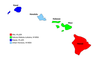
| 58 | Honolulu, HI MSA | 963,607 | 54 | Honolulu, HI MSA | 963,607 | 56 | Honolulu CDP, Hawaii [2] | 340,936 |
| 59 | Omaha-Council Bluffs-Fremont, NE-IA CSA | 913,883 | 59 | Omaha-Council Bluffs, NE-IA MSA | 877,110 | 43 | Omaha, Nebraska | 415,068 |
| 60 | Albuquerque, NM MSA | 898,642 | 58 | Albuquerque, NM MSA | 898,642 | 32 | Albuquerque, New Mexico | 552,804 |
| 61 | Little Rock-North Little Rock-Pine Bluff, AR CSA | 886,992 | 73 | Little Rock-North Little Rock-Conway, AR MSA | 709,901 |
| 62 | Sarasota-Bradenton-Punta Gorda, FL CSA | 869,866 | 74 | North Port-Bradenton-Sarasota, FL MSA | 709,355 |
| 63 | Bakersfield-Delano, CA MSA | 851,710 | 62 | Bakersfield-Delano, CA MSA | 851,710 | 53 | Bakersfield, California | 352,428 |
| 64 | Baton Rouge-Pierre Part, LA CSA | 831,395 | 67 | Baton Rouge, LA MSA | 808,242 | 89 | Baton Rouge, Louisiana [24] | 230,139 |
| 65 | Allentown-Bethlehem-Easton, PA-NJ MSA | 824,916 | 65 | Allentown-Bethlehem-Easton, PA-NJ MSA | 824,916 |
| 66 | El Paso, TX MSA | 820,790 | 66 | El Paso, TX MSA | 820,790 | 19 | El Paso, Texas | 665,568 |
| 67 | Columbia-Newberry, SC CSA | 814,837 | 71 | Columbia, SC MSA | 777,116 |
| 68 | McAllen-Edinburg-Mission, TX MSA | 797,810 | 69 | McAllen-Edinburg-Mission, TX MSA | 797,810 |
| 69 | Syracuse-Auburn, NY CSA | 742,291 | 81 | Syracuse, NY MSA | 662,553 |
| 70 | Toledo-Fremont, OH CSA | 711,000 | 83 | Toledo, OH MSA | 650,266 | 68 | Toledo, Ohio | 286,038 |
| 71 | Chattanooga-Cleveland-Athens, TN-GA CSA | 702,714 | 99 | Chattanooga, TN-GA MSA | 533,372 |
| 72 | Lexington-Fayette–Frankfort–Richmond, KY CSA | 696,340 | 106 | Lexington-Fayette, KY MSA | 479,244 | 63 | Lexington, Kentucky [21] | 301,569 |
| 73 | Stockton, CA MSA | 696,214 | 77 | Stockton, CA MSA | 696,214 | 64 | Stockton, California | 296,357 |
| 74 | Springfield, MA MSA | 693,204 | 78 | Springfield, MA MSA | 693,204 |
| 75 | Harrisburg-Carlisle-Lebanon, PA CSA | 687,222 | 95 | Harrisburg-Carlisle, PA MSA | 552,911 |
| 76 | Charleston-North Charleston-Summerville, SC MSA | 682,121 | 79 | Charleston-North Charleston-Summerville, SC MSA | 682,121 |
| 77 | Youngstown-Warren, OH-PA CSA | 670,309 | 92 | Youngstown-Warren-Boardman, OH-PA MSA | 562,739 |
| 78 | Wichita-Winfield, KS CSA | 661,798 | 87 | Wichita, KS MSA | 625,526 | 50 | Wichita, Kansas | 384,445 |
| 79 | Colorado Springs, CO MSA | 660,319 | 82 | Colorado Springs, CO MSA | 660,319 | 41 | Colorado Springs, Colorado | 426,388 |
| 80 | Des Moines-Newton-Pella, IA CSA | 650,137 | 89 | Des Moines-West Des Moines, IA MSA | 580,255 |
| 81 | Madison-Baraboo, WI CSA | 638,757 | 90 | Madison, WI MSA | 576,467 | 83 | Madison, Wisconsin | 236,901 |
| 82 | Cape Coral-Fort Myers, FL MSA | 631,330 | 85 | Cape Coral-Fort Myers, FL MSA | 631,330 |
| 83 | Boise City-Nampa, ID MSA | 627,664 | 86 | Boise City-Nampa, ID MSA | 627,664 |
| 84 | Portland-Lewiston-South Portland, ME CSA | 623,205 |
| 85 | Fort Wayne-Huntington-Auburn, IN CSA | 615,077 | 122 | Fort Wayne, IN MSA | 419,453 | 75 | Fort Wayne, Indiana | 255,824 |
| 86 | Lakeland-Winter Haven, FL MSA | 609,492 | 88 | Lakeland-Winter Haven, FL MSA | 609,492 |
| 87 | Mobile-Daphne-Fairhope, AL CSA | 599,294 |
| 88 | Huntsville-Decatur, AL CSA | 579,550 |
| 89 | Jackson-Yazoo City, MS CSA | 573,280 | 96 | Jackson, MS MSA | 545,394 |
| 90 | Port St. Lucie-Sebastian-Vero Beach, FL CSA | 566,768 |
| 91 | South Bend-Elkhart-Mishawaka, IN-MI CSA | 564,679 |
| 92 | Scranton–Wilkes-Barre, PA MSA | 563,223 | 91 | Scranton–Wilkes-Barre, PA MSA | 563,223 |
| 93 | Augusta-Richmond County, GA-SC MSA | 561,858 | 93 | Augusta-Richmond County, GA-SC MSA | 561,858 |
| 94 | Lafayette-Acadiana, LA CSA | 554,517 |
| 95 | Palm Bay-Melbourne-Titusville, FL MSA | 543,566 | 97 | Palm Bay-Melbourne-Titusville, FL MSA | 543,566 |
| 96 | Provo-Orem, UT MSA | 540,834 | 98 | Provo-Orem, UT MSA | 540,834 |
| 97 | York-Hanover-Gettysburg, PA CSA | 538,204 |
| 98 | Lansing-East Lansing-Owosso, MI CSA | 534,979 |
| 99 | Lancaster, PA MSA | 523,594 | 100 | Lancaster, PA MSA | 523,594 |
| 100 | Modesto, CA MSA | 518,522 |
| 102 | Reno-Sparks-Fernley, NV CSA | 481,477 | 116 | Reno-Sparks, NV MSA | 429,606 | 91 | Reno, Nevada | 227,511 |
| 106 | Corpus Christi-Kingsville, TX CSA | 464,014 | 115 | Corpus Christi, TX MSA | 431,381 | 61 | Corpus Christi, Texas | 307,953 |
| 127 | Anchorage, AK MSA | 387,516 | 134 | Anchorage, AK MSA | 387,516 | 66 | Anchorage, Alaska [22] | 295,570 |
| 139 | Lubbock-Levelland, TX CSA | 312,894 | 163 | Lubbock, TX MSA | 290,002 | 84 | Lubbock, Texas | 233,740 |
| 142 | Lincoln, NE MSA | 306,503 | 155 | Lincoln, NE MSA | 306,503 | 72 | Lincoln, Nebraska | 262,341 |
| 164 | Laredo, TX MSA | 256,496 | 183 | Laredo, TX MSA | 256,496 | 81 | Laredo, Texas | 241,935 |