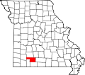
Fremont Hills, Missouri | |
---|---|
Coordinates: 37°3′56″N93°15′10″W / 37.06556°N 93.25278°W | |
Country | United States |
State | Missouri |
County | Christian |
Area | |
• Total | 0.55 sq mi (1.43 km2) |
• Land | 0.55 sq mi (1.43 km2) |
• Water | 0.00 sq mi (0.00 km2) |
Elevation | 1,286 ft (392 m) |
Population (2020) | |
• Total | 1,049 |
• Density | 1,896.93/sq mi (732.30/km2) |
Time zone | UTC-6 (Central (CST)) |
• Summer (DST) | UTC-5 (CDT) |
ZIP code | 65714 [3] |
Area code | 417 |
FIPS code | 29-25957 [4] |
GNIS feature ID | 1669600 [2] |
Website | https://fremonthills.gov/ |
Fremont Hills is a city in Christian County, Missouri, United States. The population was 1,049 at the 2020 census. [5] It is part of the Springfield, Missouri Metropolitan Statistical Area.
Fremont Hills is located at 37°3′56″N93°15′10″W / 37.06556°N 93.25278°W (37.065582, -93.252872). [6]
According to the United States Census Bureau, the city has a total area of 0.55 square miles (1.42 km2), all land. [7]
Census | Pop. | Note | %± |
---|---|---|---|
1990 | 201 | — | |
2000 | 597 | 197.0% | |
2010 | 826 | 38.4% | |
2020 | 1,049 | 27.0% | |
U.S. Decennial Census [8] |
As of the census [9] of 2010, there were 826 people, 319 households, and 272 families living in the city. The population density was 1,501.8 inhabitants per square mile (579.8/km2). There were 345 housing units at an average density of 627.3 per square mile (242.2/km2). The racial makeup of the city was 97.5% White, 0.2% African American, 0.4% Native American, 0.6% Asian, 0.1% from other races, and 1.2% from two or more races. Hispanic or Latino of any race were 0.8% of the population.
There were 319 households, of which 29.2% had children under the age of 18 living with them, 82.8% were married couples living together, 1.6% had a female householder with no husband present, 0.9% had a male householder with no wife present, and 14.7% were non-families. 11.0% of all households were made up of individuals, and 4.4% had someone living alone who was 65 years of age or older. The average household size was 2.59 and the average family size was 2.80.
The median age in the city was 49.7 years. 21.1% of residents were under the age of 18; 5.5% were between the ages of 18 and 24; 17.6% were from 25 to 44; 36% were from 45 to 64; and 20% were 65 years of age or older. The gender makeup of the city was 51.3% male and 48.7% female.
As of the census [4] of 2000, there were 597 people, 224 households, and 191 families living in the city. The population density was 1,147.0 inhabitants per square mile (442.9/km2). There were 230 housing units at an average density of 441.9 per square mile (170.6/km2). The racial makeup of the city was 98.16% White, 0.17% Native American, 0.50% Asian, 0.50% from other races, and 0.67% from two or more races. Hispanic or Latino of any race were 0.84% of the population.
There were 224 households, out of which 34.4% had children under the age of 18 living with them, 80.8% were married couples living together, 4.0% had a female householder with no husband present, and 14.3% were non-families. 11.2% of all households were made up of individuals, and 1.3% had someone living alone who was 65 years of age or older. The average household size was 2.67 and the average family size was 2.85.
In the city the population was spread out, with 23.6% under the age of 18, 4.4% from 18 to 24, 25.3% from 25 to 44, 37.4% from 45 to 64, and 9.4% who were 65 years of age or older. The median age was 43 years. For every 100 females, there were 100.3 males. For every 100 females age 18 and over, there were 103.6 males.
The median income for a household in the city was $87,863, and the median income for a family was $94,346. Males had a median income of $66,250 versus $32,292 for females. The per capita income for the city was $39,895. About 2.9% of families and 3.5% of the population were below the poverty line, including 5.7% of those under age 18 and none of those age 65 or over.
Amado is a census-designated place (CDP) in Santa Cruz County, Arizona, United States. The population was 295 at the 2010 census.
Parker is a city in southeastern Fremont County, Idaho, United States. The population was 305 at the 2010 census. It is part of the Rexburg, Idaho Micropolitan Statistical Area.
North City is a village in Franklin County, Illinois, United States. As of the 2020 census, the population was 509. North City is also known as "Coello". The current mayor is Curtis Overton.
Waynetown is a town in Wayne Township, Montgomery County, in the U.S. state of Indiana. The population was 960 at the 2020 census.
Imogene is a city in Fremont County, Iowa, United States. The population was 39 at the time of the 2020 census.
Randolph is a city in Fremont County, Iowa, United States. The population was 189 at the time of the 2020 census. It is the birthplace of Virginia Smith, Republican U.S. representative from the 3rd District of Nebraska from 1975 until 1991.
Sidney is a city in Fremont County, Iowa, United States. The population was 1,070 at the time of the 2020 census. It is the county seat of Fremont County and is one of the smallest county seats in the state.
Thurman is a city in Fremont County, Iowa. As of the 2020 census, the city population was 167.
Fremont is a city in Mahaska County, Iowa, United States. The population was 708 at the time of the 2020 census.
Kirkville is a city in Wapello County, Iowa, United States. The population was 157 at the time of the 2020 census.
Fremont is a city in Newaygo County, Michigan, United States. The population was 4,516 at the time of the 2020 census.
Zimmerman is a city in Sherburne County, Minnesota, United States. The population was 5,228 at the 2010 census.
Stockton is a city in Cedar County, Missouri, United States. The population was 1,683 at the 2020 census. It is the county seat of Cedar County.
Bennington is a city in Douglas County, Nebraska, United States. The population was 2,026 at the 2020 U.S. Census.
Tulalip Bay is a former census-designated place (CDP) in western Snohomish County, Washington, United States. The population was 1,561 at the 2000 census. The CDP was discontinued at the 2010 census. It is the largest community within the reservation of the federally recognized Tulalip Tribes of Washington.
Hudson is a town in Fremont County, Wyoming, United States. The population was 458 at the 2010 census.
Edwards is a hamlet in St. Lawrence County, New York, United States. The population was 439 at the 2010 census. It was an incorporated village until dissolution in 2012.
Pewaukee is a village in Waukesha County, Wisconsin, United States. The population was 8,238 at the 2020 census. The village is nearly surrounded by the City of Pewaukee. The village was incorporated from what was formerly the Town of Pewaukee, and the remainder of the town later incorporated as a city.
Fremont is a village in Waupaca County, Wisconsin, United States. It is surrounded by Town of Fremont. The population was 679 at the 2010 census. Fremont has been referred to as the "White Bass Capital of the World."
Dayton Township is a civil township of west central Newaygo County in the U.S. state of Michigan. The population was 2,002 at the 2000 census.