History
More than 300 boats ran aground near the Golden Gate during the California Gold Rush years, requiring a lighthouse.
The original Point Bonita Lighthouse, a 56-foot (17 m) brick tower, was built in 1855 at 306 feet (93 m) above sea level with a second order Fresnel lens. This was too high. Unlike the East Coast of the United States, the West Coast has dense high fog, which leaves lower elevations clear. Since the original light was so high, it was often cloaked in fog and could not be seen from the sea. As a result, the lighthouse was moved to its current location at 124 feet (38 m) above sea level in 1877. To access the new site, a 118-foot (36 m) long tunnel was hand carved through hard rock. [4]
The lighthouse had the first fog signal on the West Coast, in the form of a 24-pounder siege gun.
Up until 1940 the lighthouse could be reached by a trail, but erosion caused the trail to crumble into the sea. A wooden walkway was installed, but when that became treacherous a suspension bridge was built in 1954. This is the only lighthouse in the United States which can only be reached by a suspension bridge.
The suspension bridge underwent repairs in 1979 and again in 1991, but the metal components were not able to stand up to the sea spray. As a result, the suspension bridge to the light house was closed to public access on January 6, 2010. According to the Federal Highway Administration, the bridge, which was 56 years old, had started to rust. It was replaced by a new span which opened April 13, 2012.
The new bridge construction cost a little over $1 million. It is made of tropical hardwood with steel suspension cables and attachments. [5]
The United States Coast Guard currently maintains the light and fog signal.
Public access
The lighthouse is accessible to the public during limited hours (12:30–3:30 p.m.) on Sundays and Mondays, [6] as well as on ranger-led interpretive sunset hikes, which requires a sign-up. Access to the bridge is barred at other times by a metal door on the shore end of the tunnel.
The lighthouse closed in March 2020 for the COVID-19 pandemic, but resumed tours two years later on February 20, 2022. [7]
The Point Bonita Suspension Bridge in the Golden Gate National Recreation Area is closing indefinitely for repairs, park officials announced on Monday. [8] Visitors will still be able to access the half-mile trail leading to the historic landmark, but access to the lighthouse itself will be suspended. This latest closure will allow park officials to conduct a more thorough inspection of the 200-foot-long bridge, which is made of hardwood and steel suspension cables. "Wind gusts and sea spray make Point Bonita an inhospitable place for infrastructure, We don't have a timeline for its reopening yet, but we'll share updates on our website and social media." [9] said Julian Espinoza, a spokesperson for the Golden Gate recreation area.
This page is based on this
Wikipedia article Text is available under the
CC BY-SA 4.0 license; additional terms may apply.
Images, videos and audio are available under their respective licenses.
 1856 Point Bonita Light – U.S. Coast Guard Archive
 Point Bonita Light – U.S. Coast Guard Archive
 Point Bonita Light detail
 View of the lighthouse
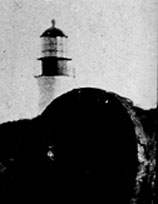
 Point Bonita lighthouse
 Hand carved tunnel leading to lighthouse
 Invasive Ice Plant near Point Bonita lighthouse


