Power sector of Andhra Pradesh

Last updated

Power sector of Andhra Pradesh is divided into 4 categories namely Regulation, Generation, Transmission and Distribution. Andhra Pradesh Electricity Regulatory Commission (APERC) is the regulatory body. [1] APGENCO deals with the electricity production and also maintenance, proposes new projects and upgrades existing ones as well. [2] The APGENCO also set up a Special Purpose Vehicle (SPV), named as Andhra Pradesh Power Development Company Limited (APPDCL), a joint venture company of APGENCO (with 50% equity) and IL&FS (50% equity) to set up Krishnapatanam thermal power project (2x800 MW). [3]

Contents

APTRANSCO is set up for transmission of power. [4] Power distribution in the state is divided into three divisions, namely Eastern Power Distribution Corporation Limited (APEPDCL), Central Power Distribution Corporation Limited (APCPDCL [5] ) and Southern Power Distribution Corporation Limited (APSPDCL), which distributes the power to the households, agriculture and the industries. [6] APGENCO, APPDCL, NTPC and other private firms contribute to the generation of power in the state of Andhra Pradesh. [7] [8] [9] Andhra Pradesh has become the second state in India to achieve 100% electrification of all households. [10] Weighted average cost of power generation and purchases is INR 3.45 per kWh which is highest in the country. [11] Andhra Pradesh is also leader by installing 433 nos electric vehicle charging stations (EVCS) out of 927 nos installed in the entire country as on 30 June 2020. [12]

Under the program of installing 500 GW capacity of renewable power capacity by 2030, nearly 59 GW (25%) of solar and wind power is identified out of 236.58 GW in three districts of the state. [13]

The newly formed Andhra Pradesh Green Energy Corporation Limited (APGECL), a 100% subsidiary of APGENCO, will be the trading agency/licensee for the 10 GW solar project in a phased manner and for connecting it to the grid. [14] The 10 GW solar projects would be used to meet the entire agriculture power consumption which will be met during the day time for nine hours duration daily. [15] Andhra Pradesh is also leading in installation of solar power /off grid agriculture pump sets. [16] A renewable energy export policy for Andhra Pradesh was also announced to facilitate the setting up of 120 GW solar, wind and solar-wind hybrid energy parks by using 0.5 million acres of land. [17] New & Renewable Energy Development Corporation of Andhra Pradesh (NREDCAP), a state owned company, is actively involved in promoting renewable energy projects in the state. [18] Roof top solar power cost/unit in the state are falling below the domestic power tariff. [19]

The total installed utility power generation capacity is nearly 24,854 MW in the state as of 31 March 2020 [20] APtransCo has made long term power purchase agreements for 19,068 MW as of 31 March 2019. [21] [22] The per capita electricity consumption is 1234 units with 63,143 million KWh gross electricity supplied in the year 2018–19. [21] [23] The performance of Krishnapatanam thermal power station (2X800 MW) with super critical pressure technology is not satisfactory even after one year commercial operation as the units rarely operate at rated capacity forcing the state to purchase costly power from day ahead trading in IEX. [24] [25]

Power sector of Andhra Pradesh flow chart Power sector of Andhra Pradesh.jpg
Power sector of Andhra Pradesh flow chart
Dr Narla Tata Rao Thermal Power Station (500 MW Unit) Dr Narla Tata Rao Thermal Power Station in January 2015.JPG
Dr Narla Tata Rao Thermal Power Station (500 MW Unit)

Short term power purchases

APDisComs purchase regularly from the energy exchange, etc. to meet the peak load and energy shortages. As the power purchases/sales are done on daily basis without proper planning and optimum utilization of APGENCO power generation capacity, APERC has given guidelines to the DisComs for implementation while making short term (less than one year duration) purchases and sales in the year 2022. [26] [27]

Non-renewable

Thermal power

India Andhra Pradesh location map (current).svg
Blue pog.svg
Krishnapatnam
Blue pog.svg
Ibrahimpatnam
Blue pog.svg
Parawada
Blue pog.svg
Muddanur
Blue pog.svg
Thamminapatnam
Red pog.svg
Pudimadaka
Red pog.svg
Polaki
Map of coal based thermal power plants in the Indian state of Andhra Pradesh. Blue are operational and Red are proposed [28]

Thermal power plants are based on the fuel coal, gas, diesel etc. Public sector undertaking NTPC, state level power generating companies and private firms are engaged in this sector for power generation.

Currently operating coal based thermal power plants in Andhra Pradesh are listed below. [29] [30]

NameOperatorLocationDistrictSectorCapacity
(MW)
Coordinates
Simhadri Super Thermal Power Plant NTPC Parawada Visakhapatnam Central2,000 17°35′38″N83°5′23″E / 17.59389°N 83.08972°E / 17.59389; 83.08972 (Simhadri Super Thermal Power Plant)
Dr Narla Tatarao TPS APGENCO Vijayawada Krishna State2,560 16°35′58″N80°32′12″E / 16.59944°N 80.53667°E / 16.59944; 80.53667 (Dr Narla Tata Rao Thermal Power Station)
Rayalaseema Thermal Power Station [31] APGENCO Muddanur Kadapa State1,650 14°42′14″N78°27′29″E / 14.70389°N 78.45806°E / 14.70389; 78.45806 (Rayalaseema Thermal Power Station)
Sri Damodaram Sanjeevaiah Thermal Power Station APPDCL Krishnapatnam Nellore Joint2,400 14°19′39″N80°07′15″E / 14.32750°N 80.12083°E / 14.32750; 80.12083 (Sri Damodaram Sanjeevaiah Thermal Power Station)
Vizag Thermal Power Station Hinduja Gajuwaka VisakhapatnamPrivate1,040 17°33′45″N83°8′15″E / 17.56250°N 83.13750°E / 17.56250; 83.13750 (Hinduja Thermal Power Station)
Simhapuri Thermal Power StationSEPLKrishnapatanamNellorePrivate600 14°12′35″N80°05′23″E / 14.20972°N 80.08972°E / 14.20972; 80.08972 (Simhapuri Thermal Power Station)
Meenakshi Thermal Power StationMEPLKrishnapatanamNellorePrivate1,000 14°12′57″N80°05′19″E / 14.21583°N 80.08861°E / 14.21583; 80.08861 (Meenakshi Thermal Power Station)
Sembcorp Energy India LimitedSEILKrishnapatanamNellorePrivate1,320 14°19′45″N80°08′27″E / 14.32917°N 80.14083°E / 14.32917; 80.14083 (Pynampuram Power Station)
SGPL Power StationSGPLKrishnapatanamNellorePrivate1,320 14°21′5″N80°08′37″E / 14.35139°N 80.14361°E / 14.35139; 80.14361 (SGPL Power Station)
TOTAL13,890

Gas fuel-based

India Andhra Pradesh location map (current).svg
Blue pog.svg
Red pog.svg
Red pog.svg
Red pog.svg
Red pog.svg
Red pog.svg
Red pog.svg
Red pog.svg
Red pog.svg
Map of currently operating combined cycle gas turbine power plants in the Indian state of Andhra Pradesh

The following are the list of presently installed combined cycle gas turbine power plants and diesel engine power plants in the state. However many of these power plants are not operating due to non-availability of natural gas and high cost of liquid fuels. [32]

Power stationOperatorLocationDistrictSectorCapacity
(MW)
Plant Coordinates
APGPCL PlantAPGPCLVijjeswaram W. Godavari Joint272 16°56′02″N81°43′27″E / 16.93389°N 81.72417°E / 16.93389; 81.72417 (APGPCL Plant)
Lanco Kondapalli Power Plant Lanco Infratech Kondapalli Krishna Private1466 16°38′20″N80°33′00″E / 16.63889°N 80.55000°E / 16.63889; 80.55000 (Lanco Kondapalli Power Plant)
Gautami Combined Cycle Power Plant GVK Peddapuram E. Godavari Private464 17°02′21″N82°08′43″E / 17.03917°N 82.14528°E / 17.03917; 82.14528 (Gautami Combined Cycle Power Plant)
Konaseema Combined Cycle Power PlantKonaseema Gas Power Limited (KGPL) Ravulapalem E. GodavariPrivate445 16°44′05″N81°51′44″E / 16.73472°N 81.86222°E / 16.73472; 81.86222 (Konaseema Combined Cycle Power Plant)
Vemagiri Combined Cycle Power Plant GMR VemagiriE. GodavariPrivate370 16°55′29″N81°48′46″E / 16.92472°N 81.81278°E / 16.92472; 81.81278 (Vemagiri Combined Cycle Power Plant)
GMR Rajamundry Combined Cycle Power Plant [33] GMR VemagiriE. GodavariPrivate768 16°55′28″N81°48′46″E / 16.92444°N 81.81278°E / 16.92444; 81.81278 (Vemagiri Combined Cycle Power Plant)
Samarlakota Combined Cycle Power Plant [34] Reliance Samarlakota E. GodavariPrivate1870 17°02′19″N82°08′05″E / 17.03861°N 82.13472°E / 17.03861; 82.13472 (Samarlakota Combined Cycle Power Plant)
Godavari Gas Power Plant [35] APGENCO Jegurupadu E. GodavariState216 16°55′55″N81°51′37″E / 16.93194°N 81.86028°E / 16.93194; 81.86028 (Godavari Gas Power Plant)
Jegurupadu Combined Cycle Power Plant GVK Jegurupadu E. GodavariPrivate229 16°55′54″N81°51′36″E / 16.93167°N 81.86000°E / 16.93167; 81.86000 (Jegurupadu Combined Cycle Power Plant)
Spectrum Combined Cycle Power PlantSpectrum Kakinada E. GodavariPrivate209 17°03′31″N82°18′34″E / 17.05861°N 82.30944°E / 17.05861; 82.30944 (Spectrum Combined Cycle Power Plant)
GMR (barge mounted) Power PlantGMRKakinadaE. GodavariPrivate237 17°03′32″N82°18′33″E / 17.05889°N 82.30917°E / 17.05889; 82.30917 (GMR barge mounted power station)
LVS Diesel Engine Power StationGreenkoVishakhapatnam Visakhapatnam Private37 17°50′45″N83°14′13″E / 17.84583°N 83.23694°E / 17.84583; 83.23694 (LVS Power Ltd)
Panduranga CCPPPESPLAnnadevarapetaW. GodavariPrivate116 17°07′45″N81°36′09″E / 17.12917°N 81.60250°E / 17.12917; 81.60250 (Panduranga CCPP)
RVK Energy power plant [36] KSK Energy Ventures Rajahmundry E. GodavariPrivate436
Sriba power plantSriba industriesChigurukotaKrishnaPrivate30
Silkroad sugar power plantEID ParryKakinadaE. GodavariPrivate35
Srivathsa Power plantAsian GencoPrivate17
Total7,217

Renewable

Hydroelectric

This is the list of major hydroelectric power plants in Andhra Pradesh. [37]

Srisailam Dam Srisailam Damm.jpg
Srisailam Dam
Srisailam right bank power house Power generator rooms.jpg
Srisailam right bank power house
Power station nameOperatorLocationSectorUnit wise Capacity
MW
Capacity

MW [25]

Donkarayi PH APGENCO E. Godavari State1x2525.00
Hampi canal Power House (PH)APGENCOJoint project of AP, TS & Karnataka
Located in Karnataka
State4 x 9
(AP Share-28.8)
28.80
Lower Sileru PH APGENCOE. GodavariState4 x 115460.00
Machkund PH APGENCOJoint project of AP, TS & Odisha
Located in Odisha
State3 x 17 + 3 x 23
(AP Share-84)
84.00
Nagarjuna Sagar Right Canal PHAPGENCO Nagarjuna Sagar Dam, Guntur district State3 x 3090.00
Nagarjuna Sagar tail pond PHAPGENCO Nagarjuna Sagar Dam, Guntur districtState2 x 2550.00
Penna Ahobilam PHAPGENCOKorrakodu, Anantapur district State2 x 1020.00
Srisailam Right Bank PHAPGENCO Srisailam, Kurnool State7 x 110770.00
TB Dam PHAPGENCOJoint project of AP, TS & Karnataka
Located in Karnataka
State4 × 9
(AP Share-28.8)
28.80
Upper Sileru PH APGENCO Visakhapatnam State4 x 60240.00
Somasila PH Balaji Energy Nellore Private2 x 5, 2 x 4, 1 x 2, 1 x 3 [38] [39] 23.00
Chettipeta Mini Hydel [40] APGENCO West Godavari district State2 x 0.51.00
Polavaram Hydro-Electric projectAPGENCOAnguluru, East Godavari district State12 x 80
Under Construction [41]
Pinnapuram Pumped Storage Project (PSP)Greenko Energynear Nandyal, Kurnool district Private4 x 240, 2 x 120
Under Construction [42] [43]
Veeraballi PSPAstha Greennear Veeraballi, Kadapa district Private2720 MW
Under investigation [44]
Upper Sileru PSPAPGENCOnear Sileru village, Visakhapatnam State9 x 150 MW
Under hold due to very high cost [45]
Chitravati PSPAPGENCOnear Peddakotla village, Anantapuramu districtState2 x 250 MW [46]
Under investigation [47]
Singanamala PSPNREDCAPAnantapuramu districtState800 MW
Under investigation [48]
Overall capacity in (MW) [22] 1820.60

Pumped storage hydroelectricity projects

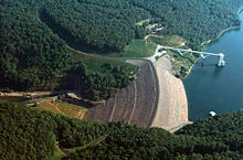
Pumped hydroelectric energy storage (PHES) projects with high water head are the cheap means of converting intermittent renewable power generation sources like solar PV or wind power in to base load supply for round the clock needs throughout the year. [49] [50] AP state is endowed with vast PHES potential adequate to utilise its vast solar PV power generation potential (above 1,000,000 MW installed on 16,000 km2 marginal lands) to meet ultimate green energy requirements of its peak population (60 million). [51] AP is considering on a major scale to install PHES projects to make available the surplus wind / solar power during the peak load hours. [52] [53] PHESs also generate income, in addition to hydroelectricity cess/royalty, to the state in the form of water use charges at commercial rates for the evaporation loss or consumptive water from the reservoirs. The area occupied by the high head PHES is less than the area occupied by the equivalent battery energy storage system (BESS) housed in a three storied building. High head PHES installation cost (< US$40 per KWh in a day) is less than the cost of land and buildings required to house the equivalent BESS. [54] [55] PHES are more suitable in India where energy and water storage needs are complementary. [55] [56] Unlike the static BESS, the rotating turbo-generator of a PHES will enhance dynamic inertia (GD2) of the grid which contributes to a stable grid to ride through the power disturbances when power generation in the grid is dominated by the static solar PV power. [57] Variable speed PHES plants also deliver the power grid ancillary services. [58] In high head PHES, unlined pressure tunnels/shafts are constructed to the extent feasible for reducing construction cost. [59]

Blast-hole drilling at an opencast mine. Bingham Canyon Mine, west face detail, Utah.jpg
Blast-hole drilling at an opencast mine.

The water reservoir of a PHES is created by building embankment dams wherever required up to the required height and length. The rock required for building the dams is excavated from the reservoir area. Cheaper drilling and blasting method is extensively used deploying state of the art earth moving equipment because huge quantity of rock excavation is required for the construction of the rock-fill dams. [60] [61]

A rock-fill embankment dam. Gathrightdam4.jpg
A rock-fill embankment dam.

Polavaram right bank PHES: A 103,000 MW PHES project is under investigation with an upper reservoir, located near Parantapalle hamlet in West Godavari district, with 90 tmcft live storage at 700 m msl full reservoir level (FRL). The turkey-nest type upper reservoir is 18 km long from north to south and 1.1 km wide and its water surface area is 16 km2 with 200 m water depth and nearly 90 tmcft live storage. [62] The adjacent Polavaram reservoir at FRL 45 m msl with 194 tmcft gross storage is the lower reservoir as perennial water source. The average water head available is 600 m with a provision to draw 33 tmcft/day from the Polavaram reservoir by the PHES units located in semi open or underground power houses. To run the PHES on daily basis, the lower reservoir is to be kept empty by 33 tmcft below its FRL for holding the water released by PHES in generation mode. Another 33 tmcft is used to compensate the loss of storage capacity in the lower reservoir. This buffer storage is released in to lower reservoir for irrigation, etc. needs once in a year at the end of monsoon year and it is replenished at the earliest from the flood water inflows into the lower reservoir. Also seepage and evaporation losses from the upper reservoir are met from the buffer storage sourced from flood waters and not drawn from the lower reservoir storage. The excess buffer storage maintained in this upper reservoir can also serve up to 24 tmcft for other PHESs in the state which are using Godavari basin water and have no buffer storage of their own (ex: Jalaput PHES). The upper reservoir can be further expanded by 3.5 km length on its south side to enhance the live / buffer storage substantially. The PHES project can produce 412 billion KWh at 4000 hours/year or 12 hours/day operation in generation mode by consuming the surplus power generated from the solar and wind power plants during the day time. This PHES can also moderate the severe floods by utilizing empty volume kept in the lower reservoir or operating in pump mode (maximum 7.63 lakh cusecs) to fill the upper reservoir. In case of emergency / repairs, the entire water storage in the upper reservoir can be emptied safely into the lower reservoir / river within 24 hours by running the PHES in generation mode.

Srisailam right bank PHES: A 77,000 MW PHES project is feasible with an upper reservoir, located on the right bank side within 1000 m distance of Srisailam reservoir, with 87 tmcft live storage at 650 m msl FRL. The reservoir bunds are constructed on 500 m msl contour line by 155 m high and the water surface area of the upper reservoir is nearly 20 km2. The adjacent Srisailam reservoir at FRL 270 m msl with 185 tmcft live storage is the lower reservoir with perennial water source. The average water head available is 340 m with provision to draw water from the Srisailam reservoir by the PHES units located in semi open or underground power houses. The PHES project can produce 308 billion KWh at 4000 hours/year or 12 hours/day operation in generation mode. Only 43.5 tmcft (50%) reservoir storage is used for power generation on daily basis and the remaining half kept as buffer storage to compensate the loss of storage in downstream reservoir due to PHES by releasing water once in a year in to the Srisailam reservoir to meet irrigation water requirements. The buffer storage is replenished later at the earliest during the monsoon/floods. This PHES can also moderate the severe floods by utilizing empty volume kept in the lower reservoir or operating in pump mode (maximum 10 lakh cusecs) to fill the upper reservoir.

Feasible PHES projects

List of feasible PHES locations
PHES name/
lower reservoir [63]
Power potential
(MW)
Power generation
(Billion KWh/yr)
Upper reservoirAverage water
head (meters)
Remarks
LocationCoordinateRiver basinWater area
(km2)
Live storage
(tmcft)
FRL
(m msl)
MDDL
(m msl)
Polavaram right bank PHES103,000412 West Godavari district 17°27′33″N81°29′43″E / 17.45917°N 81.49528°E / 17.45917; 81.49528 (Polavavaram right bank PHES) Godavari169070050060057 tmcft buffer storage available. The distance between the two reservoirs is nearly 1.7 km.
Srisailam right bank PHES77,000308Kurnool district 16°02′33″N78°30′51″E / 16.04250°N 78.51417°E / 16.04250; 78.51417 (Srisailam right bank PHEP) Krishna208765050034043.5 tmcft buffer storage included. The distance between the two reservoirs is nearly 1.1 km.
Gandikota PHES128,000112 Kadapa district 14°49′47″N78°13′41″E / 14.82972°N 78.22806°E / 14.82972; 78.22806 (Gandikota PHES1) Penna 2152435335210Buffer storage 26 tmcft provided. The distance between the two reservoirs is nearly 2.1 km.
Gandikota PHES2 [64] 6001.12 Kadapa district 14°46′29″N78°17′7″E / 14.77472°N 78.28528°E / 14.77472; 78.28528 (Gandikota PHES2) Penna 10.16515505303It is a peaking PHES with six hours daily operation in generation mode. No buffer storage is provided. The distance between the two reservoirs is nearly 2.8 km.
Paidipalem PHES11,8507.4Kadapa district 14°43′47″N78°11′9″E / 14.72972°N 78.18583°E / 14.72972; 78.18583 (Paidipalem PHES1) Penna12.5600510285Buffer storage 1.25 tmcft provided. The distance between the two reservoirs is nearly 3.1 km.
Paidipalem PHES22,75011Kadapa district 14°41′21″N78°13′25″E / 14.68917°N 78.22361°E / 14.68917; 78.22361 (Paidipalem PHES2) Penna1.53.7600500285Buffer storage 1.85 tmcft provided. The distance between the two reservoirs is nearly 2.9 km.
Buggavanka PHES6002.4Kadapa district 14°24′5″N78°52′15″E / 14.40139°N 78.87083°E / 14.40139; 78.87083 (Buggavanka PHES) Penna0.80.9470410260Buffer storage 0.45 tmcft provided. The distance between the two reservoirs is nearly 3.5 km.
Annamayya PHES [65] 11504.6Kadapa district 14°12′25″N78°57′51″E / 14.20694°N 78.96417°E / 14.20694; 78.96417 (Annamayya PHES) Penna1.11.6555455285Buffer storage 0.8 tmcft provided. Distance between the two reservoirs is nearly 6 km.
Mylavaram PHES14,00056Kadapa district 14°48′1″N78°16′35″E / 14.80028°N 78.27639°E / 14.80028; 78.27639 (Mylavaram PHES) Penna920500375275Buffer storage 10 tmcft provided. The distance between the two reservoirs is nearly 3.7 km.
Brahmamsagar PHES13,00052Kadapa district 14°46′27″N78°52′3″E / 14.77417°N 78.86750°E / 14.77417; 78.86750 (Brahmamsagar PHES) Penna9.538400250130Buffer storage 19 tmcft provided. The distance between the two reservoirs is nearly 1.5 km.
Telugu Ganga subsidiary reservoirs PHES2,60010.4 Kurnool district 14°51′25″N78°43′51″E / 14.85694°N 78.73083°E / 14.85694; 78.73083 (Telugu Ganga PHES) Penna48400250120Buffer storage 4 tmcft provided. The distance between the two reservoirs is nearly 1.5 km.
Owk PHES14,70018.8Kurnool district 15°14′51″N78°2′49″E / 15.24750°N 78.04694°E / 15.24750; 78.04694 (Owk PHES1) Penna100210500350220Works on a seasonal basis to store 201.7 tmcft Krishna and Godavari waters as well as on daily basis. The stored water is also used as carryover storage to meet water shortages in drought years. Buffer storage 4.15 tmcft included. This upper reservoir will supply irrigation water to the Handri catchment area in the Kurnool district and the left bank side of the Penna river in the Ananthapur district including water supply augmentation to the Handri-Neeva project. This upper reservoir is so planned by its area location to cut across the local Erramala hill range from east to west to supply irrigation water mostly by gravity. The distance between the two reservoirs is nearly 5.7 km.
Owk PHES2 [66] 8001.65Kurnool district 15°9′37″N78°4′5″E / 15.16028°N 78.06806°E / 15.16028; 78.06806 (Owk PHES2) Penna0.60.4400380165Peaking PHES for 6 hours daily operation. No Buffer storage is provided. The distance between the two reservoirs is nearly 1.5 km.
Gorakallu PHES12,50050Kurnool district 15°35′33″N78°22′17″E / 15.59250°N 78.37139°E / 15.59250; 78.37139 (Gorakallu PHES) Penna37100450300170Works on a seasonal basis to store 71.4 tmcft Krishna and Godavari waters and otherwise as PHES on daily basis. The stored water is also used as carryover storage to meet water shortages in drought years. Buffer storage 14.28 tmcft included. The distance between the two reservoirs is nearly 2.3 km.
Velugodu PHES 7,80031Kurnool district 15°42′21″N78°39′25″E / 15.70583°N 78.65694°E / 15.70583; 78.65694 (veligodu PHES) Penna40100420270100Works on a seasonal basis to store 70 tmcft Krishna and Godavari waters and otherwise as PHES on daily basis. The stored water is also used as carryover storage to meet water shortages in drought years. Buffer storage 15 tmcft included. The distance between the two reservoirs is nearly 3.1 km.
Mid Pennar PHES2,60010.4 Anantapur district 14°52′47″N77°23′27″E / 14.87972°N 77.39083°E / 14.87972; 77.39083 (Mid Pennar PHES) Penna3.7510525375100Buffer storage 5 tmcft included. The distance between the two reservoirs is nearly 0.7 km.
Chitravati PHES [67] 5000.95 Anantapur district 14°34′27″N77°56′3″E / 14.57417°N 77.93417°E / 14.57417; 77.93417 (Chitravati PHES) Penna0.50.21475455176Peaking load PHES. No buffer storage is included. The distance between the two reservoirs is nearly 0.81 km.
Somasila PHES [68] 1,2002.3 Nellore district 14°30′57″N79°16′25″E / 14.51583°N 79.27361°E / 14.51583; 79.27361 (Somasila PHES) Penna10.18624600511Peaking load PHES. No buffer storage is included. The distance between the two reservoirs is nearly 2.9 km.
Kalyani PHES3,70014.8 Chittoor district 13°43′9″N79°18′47″E / 13.71917°N 79.31306°E / 13.71917; 79.31306 (Kalyani PHES) Swarnamukhi 1.51.811001000790Buffer storage 0.9 tmcft included. The distance between the two reservoirs is nearly 7.5 km. The upper reservoir of the PHES can also supply water to Tirumala in case of water shortages.
Yeleru PHES5,50022 East Godavari district 17°20′1″N82°9′23″E / 17.33361°N 82.15639°E / 17.33361; 82.15639 (Yeleru PHES) Yeleru2.005.3500350400Buffer storage 2.65 tmcft included. The distance between the two reservoirs is nearly 5.5 km.
Tandava PHES9,20036.8 Visakhapatnam district 17°43′35″N82°27′47″E / 17.72639°N 82.46306°E / 17.72639; 82.46306 (Tandava PHES) Tandava1.5041050850875Buffer storage 2 tmcft included. The distance between the two reservoirs is nearly 7.5 km.
Raiwada PHES2,3509.4Visakhapatnam district 18°3′17″N82°54′55″E / 18.05472°N 82.91528°E / 18.05472; 82.91528 (Raiwada PHES) Sarada 0.502635485450Buffer storage 1 tmcft included. The distance between the two reservoirs is nearly 4.85 km.
Pedderu PHES1,4255.5Visakhapatnam district 17°52′37″N82°40′9″E / 17.87694°N 82.66917°E / 17.87694; 82.66917 (Pedderu PHES) Sarada0.250.7950850780Buffer storage 0.35 tmcft included. The distance between the two reservoirs is nearly 3.1 km. Water to rock ratio at least 2.
Konam PHES2,2008.8Visakhapatnam district 17°55′47″N82°40′19″E / 17.92972°N 82.67194°E / 17.92972; 82.67194 (Konam PHES) Sarada1.21.7725625495Buffer storage 0.85 tmcft included. The distance between the two reservoirs is nearly 5.8 km.
NTR PHES6502.6Visakhapatnam district 17°57′35″N82°46′35″E / 17.95972°N 82.77639°E / 17.95972; 82.77639 (NTR PHES) Sarada0.20.4775700640Buffer storage 0.2 tmcft included. The distance between the two reservoirs is nearly 2.6 km.
Varaha PHES1,3004.2Visakhapatnam district 17°49′25″N82°42′5″E / 17.82361°N 82.70139°E / 17.82361; 82.70139 (Varaha PHES) Varaha0.520.75820750660Buffer storage 0.37 tmcft included. The distance between the two reservoirs is nearly 3.6 km. Water to rock ratio at least 2.
Tatipudi PHES9,00036 Vizianagaram district 18°15′25″N83°8′41″E / 18.25694°N 83.14472°E / 18.25694; 83.14472 (Tatipudi PHES) Gosthani 26.5700500535Buffer storage 3.25 tmcft included. Distance between the two reservoirs is nearly 7.5 km.
Andra PHES 2,50010Vizianagaram district 18°22′7″N83°9′55″E / 18.36861°N 83.16528°E / 18.36861; 83.16528 (Andra PHES) Champavati 0.71.8800710520Buffer storage 0.9 tmcft included. Distance between the two reservoirs is nearly 4.3 km.
Peddagadda PHES3,10012.4Vizianagaram district 18°23′41″N83°4′41″E / 18.39472°N 83.07806°E / 18.39472; 83.07806 (Peddagadda PHES) Nagavali 1.82790650600Buffer storage 1 tmcft included. Distance between the two reservoirs is nearly 7 km.
Vengalaraya Sagar PHES2,2509Vizianagaram district 18°37′7″N83°14′55″E / 18.61861°N 83.24861°E / 18.61861; 83.24861 (Vengalaraya Sagar PHES) Nagavali0.52660510430Buffer storage 1 tmcft included. The distance between the two reservoirs is nearly 2.65 km. Water to rock ratio at least 2.
Vattigedda PHES1,2505Vizianagaram district 18°49′41″N83°37′23″E / 18.82806°N 83.62306°E / 18.82806; 83.62306 (Vattigadda PHES) Nagavali0.91.8440290255Buffer storage 0.9 tmcft included. The distance between the two reservoirs is nearly 2.85 km. Water to rock ratio at least 2.
Nagavali PHES2501Vizianagaram district 18°36′57″N83°50′1″E / 18.61583°N 83.83361°E / 18.61583; 83.83361 (Nagavali PHES) Nagavali410300140200Pumps water @ 5500 cusecs on a seasonal basis to store 9.75 tmcft Nagavali river flood waters. The stored water during monsoon months is released back in later months during the night time for irrigation needs. Rest of the year, PHES works on a daily basis to generate power during nighttime. The stored water is also used as carryover storage to meet water shortages in drought years. A new barrage with 0.25 tmcft live storage will be constructed near 18°32′57″N83°48′5″E / 18.54917°N 83.80139°E / 18.54917; 83.80139 (Nagavali River) across the Nagavali river to divert water to the tunnel of the PHES. Buffer storage 0.25 tmcft included. The distance between the upper reservoir and the river is nearly 8.25 km.
Jhanjavati PHES 2,3509.4Vizianagaram district 18°53′7″N83°23′51″E / 18.88528°N 83.39750°E / 18.88528; 83.39750 (Jhanjavati PHES) Nagavali0.51.5530330300No buffer storage required as the lower reservoir is not used presently. The distance between the two reservoirs is nearly 2.37 km. Water to rock ratio at least 2. The unused reservoir area on the right of the Jhanjavati river is isolated from the river by constructing a 2.2 km long earth bund up to 150 m msl to create 1.5 tmcft water storage for using as a lower reservoir.
Hiramandalam PHES [69] 2,50010 Srikakulam district 18°41′19″N83°52′57″E / 18.68861°N 83.88250°E / 18.68861; 83.88250 (Hiramandalam PHES) Vamsadhara 37240901353.5 tmcft buffer storage included. The distance between the two reservoirs is nearly 4.5 km.
Gotta barrage PHES [70] 750 + 10,000 = 10,7501.5Srikakulam district 18°41′39″N84°1′15″E / 18.69417°N 84.02083°E / 18.69417; 84.02083 (Gotta barrage PHES) Vamsadhara408022070135The main purpose of this PHES is to store up to 79 tmcft flood waters which are going waste to the sea every year. The stored water is also used as carryover storage to meet water shortages in drought years. The PHES pumps flood water @ 23,000 cusecs from the Vamsdhara river during the monsoon months and works as PHES the rest of the year. Buffer storage 0.5 tmcft included. The distance between the two reservoirs is nearly 7.3 km.

The upper reservoir of this PHES can also be connected to the Hiramandalam reservoir at 18°40′5″N83°56′37″E / 18.66806°N 83.94361°E / 18.66806; 83.94361 (Hiramandalam reservoir) (20 tmcft storage) by 9 km long tunnels to use 16.5 tmcft per day by installing a 10,000 MW PHES to generate power for nine months duration in a year when the reservoir is empty by 16.5 tmcft or more.

Kumbum PHES2,2008.8Prakasam district 15°37′35″N79°5′1″E / 15.62639°N 79.08361°E / 15.62639; 79.08361 (Kumbum PHES) Gundlakamma 5.55.8380255140Buffer storage 2.9 tmcft included. The distance between the two reservoirs is nearly 2.3 km.
Nallamala Sagar PHES1 26,500106Prakasam district 15°40′37″N79°5′5″E / 15.67694°N 79.08472°E / 15.67694; 79.08472 (Nallamala PHES1) Gundlakamma 7784.5380240120Buffer storage 42.25 tmcft included. The distance between the two reservoirs is nearly 2 km.
Nallamala Sagar PHES29003.6Prakasam district 15°39′25″N79°4′23″E / 15.65694°N 79.07306°E / 15.65694; 79.07306 (Nallamala PHES2) Gundlakamma 1.52.5380230130Buffer storage 1.25 tmcft included. Distance between the two reservoirs is nearly 1.75 km.
Nagarjuna Sagar Dam Right Bank PHES1,5001.5Kurnool district 16°5′39″N78°54′51″E / 16.09417°N 78.91417°E / 16.09417; 78.91417 (Nagarjunasagar Dam Right Bank PHES) Krishna --27024590Mainly works to pump water from existing Nagarjunasagar reservoir into existing Srisailam reservoir on a seasonal basis to store Krishna and Godavari waters and otherwise as PHES on daily basis. The distance between the two reservoirs is nearly 3.1 km.
Nagarjuna Sagar Right Bank PHES137,000148 Prakasam district 16°5′51″N78°55′51″E / 16.09750°N 78.93083°E / 16.09750; 78.93083 (Nagarjunasagar Right Bank PHES1) Krishna834650500425Buffer storage 17 tmcft provided. The minimum level to be maintained in Nagarjunasagar reservoir is 164 m msl. The distance between the two reservoirs is nearly 1.1 km.
Nagarjuna Sagar Right Bank PHES2112,000448Prakasam district 16°7′45″N78°56′19″E / 16.12917°N 78.93861°E / 16.12917; 78.93861 (Nagarjunasagar Right Bank PHES2) Krishna21101650500425Buffer storage 55.5 tmcft provided. The minimum level to be maintained in Nagarjunasagar reservoir is 164 m msl. The distance between the two reservoirs is nearly 1.5 km.
Nagarjuna Sagar Right Bank PHES366,000264Prakasam district 16°10′7″N78°55′35″E / 16.16861°N 78.92639°E / 16.16861; 78.92639 (Nagarjunasagar Right Bank PHES3) Krishna1159650500428Buffer storage 29.5 tmcft provided. The minimum level to be maintained in Nagarjunasagar reservoir is 164 m msl and the corresponding loss of live storage located below this level in Nagarjunasagar reservoir can be included in the buffer storage of PHESs. The distance between the two reservoirs is nearly 2.9 km.
Nagarjuna Sagar tail pond PHES1,5001.0 Guntur district 16°34′39″N79°20′25″E / 16.57750°N 79.34028°E / 16.57750; 79.34028 (Nagarjuna Sagar tail pond PHES) Krishna--180164105Mainly works to pump water from existing Nagarjuna Sagar tail pond into existing Nagarjuna Sagar reservoir on a seasonal basis to store Krishna and Godavari waters and otherwise as PHES on daily basis.
Pulichintala Right Bank PHES3000.2Guntur district 16°37′49″N79°31′11″E / 16.63028°N 79.51972°E / 16.63028; 79.51972 (Pulichintala Right Bank PHES) Krishna-2757225Mainly works to pump water from existing Pulichintala reservoir into existing Nagarjuna Sagar tail pond on a seasonal basis to store Krishna and Godavari waters and otherwise as PHES on daily basis.
Vykuntapuram PHES4000.2Guntur district 16°46′43″N80°3′55″E / 16.77861°N 80.06528°E / 16.77861; 80.06528 (Vykuntapuram PHES) Krishna--555025Mainly works to pump water from backwaters of new Vykuntapuram barrage across Krishna river upstream of Prakasam Barrage to existing Pulichintala reservoir on a seasonal basis to store Krishna and Godavari waters and otherwise as PHES on daily basis.
Jalaput PHES65,000260 Visakhapatnam district 18°26′53″N82°28′11″E / 18.44806°N 82.46972°E / 18.44806; 82.46972 (Jalaputk PHES) Sileru -31.5838.4818.6380The PHES is constructed by connecting existing Jalaput reservoir with existing Balimela Reservoir (MDDL at 439 m msl, FRL at 462 m msl and live storage 95 tmcft) by a 13 km long unlined pressure tunnel/penstock with underground power station. [59]
Donkarayi PHES35,000140Visakhapatnam district 17°54′47″N81°51′45″E / 17.91306°N 81.86250°E / 17.91306; 81.86250 (Donkarayi PHES) Sileru 202690075055013 tmcft buffer storage provided. The buffer storage can be enhanced by another 35 tmcft by increasing the FRL to 950 m msl to serve other PHES which are using Godavari water. Distance between the two reservoirs is nearly 3.7 km.
Bhupathipalem PHES8003.2East Godavari district 17°28′35″N81°47′49″E / 17.47639°N 81.79694°E / 17.47639; 81.79694 (Bhupathipalem PHES) Godavari115404803100.5 tmcft buffer storage provided. The distance between the two reservoirs is nearly 4.5 km.
Polavaram Left bank PHES143,000172 East Godavari district 17°29′51″N81°27′53″E / 17.49750°N 81.46472°E / 17.49750; 81.46472 (Polavavaram left bank PHES1) Godavari 518600450470The required 18 tmcft buffer storage is provided in other PHESs located in the Godavari river basin. The distance between the two reservoirs is nearly 3.1 km.
Polavaram Left bank PHES212,00048East Godavari district 17°29′15″N81°31′37″E / 17.48750°N 81.52694°E / 17.48750; 81.52694 (Polavavaram left bank PHES2) Godavari24.5600450530The required 4.5 tmcft buffer storage is provided in other PHESs located in the Godavari river basin. The distance between the two reservoirs is nearly 1.7 km.
Rayalaseema PHES6,20024.8 Chittoor district 13°44′25″N79°12′5″E / 13.74028°N 79.20139°E / 13.74028; 79.20139 (Rayalaseema PHES) Penna 62.1610600550The main purpose of this PHES is to transfer Krishna and Godavari waters @ 50,000 cusecs to high lands of Rayalaseema with only one lift from 80 m msl 13°57′47″N79°32′5″E / 13.96306°N 79.53472°E / 13.96306; 79.53472 near Venkatagiri town in Nellore district to the upper reservoir at 610 m msl in Chittoor district to irrigate by gravity canal vast high lands in Rayalaseema region up to Bhairivani tippa reservoir on Vedavathi River in Ananthapur district. [71] This underground power station will also work as PHES. PHES powerhouse is to be connected to a 41 km long unlined pressure tunnel which will work as penstocks to the turbine units. [59] [72]
Total735,5502,900---4601225---

Notes: Power potential (MW) is in generation mode, MDDL→ Minimum Draw Down Level or lowest bed level of the reservoir, FRL→ Full Reservoir Level, m msl→ meters above mean sea level. The total water storage includes nearly 432 tmcft of irrigation components. PHES water storage is 793 tmcft only. The PHES land requirement is nearly 1% of the land required (41,250 km2) for equivalent electricity generation by Solar PV power plants. [55] The power potential doubles in case of pumping operation for six hours in a day for the same water storage.

Solar

India Andhra Pradesh location map (current).svg
Green pog.svg
Nambulapulakunta
Blue pog.svg
Vinukonda
Green pog.svg
Kovvur
Blue pog.svg
Galiveedu
Blue pog.svg
Pinnapuram
Green pog.svg
Nagalapuram
Green pog.svg
Kalyandurg
Green pog.svg
Nallapadu
Blue pog.svg
Jaggayapeta
Green pog.svg
Nagarimadugu
Map of currently operating and proposed Solar power plants in the Indian state of Andhra Pradesh. Green are currently Operating and blue are proposed.

The state is endowed with vast photovoltaic power potential on its marginally productive lands. [73] The state has total installed solar power capacity of 4,116.01 MW as of 30 June 2021. [38] [74] [75] [76] [77]

The state is planning to add 10,050 MW solar power capacity to provide power supply to farming sector during the day time. [78] [79] Out of 10,050 MW, 6,400 MW capacity at 10 sites were offered for bidding. The winning tariffs are Rs 2.50 per unit which are at least 25% more than the earlier awarded tariffs of Rs 2 per unit in November 2020 even after reducing scope of work (no HV transmission line construction outside the solar park), state providing the land on lease, giving state guarantee for the timely payment for the power sold, allowing the state guarantee as security to get financial assistance at lower interest rates, disregarding higher solar power potential at these sites compared to Western and northern regions, etc. [80] [81] The AP high court has stayed the award of contracts to the successful bidders on the grounds that these contracts are excluded from the jurisdiction of APERC in contravention of the electricity act, 2003. [82] [83]

The state has offered five Ultra Mega Solar Power Projects with a total capacity of 12,200 MW to developers under renewable power export policy outside the state. [84] [85] [86] [87] [88]

NameOperatorLocationDistrictSectorInstalled Capacity (MW)
Kurnool Ultra Mega Solar Park [89] NTPC Pinnapuram Kurnool district  central1,000
NP Kunta Ultra Mega Solar Power Project Many Nambulapulakunta (Kadiri) Anantapur district  central978
Ananthapuramu - II Mega Solar Park [90] APGENCO Talaricheruvu Anantapur district  state400
Galiveedu Solar Park [91] Marrikommadinne, Galiveedu mandal Kadapa district  central400
Kadapa Ultra Mega Solar Park [92] ENGIEPonnampalle, Mylavaram mandal Kadapa district  state250
Amruth Solar Power Plant [93] Amrit Jal Ventures Kadiri Anantapur district  private1
MEIL solar thermal [94] Megha Engineering & Infrastructures LimitedNagalapuram Anantapur district 50
Banaganapalle solarWelspunVemulapadu, Banaganapalle mandal Kurnool district 70
Hindupur solarACMEPatraganipalle, Hindupur mandal Anantapur district 50
Yadiki solarAzure PowerVemulapadu, Yadiki mandal Anantapur district 50
Kuppam solarACMEMorsanapalli, Kuppam mandal Chittoor district Private40
Parigi solarFirst SolarBeechiganipalle, Parigi mandal Anantapur district 40
Mudasarlova Reservoir Solar ParkAPGENCO Visakhapatnam Visakhapatnam district  state2
Simhadri floating solarNTPC Visakhapatnam Visakhapatnam district  central25

Wind power

India Andhra Pradesh location map (current).svg
Green pog.svg
Kolimigundla
Green pog.svg
Atmakur
Green pog.svg
Puthlur
Green pog.svg
Ramagiri
Blue pog.svg
Nallakonda
Green pog.svg
Gandikota
Green pog.svg
Tirumala
Blue pog.svg
Srisailam
Blue pog.svg
Araku
Map of currently operating and proposed Wind power plants [95] in the Indian state of Andhra Pradesh

The state has total installed wind power capacity of 4,083.57 MW as on 30 June 2021. [38] [74] [75] [96] [97]

NameOperatorLocationDistrictSectorUnit wise Capacity (MW)Installed Capacity (MW)
Ramagiri Wind Mills [98] APGENCO Ramagiri Anantapur State10x0.22.00
Narmada Wind farm [99] CLP Wind Farms (India) Private Ltd.Nallakonda Anantapur Private1 x 50.450.04
Puthlur RCI Wind farm [100] Wescare (India) Ltd.Puthlur Anantapur Private1 x 2020.00

Other utility power plants

In addition to above projects, there are nearly 103 MW small Hydro plants, nearly 490 MW bagasse, industrial & municipal waste, bio-mass co-generation, & bio-mass based power projects, nearly 78.79 mini power plants (grid connected) and nearly 67.20 MW other (grid connected) plants based on isolated gas wells, etc. in private sector. [38] [37] These power plants are not covering captive power capacity in various industries that are not grid connected. In addition, there are innumerable diesel generator sets installed in the state for stand by supply and emergency power supply needs during power outages.

Transmission system

Per capita power generation [101]
YearKwh/head
2014–15
1,040
2015–16
1,230
2016–17
1,319
2017–18
1,388
2018–19
1,480
2019–20
1,507
2020–21
1,434
2021–22
1,567

The state has well spread transmission system. APTransCo / DisComs owned and operated transmission lines from 400 kV to 11 kV is 231,127 circuit kilometers excluding the HT lines owned and operated by PGCIL in the state. [102] [103] For importing and exporting power, the state grid is well interconnected with adjoining western and eastern regional grids in addition to adjoining state grids. [104] The spread of high voltage transmission lines (≥ 11 kV) is such that it can form a square matrix of area 1.93 km2 (i.e. on average, at least one HT line within 0.7 km vicinity) in 160,205 km2 total area of the state. DisComs owned and operated LT lines (below 11 kV) are 292,158 circuit kilometers. It represents that there is at least one HT or LT line availability on average within the vicinity of 306 meters in the entire state area. The state has 3183 nos substations (≥ 33 kV) which represents one substation in every 50.33 km2 area on average (i.e. one substation with in 3.6 km distance on average). [22] However the maximum peak load met is 9,453 MW as of 14 October 2018. [74] Huge installed capacity of the transmission network and the substations are being underutilized with low demand factor.

See also

Related Research Articles

<span class="mw-page-title-main">Pumped-storage hydroelectricity</span> Electric energy storage system

Pumped-storage hydroelectricity (PSH), or pumped hydroelectric energy storage (PHES), is a type of hydroelectric energy storage used by electric power systems for load balancing. The method stores energy in the form of gravitational potential energy of water, pumped from a lower elevation reservoir to a higher elevation. Low-cost surplus off-peak electric power is typically used to run the pumps. During periods of high electrical demand, the stored water is released through turbines to produce electric power. Although the losses of the pumping process make the plant a net consumer of energy overall, the system increases revenue by selling more electricity during periods of peak demand, when electricity prices are highest. If the upper lake collects significant rainfall or is fed by a river then the plant may be a net energy producer in the manner of a traditional hydroelectric plant.

<span class="mw-page-title-main">Dinorwig Power Station</span> Dam in Dinorwig, Wales

The Dinorwig Power Station, known locally as Electric Mountain, or Mynydd Gwefru, is a pumped-storage hydroelectric scheme, near Dinorwig, Llanberis in Snowdonia national park in Gwynedd, north Wales. The scheme can supply a maximum power of 1,728 MW (2,317,000 hp) and has a storage capacity of around 9.1 GWh (33 TJ).

<span class="mw-page-title-main">Electricity sector in India</span> Power generation and distribution

India is the third largest producer of electricity in the world. During the fiscal year (FY) 2022–23, the total electricity generation in the country was 1,844 TWh, of which 1,618 TWh was generated by utilities.

<span class="mw-page-title-main">Grid energy storage</span> Large scale electricity supply management

Grid energy storage is a collection of methods used for energy storage on a large scale within an electrical power grid. Electrical energy is stored during times when electricity is plentiful and inexpensive or when demand is low, and later returned to the grid when demand is high, and electricity prices tend to be higher.

<span class="mw-page-title-main">Nagarjuna Sagar Dam</span> Dam in Andhra Pradesh & Nalgonda district, Telangana

Nagarjuna Sagar Dam is a masonry dam across the Krishna River at Nagarjuna Sagar which straddles the border between Palnadu district in Andhra Pradesh and Nalgonda district in Telangana. The dam provides irrigation water to the districts of Palnadu, Guntur, Nalgonda, Prakasam, Khammam, Krishna, and parts of West Godavari. It is also a source of electricity generation for the national grid.

<span class="mw-page-title-main">Srisailam Dam</span> Dam in Andhra Pradesh and Telangana, India

The Srisailam Dam is constructed across the Krishna River in Nandyal district, Andhra Pradesh and Nagarkurnool district, Telangana near Srisailam temple town and is the 2nd largest capacity working hydroelectric station in India.

The energy policy of India is to increase the locally produced energy in India and reduce energy poverty, with more focus on developing alternative sources of energy, particularly nuclear, solar and wind energy. Net energy import dependency was 40.9% in 2021-22.

<span class="mw-page-title-main">Vamsadhara River</span> River in India

River Vamsadhara or River Banshadhara is an important east flowing river between Rushikulya and Godavari, in Odisha and Andhra Pradesh states in India.

<span class="mw-page-title-main">Solar power in India</span>

India's solar power installed capacity was 73.32 GWAC as of 31 December 2023.

<span class="mw-page-title-main">Andhra Pradesh Power Generation Corporation</span>

Andhra Pradesh Power Generation Corporation Limited is power generating organization in Andhra Pradesh. It undertakes operation and maintenance of the power plants and also setting up new power projects alongside upgrading the project's capacity. Under the recommendations of Hittenbhayya committee setup by TDP Govt..

<span class="mw-page-title-main">Renewable energy in India</span>

India is the world's 4th largest consumer of electricity and the world's 3rd largest renewable energy producer with 40% of energy capacity installed in the year 2022 coming from renewable sources. Ernst & Young's (EY) 2021 Renewable Energy Country Attractiveness Index (RECAI) ranked India 3rd behind USA and China. In FY2023-24, India is planning to issue 50 GW tenders for wind, solar and hybrid projects. India has committed for a goal of 500 GW renewable energy capacity by 2030. In line with this commitment, India's installed renewable energy capacity has been experiencing a steady upward trend. From 94.4 GW in 2021, the capacity has gone up to 119.1 GW in 2023 as of Q4.

<span class="mw-page-title-main">Hydroelectric power in India</span>

India is 5th globally for installed hydroelectric power capacity. As of 31 March 2020, India's installed utility-scale hydroelectric capacity was 46,000 MW, or 12.3% of its total utility power generation capacity. Additional smaller hydroelectric power units with a total capacity of 4,683 MW have been installed. India's hydroelectric power potential is estimated at 148,700 MW at 60% load factor. In the fiscal year 2019–20, the total hydroelectric power generated in India was 156 TWh with an average capacity factor of 38.71%.

<span class="mw-page-title-main">Polavaram Project</span> Dam in Eluru district, Andhra Pradesh

The Polavaram Project is an under construction multi-purpose irrigation project on the Godavari River in the Eluru District and East Godavari District in Andhra Pradesh. The project has been accorded National project status by the Central Government of India. Its reservoir back water spreads up to the Dummugudem Anicut and approx 115 km on Sabari River side. Thus back water spreads into parts of Chhattisgarh and Odisha States. It gives major boost to tourism sector in Godavari Districts as the reservoir covers the famous Papikonda National Park, Polavaram hydro electric project (HEP) and National Waterway 4 are under construction on left side of the river. It is located 40 km to the upstream of Sir Arthur Cotton Barrage in Rajamahendravaram City and 25 km from Rajahmundry Airport.

<span class="mw-page-title-main">Energy in California</span> Overview of the use of energy in California, U.S.

Energy in California is a major area of the economy of California. California is the state with the largest population and the largest economy in the United States. It is second in energy consumption after Texas. As of 2018, per capita consumption was the fourth-lowest in the United States partially because of the mild climate and energy efficiency programs.

<span class="mw-page-title-main">Basava Sagara</span> Dam in Karnataka, India

Basava Sagar Dam, previously known as Narayanpura Dam, is a dam constructed across the Krishna River at Yadgir District, Karnataka State, India. The reservoir that it impounds is known as Basava Sagar, and has a total storage capacity of 37.965 tmcft (1.075 km³), with 30.5 tmcft (0.85 km³) live storage. The full reservoir level is 492.25 m MSL and the minimum draw down level is 481.6 m MSL. It was a single purpose project meant only for irrigation, but downstream electrical generation and drinking water considerations enter into its management. The dam is 29 meters high and over 10.637 kilometres (6.610 mi) long, and has 30 gates for water release. 22 Spillway Gates are present in the Dam It took Rs. 50.48 crore to complete.

<span class="mw-page-title-main">Nagarjuna Sagar tail pond</span> Reservoir in India

Nagarjuna Sagar tail pond is a multipurpose reservoir located 21 km downstream from the Nagarjuna Sagar Dam across the Krishna River near Satrasala in Nalgonda district, India. Its gross water storage capacity is 6 Tmcft. The reservoir water spread area extends up to the toe of the Nagarjuna Sagar dam. The project was completed by July 2014.

<span class="mw-page-title-main">Kurnool Ultra Mega Solar Park</span> 3rd Largest Solar Park in India

Kurnool Ultra Mega Solar Park in Andhra Pradesh is a solar park spread over a total area of 24 square kilometres (9.3 sq mi) in Panyam mandal of Kurnool district, Andhra Pradesh, with a capacity of 1000 MW. It was inaugurated by then chief minister of Andhra Pradesh Nara Chandrababu Naidu in 2019 The park was built at an investment of around 70 billion (US$880 million) by solar power developers and the Central and State governments. Solar power developers invested 10 billion (US$130 million), while the remaining 60 billion (US$750 million) was funded by APSPCL supported by a 2 billion (US$25 million) grant from the Union Government.

Kadapa Ultra Mega Solar Park is a solar park spread over a total area of 5,927.76 acres (23.9888 km2) in the Mylavaram mandal of Kadapa district, Andhra Pradesh.

<span class="mw-page-title-main">Purulia Pumped Storage Power Station</span> Dam in Purulia district, West Bengal

The Purulia Pumped Storage Project is a pumped storage hydroelectric power plant, located at Purulia district of West Bengal, India. The Ajodhya Hills offered suitable terrain for construction of upper and lower reservoirs. The scheme can supply a maximum power of 900-megawatt (1,200,000 hp).

References

  1. "Regulatory body of AP power sector". Andhra Pradesh Electricity Regulatory Commission. Retrieved 4 July 2014.
  2. "APGENGO overview". APGENCO. Archived from the original on 14 July 2014. Retrieved 19 June 2014.
  3. "APGENCO and APPDCL". apgenco. Archived from the original on 12 June 2014. Retrieved 4 July 2014.
  4. "APTRANSCO". Transmission Corporation of AP. Archived from the original on 20 June 2014. Retrieved 4 July 2014.
  5. "APCPDCL" . Retrieved 29 September 2023.
  6. "Consumer wise real Time AP Power Supply Position". Archived from the original on 19 June 2016. Retrieved 4 July 2016.
  7. "Andhra Pradesh pulls out of PPAs with NTPC". 30 June 2020. Retrieved 4 July 2020.
  8. "Power Allocation from Central Sector" . Retrieved 4 July 2017.
  9. "Merit Order Despatch of Electricity" . Retrieved 4 July 2017.
  10. "Andhra Pradesh becomes second state to achieve 100% electrification". The Economic Times. Retrieved 13 September 2016.
  11. "Weighted average cost of power" . Retrieved 29 January 2021.
  12. "Details of EVCS in India" . Retrieved 11 July 2020.
  13. "Transmission System for Integration of over 500 GW RE Capacity by 2030" (PDF). CEA. Retrieved 18 December 2022.
  14. "Andhra High Court Quashes the 6.4 GW Solar Project Tender by APEGCL". 17 June 2021. Retrieved 18 June 2021.
  15. "Andhra Pradesh Amends 10 GW Agricultural Solar Program to Mitigate Cash Flow Issues" . Retrieved 23 June 2020.
  16. "Energization of pump sets as on 31 March 2019" (PDF). Retrieved 4 July 2019.
  17. "Andhra Pradesh Launches Policy to Export Renewable Power to Other States". 21 July 2020. Retrieved 23 July 2020.
  18. "GIS map of RE power projects and EV charging stations in AP state" . Retrieved 3 June 2021.
  19. "Residential Rooftop Solar To Cost Rs 31,200/Kw In Andhra Pradesh after Subsidy" . Retrieved 6 July 2021.
  20. "All India Installed Capacity of Utility Power Stations" (PDF). Retrieved 25 April 2020.
  21. 1 2 "Salient features at a glance" (PDF). Retrieved 13 May 2020.
  22. 1 2 3 "Salient features of A.P.Transco / A.P.Genco / Discoms" (PDF). Retrieved 13 March 2018.
  23. Raghavendra, V. (12 March 2016). "Uninterrupted power for HT consumers soon". The Hindu . Retrieved 13 March 2016.
  24. "Daily area wise prices" . Retrieved 23 October 2016.
  25. 1 2 "Station wise daily power generation data" . Retrieved 13 October 2020.
  26. "Andhra Pradesh issues short term power procurement regulations". 14 February 2022. Retrieved 15 February 2022.
  27. "APERC short term power procurement regulations, 2022" (PDF). Retrieved 15 February 2022.
  28. "List of Upcoming Thermal Plants in India".
  29. "List of power stations in India" (PDF). Cea.nic.in. Retrieved 4 July 2019.
  30. "All the World's Coal Power Plants in One Map". 19 August 2019. Retrieved 4 November 2019.
  31. "Coal-Fired Plants in Andhra Pradesh". Gallery. Power Plants Around The World. 5 April 2014. Archived from the original on 6 December 2012. Retrieved 10 May 2014.
  32. "Utilization of stranded gas based power plants, See Annexures I & II)" (PDF). Archived from the original (PDF) on 4 April 2015. Retrieved 15 May 2015.
  33. "GMR Rajahmundry Ltd" . Retrieved 12 May 2015.
  34. "Reliance Power begins equipment exports from its Samalkot project to Bangladesh proj to cut debt" . Retrieved 29 June 2021.
  35. "Two Andhra PSUs acquire 216 MW gas power plant from GVK" . Retrieved 15 December 2016.
  36. "See Annexure 2.3, Draft National Electricity Plan, 2016, CEA" (PDF). Retrieved 15 December 2016.
  37. 1 2 "Salient data on 31 January 2016 of APTrasCo, APGenCo, Discoms" (PDF). Retrieved 27 March 2016.
  38. 1 2 3 4 "Status of Renewable Energy Power Projects Commissioned in AP State, NREDCAP" (PDF). Retrieved 1 July 2021.
  39. "Balaji Energy to setup 10 MW Somasila hydro electric project" . Retrieved 27 March 2019.
  40. "Chetti Peta Mini Hydro Power Plant". Alternate Hydro Energy Center. Retrieved 5 July 2014.
  41. "AP Genco paves a new trend in works contracts" . Retrieved 27 March 2018.
  42. "AFRY awarded Detailed Design Consultancy Services Contract for a 1200 MW Pumped Storage Project" . Retrieved 4 May 2020.
  43. "Pre Feasibility Report of Pinnapuram IRESP - Storage Project" (PDF). Retrieved 4 September 2020.
  44. "2720 MW Pumped Storage Project (page 5)" (PDF). Retrieved 4 September 2020.
  45. "1350 MW Upper Sileru Pumped Storage Project" (PDF). Retrieved 4 June 2021.
  46. "Chitravathi Pumped Storage Project, India" . Retrieved 26 February 2024.
  47. "Environment and Forest Clearances for Dam Projects in 2021" . Retrieved 17 January 2022.
  48. "Comments on Power Ministry Draft Guidelines on Pump Storage Projects in India" . Retrieved 9 March 2023.
  49. "Pumped hydro electricity storage is making a comeback in India, and the world is taking notice" . Retrieved 20 May 2020.
  50. "Declining Renewable Costs Drive Focus on Energy Storage" . Retrieved 20 May 2020.
  51. "Interactive map showing the feasible locations of PSS projects in Andhra Pradesh state" . Retrieved 19 November 2019.
  52. "Preparation of feasibility reports for pumped-storage hydroelectricity projects, NREDCAP, GoAP" (PDF). Retrieved 20 November 2019.
  53. "Andhra Pradesh gov't approves 2.75 GW solar-wind-pumped hydro project by Greenko" . Retrieved 20 November 2019.
  54. "Getting to 100% renewables requires cheap energy storage. But how cheap?" . Retrieved 20 May 2020.
  55. 1 2 3 Hunt, Julian D.; Byers, Edward; Wada, Yoshihide; Parkinson, Simon; Gernaat, David E. H. J.; Langan, Simon; Van Vuuren, Detlef P.; Riahi, Keywan (2020). "Global resource potential of seasonal pumped hydropower storage for energy and water storage". Nature Communications. 11 (1): 947. Bibcode:2020NatCo..11..947H. doi:10.1038/s41467-020-14555-y. PMC   7031375 . PMID   32075965.
  56. "Converting to Full-Power" . Retrieved 10 August 2020.
  57. "100% renewable electricity at no extra cost, a piece of cake?" . Retrieved 20 May 2020.
  58. "Variable Speed Is Key To World's Biggest Pumped Hydro Energy Storage Project, China's Fengning Plant". 4 July 2018. Retrieved 28 August 2020.
  59. 1 2 3 "Unlined pressure conduits - used in hydropower plants" (PDF). Retrieved 20 August 2020.
  60. "Dam built by robots? Japan's Obayashi tests it out" . Retrieved 23 July 2020.
  61. "Overburden blasting in a mega coal mine". YouTube . Retrieved 23 October 2020.
  62. "Elon Musk Should Build Pumped Hydro With Tesla Energy, The Boring Co., & Coal Miners". 9 November 2019. Retrieved 17 May 2020.
  63. "List of existing water reservoirs in AP state" . Retrieved 15 February 2022.
  64. "Gandikota PHES: Techno-commercial Feasibility Report" (PDF). Retrieved 14 September 2020.
  65. "Annamayya (Cheyyeru) Reservoir" . Retrieved 23 July 2020.
  66. "Owk PHES: Techno-commercial Feasibility Report" (PDF). Retrieved 14 September 2020.
  67. "Chitravati PHES: Techno-commercial Feasibility Report" (PDF). Retrieved 14 September 2020.
  68. "Somasila PHES: Techno-commercial Feasibility Report" (PDF). Retrieved 14 September 2020.
  69. "Hiramandalam Reservoir" . Retrieved 23 July 2020.
  70. "Gotta Barrage" . Retrieved 23 July 2020.
  71. "Multipurpose Freshwater Coastal Reservoirs and Their Role in Mitigating Climate Change" (PDF). Retrieved 23 May 2023.
  72. "Development of Tunnelling Technology in China over the Past 40 Years" (PDF). Retrieved 23 June 2022.
  73. "Global solar atlas" . Retrieved 1 January 2021.
  74. 1 2 3 "Salient features of A.P.TRANSCO / A.P.GENCO / DISCOMS" (PDF). Retrieved 24 February 2019.
  75. 1 2 "(page 17) Aggregate Revenue Requirement and Tariff Proposal for the Retail Supply Business for FY 2018-19, APSPDCL" . Retrieved 5 January 2018.
  76. "State wise installed solar power capacity" (PDF). Ministry of New and Renewable Energy, Govt. of India. Archived from the original (PDF) on 12 July 2017. Retrieved 24 October 2016.
  77. "Andhra Pradesh Solar Power Corporation Ltd" . Retrieved 24 October 2016.
  78. "10,050 MW mega solar power plants to come up in two phases in Andhra Pradesh" . Retrieved 13 May 2020.
  79. "Bid documents (6050 MW) submitted for judicial review (s.no. 6 to 15)" . Retrieved 2 October 2020.
  80. "AP HC directs State not to enter into deals on 6,400 MW solar tender". 8 January 2021. Retrieved 4 February 2021.
  81. "Gujarat 700 MW award cancellation will impact solar investment" . Retrieved 11 February 2021.
  82. "Adani group bags 3,000 MW solar power parks in Andhra Pradesh" . Retrieved 4 February 2021.
  83. "Renewable Energy: Delays in signing PPAs and the future challenges for procurement" . Retrieved 11 February 2021.
  84. "Kadiri ultra-mega solar park (4000 MW)" (PDF). Retrieved 2 October 2020.
  85. "Obuladevucheruvu ultra-mega solar park (2400MW)" (PDF). Retrieved 2 October 2020.
  86. "Ralla Anantapuram ultra-mega solar park (2400 MW)" (PDF). Retrieved 2 October 2020.
  87. "Badvel ultra-mega solar park (1400MW)" (PDF). Retrieved 2 October 2020.
  88. "Kalasapadu ultra-mega solar park (2000MW)" (PDF). Retrieved 2 October 2020.
  89. "Softbank Joint Venture SB Energy Commissions 350 Megawatt Solar Project In India". 21 April 2017. Retrieved 22 April 2017.
  90. "Solar plant commissioned". The Hindu . 19 February 2019. Retrieved 20 February 2019.
  91. "SECI Refuses to Lower Tariffs for Andhra Solar Projects" . Retrieved 17 February 2020.
  92. "ENGIE fully commissions 250 MW Kadapa solar project in Andhra Pradesh" . Retrieved 17 February 2020.
  93. "Amrit Jal Ventures commissions solar unit in Kadiri". The Hindu Business Line. 8 March 2012. Retrieved 4 July 2014.
  94. "Megha Solar Plant". National Renewable Energy Laboratory. Archived from the original on 28 April 2015. Retrieved 29 April 2015.
  95. "Potential windfarm (India)". The Wind Power. Retrieved 31 March 2010.
  96. "State wise installed capacity as of 19 October 2016". 19 October 2016. Retrieved 20 October 2016.
  97. "Installed capacity of wind power projects in India" . Retrieved 27 July 2015.
  98. "Ramgiri windfarm (India)". The Wind Power. Retrieved 5 July 2014.
  99. "CLP to develop two new windfarms". Panchabuta Renewable Energy & Cleantech in India. 7 March 2011. Retrieved 4 July 2014.
  100. "Puthlur RCI windfarm (India)". The Wind Power. Retrieved 4 July 2014.
  101. "Per capita power consumption, CEA Dash Board" . Retrieved 22 April 2021.
  102. "Salient data of APTrasCo, APGenCo, Discoms" (PDF). Retrieved 27 October 2015.
  103. "Power map of southern region" (PDF). Retrieved 27 October 2015.
  104. "Connectivity between Southern Grid and Other Power Grids Can Support 19.95 GW" . Retrieved 2 April 2018.