Texico, New Mexico

Last updated
Texico, New Mexico
Texico New Mexico grain elevator 2010.jpg
Grain elevator in New Mexico, wooden building in Texas
Curry County New Mexico Incorporated and Unincorporated areas Texico Highlighted.svg
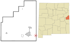
Location of Texico, New Mexico
Usa edcp relief location map.png
Red pog.svg
Texico
Location in the United States
Coordinates: 34°23′28″N103°2′54″W / 34.39111°N 103.04833°W / 34.39111; -103.04833 Coordinates: 34°23′28″N103°2′54″W / 34.39111°N 103.04833°W / 34.39111; -103.04833
Country United States
State New Mexico
County Curry
Area
[1]
  Total0.83 sq mi (2.14 km2)
  Land0.83 sq mi (2.14 km2)
  Water0.00 sq mi (0.00 km2)
Elevation
4,147 ft (1,264 m)
Population
 (2020) [2]
  Total956
  Density1,155.99/sq mi (446.31/km2)
Time zone UTC-7 (Mountain (MST))
  Summer (DST) UTC-6 (MDT)
ZIP code
88135
Area code 575
FIPS code 35-77250
GNIS feature ID0915905

Texico is a city in Curry County, New Mexico, United States. Its population was 1,130 at the 2010 census. The city is located on the Texas-New Mexico border with the town of Farwell across the border.

Contents

Etymology

The name is a portmanteau of "Texas" and "New Mexico". Texico is located on the Texas-New Mexico border. The city of Farwell borders Texico on the Texas side of the border.

Geography

Texico is located on the high plains of Eastern New Mexico in a region known as the Llano Estacado. According to the United States Census Bureau, the city has a total area of 0.8 square miles (2.1 km2), all land.

Demographics

As of the census [3] of 2000, 1,065 people, 381 households, and 278 families were residing in the city. The population density was 1,299 persons per square mile (501.5/km2). The 414 housing units averaged 504.9 per sq mi (194.9/km2). The racial makeup of the city was 59.15% White, 4.60% African American, 1.22% Native American, 0.09% Asian, 0.09% Pacific Islander, 31.46% from other races, and 3.38% from two or more races. Hispanics or Latinos of any race were 47.32% of the population.

Of the 381 households, 37.3% had children under the age of 18 living with them, 55.4% were married couples living together, 11.8% had a female householder with no husband present, and 26.8% were not families. About 23.9% of all households were made up of individuals, and 12.3% had someone living alone who was 65 years of age or older. The average household size was 2.80, and the average family size was 3.34.

In the city, the age distribution was 30.8% under 18, 8.6% from 18 to 24, 28.1% from 25 to 44, 19.7% from 45 to 64, and 12.8% who were 65 or older. The median age was 34 years. For every 100 females, there were 97.2 males. For every 100 females age 18 and over, there were 89.5 males.

The median income for a household in the city was $24,519, and for a family was $29,554. Males had a median income of $23,672 versus $15,250 for females. The per capita income for the city was $10,584. About 17.3% of families and 20.9% of the population were below the poverty line, including 18.8% of those under age 18 and 19.4% of those age 65 or over.

Historical population
CensusPop.
1910 409
1920 381−6.8%
1930 56949.3%
1940 478−16.0%
1950 69144.6%
1960 88928.7%
1970 772−13.2%
1980 95824.1%
1990 9660.8%
2000 1,06510.2%
2010 1,1306.1%
2020 956−15.4%
U.S. Decennial Census [4] [2]

Climate

According to the Köppen climate classification, Texico has a semiarid climate, BSk on climate maps. [5]

Climate data for Texico, New Mexico
MonthJanFebMarAprMayJunJulAugSepOctNovDecYear
Average high °C (°F)12
(53)
14
(57)
18
(65)
23
(73)
27
(81)
32
(90)
33
(91)
32
(89)
28
(83)
23
(74)
16
(61)
12
(53)
23
(73)
Average low °C (°F)−5
(23)
−3
(26)
−1
(31)
4
(39)
9
(48)
14
(57)
17
(62)
16
(60)
12
(53)
6
(43)
−1
(31)
−4
(24)
5
(41)
Average precipitation mm (inches)10
(0.4)
10
(0.4)
20
(0.8)
20
(0.8)
51
(2)
61
(2.4)
71
(2.8)
79
(3.1)
46
(1.8)
43
(1.7)
13
(0.5)
13
(0.5)
430
(17.1)
Source: Weatherbase [6]

Education

Texico is within the Texico Municipal Schools school district. [7]

Texico is also featured in the Egyptian film Viva Zalata starring Fouad Al-Mohandes, a parody of the classic film Viva Zapata .

Texico is the name of the town in the 2008 movie Swing Vote starring Kevin Costner. Although the name of the city was used, the actual filming was done in Belen, south of Albuquerque.


See also

Related Research Articles

<span class="mw-page-title-main">Parmer County, Texas</span> County in Texas, United States

Parmer County is a county located in the southwestern Texas Panhandle on the High Plains of the Llano Estacado in the U.S. state of Texas. As of the 2020 census, the population was 9,869. The county seat is Farwell. The county was created in 1876 and later organized in 1907. It is named in honor of Martin Parmer, a signer of the Texas Declaration of Independence and early judge. Parmer County was one of 10 prohibition, or entirely dry, counties in the state of Texas, but is now a wet county.

<span class="mw-page-title-main">Oldham County, Texas</span> County in Texas, United States

Oldham County is a county located in the U.S. state of Texas. As of the 2020 census, its population was 1,758. Its county seat is Vega. The county was created in 1876 and organized in 1881. Oldham County is included in the Amarillo, TX Metropolitan Statistical Area.

<span class="mw-page-title-main">Curry County, New Mexico</span> County in New Mexico, United States

Curry County is a county located in the U.S. state of New Mexico. As of the 2010 census, its population was 48,376. Its county seat is Clovis. The county is named in honor of George Curry, territorial governor of New Mexico from 1907 to 1910.

<span class="mw-page-title-main">Clovis, New Mexico</span> City in New Mexico, United States

Clovis is a city in and the county seat of Curry County, New Mexico. The city had a population of 37,775 as of the 2010 census, and a 2019 estimated population of 38,319. Clovis is located in the New Mexico portion of the Llano Estacado, in the eastern part of the state.

<span class="mw-page-title-main">Whiteface, Texas</span> Community in Texas, United States

Whiteface is a town in Cochran County, Texas, United States. The population was 449 at the 2010 census.

<span class="mw-page-title-main">Paducah, Texas</span> Town in Texas, United States

Paducah is a town in Cottle County, Texas, United States. The population was 1,186 at the 2010 census, down from 1,498 in 2000. It is the county seat of Cottle County. It is just south of the Texas Panhandle and east of the Llano Estacado.

<span class="mw-page-title-main">Ralls, Texas</span> City in Texas, United States

Ralls is a city in Crosby County, Texas, United States. It was named after John Robinson Ralls, who with the help of W.E. McLaughlin, laid out the townsite in July 1911. As of the 2010 census, it had a population of 1,944, down from 2,252 at the 2000 census. Ralls is surrounded by productive farm lands that primarily produce cotton and grains, with lesser amounts of soybean, sunflower seed, and vegetables.

<span class="mw-page-title-main">Plainview, Texas</span> City in Texas, United States

Plainview is a city in and the county seat of Hale County, Texas, United States. As of the 2010 census, the population was 22,194.

<span class="mw-page-title-main">Levelland, Texas</span> City in Texas, United States

Levelland is a city in Hockley County, Texas, in the United States. As of the 2010 census, the city population was 13,542, up from 12,866 at the 2000 census. It is the county seat of Hockley County. It is located on the Llano Estacado, 30 miles (48 km) west of Lubbock. Major industries include cotton farming and petroleum production. It is the home of South Plains College. Levelland is the principal city of the Levelland micropolitan statistical area, which includes all of Hockley County and part of the larger Lubbock–Levelland combined statistical area. Levelland was so named on account of the flat land at the town site.

<span class="mw-page-title-main">Amherst, Texas</span> City in Texas, United States

Amherst is a city in Lamb County, Texas, United States. The population was 721 at the 2010 census.

<span class="mw-page-title-main">Earth, Texas</span> City in Texas, United States

Earth is a small, rural city in Lamb County, West Texas, United States. As of the 2010 Census, the population was 1,065.

<span class="mw-page-title-main">Olton, Texas</span> City in Texas, United States

Olton is a city in Lamb County, Texas, United States. The population was 2,215 at the 2010 census.

<span class="mw-page-title-main">Sudan, Texas</span> City in Texas, United States

Sudan is a city in Lamb County in Texas, United States. Its population was 958 at the 2010 census.

New Deal is a U.S. town in Lubbock County, Texas. The population was 794 at the 2010 census. It is part of the Lubbock Metropolitan Statistical Area and the Llano Estacado region.

<span class="mw-page-title-main">Ransom Canyon, Texas</span> Town in Texas, United States

Ransom Canyon is a town in Lubbock County of West Texas, United States. The population was 1,096 at the 2010 census. It is part of the Lubbock Metropolitan Statistical Area.

<span class="mw-page-title-main">Shallowater, Texas</span> Community in Texas, United States

Shallowater is a city in Lubbock County, Texas, United States. Shallowater is on U.S. Route 84 and the Burlington Northern Santa Fe line, 12 miles (19 km) northwest of Lubbock. Its population was 2,484 at the 2010 census. It is part of the Lubbock metropolitan statistical area.

<span class="mw-page-title-main">Slaton, Texas</span> City in Texas, United States

Slaton is a city in Lubbock County, Texas, United States founded by German immigrants. Slaton was the westernmost German settlement in Texas. The population was 6,121 at the 2010 census. Slaton is part of the Lubbock Metropolitan Statistical Area.

<span class="mw-page-title-main">New Home, Texas</span> City in Texas, United States

New Home is a small city in Lynn County, Texas, United States. The population was 334 at the 2010 census.

<span class="mw-page-title-main">Bovina, Texas</span> City in Texas, United States

Bovina is a city in Parmer County, Texas, United States. The population was 1,868 at the 2010 census.

<span class="mw-page-title-main">Farwell, Texas</span> City in Texas, United States

Farwell is a city in and the county seat of Parmer County, Texas, United States. Its population was 1,363 at the 2010 census. The city is located on the Texas-New Mexico border with the city of Texico, New Mexico, across the border.

References

  1. "ArcGIS REST Services Directory". United States Census Bureau. Retrieved October 12, 2022.
  2. 1 2 "Census Population API". United States Census Bureau. Retrieved Oct 12, 2022.
  3. "U.S. Census website". United States Census Bureau . Retrieved 2008-01-31.
  4. "Census of Population and Housing". Census.gov. Retrieved June 4, 2015.
  5. Climate Summary for Texico, New Mexico
  6. "Weatherbase.com". Weatherbase. 2013. Retrieved on October 3, 2013.
  7. "2020 CENSUS - SCHOOL DISTRICT REFERENCE MAP: Curry County, NM" (PDF). U.S. Census Bureau . Retrieved 2022-07-12.