
Washington is a town in the City of Sunderland district of Tyne and Wear, England. Historically part of County Durham, it is the ancestral settlement of the Washington family, which George Washington descended from.

Fakenham is a market town and civil parish in Norfolk, England. It is situated on the River Wensum, about 25 miles north west of Norwich. The town is the junction of several local roads, including the A148 from King's Lynn to Cromer, the A1067 to Norwich and the A1065 to Swaffham.

Llanfair Caereinion is a market town and community in Montgomeryshire, Powys, Wales upon the River Banwy, around 8 miles west of Welshpool. In 2011 the ward had a population of 1,810; the town itself had a population of 1,055 according to Nomis.

Eckington is a village and civil parish in North East Derbyshire, England. It is 7 miles (11 km) northeast of Chesterfield and 9 miles (14 km) southeast of Sheffield city centre, on the border with South Yorkshire.

Cradley Heath is a town in the Rowley Regis area of the Metropolitan Borough of Sandwell, West Midlands, England, 2 miles (3 km) north-west of Halesowen, 3 miles (5 km) south of Dudley and 8 miles (13 km) west of central Birmingham. Cradley Heath is often confused with the neighbouring Halesowen district of Cradley from which it is separated by the River Stour; both are in the Black Country but have long been administered by different local authorities, and until 1966 were in separate counties.
Jarrow is a constituency represented in the House of Commons of the UK Parliament since 2019 by Kate Osborne of the Labour Party.

South Shields is a borough constituency represented in the House of Commons of the Parliament of the United Kingdom. It elects one Member of Parliament (MP) by the first past the post system of election. It has been represented by Emma Lewell-Buck of the Labour Party since 2013.

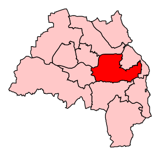
William Reid Blyton, Baron Blyton was a British Labour Party politician who served as Member of Parliament (MP) for Houghton-le-Spring in the County of Durham from 1945 to 1964.
Poleglass is an area of west Belfast in Northern Ireland. It is the name of a townland, a modern electoral ward, and a housing estate. The townland is situated in the civil parish of Derriaghy and the historic Barony of Belfast Upper. It is mainly an Irish nationalist area.

Shinfield is a village and civil parish in the English county of Berkshire, just south of Reading. It contains 4,313 acres (17.45 km2) and is administered by the unitary authority of Wokingham District. Shinfield Park is the northern part of the parish, becoming physically separated from Reading when the M4 motorway was constructed in 1971.

Brockley Whins is an area in South Tyneside, part of South Shields, with a postcode of NE32 [1]

Snaith is a market town and parish in the civil parish of Snaith and Cowick in the East Riding of Yorkshire, England. The town is close to the River Aire and the M62 and M18 motorways. The town is located 7 miles (11 km) west of Goole, 10 miles (16 km) east of Knottingley, 8 miles (13 km) south of Selby, 10 miles (16 km) southwest of Howden and 8 miles (13 km) northwest of Thorne.

The A183 road runs from South Shields in Tyne and Wear, through Sunderland and ends at Chester-le-Street in County Durham. It is a major route in South Tyneside, Sunderland and Chester-le-Street serving many areas and landmarks along its route.

Rushall is a suburb in the Metropolitan Borough of Walsall in the West Midlands, England. It is centred on the main road between Walsall and Lichfield. It is mentioned in the Domesday Book but has mostly developed since the 1920s. Rushall was historically a part of the county of Staffordshire before it was incorporated with much of the old Aldridge-Brownhills Urban District into the modern-day Walsall district.

South Shields Interchange is the Tyne and Wear Passenger Transport Executive ran transport hub which serves the coastal town of South Shields, South Tyneside in Tyne and Wear, England.

The A1300 is the main 'cross town' route in South Shields, Tyne and Wear. The road runs from Simonside to Marsden via Harton Nook. It is 3.7 miles (6 km) long.
Earlswood is a small village in Warwickshire, England in the Tanworth-in-Arden Civil parish of the Stratford-on-Avon District. However, the northernmost part of the village lies within Tidbury Green parish in the Solihull Metropolitan Borough of the West Midlands. A hamlet called Warings Green also lies in the south east of the village, with the northernmost point crossing into the parish of Cheswick Green in the borough of`Solihull. The village's postal code, B94, is in the Birmingham postcode area. It is in the ecclesiastical parish of St Patrick, Salter Street. The village is surrounded by farmland and forests and it gives its name to Earlswood Lakes as well as to Earlswood railway station, even though The Lakes railway station is located closer to the main part of the village.

Cwmbran bus station is a bus terminus and interchange located in the town centre of Cwmbran, South Wales.

Georgetown is a village in the Sirhowy Valley in Blaenau Gwent. It belongs in the ward of Georgetown.
