Borough of Princeton, New Jersey | |
|---|---|
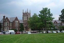
 Monument Hall, the borough hall for the previous incarnation of Princeton Borough | |
 Location of Princeton Township and Borough in Mercer County highlighted in red (right). Inset map: Location of Mercer County in New Jersey highlighted in orange (left). | |
 Census Bureau map of Borough of Princeton, New Jersey | |
| Coordinates: 40°21′02″N74°39′34″W / 40.350461°N 74.659371°W | |
| Country | |
| State | |
| County | Mercer |
| Incorporated | February 11, 1813 |
| Disestablished | January 1, 2013 |
| Government | |
| • Type | Borough |
| • Body | Borough Council |
| • Mayor | Yina Moore (D, term ended December 31, 2012) [2] [3] [4] |
| • Administrator | Robert W. Bruschi [5] |
| • Clerk | Robert W. Bruschi (acting) [6] |
| Area | |
• Total | 1.843 sq mi (4.774 km2) |
| • Land | 1.842 sq mi (4.772 km2) |
| • Water | 0.00039 sq mi (0.001 km2) 0.03% |
| • Rank | 423rd of 566 in state 10th of 13 in county [7] |
| Elevation | 190 ft (58 m) |
| Population | |
• Total | 12,307 |
| • Rank | 198th of 566 in state 10th of 13 in county [12] |
| • Density | 6,679.2/sq mi (2,578.9/km2) |
| • Rank | 70th of 566 in state 2nd of 13 in county [12] |
| Time zone | UTC-5 (Eastern (EST)) |
| • Summer (DST) | UTC-4 (Eastern (EDT)) |
| ZIP code | 08540, 08542 [13] |
| Area codes | 609 and 640 |
| FIPS code | 3402160900 [7] [14] [15] |
| GNIS feature ID | 0885361 [7] [16] |
| Website | princetonboro.org |
The Borough of Princeton was a borough of New Jersey that existed from 1813 until the end of 2012. On January 1, 2013, it merged with Princeton Township to form Princeton, New Jersey; both the Borough of Princeton and Princeton Township were dissolved in the merger.
Contents
- Geography
- Demographics
- Census 2010
- Census 2000
- Climate
- Ecology
- Government
- Local government
- Merger of borough and township
- Federal, state and county representation
- Politics
- Education
- Colleges and universities
- Primary and secondary schools
- Public libraries
- Popular culture
- Sister city
- Notable people
- See also
- References
- External links
The borough was located in Mercer County, in the U.S. state of New Jersey, and was completely surrounded by the former Princeton Township, from which it was formed in 1894. As of the 2010 United States census, the borough had a population of 12,307, [9] [10] [11] reflecting a decline of 1,896 (-13.3%) from the 14,203 counted in the 2000 Census, which had in turn increased by 2,187 (+18.2%) from the 12,016 counted in the 1990 Census. [17]
The Borough of Princeton was incorporated by an act of the New Jersey Legislature on February 11, 1813, within portions of West Windsor Township (in what was then part of Middlesex County) and Montgomery Township (in Somerset County), and was reincorporated on November 27, 1822. The borough became part of the newly created Mercer County in 1838, and became a fully independent municipality circa 1894. Portions of territory were acquired from Princeton Township on January 4, 1928, and August 21, 1951. [18] On November 8, 2011, voters in Princeton Borough voted to consolidate with Princeton Township. [19]
Morven, the former residence of the Governor of New Jersey, is at 55 Stockton Street in the former borough, while the current residence is Drumthwacket in the former township.