Eagle Farm, Queensland

Last updated

Map all coordinates using: OpenStreetMap
Eagle Farm
Brisbane,  Queensland
Universal Field Robots workshop in Eagle Farm, Queensland 01.jpg
Industrial premises, Eagle Farm
Australia Queensland location map.svg
Red pog.svg
Eagle Farm
Coordinates 27°25′53″S153°05′17″E / 27.4313°S 153.0880°E / -27.4313; 153.0880 (Eagle Farm (centre of suburb))
Population11 (2021 census) [1]
 • Density1.86/km2 (4.83/sq mi)
Postcode(s) 4009
Area5.9 km2 (2.3 sq mi)
Time zone AEST (UTC+10:00)
Location8.9 km (6 mi) NE of Brisbane GPO
LGA(s) City of Brisbane
(Hamilton Ward) [2]
State electorate(s) Clayfield
Federal division(s)
Suburbs around Eagle Farm:
Hendra Brisbane Airport Pinkenba
Ascot Eagle Farm Pinkenba
Hamilton Morningside Murarrie

Eagle Farm is an eastern industrial suburb of the City of Brisbane, Queensland, Australia. [3] In the 2016 census, Eagle Farm had a population of 0 people. [1]

Contents

The neighbourhood of Whinstanes is located in Eagle Farm ( 27°26′00″S153°05′00″E / 27.4333°S 153.0833°E / -27.4333; 153.0833 (Whinstanes) ). [4]

Geography

Eagle Farm is situated 8.5 kilometres (5.3 mi) north-east of the Brisbane central business district. It is bounded to the south by the median of the Brisbane River. [5] Eagle Farm is within the industrial-development zone known as Australia TradeCoast.

Kingsford Smith Drive passes through the suburb from west (Hamilton) to east (Pinkenba). The Gateway Motorway passes through the suburb from the south (Murarrie) crossing the Brisbane River via the Sir Leo Hielscher Bridges and then exits to the north (Brisbane Airport). The Southern Cross Way splits from the Gateway Motorway and also heads north-west, becoming the north-western boundary of Eagle Farm with Hamilton. [6]

The Doomben/Pinkenba railway line passes through the suburbs from west (Ascot/Hamilton) to east (Pinkenba) to the north of Kingsford Smith Drive. There are no railway stations within the suburb any more. [6]

The Royal Queensland Golf Club is located at 431 Curtin West Avenue and extends south to the river. [7] Apart from the golf course, the suburb is industrial. [6]

Despite the name, the Eagle Farm Racecourse, home of the Queensland Turf Club (QTC) and the main racecourse for thoroughbred gallopers in Brisbane, is located in neighbouring Ascot. [6]

History

Eagle Farm first appeared as a name in 1839, identifying a cultivation area in the Moreton Bay penal settlement. In 1829, Captain Patrick Logan chose this well-watered, fertile site between the Brisbane River and Serpentine Creek to farm mostly maize, pigs and cattle. The origin of the name apparently arose from eagles being observed around the farm. By 1834, women prisoners were working as field labour at Eagle Farm. By 1836, forty female prisoners were housed there, washing and mending clothes, growing vegetables. The site remained a prison for twice convicted female felons until transportation ended in 1839. Conditions for the females at the prison were documented by the Quaker missionary James Backhouse in 1836. [4]

In the 1850s, Aboriginal people set up camps in the Breakfast Creek Eagle Farm area, including groups of the Bribie Island, Ningy-Ningy (Toorbul Point to Redcliffe) and Wide Bay Aboriginal peoples, who were losing their traditional territory further north. [8]

Eagle Farm State School opened on 1 August 1864. In 1908, the school was renamed Hendra State School. [9]

In October 1895, the Queensland Government approved the extension of the Racecourse railway which terminated at Racecourse railway station (now Ascot railway station) through Eagle Farm to Pinkenba to provide access to the Pinkenba Wharf on the Brisbane River. This created a number of new railway stations: Doomben, Whinstanes, Baraini (later renamed Airport to service Eagle Farm Airport, then later renamed Eagle Farm), Bunour, Meeandah and Pinkenba. The line opened to Meeandah on 31 March 1897, but the section to Pinkenba was below the high tide level and had to be reclaimed using sand dredged to construct a railway wharf on the river. The line opened to Pinkenba on 1 September 1897. In 1976, a new Whinstanes-Doomben railway station was created between the original two stations to replace them, and was renamed simply Doomben railway station in the 1990s. From 27 January 1998, the line terminated at this station and the following stations are now abandoned. [10]

On 24 April 1920, auctioneer Thorpe and Sharp offered 87 "park like" suburban allotments in the Whinstanes Junction Estate to the north-east of the Whinstanes railway station (no longer extant). The estate was bounded by Lamington Avenue to the south and the Doomben Racecourse to the north with allotments facing two streets Birdwood Street and Monash Streets. As at 2019, this area is an industrial estate with Western Avenue passing through it with no sign of Birdwood and Monash Streets. [11] [12]

The Eagle Farm Airport served as Brisbane's main airport until the opening of the present Brisbane Airport in 1988. During WWII U.S. Navy Seabees of the 55th CB built Camp Seabee adjacent to Australian CCC Camp by the Airport as a staging centre for Construction Battalions assigned to MacArthur's 7th Amphibious force. It was the smallest of the military installations at Eagle farm. They also built an adjoining Advance Base Construction Depot (ABCD) and the USN Ordnance depot at Mt. Coot-Tha. CBs that were there were the 19th, 55th, 60th, 77th, 84th, 91st, 104th and the CBMU 564. The base operated from March 1943 until mid October 1945. The Royal navy moved into Camp Seabee and the Australian Army took over the ABCD and Ordnance depot.

At the 2011 census [13] and the 2016 census, Eagle Farm had a population of 0 people. [1]

Heritage listings

Second World War Hangar No. 7, 2015 Second World War Hangar No. 7 wide.jpg
Second World War Hangar No. 7, 2015

Eagle Farm has a number of heritage-listed sites, including:

Allison Engine Testing Stands

Allison Engine Testing Stands, 2015 Allison Engine Testing Stands from north.jpg
Allison Engine Testing Stands, 2015

The Allison Engine Testing Stands site is part of Brisbane's TradeCoast Central at the old Brisbane airport site in the suburb of Eagle Farm, where new and rebuilt World War II Allison V-12 in-line liquid cooled aero engines were tested in the open air prior to fitting into reassembled aircraft, notably the P38-Lightning, Curtis Kittyhawk and Bell Airacobra. The masonry sections of the remains, being buildings and dividers between the engine testing bays, are largely intact. The engines were refurbished at the Holden Breakfast Creek facility. Many of the workers in the Holden facility were women. [17] [18]

Education

Primary

The nearest government primary school is in neighbouring Hamilton.

Secondary

The nearest government secondary school is Aviation State High School in neighbouring Hendra. [6]

Tertiary

Gateway College opened in 1966. It is now known as TAFE Queensland SkillsTech, featuring trade courses such as electrical, plumbing, glass and glazing, renewable energy and electronics. Construction of a $40 million Robotics and Advanced Manufacturing Centre (RAMC) began in October 2023. [19]

See also

Related Research Articles

<span class="mw-page-title-main">Eagle Junction railway station</span> Railway station in Brisbane, Queensland, Australia

Eagle Junction railway station is located on the North Coast line in Queensland, Australia. It is one of two railway stations serving the Brisbane suburb of Clayfield, the other being Clayfield railway station. North of the station, the Pinkenba and Airport lines branch off.

<span class="mw-page-title-main">Doomben railway line</span> Railway line in Brisbane, Australia

The Doomben railway line is a railway line in the City of Brisbane, Queensland, Australia. It is the part of the Pinkenba railway line that still operates a regular passenger service. Doomben, or dumben, is the Indigenous Yuggera name for a tree fern which was prolific in the area. The railway line branches from the North Coast line at Eagle Junction, extending 8 kilometres (5.0 mi) to the industrial suburb of Pinkenba, situated on the northern bank at the mouth of the Brisbane River. It is part of the Queensland Rail Citytrain network.

<span class="mw-page-title-main">Clayfield railway station</span> Railway station in Brisbane, Queensland, Australia

Clayfield railway station is located on the Pinkenba line in Queensland, Australia. It is one of two railway stations serving the Brisbane suburb of Clayfield, the other being Eagle Junction railway station.

<span class="mw-page-title-main">Hendra railway station</span> Railway station in Brisbane, Queensland, Australia

Hendra railway station is located on the Pinkenba line in Queensland, Australia. It serves the Brisbane suburb of Hendra.

<span class="mw-page-title-main">Ascot railway station, Brisbane</span> Railway station in Brisbane, Queensland, Australia

Ascot railway station is located on the Pinkenba line in Queensland, Australia. It serves the Brisbane suburb of Ascot adjacent to Eagle Farm Racecourse.

<span class="mw-page-title-main">Doomben railway station</span> Railway station in Brisbane, Queensland, Australia

Doomben railway station is the terminal station of the Doomben line in Queensland, Australia. It serves the Brisbane suburb of Ascot adjacent to Doomben Racecourse.

<span class="mw-page-title-main">Ascot, Queensland</span> Suburb of Brisbane, Queensland, Australia

Ascot is a north-east suburb in the City of Brisbane, Queensland, Australia. In the 2016 census, Ascot had a population of 5,777 people.

<span class="mw-page-title-main">Pinkenba, Queensland</span> Suburb of Brisbane, Queensland, Australia

Pinkenba is a town and eastern coastal suburb within the City of Brisbane, Queensland, Australia. In the 2016 census, Pinkenba had a population of 368 people.

<span class="mw-page-title-main">Pinkenba railway station</span> Former railway station in Brisbane, Queensland, Australia

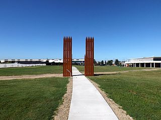
Pinkenba railway station was a railway station on the Pinkenba railway line in the suburb of Pinkenba, City of Brisbane, Queensland, Australia. It was originally the terminus station of the Pinkenba Line, just 9 kilometres (5.6 mi) from the Brisbane central business district and 14.1 kilometres (8.8 mi) from Central station by rail. It opened in 1897 and was rebuilt in 1969, with a new station closer to the township of Pinkenba. The first station became a shunters' quarters. The line closed to all passenger traffic in 1993.

<span class="mw-page-title-main">Hendra, Queensland</span> Suburb of Brisbane, Queensland, Australia

Hendra is a suburb of the City of Brisbane, Queensland, Australia. In the 2021 census, Hendra had a population of 4,914 people.

<span class="mw-page-title-main">Eagle Farm Racecourse</span>

Eagle Farm Racecourse is a heritage-listed horse racing venue in Brisbane, Queensland, Australia. It is located at the northern end of Racecourse Road in the suburb of Ascot, 7 kilometres (4.3 mi) from the Brisbane central business district.

<span class="mw-page-title-main">Doomben Racecourse</span> Horse racing venue in Bribane, Queensland, Australia

Doomben Racecourse is a horse racing venue in Brisbane, Queensland, Australia. It is located in the suburb of Ascot, 7 kilometres north of the Brisbane central business district. The Doomben course neighbours another thoroughbred venue called the Eagle Farm Racecourse and can be accessed via car, train or bus. Together with Eagle Farm, these courses are considered the two major racecourses in South East Queensland, and can be seen sharing irrigation systems and some of Brisbane Racings feature events.

<span class="mw-page-title-main">Eagle Farm railway station</span> Former railway station in Brisbane, Queensland, Australia

Eagle Farm railway station is an abandoned passenger station in Brisbane, Queensland, Australia. It is on the Pinkenba railway line, only 6.8 kilometres (4.2 mi) (4.2 mi) from the Brisbane central business district; 10.9 kilometres (6.8 mi) from Central station by rail.

<span class="mw-page-title-main">Hamilton, Queensland</span> Suburb of Brisbane, Queensland, Australia

Hamilton is an affluent riverside mixed-use suburb in the north-east of the City of Brisbane, Queensland, Australia. Hamilton is located along the north bank of the Brisbane River. In the 2021 census, Hamilton had a population of 8,922 people.

<span class="mw-page-title-main">Eagle Junction, Queensland</span> Suburb of Brisbane, Queensland, Australia

Eagle Junction is a former suburb of Brisbane, Queensland, Australia. It is now a neighbourhood within the suburb of Clayfield.

<span class="mw-page-title-main">Racecourse Road, Brisbane</span> Road in Brisbane, Australia

Racecourse Road is a road in the suburb of Hamilton in the City of Brisbane, Queensland, Australia. It is a dining, shopping and entertainment precinct in Brisbane, that connects Kingsford Smith Drive and the Eagle Farm Racecourse.

<span class="mw-page-title-main">Eagle Farm Women's Prison and Factory Site</span> Historic site in Queensland, Australia

Eagle Farm Women's Prison and Factory Site is a heritage-listed archaeological site at 116 Lamington Avenue, Eagle Farm, City of Brisbane, Queensland, Australia. It operated between 1829 and 1839 as part of the Moreton Bay penal settlement. It is on the site now part of the Australia TradeCoast, previously the Eagle Farm Airport. It was added to the Queensland Heritage Register on 7 February 2005.

Whinstanes railway station is a former railway station on the Pinkenba railway line in Brisbane, Australia. Constructed in the 19th century next to a branch constructed to service wharves at Hamilton, the station was situated only 700 m east of Doomben railway station. The station closed in 1976, as it was merged with Doomben station. This was due to the expense of raising higher level platforms of two stations adjacent to each other and for a time the new station was known as Whinstanes-Doomben, until the "Whinstanes" name was dropped with the electrification of the line in 1988.

<span class="mw-page-title-main">Eagle Farm Racecourse and Ascot railway station</span> Historic site in Queensland, Australia

Eagle Farm Racecourse and Ascot Railway station is a heritage-listed pair of racecourse and railway station at 230 Lancaster Road, Ascot, City of Brisbane, Queensland, Australia. It was built from 1863 onwards. The racecourse is also known as Ascot Racecourse and Brisbane Racecourse, and Ascot railway station was previously known as Racecourse railway station. It was added to the Queensland Heritage Register on 25 June 2004.

References

  1. 1 2 3 Australian Bureau of Statistics (27 June 2017). "Eagle Farm (SSC)". 2016 Census QuickStats. Retrieved 20 October 2018. OOjs UI icon edit-ltr-progressive.svg
  2. "Hamilton Ward". Brisbane City Council. Archived from the original on 12 March 2017. Retrieved 12 March 2017.
  3. "Eagle Farm – suburb in City of Brisbane (entry 50393)". Queensland Place Names. Queensland Government . Retrieved 25 January 2020.
  4. 1 2 "Eagle Farm". Queensland Places. University of Queensland. Archived from the original on 2 March 2020. Retrieved 3 March 2020.
  5. "Queensland Globe; Layer:Boundaries". Archived from the original on 19 December 2017. Retrieved 19 May 2022.
  6. 1 2 3 4 5 "Queensland Globe". State of Queensland . Retrieved 11 March 2020.
  7. "Royal Queensland Golf Club". Royal Queensland Golf Club. Archived from the original on 22 May 2014. Retrieved 22 May 2014.
  8. Fisher, Rod. "From depredation to degradation in Brisbane: The Aboriginal presence 1824–1860" Archived 22 March 2014 at the Wayback Machine , Brisbane History Group, 1992
  9. Queensland Family History Society (2010), Queensland schools past and present (Version 1.01 ed.), Queensland Family History Society, ISBN   978-1-921171-26-0
  10. Kerr, John (1990). Triumph of narrow gauge : a history of Queensland Railways. Boolarong Publications. pp. 74–75. ISBN   978-0-86439-102-5.
  11. T. M. Burke Land Agent; Farley & Hanley, Surveyors (1920). "Whinstanes Junction Estate" (advertisement). hdl:10462/deriv/259650.
  12. "Saturday, 24 April. Sale by auction, on the ground, at 3 P.M. Whinstanes Junction Estate [Advertisement]". The Brisbane Courier . No. 19,414. Queensland, Australia. 10 April 1920. p. 9. Archived from the original on 31 March 2022. Retrieved 26 November 2019 via National Library of Australia.
  13. Australian Bureau of Statistics (31 October 2012). "Eagle Farm (State Suburb)". 2011 Census QuickStats. Retrieved 25 October 2013. OOjs UI icon edit-ltr-progressive.svg
  14. "Allison Testing Stands (former) (entry 602329)". Queensland Heritage Register . Queensland Heritage Council. Retrieved 19 June 2013.
  15. "Eagle Farm Women's Prison and Factory Site (entry 600186)". Queensland Heritage Register . Queensland Heritage Council. Retrieved 19 June 2013.
  16. "Second World War Hangar No. 7 (entry 601007)". Queensland Heritage Register . Queensland Heritage Council. Retrieved 19 June 2013.
  17. "Hangar 7, Eagle Farm Aviation Society". Archived from the original on 25 January 2014. Retrieved 21 March 2014.
  18. Marks, Roger. "Allison Engine Plant Breakfast Creek", Book 18, Brisbane – WW2 v Now, 2006
  19. https://statements.qld.gov.au/statements/98922