Flowood | |
|---|---|
| City of Flowood | |
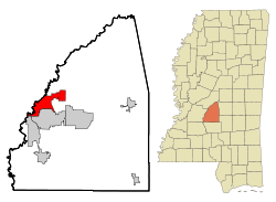 Location of Flowood, Mississippi | |
 Flowood Location in the United States | |
| Coordinates: 32°19′0″N90°6′53″W / 32.31667°N 90.11472°W | |
| Country | United States |
| State | Mississippi |
| County | Rankin |
| Government | |
| • Type | Mayor-Council |
| • Mayor | Kathy Smith (R) [1] [2] |
| • Board of Aldermen | Deron Harmon Kimberly Buford Kirk McDaniel Seth Robbins Donald Flynt |
| Area | |
• Total | 29.20 sq mi (75.62 km2) |
| • Land | 28.80 sq mi (74.59 km2) |
| • Water | 0.40 sq mi (1.03 km2) |
| Elevation | 269 ft (82 m) |
| Population (2020) | |
• Total | 10,202 |
| • Density | 354.3/sq mi (136.78/km2) |
| Time zone | UTC-6 (Central (CST)) |
| • Summer (DST) | UTC-5 (CDT) |
| ZIP codes | 39232 (Flowood) 39047 (Brandon) |
| Area codes | 601, 769 |
| FIPS code | 28-25100 |
| GNIS feature ID | 0670061 |
| Website | www |
Flowood is a city in Rankin County, Mississippi, United States. The population was 10,202 as of the 2020 census. [4] A suburb of Jackson, Flowood is part of the Jackson Metropolitan Statistical Area, and is located northeast of the state capital.
