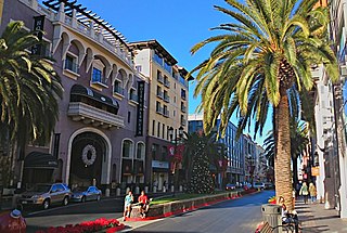
San Jose, officially the City of San José, is the largest city in Northern California by both population and area. With a 2022 population of 971,233, it is the most populous city in both the Bay Area and the San Jose–San Francisco–Oakland Combined Statistical Area—which in 2022 had a population of 7.5 million and 9.0 million respectively—the third-most populous city in California after Los Angeles and San Diego, and the 13th-most populous in the United States. Located in the center of the Santa Clara Valley on the southern shore of San Francisco Bay, San Jose covers an area of 179.97 sq mi (466.1 km2). San Jose is the county seat of Santa Clara County and the main component of the San Jose–Sunnyvale–Santa Clara Metropolitan Statistical Area, with an estimated population of around two million residents in 2018.
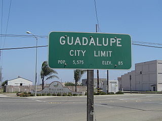
Guadalupe is a small city located in Santa Barbara County, California. According to the U.S. Census of 2010, the city has a population of 7,080. Guadalupe is economically and socially tied to the city of Santa Maria, which is about 8 miles (13 km) to the east. It is located at the intersection of Highway 1 and Highway 166, immediately south of the Santa Maria River, and 5 miles (8 km) east of the Pacific Ocean.
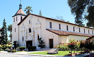
Santa Clara is a city in the county of the same name in the state of California. The city's population was 127,647 at the 2020 census, making it the eighth-most populous city in the Bay Area. Located in the southern Bay Area, the city was founded by the Spanish in 1777 with the establishment of Mission Santa Clara de Asís under the leadership of Junípero Serra.

The Guadalupe River mainstem is an urban, northward flowing 14 miles (23 km) river in California whose much longer headwater creeks originate in the Santa Cruz Mountains. The river mainstem now begins on the Santa Clara Valley floor when Los Alamitos Creek exits Lake Almaden and joins Guadalupe Creek just downstream of Coleman Road in San Jose, California. From here it flows north through San Jose, where it receives Los Gatos Creek, a major tributary. The Guadalupe River serves as the eastern boundary of the City of Santa Clara and the western boundary of Alviso, and after coursing through San José, it empties into south San Francisco Bay at the Alviso Slough.

Almaden Quicksilver County Park is a 4,163 acres (17 km2) park that includes the grounds of former mercury ("quicksilver") mines adjacent to south San Jose, California, USA. The park's elevation varies greatly: the most used entrances are less than 600 feet above sea level, while the highest point in the park is over 1,700 feet above sea level.
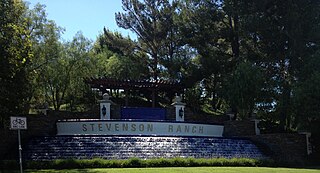
Stevenson Ranch is an unincorporated community in the Santa Clarita Valley of Los Angeles County, California. Stevenson Ranch is set in the foothills of the Santa Susana Mountains and lies west of Interstate 5 and the city of Santa Clarita. Stevenson Ranch encompasses about 6.4 square miles (17 km2). About 1,000 acres (4.0 km2) are set aside as parks, recreation areas, and open space. A master-planned community, it was approved by the county Board of Supervisors in 1985. The population was 20,178 at the time of the 2020 census. For statistical purposes, the Census Bureau has designated it a census-designated place (CDP).

Agnews Developmental Center were two psychiatric and medical care facilities, located in Santa Clara, California and San Jose, California respectively.

Lennar Corporation is a home construction company based in the Waterford District, an unincorporated area of Miami-Dade County, Florida with a Miami postal address. As of 2023, the company was the second-largest home construction company in the United States based on the number of homes sold. In 2023, the company was ranked 119th on the Fortune 500.
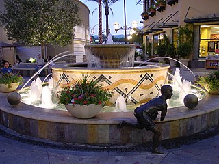
Santa Clarita is a city in northwestern Los Angeles County in the U.S. state of California. With a 2020 census population of 228,673, it is the third-most populous city in Los Angeles County, the 17th-most populous in California, and the 103rd-most populous city in the United States. It is located about 30 miles (48 km) northwest of downtown Los Angeles, and occupies 70.75 square miles (183.2 km2) of land in the Santa Clarita Valley, along the Santa Clara River. It is a classic example of a U.S. edge city, satellite city, or boomburb.
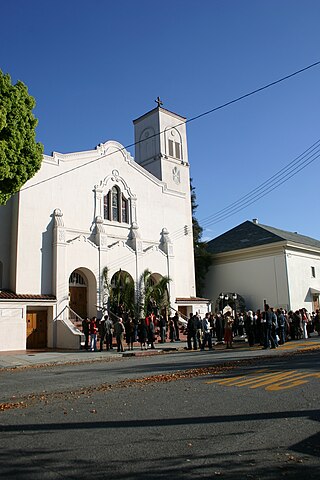
Saint Clare Parish is a parish in the Roman Catholic Diocese of San Jose in California. It is located in Santa Clara, California.
Alameda Point is the name given to the lands of the former Naval Air Station Alameda in the City of Alameda, California. Alameda Point consists of 1,560 acres (6.3 km2) of land area at the western end of the island of Alameda. Most of the land was reclaimed from the San Francisco Bay.

The Newhall Land and Farming Company is a land management company based in Valencia, Santa Clarita, California, United States. The company is responsible for the master community planning of Valencia and previously developed other areas such as Canyon Country and Newhall which together with Saugus and Valencia would merge to create the city of Santa Clarita in 1987. The company is also responsible for the management of farm land elsewhere in the state.
San Jose, California, is the third largest city in the state, and the largest of all cities in the San Francisco Bay Area and Northern California, with a population of 1,021,795.

The VTA light rail system serves San Jose and nearby cities in Santa Clara County, California. It is operated by the Santa Clara Valley Transportation Authority (VTA) and has 42.2 miles (67.9 km) of network comprising three main lines on standard gauge tracks. Originally opened on December 11, 1987, the light rail system has expanded since then, and currently has 60 stations in operation.
Kofi S. Bonner is an American architect and planner widely known for the heading the redevelopment of the city of Emeryville, California. In 1995, Bonner was the deputy executive director of the San Francisco Redevelopment Agency before resigning to become the director of community & economic development for the city of Oakland, California. In 1997, he was selected as the interim city manager for the city of Oakland, California and subsequently was the chief economic policy advisor to San Francisco Mayor Willie Brown. In 1998, Bonner became executive vice president and chief administrative officer for the Cleveland Browns football organization of the National Football League. In 2004, Bonner was hired by MBNA and then in 2006 became director of urban land for Lennar. He worked as regional president at FivePoint, a position he assumed when his previous role as president in Lennar's Bay Area Urban division transitioned into FivePoint in July 2016. In this role, Bonner oversaw all land acquisition and urban development activities for FivePoint in northern California, including The San Francisco Shipyard and Candlestick Point, Treasure Island, and the Concord Naval Weapons Station.

Agnew's Village was a small unincorporated village in what is now Santa Clara, California. It was named for Abram Agnew, a Santa Clara Valley pioneer from Ohio who settled there around 1873. Agnew donated 4 acres (1.6 ha) of land for a South Pacific Coast Railroad station and laid out the town, causing the station and town to be referred to as "Agnew's". The railroad depot is still standing.

Santa Clara County, officially the County of Santa Clara, is the sixth-most populous county in the U.S. state of California, with a population of 1,936,259 as of the 2020 census. Santa Clara County and neighboring San Benito County form the San Jose–Sunnyvale–Santa Clara metropolitan statistical area, which is part of the larger San Jose–San Francisco–Oakland combined statistical area. Santa Clara is the most populous county in the San Francisco Bay Area and in Northern California.
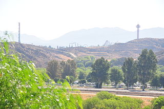
Valencia is an unincorporated community in northwestern Los Angeles County, California, United States. The area, west of Interstate 5, is expanding with residential development and already includes major commercial and industrial parks. It straddles State Route 126 and the Santa Clara River.

Santa Clara City Library is a public library in Santa Clara, California. There are currently three locations: the Mission Branch Library; the Northside Branch Library, which opened on August 9, 2014; and the (main) Central Park Library.

Rincon de los Esteros, also known as Innovation Triangle, the Golden Triangle, the Innovation District, or simply as Rincon, is a vast district of San Jose, California, making up a significant portion of North San Jose. The district has one of the largest concentrations of high tech company headquarters and campuses in Silicon Valley.


