Angora station

Last updated
Angora
SEPTA.svg
Angora SEPTA station.jpg
Facing south from westbound side of tracks.
General information
Location1099 South 58th Street, Philadelphia, Pennsylvania
Coordinates 39°56′41″N75°14′19″W / 39.94479°N 75.23867°W / 39.94479; -75.23867
Owned by SEPTA
Platforms2 side platforms
Tracks2
Connections at 58th/Baltimore
Aiga bus trans.svg SEPTA City Bus : G
Other information
Fare zone1
History
ElectrifiedDecember 2, 1928 [1]
Services
Preceding station SEPTA.svg SEPTA Following station
Fernwood–Yeadon
toward Wawa
Media/Wawa Line 49th Street
61st & Baltimore
Terminus
Route 34
major stops
40th Street Portal
toward 13th Street
Former services
Preceding station Pennsylvania Railroad Following station
Fernwood
toward West Chester
West Chester Line 49th Street
Future services (2024)
Preceding station SEPTA.svg SEPTA Following station
Fernwood–Yeadon
toward Wawa
Media/Wawa Line 49th Street
Preceding station SEPTA Metro.svg SEPTA Metro Following station
61st–Baltimore / Angora
Terminus
T2
major stops
40th Street Portal
toward 13th Street

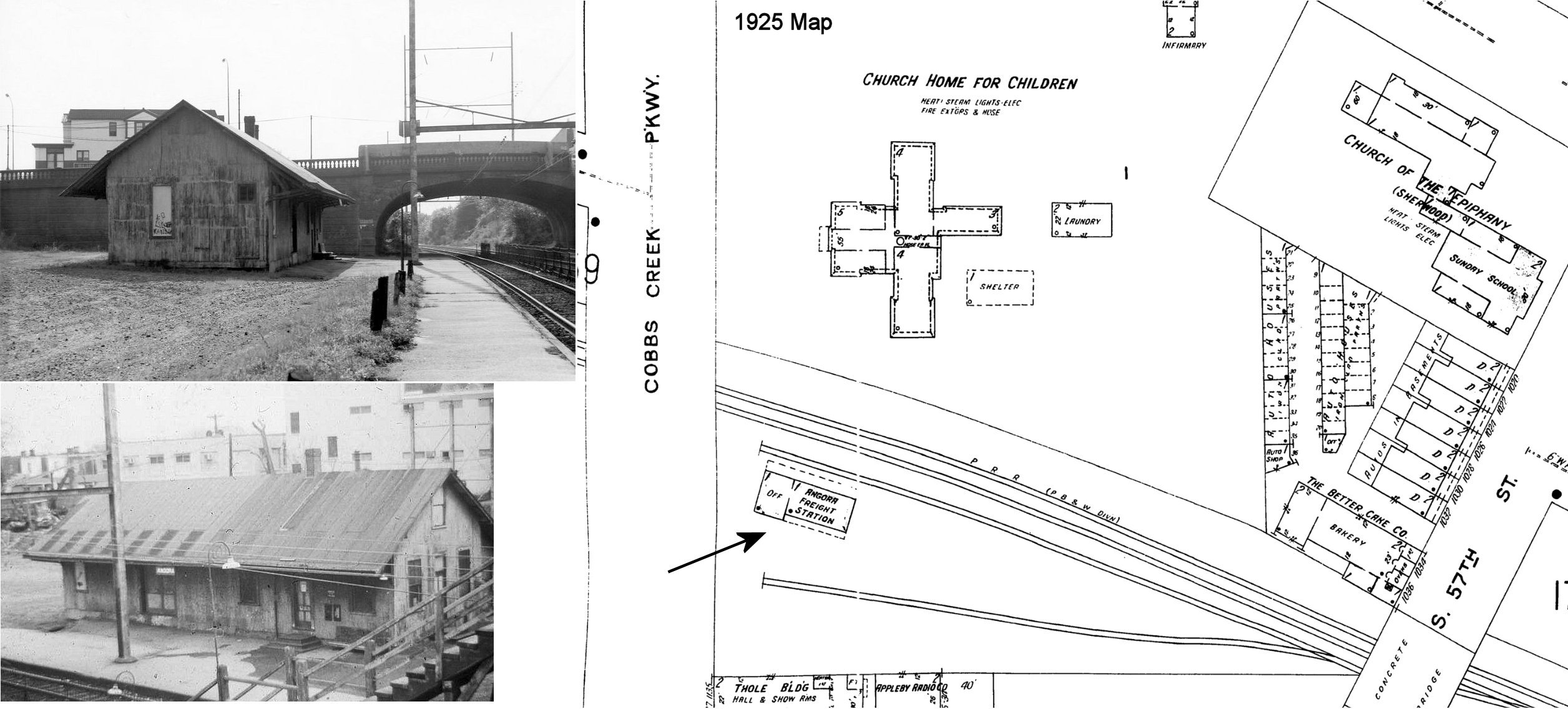
Angora station is a SEPTA railway station in Philadelphia. It serves the Media/Wawa Line and is officially located at 58th Street near Baltimore Avenue in Southwest Philadelphia's Angora neighborhood, however the actual location is south of Baltimore Avenue. Part of Cobbs Creek Parkway runs along 58th Street from Baltimore Avenue, over the railroad bridge, to nearby Hoffman Avenue. In 2013, this station saw 36 boardings and 37 alightings on an average weekday, making it SEPTA's least used regional rail station. [2]

Contents

Angora station lies several blocks southeast of the Angora Loop station, which is the western terminus of Route 34 on the SEPTA Subway-Surface Trolley Lines, a line that runs along Baltimore Avenue, three blocks north of the station.

Station layout

Angora has two low-level side platforms.

Related Research Articles

<span class="mw-page-title-main">West Philadelphia</span> Neighborhood of Philadelphia, Pennsylvania

West Philadelphia, nicknamed West Philly, is a section of the city of Philadelphia. Although there are no officially defined boundaries, it is generally considered to reach from the western shore of the Schuylkill River, to City Avenue to the northwest, Cobbs Creek to the southwest, and the SEPTA Media/Wawa Line to the south. An alternate definition includes all city land west of the Schuylkill; this would also include Southwest Philadelphia and its neighborhoods. The eastern side of West Philadelphia is also known as University City.

<span class="mw-page-title-main">SEPTA subway–surface trolley lines</span> Philadelphia trolley lines

The SEPTA subway–surface trolley lines are a collection of five SEPTA trolley lines that operate on street-level tracks in West Philadelphia and Delaware County, Pennsylvania, and also underneath Market Street in Philadelphia's Center City. The lines, Routes 10, 11, 13, 34, and 36, collectively operate on about 39.6 miles (63.7 km) of route.

<span class="mw-page-title-main">Hatboro station</span>

Hatboro station is a rail station on SEPTA Regional Rail's Warminster Line, formerly the Reading Railroad's New Hope Branch, in Hatboro, Pennsylvania and once terminus for electrified MUs. Electrification was extended to Warminster in 1974. Current trains stopping at Hatboro station are the SEPTA Silverliner IV and the SEPTA Silverliner V. The station is located at the intersection of Byberry Road and Penn Street. The station features a passing siding for handling multiple trains as well as a 100-space parking lot. The current brick construction station stands at 20' x 55' and was built in 1935. An original wood construction freight station was completed in 1871 but no longer stands at the site.

<span class="mw-page-title-main">Wayne Junction station</span> SEPTA junction station in Nicetown, Philadelphia, Pennsylvania, United States

Wayne Junction station is a SEPTA Regional Rail junction station located at 4481 Wayne Avenue, extending along Windrim Avenue to Germantown Avenue. The station is located in the Nicetown neighborhood of Philadelphia. Wayne Junction serves as a multi-modal transfer point between six of SEPTA's regional rail lines as well as three major transit routes – the Route 75 Trackless Trolley and the Route 23 and 53 bus lines. The station served more than 321,000 riders annually in 2018.

<span class="mw-page-title-main">Eastwick station</span> SEPTA train station in Eastwick, Philadelphia, Pennsylvania, United States

Eastwick station is a SEPTA Regional Rail station in Philadelphia. It serves the Airport Line to Philadelphia International Airport. Located below 84th Street and situated between Mario Lanza Boulevard and Bartram Avenue, it is the sole stop between central Philadelphia and the Philadelphia International Airport Terminals. Eastwick is within walking distance of the Eastwick Loop station of the 36 trolley which is located at Island Avenue and 80th Street. In 2013, this station saw 367 boardings and 421 alightings on an average weekday. The station is accessed from Interstate 95 northbound via exit 10 and southbound via exit 12B.

<span class="mw-page-title-main">Newark station (Delaware)</span> Train station in Newark, Delaware

Newark station is a train station in Newark, Delaware, on Amtrak's Northeast Corridor, serving a limited number of Amtrak Northeast Regional trains and SEPTA's Wilmington/Newark Line regional rail trains.

<span class="mw-page-title-main">49th Street station (SEPTA Regional Rail)</span> SEPTA Regional Rail station in Philadelphia

49th Street station is a SEPTA Regional Rail station in Philadelphia. It is located at 1104 South 49th Street in the Kingsessing section of Southwest Philadelphia, and serves the Media/Wawa Line. In 2013, this station saw 62 boardings and 52 alightings on an average weekday.

<span class="mw-page-title-main">SEPTA Route 11</span> Philadelphia trolley line

Route 11, also known as the Woodland Avenue Line, is a trolley line operated by the Southeastern Pennsylvania Transportation Authority (SEPTA) that connects the 13th Street station in downtown Philadelphia, Pennsylvania, to Darby Transportation Center in Darby, Pennsylvania. It is one of five lines that are part of the subway–surface trolley system. Sitting at an average of 13,580 riders per weekday in 2019, it is the most used subway-surface trolley route, even though it lacks overnight service.

<span class="mw-page-title-main">SEPTA Route 13</span> Philadelphia trolley line

SEPTA Route 13, also known as the Chester Avenue Line, is a trolley line operated by the Southeastern Pennsylvania Transportation Authority (SEPTA) that connects 13th Street Station in downtown Philadelphia, Pennsylvania, with Yeadon and Darby, Pennsylvania. It is one of five lines that are part of the Subway-Surface Trolley system.

<span class="mw-page-title-main">SEPTA Route 34</span> Trolley line in Philadelphia, Pennsylvania

SEPTA's subway–surface trolley route 34, also called the Baltimore Avenue subway line, is a trolley line operated by the Southeastern Pennsylvania Transportation Authority (SEPTA) that connects the 13th Street station in downtown Philadelphia, Pennsylvania, to the Angora Loop station in the Angora neighborhood of West Philadelphia.

<span class="mw-page-title-main">SEPTA Route 36</span> Philadelphia trolley line

SEPTA's Subway-Surface Trolley Route 36 is a trolley line operated by the Southeastern Pennsylvania Transportation Authority (SEPTA) that connects the 13th Street station in downtown Philadelphia, Pennsylvania, to the Eastwick Loop station in Eastwick section of Southwest Philadelphia, although limited service is available to the Elmwood Carhouse. It is the longest of the five lines that are part of the Subway-Surface Trolley system, and was even longer between 1956 and 1962 when the western terminus was at 94th Street and Eastwick Avenue. From 1962 through the 1970s, it was at 88th Street and Eastwick Avenue, making the route 16.2 miles (26.1 km) long. Since 1975, it only goes as far as what was once 80th Street at the southern edge of the Penrose Plaza shopping center parking lot.

<span class="mw-page-title-main">61st Street station (SEPTA)</span> Tram stop in Philadelphia, Pennsylvania

61st Street station is a SEPTA trolley stop in Philadelphia. It is located in the Angora neighborhood of Philadelphia near Baltimore Avenue, where US 13 crosses Cobbs Creek into Delaware County. It is the western terminus of the SEPTA subway–surface trolley lines route 34. Trolleys run from here to Center City Philadelphia.

The Baltimore Pike was an auto trail connecting Baltimore, Maryland, with Philadelphia, Pennsylvania.

<span class="mw-page-title-main">Pennsylvania Route 3</span> State highway in Chester, Delaware, and Philadelphia counties in Pennsylvania, US

Pennsylvania Route 3 is a 24.3-mile (39.1 km) state highway located in the southeastern portion of Pennsylvania. The route runs from U.S. Route 322 Business in West Chester east to PA 611 in Philadelphia.

<span class="mw-page-title-main">Southwest Philadelphia</span> Neighborhood of Philadelphia in Philadelphia, Pennsylvania

Southwest Philadelphia is a section of Philadelphia, Pennsylvania, United States. The section can be described as extending from the western side of the Schuylkill River to the city line, with the SEPTA. The northern border is defined by the Philadelphia City Planning Commission as east from the city line along Baltimore Avenue moving south along 51st Street to Springfield Ave. It follows the train tracks until 49th Street. From 49th and Kingsessing Ave the line moves east along Kingsessing Ave. The line then moves south along 46th St to Paschall Ave where it jogs to join Grays Ferry where the line runs to the Schuylkill River.

<span class="mw-page-title-main">Angora, Philadelphia</span> Neighborhood of Philadelphia in Pennsylvania, United States

Angora is a neighborhood in the Southwest section of Philadelphia, Pennsylvania, United States. Although its boundaries are not precise, West Philadelphia is to its north, Kingsessing is to the south, Cedar Park is to the east, and Cobbs Creek is to the west. The Angora Commuter Rail Station on the Media/Wawa Line, two bus lines, and a trolley line all intersect around Baltimore Avenue and 58th Street, which is unofficially the nexus of the neighborhood.

<span class="mw-page-title-main">U.S. Route 1 in Pennsylvania</span> Highway in Pennsylvania

U.S. Route 1 (US 1) is a major north–south U.S. Route, extending from Key West, Florida, in the south to Fort Kent, Maine, at the Canada–United States border in the north. In the U.S. state of Pennsylvania, US 1 runs for 81 miles (130 km) from the Maryland state line near Nottingham northeast to the New Jersey state line at the Delaware River in Morrisville, through the southeastern portion of the state. The route runs southwest to northeast and serves as a major arterial road through the city of Philadelphia and for many of the suburbs in the Delaware Valley metropolitan area. South of Philadelphia, the road mostly follows the alignment of the Baltimore Pike. Within Philadelphia, it mostly follows Roosevelt Boulevard. North of Philadelphia, US 1 parallels the route of the Lincoln Highway. Several portions of US 1 in Pennsylvania are freeways, including from near the Maryland state line to Kennett Square, the bypass of Media, the concurrency with Interstate 76 and the Roosevelt Expressway in Philadelphia, and between Bensalem Township and the New Jersey state line.

<span class="mw-page-title-main">U.S. Route 13 in Pennsylvania</span> Highway in Pennsylvania

U.S. Route 13 (US 13) is a United States Numbered Highway running from Fayetteville, North Carolina, north to Morrisville, Pennsylvania. The route runs for 49.359 miles (79.436 km) through the Delaware Valley in the U.S. state of Pennsylvania. The route enters the state from Delaware in Marcus Hook, Delaware County. It continues northeast through Delaware County, passing through the city of Chester before heading through suburban areas along Chester Pike to Darby. US 13 enters the city of Philadelphia on Baltimore Avenue and runs through West Philadelphia to University City, where it turns north along several city streets before heading east across the Schuylkill River along Girard Avenue. The route turns north and heads to North Philadelphia, where it runs northeast along Hunting Park Avenue. US 13 becomes concurrent with US 1 on Roosevelt Boulevard, continuing into Northeast Philadelphia. US 13 splits southeast on a one-way pair of streets before heading northeast out of the city on Frankford Avenue. The route continues into Bucks County as Bristol Pike, heading northeast to Bristol, where it turns into a divided highway. US 13 becomes a freeway in Tullytown and continues north to its terminus at US 1 in Falls Township, near Morrisville. US 13 roughly parallels Interstate 95 (I-95) through its course in Pennsylvania.

Callowhill Depot is a bus and trolley barn operated by the Southeastern Pennsylvania Transportation Authority (SEPTA), located in West Philadelphia, near the Delaware County border. It was built in 1913 by the Philadelphia Rapid Transit Company (PRT) and was later operated by the Philadelphia Transportation Company (PTC) before being taken over by SEPTA. The depot was constructed as part of the Thomas E. Mitten modernization program. Since its construction, the depot has suffered fire damage and reconstruction in 1949, 1950, and 1995.

<span class="mw-page-title-main">Media/Wawa Line</span> SEPTA Regional Rail line between Center City Philadelphia and Wawa, Delaware County

The Media/Wawa Line is a SEPTA Regional Rail service that runs from Center City Philadelphia west to Wawa in Delaware County. It uses the West Chester Branch, which connects with the SEPTA Main Line at 30th Street Station. Under the Pennsylvania Railroad, service continued to West Chester, Pennsylvania. On September 19, 1986, however, service was truncated to Elwyn.

References

  1. "Electric Trains to Start Sunday". The Chester Times. November 30, 1928. p. 1. Retrieved August 21, 2020 via Newspapers.com. Open Access logo PLoS transparent.svg
  2. "Fiscal Year 2015 Annual Service Plan" (PDF). SEPTA. May 2014. pp. 62 & 66. Archived from the original (PDF) on 2014-08-12.

Commons-logo.svg Media related to Angora station at Wikimedia Commons