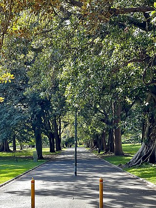
A memorial of Busby's Bore located in Centennial Park, erected in 1988, pictured in 2017.Fountain in Hyde Park, commemorating Sydney's second source of water and its first piped water supply, pictured in 2019.
By the 1820s, the Tank Stream, Sydney's original water supply, had become little more than an open sewer, and the growing colony had become reliant on wells or water carted from the Lachlan Swamps. In 1826, Busby recommended that water from the Lachlan Swamps be delivered to a reservoir at the Racecourse (now Hyde Park) via a tunnel (or 'bore'). The reservoir was not approved but construction of the tunnel began in September 1827.[5] The Bore was not completed until 1837[6] but began supplying drinkable water in 1830.
The construction of Busby's Bore, a water supply tunnel extending from Centennial Park to Hyde Park, began in September 1827 and was completed 10 years later. The bore was designed to carry water from the Lachlan Swamp, now Centennial and Queen's Parks. It would supply the "rising capital of Australia", as Sydney was described in the Report of a Committee of the Legislative Council appointed to enquire into the state of the tunnel and outstanding wage claims in 1837.[1]
The water was gravity fed, the fall being 53 centimetres (1ft 9in) over the 3.6 kilometres (2+1⁄4mi) from end to end, to feed out at Hyde Park at a height sufficient to allow the supply of the General Hospital in Macquarie Street. The tunnel had to be re-routed around the sites of the Sydney Football Stadium and the Sydney Cricket Ground and through the Showground because of quicksand encountered in Moore Park.[1] The Bore commenced at what is now Busby's Pond, close to the present Lang Road entrance to Centennial Park and ended in the present Hyde Park near the Oxford Street entrance. From there, a line of pipe supported on trestles extended to a point near the corner of Park and Elizabeth Streets.
John Busby had been employed as a mineral and water surveyor in England, Ireland and Scotland. He applied to the English Colonial Office for employment in NSW. Lord Bathurst, then Secretary of State, appointed him as Mineral Surveyor and Civil Engineer with particular attention to "the management of coal mines [and] in supplying the Town of Sydney with water". Busby arrived in Sydney in 1824 aged 59. He was employed as engineer at the Newcastle Coal Mines and on the breakwater then under construction there. However, his major task was to undertake surveys with a view to obtaining a permanent and adequate water supply for Sydney.[1]
During Busby's time at Newcastle, the Sydney domestic water still came from the virtually defunct and certainly highly polluted Tank Stream and a spring at Ultimo and another near Oxford Street. These were supplemented by wells both public and private. Many of these, especially those in the north of the town, were contaminated.[1]
At the start of construction Busby engaged his son, Alexander, as his assistant, but the appointment was disallowed in London. William Busby then acted as assistant at his fathers expense. There were three free overseers but these were for the first year only. Apart from these, the whole of the work was performed by convicts. Between 50 and 140 were employed working 24 hours a day in three eight-hour shifts, a common practice in mining since it prevented an unnecessary buildup of underground water. Busby claimed that not 1 in 10 of the men were trained stone miners, that the rest had to be trained on the job. He also complained of their "vicious, drunken and idle habits" and alleged that they were often absent as they preferred to work illicitly on their own account in the town. False returns of work were made by their convict overseers. "One third of the time lost [could] be ascribed to the workmen, and the villainy of the overseers" sent to the bore. Such was the character of the men employed, that their acquired constant vigilance, though such was their character that Busby was afraid ever to enter the underground workings.' This is not surprising given the working conditions. The prisoners were often up to their waists in water. Most of the work was by pick through rock. Gunpowder was used occasionally, but when this occurred the blast fouled the air in the tunnel and filled it with smoke.[1]
Work started at the Hyde Park end and progressed along South Head Road, now Oxford Street, turning west of that road at Dowling Street, then across the west corner of Victoria Barracks to Moore Park Road. The route traversed several springs and low lying basins which drained into the bore. Thus by 1830, with the tunnel well short of the Lachlan Swamp, a pipe at Hyde Park began to supply pure, filtered water and the supply increased with the length of the bore. Offcuts from the tunnel also trapped sources of ground water.[1]
In 1833, pipes were laid to the Port to allow ships to be supplied. In 1837 the tunnel reached a point near what is now the corner of Cook and Lang Roads. The only work outstanding was an open cut into the swamp itself and the construction of reservoirs or holding dams at each end. There is no evidence that these were ever built, though some sort of channel seems to have been cut at the south end of the tunnel. Major Barney, Commander of the Royal Engineers, was called to inspect the work. Although critical of the site of the tunnel Barney considered the structure to be of professional merit and fairly done.[1] Starting in 1844, reticulation pipes were laid, allowing houses to be connected, as well as the establishment of a number of public fountains. In 1854, supply was supplemented with the installation of a small pumping station at the lower end of the swamp, as well as a number of small dams. In 1872, the Bore was cleaned and some irregularities removed, increasing the tunnel flow to about 4.5 megalitres (160×10^3cuft) per day.
Busby, then 72 years old, retired to his property, Kirkton, between Branxton and Singleton in the Hunter Valley where he died in 1857.[1]
The creation of a municipal water supply in the form of Busby's Bore highlighted the need for an administration to control its use. Municipal instructions were discussed for the colony in the early 1830s but met with fears in the community that such institutions would impose a burden of taxes or levies.[1]
In 1842 the Sydney Corporation was formed. The Sydney Corporation endeavoured to squeeze as much revenue as possible from Busby's Bore and ignored public demands for planning towards the development of new and more suitable sources. In 1851 Sydney manufacturers expressed a total lack of confidence in the Sydney Corporation after its failure to fulfil its contracts with new industrial developments such as Tooth's Brewery and Sugar Company.[1]
The length of time to complete the bore, that it relied on the simple mechanism of mechanical feed and that it and its successor, the Botany Bay Swamps Scheme, tied up land suitable for industrial development in water reserves had a significant impact on the shape and development of Sydney. The bore can also be seen as having a critical role in forcing the creation of municipal administration in the colony.[7][1]
Description
A section of wooden pipe from Busby's Bore, on display at the Powerhouse MuseumMap showing the route of the tunnel (1919).
The Bore was built by convict labour, mostly through solid sandstone. It averaged 1.5 metres (5ft) high by 1.2 metres (4ft) wide, though it varied from 0.9 metres (3ft) by 0.9 metres (3ft) to 3.4 metres (11ft) high. The completed Bore delivered about 1.5 megalitres (330,000impgal; 400,000USgal) water per day. Not all went to plan as there were injuries.[9][10]
Starting in 1859, Busby's Bore was supplemented and later supplanted by water pumped from Botany Swamps.[11] In 1934, part of the Bore under Oxford Street was filled with sand to remove the risk of subsidence under the tram lines.[12][13]
1837–Tunnel completed: 1.5 to 1.8 megalitres (53×10^3 to 64×10^3cuft) per day to water carts
1844–General pipe reticulation
1872–Refurbishment and cleanout of tunnel: 6 megalitres (210×10^3cuft) per day
1881–Some pipes laid inside tunnel in Oxford Street to reduce tainting from coal tar laid on road surface
1890–Superseded by other schemes
1902–Botanic Gardens supply only
1934–Oxford Street section backfilled with sand when the weight of tram traffic caused stone slabs under Oxford Street to collapse
2004–Proposal to reactivate Bore to supply city parks and gardens
2006–NSW Government allocates funds for restoration of the Bore to supply parks of Sydney central business district.[16][17]
Commemorative items
1962–A fountain was provided by Sydney City Council to commemorate "Sydney's second source of water and its first piped water supply." The fountain is situated in Hyde Park, near the corner of St James Road and Elizabeth Street, Sydney.[18]
1988–A cairn was placed in Centennial Park commemorating Busby's Bore, the centenary of the Water Board and the dedication of Centennial Park. The cairn is situated on Grand Drive, Centennial Park approximately 100 metres east of the Robertson Road Gates.[19]
Heritage listing
As at 10 September 1997, Busby's Bore is a unique engineering achievement which played a crucial role in the development of urban Sydney. As a product of convict labour and a major factor in the establishment of local administration in NSW (in the form of the Sydney Corporation) the bore is associated with the important steps that changed Sydney from penal colony to colonial trading port.[1]
The fabric of the bore and associated archaeological deposits possess research potential relating to substantive historical and scientific questions relating to 19th century work and technology and to changes in the environment.[1]
The intactness of the bore and the fact that it is still in use make it a rare survivor from the first half of the 19th century within urban Sydney.[20][1]
The place is important in demonstrating the course, or pattern, of cultural or natural history in New South Wales.
Busby's Bore, as a most important public work between 1827 and 1837 and Sydney's main water supply between 1837 and 1852, is a physical remnant of many of the major processes which have shaped modern Sydney.[1]
Busby's Bore was an important factor leading to the establishment of the Sydney Corporation in 1842. It highlights the Colonial Government's lack of interest in managing the problems caused by Sydney's fast growing urban population.[1]
The bore is associated with Busby and Commissioner Bigge and symbolises their aspirations for Sydney and themselves.[21][1]
The place has a strong or special association with a particular community or cultural group in New South Wales for social, cultural or spiritual reasons.
Contemporary Community Esteem – The community has demonstrated its esteem for this item through the making of a Permanent Conservation Order. It is known to be valued by groups such as the Institute for Engineers, The National Trust and Local Historical Societies.[21][1]
The place has potential to yield information that will contribute to an understanding of the cultural or natural history of New South Wales.
The bore's fabric possesses research potential regarding its construction techniques, the technology and materials available in the colony at the time, convict working conditions, the history of its use through changes made to it over time and the success of government regulation of the water supply through evidence of illegal entries.[1]
The archaeological deposits surrounding the bore may also provide evidence of its use and construction. Archaeological deposits within the curtilage of the bore may possess research potential relating to; aboriginal occupation of the area, environmental changes since colonisation including the introduction of new species, grazing, draining of swamps and development and the development of the Royal Agricultural Society's Showground.[22][1]
The place possesses uncommon, rare or endangered aspects of the cultural or natural history of New South Wales.
The intactness of this early 19th century, convict built water supply makes it a rare survivor from this period within urban Sydney. As the main water supply to Sydney from 1837 to 1853 the bore is a unique item.[23][1]
The place is important in demonstrating the principal characteristics of a class of cultural or natural places/environments in New South Wales.
The bore is representative of English rock mining techniques of the period and of rock mining in other parts of Australia. It is also representative of public works carried out by convict labour and 19th century engineering techniques.[24][1]
Hyde Park, Sydney, is an urban park, of 16.2-hectare (40-acre), located in the central business district of Sydney, in the City of Sydney local government area of New South Wales, Australia. It is the oldest public parkland in Australia. Hyde Park is on the eastern fringe of the Sydney city centre and is approximately rectangular in shape, being squared at the southern end and rounded at the northern end. It is bordered on the west by Elizabeth Street, on the east by College Street, on the north by St James Road and Prince Albert Road and on the south by Liverpool Street.
John Busby was an English-born surveyor and civil engineer, active in Australia.
St James railway station is a heritage-listed underground commuter rail station that is located on the City Circle, at the northern end of Hyde Park in the Sydney central business district of New South Wales, Australia. It is served by Sydney Trains T2 Inner West & Leppington, T3 Bankstown & T8 Airport & South line services. It is named after the nearby St James' Church. It was added to the New South Wales State Heritage Register on 2 April 1999.
Moore Park is a suburb in the Eastern Suburbs of Sydney located 3 kilometres (1.9 mi) from the CBD, in the state of New South Wales, Australia. It is part of local government area of the City of Sydney.
The Domain is a heritage-listed 34-hectare (84-acre) area of open space on the eastern fringe of the Sydney central business district, in the City of Sydney local government area of New South Wales, Australia. Separating the central business district from Woolloomooloo, The Domain adjoins the Royal Botanic Garden and is managed by The Royal Botanic Gardens and Domain Trust, a division of the NSW Office of Environment and Heritage, an agency of the Government of New South Wales. The Domain is used as a venue for outdoor concerts, open-air events, large political gatherings and rallies, as well as being used daily by the people of Sydney for exercise and relaxation. Along with the Royal Botanic Garden, The Domain was added to the New South Wales State Heritage Register on 2 April 1999.
The Tank Stream is a heritage-listed former fresh water tributary of Sydney Cove and now tunnel and watercourse located in the Sydney central business district, in the City of Sydney local government area of New South Wales, Australia. The Tank Stream was the fresh water supply for the fledgling colony of New South Wales in the late 18th century. Today it is little more than a storm water drain. It originated from a swamp to the west of present-day Hyde Park and at high tide entered Sydney Cove at what is now the intersection of Bridge and Pitt Streets in the Sydney central business district. The catchment was 65 hectares, corresponding roughly the size of the Sydney central business district. It was added to the New South Wales State Heritage Register on 2 April 1999.
Victoria Barracks is an Australian Army base in Sydney, New South Wales, Australia. Victoria Barracks is located in the suburb of Paddington, between Oxford Street and Moore Park Road. It is just north of the Moore Park, the Sydney Cricket Ground and Sydney Football Stadium. Victoria Barracks houses the Headquarters Forces Command.
The Upper Nepean Scheme is a series of dams and weirs in the catchments of the Cataract, Cordeaux, Avon and Nepean rivers of New South Wales, Australia. The scheme includes four dams and two weirs, and a gravity-fed canal system that feeds into a large storage reservoir to provide water to the Macarthur and Illawarra regions, the Wollondilly Shire, and metropolitan Sydney. The four dams and associated infrastructure are individually listed on the New South Wales State Heritage Register.
The Woronora River is a perennial river of the Sydney Basin, located in the Sutherland Shire local government area of Greater Metropolitan Sydney, approximately 22 kilometres (14 mi) south of the Sydney central business district, in New South Wales, Australia.
The Prospect Reservoir is a heritage-listed 50,200-megalitre potable water supply and storage reservoir created by the Prospect Dam, across the Prospect Creek located in the Western Sydney suburb of Prospect, in New South Wales, Australia. The eastern bounds of the reservoir are a recreational area and the western periphery are within the bounds of Western Sydney Parklands. It was added to the New South Wales State Heritage Register on 18 November 1999.
Bathurst Street is a street in the Sydney central business district in New South Wales, Australia. Bathurst Street runs for 650 metres (2,130 ft) in a west–east direction with traffic flowing in this direction only. It is situated in the southern portion of the central business district. The western terminus of Bathurst Street is at Harbour Street, Darling Harbour, with the eastern terminus at Elizabeth Street, adjacent to Hyde Park.
Centennial Parklands is the name given to a group of three urban parklands located in the eastern suburbs of Sydney, New South Wales, Australia. Comprising approximately 360 hectares, the lands encompass Centennial Park, Moore Park and Queens Park. The Parklands are listed on the New South Wales Heritage Register, with various components of national, state or local heritage significance. The parks are contained within the local government areas of City of Randwick, Waverley Municipal Council, and City of Sydney.
Petersham Reservoir is a heritage-listed water reservoir at New Canterbury Road, Petersham, Inner West Council, Sydney New South Wales, Australia. It was designed and built by the New South Wales Public Works Department. It is also known as Petersham Service Reservoir and WS089. The property is owned by Sydney Water. It was added to the New South Wales State Heritage Register on 18 November 1999.
The Upper Canal System, also called the Southern Railway Aqueduct and the Cataract Tunnel, is a heritage-listed operational gravity-fed aqueduct that supplies some of the potable water for Sydney, in New South Wales, Australia. The aqueduct comprises 54 kilometres (34 mi) of open canals, tunnels, and closed pipelines that connect the Upper Nepean Scheme with the Prospect Reservoir. The aqueduct is managed by the Sydney Catchment Authority on behalf of WaterNSW, an agency of the Government of New South Wales. It was listed on the New South Wales State Heritage Register on 18 November 1999.
The Bondi Ocean Outfall Sewer is a heritage-listed sewerage infrastructure at Blair Street, North Bondi, Sydney, Australia. The sewer line commences at the intersection of Oxford Street and College Street in Darlinghurst and then travels in a more-or-less easterly direction for 6.1 kilometres (3.8 mi) passing through a number of suburbs until it reaches Blair Street in North Bondi. It was designed and built by the Public Works Department between 1880 and 1889. It is also known as BOOS (Bondi Ocean Outfall Sewer) and Main Northern Ocean Outfall Sewer. The property is owned by Sydney Water.
The Waverley Reservoirs are four reservoirs, of which two are heritage-listed, located at Paul Street, Bondi Junction, Waverley Municipality, New South Wales, Australia. They were designed and built by the Public Works Department. The property is owned by Sydney Water, an agency of the Government of New South Wales. The properties were added to the New South Wales State Heritage Register on 18 November 1999 and 15 November 2002 respectively.
The Woollahra Reservoir or WS022 is a heritage-listed underground reservoir at 5R Oxford Street, Centennial Park, New South Wales, Australia. It was designed and built by the NSW Public Works Department. The property is owned by Sydney Water. A sign attached to a building on the site states that this is known as "Centennial Park number 1 Water Reservoir Underground WS0022". The reservoir is adjacent to Centennial Park Reservoir. This reservoir is closer to York Street than Centennial Park Reservoir. The area is enclosed by a high fence and a sign on the main gate states: WARNING KEEP OUT" and that trespassers may be prosecuted.
The Centennial Park Reservoir or WS001 is a heritage-listed underground reservoir at 3R Oxford Street, Centennial Park, New South Wales, Australia. It was designed and built by NSW Public Works Department from 1896 to 1898. The property is owned by Sydney Water.
The Crown Street Reservoir is a heritage-listed reservoir located at 285 Crown Street, Surry Hills, City of Sydney, New South Wales, Australia. It was built by Donohoe and Vaughan. It is also known as Crown Street Reservoir & Site and WS 0034. The property is owned by Sydney Water, an agency of the Government of New South Wales. It was added to the New South Wales State Heritage Register on 18 November 1999.
Rockwall is a heritage-listed house and former school at 7 Rockwall Crescent in the inner city Sydney suburb of Potts Point in the City of Sydney local government area of New South Wales, Australia. It was designed by John Verge and built from 1831 to 1837. It was added to the New South Wales State Heritage Register on 2 April 1999.
↑ "ANCIENT BORE". The Sun. No.7610. New South Wales, Australia. 23 May 1934. p.19 (LAST RACE EDITION). Retrieved 17 April 2017– via National Library of Australia.
This page is based on this Wikipedia article Text is available under the CC BY-SA 4.0 license; additional terms may apply. Images, videos and audio are available under their respective licenses.


