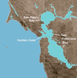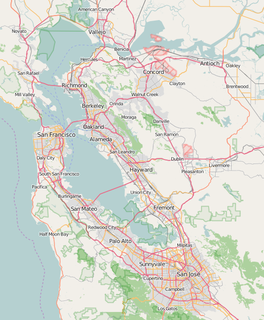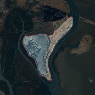
San Pablo Bay is a tidal estuary that forms the northern extension of San Francisco Bay in the East Bay and North Bay regions of the San Francisco Bay Area in northern California.

Sonoma Creek is a 33.4-mile-long (53.8 km) stream in northern California. It is one of two principal drainages of southern Sonoma County, California, with headwaters rising in the rugged hills of Sugarloaf Ridge State Park and discharging to San Pablo Bay, the northern arm of San Francisco Bay. The watershed drained by Sonoma Creek is roughly equivalent to the wine region of Sonoma Valley, an area of about 170 square miles (440 km2). The State of California has designated the Sonoma Creek watershed as a “Critical Coastal Water Resource”. To the east of this generally rectangular watershed is the Napa River watershed, and to the west are the Petaluma River and Tolay Creek watersheds.

The Napa Sonoma Marsh is a wetland at the northern edge of San Pablo Bay, which is a northern arm of the San Francisco Bay in California, United States. This marsh has an area of 48,000 acres (194 km2), of which 13,000 acres (53 km2) are abandoned salt evaporation ponds. The United States Government has designated 13,000 acres (53 km2) in the Napa Sonoma Marsh as the San Pablo Bay National Wildlife Refuge.

Hog Island is an island in the wetlands of the Petaluma River in Sonoma County, California, located at 38°09′33″N122°32′18″W near the Marin County line. San Antonio Creek enters the river just west of this island. It is mentioned in a newspaper article from 1914.

Wingo is a ghost town located in Sonoma County, California in the United States. It can be found on older maps as a dot along the sloughs of Sonoma Creek, south of the city of Sonoma and east of Schellville.

Joice Island is a small island in Grizzly Bay in California. It is part of Suisun Marsh, and has been used for hunting since the late 19th century. After a failed attempt to reclaim the land for asparagus and alfalfa farming in the early 1900s, Joice Island spent several decades as a wildlife refuge before being opened to the public for hunting in 1964. Currently, the upper portion of Joice Island is part of the California Department of Fish and Wildlife's Grizzly Island Wildlife Area; fishing, as well as the hunting of waterfowl and pigs, is permitted there on a limited basis.

Hammond Island is a small island in Suisun Bay, California. It is part of Solano County. Its coordinates are 38°06′18″N121°56′15″W. An 1850 survey map of the San Francisco Bay area made by Cadwalader Ringgold shows islands partially covering some of the current area of Hammond Island, labeled "Davis Island" and "Warrington Island".

Grizzly Island is a small island in Grizzly Bay in the San Francisco Bay Area of California. It is part of Solano County, partially managed by Reclamation Districts 2112, 2129 and 2136. Its coordinates are 38°09′05″N121°58′22″W. Islands that partially cover some of its current area, labelled "Warrington Island" and "Davis Island", are shown on an 1850 survey map of the San Francisco Bay area made by Cadwalader Ringgold and an 1854 map of the area by Henry Lange. It is labeled, along with Deadman Island, Joice Island, Simmons Island, Ryer Island and Roe Island, on a 1902 USGS map of the area.

Simmons Island is a small island in Grizzly Bay in the San Francisco Bay Area of California. It is part of Solano County, and included within Reclamation District 2127. Its coordinates are 38°05′49″N121°59′26″W. It is shown as "Simmons Island" on an 1850 survey map of the San Francisco Bay area made by Cadwalader Ringgold, and as "Simons Island" on an 1854 map of the area by Henry Lange. It is labeled, along with Deadman Island, Joice Island, Grizzly Island, Ryer Island and Roe Island, on a 1902 USGS map of the area.

Kimball Island is a small island in the Sacramento–San Joaquin River Delta. Since its discovery, it has been used to grow barley, farm fish, cultivate cannabis, and as residential land. Currently, however, it is uninhabited; since 2000, it has been left to "forever be a wetland habitat".

Chain Island is an island in Suisun Bay, downstream of the Sacramento–San Joaquin River Delta in northern California. In the late 1800s, it was considered an "obstruction to navigation" on the Sacramento River. As it was built up significantly from hydraulic mining tailings upstream on the river, plans were made in the early 20th century to remove it and recoup costs by mining the debris. However, this never happened; it was sold by the California State Lands Commission to a private individual in 1959, who listed it for sale the next year.

Bull Island is an island in the Napa River, in Napa County, California. From the 1880s onward, it was owned by the Money family, who constructed levees and reclaimed the land, using it to farm grain and potatoes. It was described as a "fine ranch" in 1918. After a levee failure in 1954, it gradually eroded into the water, becoming a salt marsh; for some time afterward, it was used as an evaporation pond for the industrial production of salt by the Leslie Salt Company. Beginning in the 1970s, Bull Island was proposed for inclusion in a variety of riparian preservation projects, but none came to fruition. However, in 1997, the Money family sold it to the California State Lands Commission, who turned it into a wildlife habitat; today it is administered as part of the Fagan Marsh Ecological Reserve, and hosts animals of numerous endangered species.

Little Island is a partially submerged marsh island in the Napa Slough, branching off from the Napa River upstream of San Pablo Bay. It is almost entirely in Napa County, California, although part of its southern tip is in Solano County; it is managed as part of the Napa-Sonoma Marshes Wildlife Area. Its coordinates are 38°10′48″N122°21′05″W, and the United States Geological Survey measured its elevation as 3 ft (0.91 m) in 1981.

Coon Island is an island in the Napa River, upstream of San Pablo Bay. It is in Napa County, California, and managed as part of the Napa-Sonoma Marshes Wildlife Area. Its coordinates are 38°11′33″N122°19′24″W, and the United States Geological Survey measured its elevation as 3 ft (0.91 m) in 1981.

Edgerly Island is an island in the Napa River, upstream of San Pablo Bay. It is in Napa County, California, and managed as part of the Napa-Sonoma Marshes Wildlife Area. Its coordinates are 38°12′12″N122°18′52″W, and the United States Geological Survey measured its elevation as 3 ft (0.91 m) in 1981.

Green Island is an island in the Napa River, upstream of San Pablo Bay. It is in Napa County, California, and managed as part of the Napa-Sonoma Marshes Wildlife Area. Its coordinates are 38°12′09″N122°18′16″W, and the United States Geological Survey measured its elevation as 23 ft (7.0 m) in 1981. It, long with Island No. 1, Island No. 2 and Tubbs Island, are labeled on a 1902 USGS map of the area.

Island No. 2 is a mostly-submerged island in Solano County, California. Formerly swampland, it was reclaimed into productive farmland, and became the subject of lengthy legal disputes in the early 20th century. Since then, it has become again submerged, and is now part of the Napa-Sonoma Marshes Wildlife Area.

Knight Island is a mostly-submerged island in the Napa River, upstream of San Pablo Bay. It is in Solano County, California, and managed as part of the Napa-Sonoma Marshes Wildlife Area. Its coordinates are 38°08′09″N122°17′58″W, and the United States Geological Survey measured its elevation as 3 ft (0.91 m) in 1981.

Russ Island is a mostly-submerged island in the Napa River, in Napa and Solano Counties, California. It was reclaimed in the late 19th century, and spent many years as productive farmland; in the 1950s, however, it was purchased by the Leslie Salt Company, and deliberately submerged to serve as an evaporation pond for salt production. The company allowed parts of it to be used for duck hunting. By the 1990s, it was acquired by the California Department of Fish and Game, who turned it into a wildlife preserve, and allowed it to return to marshland; it is now managed as part of the Napa-Sonoma Marshes Wildlife Area, and is open to hunting, fishing, birdwatching, photography and hiking activities.

Tubbs Island is an island in San Pablo Bay. It is in Sonoma County, California, and parts of it are managed as part of the Napa-Sonoma Marshes Wildlife Area. Its coordinates are 38°08′59″N122°25′27″W, and the United States Geological Survey measured its elevation as 0 ft (0 m) in 1981. It, long with Island No. 1, Island No. 2 and Green Island, are labeled on a 1902 USGS map of the area.


