Russ Island

Last updated

Russ Island
NASA Worldwind, USGS imagery map, Russ Island, California.png
USGS aerial imagery of Russ Island
Location Map San Francisco Bay Area.png
Red pog.svg
Russ Island
USA California location map.svg
Red pog.svg
Russ Island
Usa edcp location map.svg
Red pog.svg
Russ Island
Geography
Location Northern California
Coordinates 38°10′13″N122°18′44″W / 38.17028°N 122.31222°W / 38.17028; -122.31222 (Russ Island) [1]
Adjacent to Napa River
Highest elevation3 ft (0.9 m) [1]
Administration
United States
StateFlag of California.svg  California
County Napa and Solano

Russ Island is a mostly-submerged island in the Napa River, in Napa and Solano Counties, California. It was reclaimed in the late 19th century, and spent many years as productive farmland; in the 1950s, however, it was purchased by the Leslie Salt Company, and deliberately submerged to serve as an evaporation pond for salt production. The company allowed parts of it to be used for duck hunting. By the 1990s, it was acquired by the California Department of Fish and Game, who turned it into a wildlife preserve, and allowed it to return to marshland; it is now managed as part of the Napa-Sonoma Marshes Wildlife Area, and is open to hunting, fishing, birdwatching, photography and hiking activities.

Contents

Geography

An aerial view, looking toward the west, of the Napa River where it flows into San Pablo Bay through Vallejo. Islands visible include, from bottom of image: Mare, No. 1, Knight, Russ, No. 2, Green, Bull, Edgerly, Coon, Little, and Tubbs. Napa River in Vallejo.jpg
An aerial view, looking toward the west, of the Napa River where it flows into San Pablo Bay through Vallejo. Islands visible include, from bottom of image: Mare, No. 1, Knight, Russ, No. 2, Green, Bull, Edgerly, Coon, Little, and Tubbs.

Russ Island is located in the Napa River, upstream of San Pablo Bay (an embayment of San Francisco Bay). [2] Its north end is in Napa County and its south end is in Solano County. [3] Russ Island is bounded to east by the Napa River, [4] beyond which is the city of American Canyon. [5] To its southeast, on the other side of the Napa River, is Vallejo. [5] To its south is South Slough (beyond which is Knight Island) and to its southwest is China Slough [4] (beyond which is Island No. 2). [5] To its west is Devils Slough, [4] beyond which is Little Island; to its north is Napa Slough, beyond which are Coon Island and Edgerley Island. [5]

The United States Geological Survey measured its elevation as 3 ft (0.91 m) in 1981. [1] However, it is mostly flooded: [6] [7] in 1998, it was described as "marshy with tall tulles and mud flats, making it impossible to use a wheeled vehicle". [8]

History

Initial settlement and farming

An official 1876 map of Napa County shows many islands of the Napa River in their present locations, albeit divided by levees and sloughs along different boundaries than they would later come to have. [9] [10] [3] The land currently comprising Russ Island was shown, on this map, divided between a number of landowners: Harper & Langstaff, L.A. Bly, J.W. Pearson & Co., H.H. Gray, S. Gracy, H.S. King, F. Oppenheim, and J. Hughes. [9] By 1895, the only landowners on the island were shown as L.A. Bly, W.J. Little, and C.E. Davis. [11] By 1902, a United States Geological Survey map shows Russ Island as one mostly contiguous island, but covered in marsh and crossed by numerous sloughs; [12] by 1916, USGS maps show it as being almost fully surrounded by levees. [13] On the 1916 survey, as well as a 1942 survey, it is mislabeled as nearby "Knight Island"; [13] [14] however, by 1949 the error was corrected, [10] and it is shown as "Russ Island" in all maps thereafter. [3]

In 1914, Frank E. Knight was leasing the island from the Z. Russ & Sons Company and the Russ Investment Company. [15] [16] In May of that year, Russ's workers entered the island "for the purpose of repairing the levees, promising to protect [Knight]'s interests there"; Knight alleged that "the work was so done that the levees were partially destroyed, the sluice gates ruined and the wharves demolished". [15] Knight subsequently filed a lawsuit against Russ in January 1916, seeking damages of $26,500 ($712,664 in 2022). [15] [16]

In 1921, Russ Island was one of the "better known" of multiple islands lying in "an area of very fertile delta lands lying in the triangle whose points are Vallejo, Napa and Ignacio, which is bounded on the west by the Nama River, and on the northeast by Sonoma Creek, and other sloughs". [17] The area, at the time, was not "traveled by any through country or State road"; [17] a city engineer of nearby Vallejo proposed to build a highway through the area. [17]

In 1926, a large plot of Harding grass was "doing well" on the island; [18] by November 1926, it was "doing exceptionally well". [19]

Incinerator proposal

In April 1932, the Napa Fertilizer and Reduction Company (whose partners included one William N. Russ) planned to acquire a 25-year garbage disposal contract with the City and County of San Francisco; it proposed to construct a garbage incinerator on Russ Island. [20] [21]

The project met with vocal resistance from the Napa Chamber of Commerce, which passed a resolution opposing the project the same month. The Napa County Fish, Game and Forest Protective Association, which also passed resolutions to the same effect, "opposed the plan as being detrimental to hunting and fishing and to the general good of the county". [22] In May, the city attorney of county seat Napa wrote a resolution urging the county's Board of Supervisors to disallow construction of the incinerator, which was passed unanimously by the city council. [23] Ultimately, they "firmly refused" the construction of the plant, declaring themselves "opposed to the idea of garbage and refuse being shipped into this county in great quantities". [24] The project was blocked, [25] but would be "revived" in 1934 when "it became known that Commandant Yancey S. Williams of Mare Island Navy Yard had been asked the attitude of the government toward establishment of the project". [24] In response, directors of the Vallejo Chamber of Commerse "ordered a letter of protest sent to the Napa supervisors". [24]

Sheep and cattle ranching

Russ Island as it appears on a 1951 USGS topographic map. Russ Island, USGS map CA Cuttings Wharf 289711 1949 24000.png
Russ Island as it appears on a 1951 USGS topographic map.

In 1945, the entirety of Russ Island (comprising some 3,600 acres (1,500 ha)) was offered for sale for $190,000 ($3.09 million in 2022); the posting advertised "rich, level soil, well drained [...] perfect climate, no stock pests or cattle rustlers can approach ranch". [26] By 1946, William W. "Tiny" Naylor, a restaurateur from Beverly Hills, owned Russ Island, as well as nearby Little Island. [27] [28] At the time, the property was leased by the Crivelli Brothers, who used it to plant oats, barley and vetch. [4] Two years later, two cattlemen of Napa Valley (Andrew Pelissa and John Hale) purchased the island from Naylor, for approximately $185,000 ($2.25 million in 2022). [29] The transaction was completed in July 1948. [30] Pelissa and Hale ran sheep and cattle ranches on the island (as well as on other lands in Napa and Modoc counties). [31] Hubert Fruehauf, a farmer who took a "leading role in Napa County agriculture from the standpoint of both crop production and legislation", also leased Russ Island in the 20th century. [32]

In 1948, a rented monoplane crashed on the island, killing one passenger and critically injuring another. [33] The incident was subsequently investigated by the Civil Aeronautics Administration. [34] The next year, another crash would occur, when a training aircraft from nearby Hamilton Field "plunged into an oatfield". [35] The pilot, 2nd Lieutenant William Ocker, was ejected from the cockpit and killed instantly. The passenger, 1st Lieutenant Williard A. Smith, was seriously injured; he was freed from the wreckage by local farm workers who were out hunting pheasant. [35]

In November 1951, an agreement was reached for Pelissa to sell the island for $600,000 ($6.76 million in 2022) to S.J. Pringle, who was "acting as an agent for an undisclosed principal". [36] According to the title company, it was "the largest single price ever paid for a tract in the county's history". [36]

Salt production

In May 1952, the island was sold to the Leslie Salt Company, [37] at the time "the largest salt producer on the West Coast and possibly the largest solar evaporation operation in the world". [38] It was one of several islands in the Napa River purchased by the company (the total purchase included Edgerly Island, Little Island, Knight Island, Banty Island, Island No. 2, and part of Island No. 1). Leslie planned to flood and dike the islands to develop them into salt ponds; [38] the entire project was projected to cost $3,500,000 ($38.6 million in 2022), and be ready for the first harvest in 1958. [38] The salt was to be carried on barges down the Napa River, and primarily used in chemical plants. [38] During the 1950s, this project was carried out, and Russ Island became a salt evaporation pond. [39]

In September 1953, Russ Island was one of several areas added to the Napa Marshes waterfowl management area. Robert Lassen, supervisor of game for the district, said: "The Leslie Salt people have given the unattached hunter a big break in allowing the Department of Fish and Game to come in and manage their Napa marshes for hunting [...] there will be no limit on the number of hunters allowed into the Department-controlled area and no trespassing will be permitted elsewhere". [40] Duck hunting on the island proved successful: in 1957, the Napa Duck Club had blinds set up there, [41] and in 1959 Ed Hale wrote for the Napa Journal that "it was no trick at all to get our limit of ten bull cans". [42]

In 1991, Russ Island continued to be operated by Leslie Salt. [43] However, within several years, salt harvesting operations on the islands would cease. [39]

Wildlife area

In the 1990s, the California Department of Fish and Game began acquiring the areas which now comprise the Napa-Sonoma Marshes Wildlife Area, including Russ Island. In 2003, the DFG purchased the Napa Plant Site from Leslie Salt (now a part of Cargill). [7] In the Napa-Sonoma Marshes Wildlife Area Land Management Plan, Russ Island is referred to as Napa River Unit Ponds 4 and 5. [7] :156 The area is used for hunting, fishing, bird watching, photography, and hiking. [39]

Related Research Articles

<span class="mw-page-title-main">San Pablo Bay</span> Tidal estuary in the San Francisco Bay Area

San Pablo Bay is a tidal estuary that forms the northern extension of San Francisco Bay in the East Bay and North Bay regions of the San Francisco Bay Area in northern California.

<span class="mw-page-title-main">Napa River</span> River in California, United States

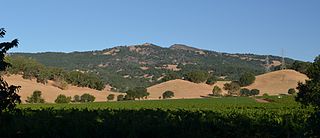
The Napa River is a river approximately 55 miles (89 km) long in the U.S. state of California. It drains a famous wine-growing region called the Napa Valley, in the mountains north of the San Francisco Bay. Milliken Creek and Mt. Veeder watersheds are a few of its many tributaries. The river mouth is at Vallejo, where the intertidal zone of fresh and salt waters flow into the Carquinez Strait and the San Pablo Bay.

<span class="mw-page-title-main">California State Route 37</span> Highway in California

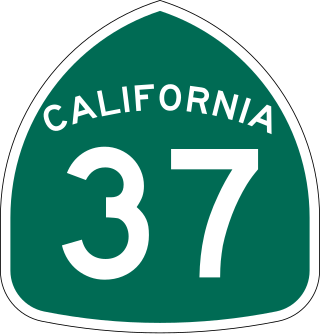
State Route 37 is a state highway in the U.S. state of California that runs 21 miles (34 km) along the northern shore of San Pablo Bay. It serves as a vital connection in the North Bay region of the San Francisco Bay Area, running from U.S. Route 101 in Novato, through northeastern Marin County, and the southern tips of both Sonoma and Solano Counties to Interstate 80 in Vallejo. Sonoma Raceway and Six Flags Discovery Kingdom are accessible from Highway 37.

Tolay Creek is a 12.5-mile-long (20.1 km) southward-flowing stream in southern Sonoma County, California, United States, which flows through Tolay Lake and ends in north San Pablo Bay.

Wingo is a ghost town located in Sonoma County, California in the United States. It can be found on older maps as a dot along the sloughs of Sonoma Creek, south of Sonoma and Schellville, and west of Buchli.

<span class="mw-page-title-main">Howell Mountains</span>

The Howell Mountains, which are also known as the Mt. George Range, are one of the California Coast Ranges. They divide the Suisun Valley on the east side, from Napa Valley on the west. Historically the southern part of the range has been referred to as both the Sierra de Suscol and as the Sierra de Napa.

<span class="mw-page-title-main">Sonoma Volcanics</span> Geologic formation of volcanic origin in California

The Sonoma Volcanics are a geologic formation of volcanic origin that is widespread in Napa and Sonoma counties, California. Most of the formation is Pliocene in age and includes obsidian, perlitic glass, diatomaceous mud, pyroclastic tuff, pumice, rhyolite tuffs, andesite breccias and interbedded volcanic (basalt) lava flows. The formation serves as the parent material for many of the soils in the Napa and Sonoma wine regions.

<span class="mw-page-title-main">Joice Island</span> Island in California

Joice Island is a small island in Grizzly Bay in California. It is part of Suisun Marsh, and has been used for hunting since the late 19th century. After a failed attempt to reclaim the land for asparagus and alfalfa farming in the early 1900s, Joice Island spent several decades as a wildlife refuge before being opened to the public for hunting in 1964. Currently, the upper portion of Joice Island is part of the California Department of Fish and Wildlife's Grizzly Island Wildlife Area; fishing, as well as the hunting of waterfowl and pigs, is permitted there on a limited basis.

<span class="mw-page-title-main">Grizzly Island</span> Island in California

Grizzly Island is a small island in Grizzly Bay in the San Francisco Bay Area of California. It is part of Solano County, partially managed by Reclamation Districts 2112, 2129 and 2136. Its coordinates are 38°09′05″N121°58′22″W. Islands that partially cover some of its current area, labelled "Warrington Island" and "Davis Island", are shown on an 1850 survey map of the San Francisco Bay area made by Cadwalader Ringgold and an 1854 map of the area by Henry Lange. It is labeled, along with Deadman Island, Joice Island, Simmons Island, Ryer Island and Roe Island, on a 1902 USGS map of the area.

<span class="mw-page-title-main">Van Sickle Island</span> Island in California

Van Sickle Island is an approximately 10,000-acre (4,000 ha) island in Suisun Bay, California. It is part of Solano County, and administered by Reclamation District 1607. Its coordinates are 38°04′00″N121°54′04″W, and in 1981 the United States Geological Survey recorded its elevation as 0 ft (0 m). The island's land is divided into 22 privately-owned parcels, used primarily for duck clubs and private residences. A railroad bridge constructed in 1913 once connected it to Montezuma and Chipps Island, from which a ferry connected to Mallard Island and Pittsburg. The rail service was discontinued and the bridges no longer exist; currently, the island is accessible by water, as well as by road on bridges from Hammond Island and Wheeler Island.

<span class="mw-page-title-main">Chain Island</span> Island in California

Chain Island is an island in Suisun Bay, downstream of the Sacramento–San Joaquin River Delta in northern California, and the westernmost piece of land in Sacramento County. In the late 1800s, it was considered an "obstruction to navigation" on the Sacramento River. As it was built up significantly from hydraulic mining tailings upstream on the river, plans were made in the early 20th century to remove it and recoup costs by mining the debris. However, this never happened; it was sold by the California State Lands Commission to a private individual in 1959, who listed it for sale the next year. In April 2016, the deed for the island was transferred; as of December 2022, Sacramento County assesses its land value at $18,622.

<span class="mw-page-title-main">Bull Island (California)</span> Island in the Napa River in California

Bull Island is an island in the Napa River, in Napa County, California. From the 1880s onward, it was owned by the Money family, who constructed levees and reclaimed the land, using it to farm grain and potatoes. It was described as a "fine ranch" in 1918. After a levee failure in 1954, it gradually eroded into the water, becoming a salt marsh; for some time afterward, it was used as an evaporation pond for the industrial production of salt by the Leslie Salt Company. Beginning in the 1970s, Bull Island was proposed for inclusion in a variety of riparian preservation projects, but none came to fruition. However, in 1997, the Money family sold it to the California State Lands Commission, who turned it into a wildlife habitat; today it is administered as part of the Fagan Marsh Ecological Reserve, and hosts animals of numerous endangered species.

<span class="mw-page-title-main">Little Island (Napa County)</span> Island in California

Little Island is a partially submerged marsh island in the Napa Slough, branching off from the Napa River upstream of San Pablo Bay. It is almost entirely in Napa County, California, although part of its southern tip is in Solano County; it is managed as part of the Napa-Sonoma Marshes Wildlife Area. Its coordinates are 38°10′48″N122°21′05″W, and the United States Geological Survey measured its elevation as 3 ft (0.91 m) in 1981.

<span class="mw-page-title-main">Coon Island (California)</span> Island in California

Coon Island is an island in the Napa River, upstream of San Pablo Bay. It is in Napa County, California, and managed as part of the Napa-Sonoma Marshes Wildlife Area. Its coordinates are 38°11′33″N122°19′24″W, and the United States Geological Survey measured its elevation as 3 ft (0.91 m) in 1981.

<span class="mw-page-title-main">Edgerly Island</span> Island in California

Edgerly Island is an island in the Napa River, upstream of San Pablo Bay. It is in Napa County, California, and managed as part of the Napa-Sonoma Marshes Wildlife Area. Its coordinates are 38°12′12″N122°18′52″W, and the United States Geological Survey measured its elevation as 3 ft (0.91 m) in 1981.

<span class="mw-page-title-main">Green Island (California)</span> Island in California

Green Island is an island in the Napa River, upstream of San Pablo Bay. It is in Napa County, California, and managed as part of the Napa-Sonoma Marshes Wildlife Area. Its coordinates are 38°12′09″N122°18′16″W, and the United States Geological Survey measured its elevation as 23 ft (7.0 m) in 1981. It, long with Island No. 1, Island No. 2 and Tubbs Island, are labeled on a 1902 USGS map of the area.

<span class="mw-page-title-main">Island No. 1</span> Island in California

Island No. 1 is a partially submerged island in the Napa River, upstream of San Pablo Bay. It is in Napa and Solano County, California, and parts of it are managed as part of the Napa-Sonoma Marshes Wildlife Area. Its coordinates are 38°08′35″N122°20′40″W, and the United States Geological Survey measured its elevation as 3 ft (0.91 m) in 1981. It, along with Island No. 2, Green Island and Tubbs Island, are labeled on a 1902 USGS map of the area.

<span class="mw-page-title-main">Island No. 2</span> Island in California

Island No. 2 is a mostly-submerged island in Solano County, California. Formerly swampland, it was reclaimed into productive farmland, and became the subject of lengthy legal disputes in the early 20th century. Since then, it has become again submerged, and is now part of the Napa-Sonoma Marshes Wildlife Area.

<span class="mw-page-title-main">Knight Island (California)</span> Island in California

Knight Island is a mostly-submerged island in the Napa River, upstream of San Pablo Bay. It is in Solano County, California, and managed as part of the Napa-Sonoma Marshes Wildlife Area. Its coordinates are 38°08′09″N122°17′58″W, and the United States Geological Survey measured its elevation as 3 ft (0.91 m) in 1981.

<span class="mw-page-title-main">Tubbs Island</span> Island in California

Tubbs Island is an island in San Pablo Bay. It is in Sonoma County, California, and parts of it are managed as part of the Napa-Sonoma Marshes Wildlife Area. Its coordinates are 38°08′59″N122°25′27″W, and the United States Geological Survey measured its elevation as 0 ft (0 m) in 1981. It, long with Island No. 1, Island No. 2 and Green Island, are labeled on a 1902 USGS map of the area.

References

  1. 1 2 3 U.S. Geological Survey Geographic Names Information System: Russ Island
  2. California State Automobile Association (1999). San Francisco Bay Region (Map). 1:190,000. American Automobile Association.
  3. 1 2 3 "Topography, State of California: Cuttings Wharf Quadrangle". United States Geological Survey. 2012. Retrieved 15 January 2022.
  4. 1 2 3 4 "Building Upsurge Shown in Permits Issued in 1947: Ranch Sold For 185,000". The News and Napa's Illustrated Weekly. Napa, California. 1948-01-14. p. 5.
  5. 1 2 3 4 United States Geological Survey (1951). "Cuttings Wharf, California" (Map). United States Department of the Interior Geological Survey. 1:24000.
  6. "Directional Map Napa-Sonoma Marshes Wildlife Area". California Department of Fish and Wildlife, Bay Delta Region. May 2019. Archived from the original on 23 April 2020. Retrieved 26 February 2021.
  7. 1 2 3 URS Corporation (October 2011). "Napa-Sonoma Marshes Wildlife Area Land Management Plan". California Department of Fish and Game. Retrieved 26 February 2021.
  8. "Missing". The Napa Valley Register. Napa, California. 1998-06-23. p. 4.
  9. 1 2 "Official map of the County of Napa, California ..." Library of Congress.
  10. 1 2 "Topography, State of California: Cuttings Wharf Quadrangle". United States Geological Survey. 1949. Retrieved 15 January 2022.
  11. "Official map of the County of Napa, California : compiled from the official records and latest surveys". Library of Congress.
  12. Goode, R.U.; Fletcher, L.C. (1902). "Topography, State of California: Napa Quadrangle". United States Geological Survey. Retrieved 15 January 2022.
  13. 1 2 Marshall, R.B.; Davis, Geo. R.; Leavitt, J.B. (1916). "Topography, State of California: Mare Island Quadrangle". United States Geological Survey. Retrieved 15 January 2022.
  14. "Topography, State of California: Mare Island Quadrangle". War Department Corps of Engineers, U.S. Army. 1942. Retrieved 15 January 2022.
  15. 1 2 3 "Suit Filed". Napa Journal. Napa, California. 1916-01-19. p. 1.
  16. 1 2 "Demands $26,500 For Flood Damage". The Sacramento Bee. Sacramento, California. 1916-01-19. p. 9.
  17. 1 2 3 "Vallejo Proposes New Road To Bay Via San Rafael". The Sacramento Bee. Sacramento, California. 1921-05-18. p. 20.
  18. "Agricultural News". Napa Journal. Napa, California. 1926-10-06. p. 3.
  19. "Miscellaneous". The Californian. Salinas, California. 1926-11-08. p. 7.
  20. "Supervisors Take Action At Meeting Here Today". The Napa Valley Register. Napa, California. 1932-04-12. p. 1.
  21. "Russ Island Project". Santa Rosa Republican. Santa Rosa, California. 1932-04-13. p. 9.
  22. "Sportsmen Oppose Russ Incinerator". The Napa Valley Register. Napa, California. 1932-04-26. p. 1.
  23. "Wharf to be Completed By May 14 For Program". Napa Journal. Napa, California. 1932-05-05. p. 1.
  24. 1 2 3 "S.F. Promoters Revive Garbage Plan Project". The Napa Valley Register. Napa, California. 1934-03-15. p. 1.
  25. "Tucker Farm Center News". The St. Helena Star. St. Helena, California. 1932-05-20. p. 9.
  26. "A Stock Breeder's Paradise". The San Francisco Examiner. San Francisco, California. 1945-04-06. p. 23.
  27. "Restaurateur Buys 734 Acre Napa Tract". The Sacramento Bee. Sacramento, California. 1946-11-05. p. 10.
  28. "Local Notes". The St. Helena Star. St. Helena, California. 1946-11-15. p. 6.
  29. "Valley Cattlemen Buy Russ Island For $185,000". The St. Helena Star. St. Helena, California. 1948-01-09. p. 7.
  30. "Napa, Solano Land Is Sold For $185,000". The Sacramento Bee. Sacramento, California. 1948-07-01. p. 11.
  31. "Veola Pelissa". The Napa Valley Register. Napa, California. 2000-04-14. p. 17.
  32. "Profile: Hubert Fruehauf Is Farm, Civic Leader". The Napa Valley Register. Napa, California. 1953-09-03. p. 11.
  33. "Plane crash investigated". Napa Journal. Napa, California. 1948-03-05. p. 9.
  34. "Pilot Killed In Vallejo Crash". Santa Cruz Sentinel. Santa Cruz, California. 1948-03-01. p. 10.
  35. 1 2 "Trio of Napa pheasant hunters witness fatal Army air crash, aid in rescue of wounded flyer". Napa Journal. Napa, California. 1949-11-27. p. 1.
  36. 1 2 "Russ Island In Napa County Is Sold For $600,000". The Sacramento Bee. Sacramento, California. 1951-11-01. p. 48.
  37. "Daily Real Estate Transcript". The Napa Valley Register. Napa, California. 1952-05-29. p. 11.
  38. 1 2 3 4 "Salt plant will involve expenditure of $3,500,000". The Napa Valley Register. Napa, California. 1952-05-14. p. 16.
  39. 1 2 3 "Area History". California Department of Fish and Wildlife. 2021-11-01.
  40. "Napa Marshes Added To Fourteen Waterfowl Areas, Opens Oct. 16". The Napa Valley Register. Napa, California. 1953-09-29. p. 6.
  41. "Prospects For Ducks Said Good". The Napa Valley Register. Napa, California. 1957-08-22. p. 10.
  42. "Creel & Cartridge". Napa Journal. Napa, California. 1959-01-08. p. 8.
  43. "Andrew Pelissa". The Napa Valley Register. Napa, California. 1991-10-10. p. 8. Retrieved 2021-11-18 via Newspapers.com.