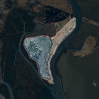
Belvedere is a residential incorporated city located on the San Francisco Bay in Marin County, California, United States. Consisting of two islands and a lagoon, it is connected to the Tiburon Peninsula by two causeways. At the 2020 census, the population was 2,126. The per capita income of Belvedere residents in 2000 was $250,000, but currently the average income is $283,000, making it one of the highest-income cities in California and the eighth highest-income community in the United States. Belvedere and Tiburon share a post office and the 94920 ZIP code.

San Rafael Bay is an embayment of San Pablo Bay, located in Marin County and the northern San Francisco Bay Area, California.

Belvedere Island is a rocky island in the San Francisco Bay in Marin County, California which was formerly separated by a marsh from the mainland, though has since been linked by two spits. Part of the town of Belvedere, California is located on the island.

Joice Island is a small island in Grizzly Bay in California. It is part of Suisun Marsh, and has been used for hunting since the late 19th century. After a failed attempt to reclaim the land for asparagus and alfalfa farming in the early 1900s, Joice Island spent several decades as a wildlife refuge before being opened to the public for hunting in 1964. Currently, the upper portion of Joice Island is part of the California Department of Fish and Wildlife's Grizzly Island Wildlife Area; fishing, as well as the hunting of waterfowl and pigs, is permitted there on a limited basis.

Simmons Island is a small island in Grizzly Bay in the San Francisco Bay Area of California. It is part of Solano County, and included within Reclamation District 2127. Its coordinates are 38°05′49″N121°59′26″W. It is shown as "Simmons Island" on an 1850 survey map of the San Francisco Bay area made by Cadwalader Ringgold, and as "Simons Island" on an 1854 map of the area by Henry Lange. It is labeled, along with Deadman Island, Joice Island, Grizzly Island, Ryer Island and Roe Island, on a 1902 USGS map of the area.

Mallard Island is a small island in Suisun Bay, at the confluence of the Sacramento and San Joaquin rivers. It is part of Contra Costa County, California. Its coordinates are 38°02′31″N121°55′07″W, and the United States Geological Survey measured its elevation as 3 ft (0.91 m) in 1981. It appears in a 1953 USGS map of the area.

Tinsley Island is a small island in the Sacramento–San Joaquin River Delta, in San Joaquin County, California, next to the Stockton Deepwater Shipping Channel. It was created in the 1930s, when dredging to improve the navigability of the San Joaquin River cut it off from Roberts Island. Since 1958, it has been owned by the St. Francis Yacht Club. In 1960, the club transported a lighthouse from San Francisco Bay to serve as its clubhouse, and in the same year began an annual "Stag Cruise"; as of 2024, the club still owns the island and maintains a clubhouse there.

Vulcan Island is a small island in the Sacramento–San Joaquin River Delta. It is part of San Joaquin County, California. Its coordinates are 37°59′21″N121°24′22″W, and the United States Geological Survey measured its elevation as 7 ft (2.1 m) in 1981. It appears on a 1952 USGS map of the area.

The Palm Tract is an island in the Sacramento–San Joaquin River Delta. It is part of Contra Costa County, California. It, along with Orwood Tract to the south, are managed by Reclamation District 2024. Its coordinates are 37°57′14″N121°35′22″W, and the United States Geological Survey measured its elevation as 10 ft (3.0 m) in 1981. It appears on 1913 and 1952 United States Geological Survey maps of the area.

Middle Ground Island is an island in Suisun Bay, an embayment of San Francisco Bay, downstream of the Sacramento–San Joaquin River Delta. It is part of Solano County, California, and not managed by any reclamation district. Its coordinates are 38°03′46″N121°58′53″W, and the United States Geological Survey measured its elevation as 0 ft (0 m) in 1981.

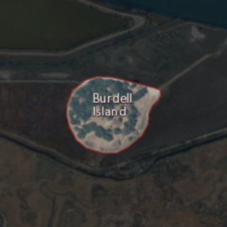
Burdell Island is a former island in the Petaluma River, upstream of San Pablo Bay. While it was previously surrounded by water and swampland, it is now surrounded mostly by dry land. It is part of Marin County, California. Its coordinates are 38°09′22″N122°33′17″W, and the United States Geological Survey gave its elevation as 52 ft (16 m) in 1981. It appears in a 1954 USGS map of the region.

Day Island is an island at the mouth of the Petaluma River in San Pablo Bay. It is part of Marin County, California. Its coordinates are 38°06′13″N122°29′26″W, and the United States Geological Survey measured its elevation as 105 ft (32 m) in 1981. It appears on a 1951 USGS map of the area, although it appears on maps from as old as 1873. The "1880 History of Marin County" by Alley, Bowen and Co. mentions "a man by name of Day" who "settled on an island in Novato township which has since borne his name" in 1851." To this day, there are still 2 houses on the island, one inhabited and one abandoned. The island is bordered by dirt and two lagoons to the west, and marshlands to the east, although it was once entirely surrounded by either marshland or water.

Neils Island is a former island in Sonoma County, California, close to the Petaluma River, upstream of San Pablo Bay. Its coordinates are 38°11′27″N122°34′41″W, and the United States Geological Survey measured its elevation as 82 ft (25 m) in 1981. It appears in a 1954 USGS map of the region.

Wood Island is a former island in Marin County, California, formerly in the Corte Madera Creek but now surrounded by land. Its coordinates are 37°56′37″N122°30′42″W, and the United States Geological Survey measured its elevation as 13 ft (4.0 m) in 1981. It appears in a 1954 USGS map of the region. In the 1960s, its principal owner was Spero Spiliotis. In 1969, the city of Larkspur passed a resolution of intent to annex the island, and in the 1970s, a ferry terminal had been proposed.

Edgerly Island is an island in the Napa River, upstream of San Pablo Bay. It is in Napa County, California, and managed as part of the Napa-Sonoma Marshes Wildlife Area. Its coordinates are 38°12′12″N122°18′52″W, and the United States Geological Survey measured its elevation as 3 ft (0.91 m) in 1981.

Island No. 1 is a partially submerged island in the Napa River, upstream of San Pablo Bay. It is in Napa and Solano County, California, and parts of it are managed as part of the Napa-Sonoma Marshes Wildlife Area. Its coordinates are 38°08′35″N122°20′40″W, and the United States Geological Survey measured its elevation as 3 ft (0.91 m) in 1981. It, along with Island No. 2, Green Island and Tubbs Island, are labeled on a 1902 USGS map of the area.

Bird Island is an island in San Francisco Bay. It is in San Mateo County, California. Its coordinates are 37°33′04″N122°14′13″W, and the United States Geological Survey gave its elevation as 7 ft (2.1 m) in 1998. It appears on a 2012 USGS map of the area.

Simms Island is a former marsh island in San Francisco Bay. It is in Marin County, California; Its coordinates are 37°57′33″N122°30′18″W, and the United States Geological Survey (USGS) gave its elevation as 13 ft (4.0 m) in 1981. It appears as an island on a USGS map in 1897; it is labeled in a 1954 map, but fully connected to the mainland.

Jakes Island is an island in San Francisco Bay. It is in Marin County, California. Its coordinates are 38°00′47″N122°29′20″W, and the United States Geological Survey gives its elevation as 52 ft (16 m). Egrets can be seen there.

Richardson Island is a former island in San Francisco Bay, in northern California. While it was once surrounded by water and marsh, development of surrounding areas caused it to become completely surrounded by land by the mid-20th century. It is located in Marin County, in the city of Corte Madera. The United States Geological Survey (USGS) gave its elevation as 16 ft (4.9 m) in 1981. It is near the end of Corte Madera Creek, where it flows into San Francisco Bay.


