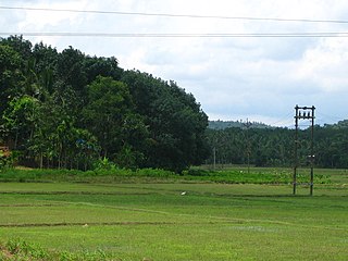
Wayanad is a district in the north-east of the Indian state of Kerala, with its administrative headquarters at the municipality of Kalpetta. It is the only plateau in Kerala. The Wayanad Plateau forms a continuation of the Mysore Plateau, the southern portion of the Deccan Plateau. It is set high in the Western Ghats with altitudes ranging from 700 to 2,100 meters. Vellari Mala, a 2,240 m (7,349 ft) high peak situated on the trijunction of Wayanad, Malappuram, and Kozhikode districts, is the highest point in Wayanad district. The district was formed on 1 November 1980 as the 12th district in Kerala, by carving out areas from Kozhikode and Kannur districts. An area of 885.92 km2 in the district is forested. Wayanad has three municipal towns—Kalpetta, Mananthavady and Sulthan Bathery. There are many indigenous tribes in this area. The Kabini River, a tributary of the Kaveri River, originates at Wayanad. Wayanad district, along with the Chaliyar valley in the neighbouring Nilambur in Malappuram district, is known for natural gold fields, which are also seen in other parts of the Nilgiri Biosphere Reserve. The Chaliyar river, which is the fourth longest river of Kerala, originates on the Wayanad plateau. The historically important Edakkal Caves are located in Wayanad district.
Sultan Bathery is a city in the Wayanad district of Kerala, India, near its borders with Tamil Nadu and Karnataka. Once known as a strategic location in the Malabar region, Sultan Bathery is the headquarters of the Sultan Bathery taluk.

Gudalur is a municipality and taluk in Nilgiris district in the Indian state of Tamil Nadu.

Wayanad Wildlife Sanctuary is a wildlife sanctuary in Wayanad, Kerala, India with an extent of 344.44 km2 (132.99 sq mi) and four hill ranges namely Sulthan Bathery, Muthanga, Kurichiat and Tholpetty. A variety of large wild animals such as gaur, Indian elephant, deer and Bengal tiger are found there. There are also quite a few unusual birds in the sanctuary. In particular, Indian peafowl tend to be very common in the area. Wayanad Wildlife Sanctuary is the second largest wildlife sanctuary in Kerala. It is bestowed with lush green forests and rich wildlife. This wildlife area houses some of the rare and endangered species of both flora and fauna.
Vellarimala Hills is a mountain range in Kerala, India, spread across Thiruvambady Panchayat in Kozhikode district and Meppadi Panchayat in Wayanad district.

Devala is a town in the Nilgiris district of Tamil Nadu. It is situated at about 17 km from Gudalur on the Gudalur–Pandalur road. It is close to the Kerala-Tamil Nadu border, with Nilambur on the Kerala side.

Kaniyambetta or Pachilakkad is a village in the Wayanad district of Kerala state, southern India. It is about 8 km from the district capital Kalpetta.
Kanjirangad is a village in Wayanad district in the state of Kerala, India.

Panamaram is a town, village in Wayanad district in the state of Kerala, India.
Payyampally is a town in Wayanad district in the state of Kerala, India.
Gudalur taluk is a taluk of Nilgiris district of the Indian state of Tamil Nadu. The headquarters of the taluk is the town of Gudalur.
Pandalur taluk is a taluk of Nilgiris district of the Indian state of Tamil Nadu. The headquarters of the taluk is the town of Pandalur.

Vythiri is a small town located in Wayanad district in the Indian state of Kerala. Along with Mananthavady and Sulthan Bathery, it is one of the three taluks in the district.

National Highway 766 is a National Highway in Southern India. NH 766 connects Kozhikode in Kerala with Kollegal in Karnataka via Mysore. Of the total distance of 272 km, 117 km is in Kerala and 155 is in Karnataka. At Kollegal, it joins National Highway 948, which connects Bengaluru and Coimbatore. The highway passes through dense forests of Western ghats of India. The NH-766 passes through 19.7 km Bandipur National Park and Wayanad wild life sanctuary.

The Paniya, also known as Paniyar and Paniyan, are an ethnic group of India. They constitute the single largest Scheduled Tribe in Kerala and are mainly found in the Wayanad District and the neighbouring areas of Karnataka. They primarily inhabit villages around edge of forestland in Kerala's Wayanad, Kozhikode, Kannur and Malappuram districts. The Paniya speak the Paniya language, which belongs to the Dravidian family, closely related to Malayalam. The center of the bonding contracts was the famous temple of the regional mother goddess of the Valliyoorkkavu shrine near Mananthavady.

The district capital of Wayanad is Kalpetta town. Kalpetta has very good road connectivity with the rest of Kerala and neighboring South Indian cities. National Highway 766 (India) NH766 connects Kalpetta with Kozhikode and Mysore. State Highways connect Kalpetta with Ooty in Tamil Nadu and Madikeri in Karnataka.
Wayanad district, which is home to Edakkal Caves, has human settlement from prehistoric era. Wayanad is the sole Plateau in Kerala. The tribal dialects of Wayanad like the Ravula language and the Paniya language are closely related to Malayalam.

Karinthandan is a legendary figure in the history of Wayanad, a district in the Indian state of Kerala. He is revered as a tribal chieftain who sacrificed his life to protect his people and their land. tris.
Thamarassery Churam is a mountain pass located in kozhikode district in Kerala, India across the Western Ghats. "Churam" is the Malayalam word for 'mountain pass'. It is a part of the National highway 766.
Kozhikode–Wayanad Tunnel Road is a proposed twin-tube tunnel road project in the South Indian state of Kerala. The proposed tunnel, which is being described as the third longest underpass in India would run through the sensitive hills and forests of the Western Ghats. It would provide an alternate route between Kozhikode and Wayanad and will reduce the distance between Anakkampoil and Meppady from 42 kilometres to less than 20 kilometres. The tunnel road is also expected to lead to a better economic growth and development in the region. Once the construction is completed, the distance between Kochi and Bengaluru would be shortened, and the districts of Wayanad and Kozhikode will be linked without crossing the Thamarassery Churam. Konkan Railway was appointed as SPV for tunnel project by Kerala Government. On 2024 September, Konkan Railway opened tenders for project and out of 7 bids Dilip Buildcon Limited awarded the project for INR 1341 crore with a construction period of 4 years. Approach Bridge at Iruvanjippuzha tender awarded to Royal Infra Construct at 80.4 crores.