List of World Heritage Sites in Southern Europe

Last updated

The UNESCO (United Nations Educational, Scientific and Cultural Organization) has designated 175 World Heritage Sites in all of the 15 sovereign countries (also called "state parties") of Southern Europe: Albania, Andorra, Bosnia and Herzegovina, Croatia, Greece, Italy, Malta, Montenegro, North Macedonia, Portugal, San Marino, Serbia, Slovenia, Spain, and Vatican City as well as one site in the British Overseas Territory of Gibraltar. [1] While Turkey has territory in Southern Europe, they are not included here but in Western Asia, and Cyprus is also included in Western Asia.

Contents

The top two countries by number of World Heritage Sites are located in this region: Italy with 58 sites and Spain with 49 sites (44 sites not including those on the Canary Islands, which are included in Africa). Seven sites are shared between several countries: Prehistoric Rock Art Sites in the Côa Valley and Siega Verde (Portugal and Spain), Rhaetian Railway in the Albula / Bernina Landscapes (Italy and Switzerland), Monte San Giorgio (Italy and Switzerland), Historic Centre of Rome, the Properties of the Holy See in that City Enjoying Extraterritorial Rights and San Paolo Fuori le Mura (Holy See and Italy), PyrénéesMont Perdu (France and Spain), Prehistoric Pile dwellings around the Alps (Austria, France, Germany, Italy, Slovenia and Switzerland) and Heritage of Mercury – Almadén and Idrija (Slovenia and Spain). [2] The first sites from the region were inscribed in 1979 a year after the list's conception, and included six sites in the former Yugoslavia and one site in Italy. [3] [4] Each year, UNESCO's World Heritage Committee may inscribe new sites on the list, or delist sites that no longer meet the criteria. Selection is based on ten criteria: six for cultural heritage (i–vi) and four for natural heritage (vii–x). [5] Some sites, designated "mixed sites," represent both cultural and natural heritage. In Southern Europe, there are 154 cultural, 16 natural, and 5 mixed sites. [2]

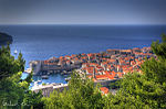
The World Heritage Committee may also specify that a site is endangered, citing "conditions which threaten the very characteristics for which a property was inscribed on the World Heritage List." One of the sites (Medieval Monuments in Kosovo) in Southern Europe is listed as endangered and four sites (Old City of Dubrovnik, Natural and Culturo-Historical Region of Kotor, Plitvice Lakes National Park and Butrint) were previously listed. Possible danger listing has been considered by UNESCO in a number of other cases. [6] [7]

Legend

The table is sortable by column by clicking on the Sort both.gif at the top of the appropriate column; alphanumerically for the Site, Area, and Year columns; by state party for the Location column; and by criteria type for the Criteria column. Transborder sites sort at the bottom.
Map all coordinates using: OpenStreetMap
Site; named after the World Heritage Committee's official designation [2]
Location; at city, regional, or provincial level and geocoordinates
Criteria; as defined by the World Heritage Committee [5]
Area; in hectares and acres. If available, the size of the buffer zone has been noted as well. A value of zero implies that no data has been published by UNESCO
Year; during which the site was inscribed to the World Heritage List
Description; brief information about the site, including reasons for qualifying as an endangered site, if applicable

World Heritage Sites

  * Trans-border site
  † In danger
SiteImageLocation Criteria Area
ha (acre)
YearDescription
18th-Century Royal Palace at Caserta with the Park, the Aqueduct of Vanvitelli, and the San Leucio Complex Caserta, fuente de Diana y Acteon. 30.JPG Provinces of Caserta and Benevento, Campania, Flag of Italy.svg  Italy
41°4′24″N14°19′35″E / 41.07333°N 14.32639°E / 41.07333; 14.32639 (18th-Century Royal Palace at Caserta with the Park, the Aqueduct of Vanvitelli, and the San Leucio Complex)
Cultural:
(i)(ii)(iii)(iv)
87 (210); buffer zone 111 (270)1997

[8]

Acropolis, Athens Parthenon-2008 entzerrt.jpg Attica, Flag of Greece.svg  Greece
37°58′15″N23°43′34″E / 37.97083°N 23.72611°E / 37.97083; 23.72611 (Acropolis, Athens)
Cultural:
(i)(ii)(iii)(iv)(vi)
3.04 (7.5); buffer zone 117 (290)1987A collection of massive, yet perfectly balanced architectural masterpieces in harmony with the natural landscape, the Acropolis of Athens is one of the most important expressions of Classical Greek aesthetics. It was completed by the 5th century BC and has since then exerted a profound influence on architecture worldwide. [9]

[10]

Alhambra, Generalife and Albayzín, Granada Dawn Charles V Palace Alhambra Granada Andalusia Spain.jpg Province of Granada, Andalusia, Flag of Spain.svg  Spain
37°10′36″N3°35′40″W / 37.17667°N 3.59444°W / 37.17667; -3.59444 (Alhambra, Generalife and Albayzín, Granada)
Cultural:
(i)(iii)(iv)
1984 [nb 1] The three sites are remnants of the Moorish influence in southern Spain. The fortress Alhambra and the palace Generalife were built by the rulers of the Emirate of Granada. The Albayzín district contains examples of the Moorish vernacular architecture and was added to the listing in 1994.

[11]

Alto Douro Wine Region Douro, Vinha e Vasilhas.jpg Douro Subregion, Trás-os-Montes e Alto Douro Province, Flag of Portugal.svg  Portugal
41°6′6″N7°47′56″W / 41.10167°N 7.79889°W / 41.10167; -7.79889 (Alto Douro Wine Region)
Cultural:
(iii)(iv)(v)
24,600 (61,000); buffer zone 225,400 (557,000)2001

[12]

Ancient and Primeval Beech Forests of the Carpathians and Other Regions of Europe Irati vista.jpg Flag of Albania.svg  Albania*;
Flag of Austria.svg  Austria*;
Flag of Belgium (civil).svg  Belgium*;
Flag of Bulgaria.svg  Bulgaria*;
Flag of Croatia.svg  Croatia*;
Mecklenburg-Vorpommern, Brandenburg, Thuringia, Hesse, Flag of Germany.svg  Germany*;
Flag of Italy.svg  Italy*;
Flag of Romania.svg  Romania*;
Prešov Region, Flag of Slovakia.svg  Slovakia*;
Flag of Slovenia.svg  Slovenia*;
Flag of Spain.svg  Spain*;
Zakarpattia Oblast, Flag of Ukraine.svg  Ukraine*
49°5′10″N22°32′10″E / 49.08611°N 22.53611°E / 49.08611; 22.53611 (Ancient and Primeval Beech Forests of the Carpathians and Other Regions of Europe)
Natural:
(ix)
92,023 (227,390); buffer zone 253,815 (627,190)2007 [nb 2] Primeval Beech Forests of the Carpathians are used to study the spread of the beech tree (Fagus sylvatica) in the Northern Hemisphere across a variety of environments and the environment in the forest. The addition of the Ancient Beech Forests of Germany in 2011 included five forests totaling 4,391 hectares (10,850 acres) that are added to the 29,278 hectares (72,350 acres) of Slovakian and Ukrainian beech forests inscribed on the World Heritage List in 2007. The site was further expanded in 2017 to include forests in 9 additional European countries.

[13] [14]

Arab–Norman Palermo and the Cathedral Churches of Cefalú and Monreale Palermo-San-Cataldo-bjs-1.jpg Province of Palermo, Sicily, Flag of Italy.svg  Italy
38°6′39″N13°21′11″E / 38.11083°N 13.35306°E / 38.11083; 13.35306 (Arab-Norman Palermo and the Cathedral Churches of Cefalú and Monreale)
Cultural:
(ii)(iv)
6.24 (15.4); buffer zone 483 (1,190)2015The new Norman rulers started to build various constructions in what is called the Arab-Norman style. They incorporated the best practices of Arab and Byzantine architecture into their own art. [15] [16]
Aranjuez Cultural Landscape Palacio Real de Aranjuez - 130921 115527.jpg Aranjuez, Community of Madrid, Flag of Spain.svg  Spain
40°2′11″N3°36′34″W / 40.03639°N 3.60944°W / 40.03639; -3.60944 (Aranjuez Cultural Landscape)
Cultural:
(ii)(iv)
2,048 (5,060); buffer zone 16,605 (41,030)2001The landscape around the Royal Palace of Aranjuez was developed by the Spanish royal family over a course of three centuries and contains innovative horticultural and design ideas. The area was the exclusive property of the royal family until the 19th century when the modern civilian city developed.

[17]

Archaeological Area and the Patriarchal Basilica of Aquileia Basilica Patriarcale (Aquileia) - Exterior.jpg Province of Udine, Friuli-Venezia Giulia, Flag of Italy.svg  Italy
45°46′6″N13°22′3″E / 45.76833°N 13.36750°E / 45.76833; 13.36750 (Archaeological Area and the Patriarchal Basilica of Aquileia)
Cultural:
(iii)(iv)(vi)
155 (380)1998

[18]

Archaeological Area of Agrigento Valle dei templi (tone-mapping) II.jpg Province of Agrigento, Sicily, Flag of Italy.svg  Italy
37°17′23″N13°35′36″E / 37.28972°N 13.59333°E / 37.28972; 13.59333 (Archaeological Area of Agrigento)
Cultural:
(i)(ii)(iii)(iv)
934 (2,310); buffer zone 1,869 (4,620)1997

[19]

Archaeological Areas of Pompei, Herculaneum and Torre Annunziata Ancient Roman Pompeii - Pompeji - Campania - Italy - July 10th 2013 - 32.jpg Province of Naples, Campania, Flag of Italy.svg  Italy
40°45′0″N14°29′0″E / 40.75000°N 14.48333°E / 40.75000; 14.48333 (Archaeological Areas of Pompei, Herculaneum and Torre Annunziata)
Cultural:
(iii)(iv)(v)
98 (240); buffer zone 24 (59)1997

[20]

Archaeological Ensemble of Tárraco Amphitheatre of Tarragona 01.jpg Province of Tarragona, Catalonia, Flag of Spain.svg  Spain
41°6′53″N1°15′34″E / 41.11472°N 1.25944°E / 41.11472; 1.25944 (Archaeological Ensemble of Tárraco)
Cultural:
(ii)(iii)
100 (250)2000The prominent Roman city of Tárraco at the site of modern-day Tarragona served as the capital of the provinces of Hispania Citerior and later Hispania Tarraconensis. The amphitheatre was constructed in the 2nd century. Most remains are only fragments or preserved under more modern buildings.

[21]

Archaeological Ensemble of Mérida Teatro Romano de Merida (Badajoz, Espana) 02.jpg Province of Badajoz, Extremadura, Flag of Spain.svg  Spain
38°54′58″N6°20′16″W / 38.91611°N 6.33778°W / 38.91611; -6.33778 (Archaeological Ensemble of Mérida)
Cultural:
(iii)(iv)
1993Mérida was founded in 25 BC by the Romans as Emerita Augusta and was the capital of the Lusitania province. Remains from the Roman era include a bridge, aqueduct, amphitheatre, theatre, circus, and forum.

[22]

Archaeological Site of Aigai (modern name Vergina) Facade of Philip II tomb Vergina Greece.jpg Imathia, Central Macedonia, Flag of Greece.svg  Greece
40°28′17″N22°19′6″E / 40.47139°N 22.31833°E / 40.47139; 22.31833 (Archaeological Site of Aigai (modern name Vergina))
Cultural:
(i)(iii)
1,421 (3,510); buffer zone 4,812 (11,890)1996The ancient city of Aigai was the first capital of the Kingdom of Macedon. In addition to the monumental palace, lavishly decorated with mosaics and painted stuccoes, the site contains a burial ground with more than 300 tumuli, one of which has been identified as that of Philip II of Macedon, father of Alexander the Great. [23]

[24]

Archaeological Site of Atapuerca
Dolina-Pano-3.jpg
Province of Burgos, Castile and León, Flag of Spain.svg  Spain
42°22′17″N3°32′50″W / 42.37139°N 3.54722°W / 42.37139; -3.54722 (Archaeological Site of Atapuerca)
Cultural:
(iii)(v)
2000The caves in the Atapuerca Mountains contain fossil remains of the earliest human beings discovered in Europe dating from nearly one million years ago. The Sima de los Huesos or "Pit of Bones" contains the world's largest collection of hominid fossils.

[25]

Archaeological Site of Delphi Delphi Composite.jpg Phocis, Central Greece, Flag of Greece.svg  Greece
38°28′53″N22°29′46″E / 38.48139°N 22.49611°E / 38.48139; 22.49611 (Archaeological Site of Delphi)
Cultural:
(i)(ii)(iii)(iv)(vi)
51 (130); buffer zone 14,314 (35,370)1987The pan-Hellenic sanctuary of Delphi, location of the oracle of Apollo, was the spiritual center of the Greek world. Situated in a spectacular natural setting at the foot of Mount Parnassus, it was a symbol of Greek cultural unity from the 8th century BC onwards. [26]

[27]

Archaeological Site of Mystras
GR-mystras-oberstadt-treppen.jpg
Laconia, Peloponnese, Flag of Greece.svg  Greece
37°4′50″N22°22′0″E / 37.08056°N 22.36667°E / 37.08056; 22.36667 (Archaeological Site of Mystras)
Cultural:
(ii)(iii)(iv)
54 (130); buffer zone 1,203 (2,970)1989Long known as "the Wonder of the Morea", the remarkably well-preserved medieval city of Mystras played a central role in the final years of the Byzantine Empire. Built on a steep hill at the foot of Mount Taygetus, it was the last Byzantine stronghold to fall to the Ottomans, holding out until 1461. [28]

[29]

Archaeological Site of Olympia Olympie Temple Zeus.JPG Elis, Western Peloponnese, Flag of Greece.svg  Greece
37°39′0″N21°40′0″E / 37.65000°N 21.66667°E / 37.65000; 21.66667 (Archaeological Site of Olympia)
Cultural:
(i)(ii)(iii)(iv)(vi)
106 (260); buffer zone 1,458 (3,600)1989The site of Olympia, built on the banks of the Alpheios river in the Peloponnese, was the location of the ancient Olympic Games beginning in 776 BC. In addition to numerous temples and sanctuaries, it contains the remains of several sporting structures, such as its famous stadium. [30]

[31]

Archaeological Sites of Mycenae and Tiryns Lions-Gate-Mycenae.jpg Argolis, Peloponnese, Flag of Greece.svg  Greece
37°44′0″N22°45′0″E / 37.73333°N 22.75000°E / 37.73333; 22.75000 (Archaeological Sites of Mycenae and Tiryns)
Cultural:
(i)(ii)(iii)(iv)(vi)
1999Mycenae and Tiryns were two of the most important cities of Mycenean Greece, which flourished between the 15th and 12th centuries BC. The Lion's Gate and Treasury of Atreus at Mycenae have been listed as "outstanding examples of human creative genius". [32]

[33]

Assisi, the Basilica of San Francesco and Other Franciscan Sites Basilica.Francis04.jpg Flag of Italy.svg  Italy
43°3′58″N12°37′21″E / 43.06611°N 12.62250°E / 43.06611; 12.62250 (Assisi, the Basilica of San Francesco and Other Franciscan Sites)
Cultural:
(i)(ii)(iii)(iv)(vi)
14,563 (35,990); buffer zone 4,087 (10,100)2000

[34]

Botanical Garden (Orto Botanico), Padua OrtoBotPadova Incrocio viali.jpg City and Province of Padua, Veneto, Flag of Italy.svg  Italy
45°23′57″N11°52′50″E / 45.39917°N 11.88056°E / 45.39917; 11.88056 (Botanical Garden (Orto Botanico), Padua)
Cultural:
(ii)(iii)
2.20 (5.4); buffer zone 11 (27)1997

[35]

Burgos Cathedral Burgos 04.jpg Burgos, Province of Burgos, Castile and León, Flag of Spain.svg  Spain
42°20′25″N3°42′14.5″W / 42.34028°N 3.704028°W / 42.34028; -3.704028 (Burgos Cathedral)
Cultural:
(ii)(iv)(vi)
1984The Gothic-style cathedral was constructed between the 13th and 16th centuries. It is the burial place of Spanish national hero, El Cid.

[36]

Butrint Amphitheatre of Butrint 2009.jpg Sarandë District, Flag of Albania.svg  Albania
39°45′4″N20°1′34″E / 39.75111°N 20.02611°E / 39.75111; 20.02611 (Butrint)
Cultural:
(iii)
3,980 (9,800); buffer zone 4,611 (11,390)1992 [nb 3] The site had been listed as endangered 1997–2005 following damages due to management and conservation.

[37]
[38]
[39]

Castel del Monte Castel del Monte - Andria.jpg Andria and Corato, Province of Bari, Apulia, Flag of Italy.svg  Italy
41°5′5″N16°16′15″E / 41.08472°N 16.27083°E / 41.08472; 16.27083 (Castel del Monte)
Cultural:
(i)(ii)(iii)
3.10 (7.7); buffer zone 10,847 (26,800)1996

[40]

Catalan Romanesque Churches of the Vall de Boí
RI-51-0000692.jpg
Province of Lleida, Catalonia, Flag of Spain.svg  Spain
42°30′17″N0°48′13″E / 42.50472°N 0.80361°E / 42.50472; 0.80361 (Catalan Romanesque Churches of the Vall de Boí)
Cultural:
(ii)(iv)
2000The small valley at the edge of the Pyrenees contains churches in Romanesque style decorated with Romanesque murals, statues, and altars. The churches are unique for their tall, square bell towers.

[41]

Cathedral, Alcázar and Archivo de Indias in Seville
Alcazar of Seville 2.JPG
Province of Seville, Andalusia, Flag of Spain.svg  Spain
37°23′2″N5°59′30″W / 37.38389°N 5.99167°W / 37.38389; -5.99167 (Cathedral, Alcázar and Archivo de Indias in Seville)
Cultural:
(i)(ii)(iii)(vi)
12 (30); buffer zone 187 (460)1987 [nb 4] The Alcázar was built during the Almohad dynasty that ruled southern Spain until the Reconquista. The cathedral dates to the 15th century and holds the tombs of Ferdinand III and Christopher Columbus. The Archivo (Archive) houses documents relating to the colonization of the Americas.

[42]

Cathedral, Torre Civica and Piazza Grande, Modena
Patrimonio dell'umanita.jpg
City and Province of Modena, Emilia–Romagna, Flag of Italy.svg  Italy
44°38′46″N10°55′32″E / 44.64611°N 10.92556°E / 44.64611; 10.92556 (Cathedral, Torre Civica and Piazza Grande, Modena)
Cultural:
(i)(ii)(iii)(iv)
1.20 (3.0); buffer zone 1.10 (2.7)1997

[43]

Cave of Altamira and Paleolithic Cave Art of Northern Spain 12 Vista general del techo de policromos.jpg Santillana del Mar, Cantabria, Flag of Spain.svg  Spain
43°22′57″N4°6′58″W / 43.38250°N 4.11611°W / 43.38250; -4.11611 (Cave of Altamira and Paleolithic Cave Art of Northern Spain)
Cultural:
(i)(iii)
2,235 (5,520)1985 [nb 5] The Cave of Altamira contains examples of cave painting from the Upper Paleolithic period, ranging from 35,000 to 11,000 BC. The original listing contained seventeen decorated caves. The caves are well-preserved because of their deep isolation from the external climate.

[44]

Central Zone of the Town of Angra do Heroismo in the Azores Igreja da Misericordia (Angra do Heroismo) - Vista exterior.jpg Terceira Island, Azores, Flag of Portugal.svg  Portugal
38°39′18″N27°13′12″W / 38.65500°N 27.22000°W / 38.65500; -27.22000 (Central Zone of the Town of Angra do Heroismo in the Azores)
Cultural:
(iv)(vi)
1983

[45]

Church and Dominican Convent of Santa Maria delle Grazie with "The Last Supper" by Leonardo da Vinci
Side and dome - Santa Maria delle Grazie - Milan 2014 (2).jpg
Province of Milano, Lombardy, Flag of Italy.svg  Italy
45°27′57″N9°10′14″E / 45.46583°N 9.17056°E / 45.46583; 9.17056 (Church and Dominican Convent of Santa Maria delle Grazie with "The Last Supper" by Leonardo da Vinci)
Cultural:
(i)(ii)
1.50 (3.7)1980

[46]

Cilento and Vallo di Diano National Park with the Archeological sites of Paestum and Velia, and the Certosa di Padula Paestum BW 2013-05-17 13-22-35.jpg Province of Salerno, Campania, Flag of Italy.svg  Italy
40°17′0″N15°16′0″E / 40.28333°N 15.26667°E / 40.28333; 15.26667 (Cilento and Vallo di Diano National Park with the Archeological sites of Paestum and Velia, and the Certosa di Padula)
Cultural:
(iii)(iv)
159,110 (393,200); buffer zone 178,101 (440,100)1998

[47]

City of Valletta Domed Church of Our Lady in Old City. Valletta, Malta, Mediterranean Sea.jpg Malta Island, Flag of Malta.svg  Malta
35°54′2″N14°30′52″E / 35.90056°N 14.51444°E / 35.90056; 14.51444 (City of Valletta)
Cultural:
(i)(vi)
56 (140)1980

[48]

City of Verona
Duomo e ponte Pietra Verona.jpg
City and Province of Verona, Veneto, Flag of Italy.svg  Italy
45°26′19″N10°59′38″E / 45.43861°N 10.99389°E / 45.43861; 10.99389 (City of Verona)
Cultural:
(ii)(iv)
453 (1,120); buffer zone 431 (1,070)2000

[49]

City of Vicenza and the Palladian Villas of the Veneto Villa godi valmarana front.jpg Provinces of Padua, Rovigo, Treviso, Venice, Verona and Vicenza, Veneto, Flag of Italy.svg  Italy
45°32′57″N11°32′58″E / 45.54917°N 11.54944°E / 45.54917; 11.54944 (City of Vicenza and the Palladian Villas of the Veneto)
Cultural:
(i)(ii)
334 (830)1994 [nb 6]

[50]
[51]

Convent of Christ in Tomar Convento de Cristo, Tomar (8089840903).jpg Tomar, Santarém District, Flag of Portugal.svg  Portugal
39°36′17″N8°25′3″W / 39.60472°N 8.41750°W / 39.60472; -8.41750 (Convent of Christ in Tomar)
Cultural:
(i)(vi)
1983

[52]

Costiera Amalfitana Amalfi Coast (6136776093).jpg Province of Salerno, Campania, Flag of Italy.svg  Italy
40°39′0″N14°36′0″E / 40.65000°N 14.60000°E / 40.65000; 14.60000 (Costiera Amalfitana)
Cultural:
(ii)(iv)(v)
11,231 (27,750)1997

[53]

Crespi d'Adda
Crespi d'Adda, Castello (Ian Spackman 2007-007-30).jpg
Province of Bergamo, Lombardy, Flag of Italy.svg  Italy
45°35′36″N9°32′18″E / 45.59333°N 9.53833°E / 45.59333; 9.53833 (Crespi d'Adda)
Cultural:
(iv)(v)
1995

[54]

Cultural Landscape of Sintra Palacio da Pena, Sintra (8505705900).jpg Sintra, Flag of Portugal.svg  Portugal
38°47′0″N9°25′0″W / 38.78333°N 9.41667°W / 38.78333; -9.41667 (Cultural Landscape of Sintra)
Cultural:
(ii)(iv)(v)
946 (2,340); buffer zone 3,641 (9,000)1995

[55]

Cultural Landscape of the Serra de Tramuntana Valldemossa, ... mossa... (6895782022).jpg Mallorca, Flag of Spain.svg  Spain
39°43′51″N2°41′41″E / 39.73083°N 2.69472°E / 39.73083; 2.69472 (Cultural Landscape of the Serra de Tramuntana)
Cultural:
(ii)(iv)(v)
30,745 (75,970); buffer zone 78,617 (194,270)2011

[56]

Delos 20100706 Terrace of the Lions Delos Cyclades Greece.jpg Cyclades, South Aegean, Flag of Greece.svg  Greece
37°24′0″N25°16′0″E / 37.40000°N 25.26667°E / 37.40000; 25.26667 (Delos)
Cultural:
(ii)(iii)(iv)(vi)
351 (870)1990The birthplace of Apollo and Artemis according to Greek mythology, the sacred island of Delos was one of the most important pan-Hellenic sanctuaries. The sanctuary of Apollo on Delos attracted pilgrims from all over Greece, making Delos a prosperous trading port. [57]

[58]

Doñana National Park Wetlands in Donana.jpg Huelva and Seville Provinces, Andalusia, Flag of Spain.svg  Spain
36°56′52″N6°21′32″W / 36.94778°N 6.35889°W / 36.94778; -6.35889 (Doñana National Park)
Natural:
(vii)(ix)(x)
54,252 (134,060)1994 [nb 7] The park consists of the delta region where the Guadalquivir River reaches the Atlantic Ocean. It is home to a diverse variety of biotopes, such as lagoons, marshlands, dunes, and maquis. The park is one of the largest heronries in the Mediterranean region and holds more than 500,000 water fowl during the winter period.

[59]
[60]

Durmitor National Park The Black Lake in Montenegro.jpg Flag of Montenegro.svg  Montenegro
43°7′59″N19°1′0″E / 43.13306°N 19.01667°E / 43.13306; 19.01667 (Durmitor National Park)
Natural:
(vii)(viii)(x)
32,100 (79,000)1980 [nb 8]

[61]
[62]

Early Christian Monuments of Ravenna
Entrance to Basilica di San Vitale.jpg
City and Province of Ravenna, Emilia-Romagna, Flag of Italy.svg  Italy
44°25′14″N12°11′47″E / 44.42056°N 12.19639°E / 44.42056; 12.19639 (Early Christian Monuments of Ravenna)
Cultural:
(i)(ii)(iii)(iv)
1.32 (3.3)1996

[63]

Episcopal Complex of the Euphrasian Basilica in the Historic Centre of Poreč MK5271 Euphrasius Basilika Porec.jpg Poreč, Istria County, Flag of Croatia.svg  Croatia
45°13′45″N13°35′40″E / 45.22917°N 13.59444°E / 45.22917; 13.59444 (Episcopal Complex of the Euphrasian Basilica in the Historic Centre of Poreč)
Cultural:
(ii)(iii)(iv)
1.10 (2.7)1997The episcopal complex, with its striking mosaics dating back to the 6th century, is one of the best examples of early Byzantine art and architecture in the Mediterranean region and the world. It includes the basilica itself, a sacristy, a baptistery and the bell tower of the nearby archbishop's palace.

[64]

Etruscan Necropolises of Cerveteri and Tarquinia Danseur avec une coupe de vin Tombe oes Leopards, Tarquinia.jpg Provinces of Rome and Viterbo, Lazio, Flag of Italy.svg  Italy
42°0′25″N12°6′7″E / 42.00694°N 12.10194°E / 42.00694; 12.10194 (Etruscan Necropolises of Cerveteri and Tarquinia)
Cultural:
(i)(iii)(iv)
21 (52); buffer zone 5,786 (14,300)2004

[65]

Ferrara, City of the Renaissance, and its Po Delta Ippovie Delta Po.JPG City and Province of Ferrara, Emilia–Romagna, Flag of Italy.svg  Italy
44°50′16″N11°37′10″E / 44.83778°N 11.61944°E / 44.83778; 11.61944 (Ferrara, City of the Renaissance, and its Po Delta)
Cultural:
(ii)(iii)(iv)(v)(vi)
46,712 (115,430); buffer zone 117,649 (290,720)1995 [nb 9]

[66]
[67]

Garrison Border Town of Elvas and its Fortifications ElvasSquare.jpg Alentejo, Flag of Portugal.svg  Portugal
38°52′50″N7°9′48″W / 38.88056°N 7.16333°W / 38.88056; -7.16333 (Garrison Border Town of Elvas and its Fortifications)
Cultural:
(iv)
179 (440); buffer zone 608 (1,500)2012The site, extensively fortified from the 17th to 19th centuries, represents the largest bulwarked dry ditch system in the work. Within its walls, the town contains barracks and other military buildings as well as churches and monasteries. While Elvas contains remains dating back to the 10th century A.D., its fortification began when Portugal regained independence in 1640. The fortifications designed by Dutch Jesuit Padre João Piscásio Cosmander represent the best surviving example of the Dutch school of fortifications anywhere. The site also contains the Amoreira Aqueduct, built to enable the stronghold to withstand lengthy sieges.

[68]

Gamzigrad-Romuliana, Palace of Galerius Gamzigrad 04a.jpg Zaječar, Flag of Serbia.svg  Serbia
43°53′57.5″N22°11′10″E / 43.899306°N 22.18611°E / 43.899306; 22.18611 (Gamzigrad-Romuliana, Palace of Galerius)
Cultural:
(iii)(iv)
179 (440); buffer zone 545 (1,350)2007The Late Roman fortified palace compound and memorial complex of Gamzigrad-Romuliana, Palace of Galerius, in the east of Serbia, was commissioned by Emperor Caius Valerius Galerius Maximianus, in the late 3rd and early 4th centuries. It was known as Felix Romuliana, named after the emperor's mother. The site consists of fortifications, the palace in the north-western part of the complex, basilicas, temples, hot baths, memorial complex, and a tetrapylon. The group of buildings is also unique in its intertwining of ceremonial and memorial functions.

[69]

Genoa: Le Strade Nuove and the system of the Palazzi dei Rolli
Centre et vieille-ville Genes 1854 (8195511417).jpg
Province of Genoa, Liguria, Flag of Italy.svg  Italy
44°24′44″N8°55′52″E / 44.41222°N 8.93111°E / 44.41222; 8.93111 (Genoa: Le Strade Nuove and the system of the Palazzi dei Rolli)
Cultural:
(ii)(iv)
16 (40); buffer zone 113 (280)2006

[70]

Gorham's Cave Complex Gorham's Cave.jpg Flag of Gibraltar.svg  Gibraltar, Flag of the United Kingdom.svg  UK
36°07′13″N5°20′31″W / 36.120397°N 5.342075°W / 36.120397; -5.342075 (Gorham's Cave) [71]
Cultural:
(iii)
2016 [71] A natural sea cave, considered to be one of the last known habitations of the Neanderthals in Europe. [71]
Ħal Saflieni Hypogeum Photo Ellis Hal Salflieni.jpg Paola, Malta Island, Flag of Malta.svg  Malta
35°52′17″N14°30′27″E / 35.87139°N 14.50750°E / 35.87139; 14.50750 (Ħal Saflieni Hypogeum)
Cultural:
(iii)
1980

[72]

Heritage of Mercury. Almadén and Idrija Minas de Almaden, Ciudad Real (RPS 21-07-2012).png Flag of Slovenia.svg  Slovenia*; Flag of Spain.svg  Spain*
38°46′31″N4°50′20″W / 38.77528°N 4.83889°W / 38.77528; -4.83889 (Heritage of Mercury. Almadén and Idrija)
Cultural:
(ii)(iv)
104 (260)2012

[73]

Historical Complex of Split with the Palace of Diocletian
Peristyle, Split 2.jpg
Split-Dalmatia County, Flag of Croatia.svg  Croatia
43°30′34″N16°26′36″E / 43.50944°N 16.44333°E / 43.50944; 16.44333 (Historical Complex of Split with the Palace of Diocletian)
Cultural:
(ii)(iii)(iv)
21 (52)1979The palace was built by the Roman emperor Diocletian at the turn of the fourth century AD, and later served as the basis of the city of Split. A cathedral was built in the Middle Ages inside the ancient mausoleum, along with churches, fortifications, Gothic and Renaissance palaces. The Baroque style makes up the rest of the area.

[74]

Historic Centre of Cordoba Mezquita-Catedral y Puente Romano, Cordoba - panoramio.jpg Province of Córdoba, Andalusia, Flag of Spain.svg  Spain
37°52′45″N4°46′47″W / 37.87917°N 4.77972°W / 37.87917; -4.77972 (Historic Centre of Cordoba)
Cultural:
(i)(ii)(iii)(iv)
1984 [nb 10] The original listing was the Great Mosque of Córdoba, a 7th-century mosque converted to a Roman Catholic cathedral in the 13th century by Ferdinand III. During the high period of the Moorish rule of the region, Córdoba had over 300 mosques and architecture that compared to that of Constantinople, Damascus, and Baghdad.

[75]
[76]

Historic Centre of Évora Centro Historico de Evora VII.jpg Évora Municipality, Alentejo, Flag of Portugal.svg  Portugal
38°24′23″N7°54′28″W / 38.40639°N 7.90778°W / 38.40639; -7.90778 (Historic Centre of Évora)
Cultural:
(ii)(iv)
1986

[77]

Historic Centre of Florence Il Duomo (5158048625).jpg City and Province of Florence, Tuscany, Flag of Italy.svg  Italy
43°46′23″N11°15′22″E / 43.77306°N 11.25611°E / 43.77306; 11.25611 (Historic Centre of Florence)
Cultural:
(i)(ii)(iii)(iv)(vi)
505 (1,250)1982

[78]

Historic Centre of Guimarães
Guimaraes - Padrao Comemorativo da Batalha do Salado.jpg
Braga District, Minho Province, Flag of Portugal.svg  Portugal
41°26′27″N8°17′41″W / 41.44083°N 8.29472°W / 41.44083; -8.29472 (Historic Centre of Guimarães)
Cultural:
(ii)(iii)(iv)
16 (40); buffer zone 45 (110)2001

[79]

Historic Centre of Naples Veduta di napoli, San martino 01.JPG City and Province of Naples, Campania, Flag of Italy.svg  Italy
40°51′5″N14°15′46″E / 40.85139°N 14.26278°E / 40.85139; 14.26278 (Historic Centre of Naples)
Cultural:
(ii)(iv)
1995

[80]

Historic Centre of Oporto, Luiz I Bridge and Monastery of Serra do Pilar Porto, vista da Gaia (26).jpg Norte, Flag of Portugal.svg  Portugal
41°8′30″N8°37′0″W / 41.14167°N 8.61667°W / 41.14167; -8.61667 (Historic Centre of Oporto)
Cultural:
(iv)
1996

[81]

Historic Centre of Rome, the Properties of the Holy See in that City Enjoying Extraterritorial Rights and San Paolo Fuori le Mura
Petersplatz Rom Vatikanstadt HDR 2013 03 b.jpg
Flag of the Vatican City - 2001 version.svg  Holy See*; Rome, Lazio, Flag of Italy.svg  Italy*
41°53′25″N12°29′32″E / 41.89028°N 12.49222°E / 41.89028; 12.49222 (Historic Centre of Rome, the Properties of the Holy See in that City Enjoying Extraterritorial Rights and San Paolo Fuori le Mura)
Cultural:
(i)(ii)(iii)(iv)(vi)
1,485 (3,670)1980 [nb 11]

[82]

Historic Centre of San Gimignano Toscana SGimignano tango7174.jpg San Gimignano, Province of Siena, Tuscany, Flag of Italy.svg  Italy
43°28′5″N11°2′30″E / 43.46806°N 11.04167°E / 43.46806; 11.04167 (Historic Centre of San Gimignano)
Cultural:
(i)(iii)(iv)
14 (35)1990

[83]

Historic Centre of Siena Siena cathedral panoramic frontview.jpg City and Province of Siena, Tuscany, Flag of Italy.svg  Italy
43°19′7″N11°19′54″E / 43.31861°N 11.33167°E / 43.31861; 11.33167 (Historic Centre of Siena)
Cultural:
(i)(ii)(iv)
170 (420); buffer zone 9,907 (24,480)1995

[84]

Historic Centre of the City of Pienza 3083PienzaCsoRossellino.JPG Pienza, Province of Siena, Tuscany, Flag of Italy.svg  Italy
43°4′37″N11°40′43″E / 43.07694°N 11.67861°E / 43.07694; 11.67861 (Historic Centre of the City of Pienza)
Cultural:
(i)(ii)(iv)
4.41 (10.9)1996

[85]

Historic Centre of Urbino Urbino-vista paese.jpg Province of Pesaro, Marche, Flag of Italy.svg  Italy
43°43′30″N12°38′0″E / 43.72500°N 12.63333°E / 43.72500; 12.63333 (Historic Centre of Urbino)
Cultural:
(ii)(iv)
29 (72); buffer zone 3,609 (8,920)1998

[86]

Historic Centres of Berat and Gjirokastra Berat Albania 10.jpg Berat and Gjirokastër, Flag of Albania.svg  Albania
40°4′10″N20°8′0″E / 40.06944°N 20.13333°E / 40.06944; 20.13333 (Historic Centres of Berat and Gjirokastra)
Cultural:
(iii)(iv)
59 (150); buffer zone 136 (340)2005 [nb 12]

[87]

Historic City of Toledo 1 Puente de Alcantara toledo 2014.jpg Province of Toledo, Castile–La Mancha, Flag of Spain.svg  Spain
39°52′1″N4°1′46″W / 39.86694°N 4.02944°W / 39.86694; -4.02944 (Historic City of Toledo)
Cultural:
(i)(ii)(vi)
1986Toledo was founded by the Romans, served as the capital of the Visigothic Kingdom, was important in Muslim Spain and during the Reconquista, and briefly served as the capital of Spain. The city combines Christian, Muslim, and Jewish influences.

[88]

Historic City of Trogir Trogir3.jpg Split-Dalmatia County, Flag of Croatia.svg  Croatia
43°30′45″N16°15′6″E / 43.51250°N 16.25167°E / 43.51250; 16.25167 (Historic City of Trogir)
Cultural:
(ii)(v)
6.40 (15.8); buffer zone 4.80 (11.9)1997Trogir's rich culture was created under the influence of old Greeks, Romans, and Venetians. It is the best-preserved Romanesque-Gothic complex not only in the Adriatic, but in all of Central Europe. Trogir's medieval core, surrounded by walls, comprises a preserved castle and tower and a series of dwellings and palaces from the Romanesque, Gothic, Renaissance and Baroque periods.

[89]

Historic Walled Town of Cuenca 007253 - Cuenca (8675297263).jpg Province of Cuenca, Castile–La Mancha, Flag of Spain.svg  Spain
40°4′36″N2°7′54″W / 40.07667°N 2.13167°W / 40.07667; -2.13167 (Historic Walled Town of Cuenca)
Cultural:
(ii)(v)
1996The Moors built the fortified city in the early 8th century, and it was captured by the Christians in the 12th century. The cathedral is the first Gothic example in Spain. The town is also famous for its casas colgados, houses that hang over the edge of a cliff.

[90]

Ibiza, Biodiversity and Culture Aerial view of the island of Sa Conillera, near St. Antoni de Portmany.jpg Balearic Islands, Flag of Spain.svg  Spain
38°54′40″N1°26′7″E / 38.91111°N 1.43528°E / 38.91111; 1.43528 (Ibiza, Biodiversity and Culture)
Mixed:
(ii)(iii)(iv)(ix)(x)
8,564 (21,160)1999The coast of Ibiza is home to posidonia oceanica, a seagrass only found in the Mediterranean that supports a diverse coastal and marine ecosystem. The island also contains numerous Phoenician ruins, and the fortified and walled older portions of the city date to the 16th century.

[91]

Isole Eolie (Aeolian Islands) Aeolian Islands (8).jpg Southern Tyrrhenian Sea, Flag of Italy.svg  Italy
38°29′16″N14°56′44″E / 38.48778°N 14.94556°E / 38.48778; 14.94556 (Isole Eolie (Aeolian Islands))
Natural:
(viii)
1,216 (3,000)2000

[92]

Ivrea, Industrial City of the 20th Century Ponte Vecchio Ivrea.jpg Ivrea, Flag of Italy.svg  Italy
45°28′0″N7°53′0″E / 45.46667°N 7.88333°E / 45.46667; 7.88333 (Ivrea)
Cultural:
(iv)
71.185 (175.90); buffer zone 400.481 (989.61)2018

[93]

La Lonja de la Seda de Valencia Llotja de la Seda (Valencia) - 21.jpg Valencia, Province of Valencia, Valencian Community, Flag of Spain.svg  Spain
39°28′28″N0°22′42″W / 39.47444°N 0.37833°W / 39.47444; -0.37833 (La Lonja de la Seda de Valencia)
Cultural:
(i)(iv)
1996La Lonja (or Llotja in Valencian language) de la Seda means Silk Exchange in English, and the group of Gothic buildings demonstrate the wealth of Valencia as an important Mediterranean and European mercantile city in the period.

[94]

Landscape of the Pico Island Vineyard Culture
Acores 2010-07-21 (5126595732).jpg
Azores, Flag of Portugal.svg  Portugal
38°30′48″N28°32′28″W / 38.51333°N 28.54111°W / 38.51333; -28.54111 (Landscape of the Pico Island Vineyard Culture)
Cultural:
(iii)(v)
190 (470); buffer zone 2,445 (6,040)2004

[95]

Las Médulas Medulas1.jpg Province of León, Castile and León, Flag of Spain.svg  Spain
42°28′10″N6°46′15″W / 42.46944°N 6.77083°W / 42.46944; -6.77083 (Las Médulas)
Cultural:
(i)(ii)(iii)(iv)
1997The Romans established a gold mine and worked the site for two centuries. They used an early form of hydraulic mining and cut aqueducts in the rock cliffs to provide water for the operations. The Romans left in the early 3rd century, leaving sheer cliff faces and mining infrastructure that is intact today.

[96]

Late Baroque Towns of the Val di Noto (South-Eastern Sicily)
Catania 2846.jpg
Provinces of Catania, Ragusa and Syracuse, Sicily, Flag of Italy.svg  Italy
36°53′35.5″N15°4′8″E / 36.893194°N 15.06889°E / 36.893194; 15.06889 (Late Baroque Towns of the Val di Noto (South-Eastern Sicily))
Cultural:
(i)(ii)(iv)(v)
113 (280); buffer zone 306 (760)2002

[97]

Longobards in Italy. Places of the power (568-774 A.D.)
Monte Sant'Angelo-Street09.jpg
Flag of Italy.svg  Italy
46°5′39″N13°25′59″E / 46.09417°N 13.43306°E / 46.09417; 13.43306 (Longobards in Italy. Places of the power (568-774 A.D.))
Cultural:
(ii)(iii)(vi)
14 (35); buffer zone 306 (760)2011The site includes seven Longobards towns: Brescia, Cividale del Friuli, Castelseprio, Spoleto, Campello sul Clitunno, Benevento and Monte Sant'Angelo.

[98]

Madriu-Perafita-Claror Valley Pont de la Tosca (Escaldes-Engordany) - 2.jpg Encamp, Andorra la Vella, Sant Julià de Lòria, Escaldes-Engordany, Flag of Andorra.svg  Andorra
42°29′41″N1°35′44″E / 42.49472°N 1.59556°E / 42.49472; 1.59556 (Madriu-Perafita-Claror Valley)
Cultural:
(v)
2004 [nb 13]

[99]
[100]

Mantua and Sabbioneta Sabbioneta-piazza ducale.jpg Flag of Italy.svg  Italy
45°9′34″N10°47′40″E / 45.15944°N 10.79444°E / 45.15944; 10.79444 (Mantua and Sabbioneta)
Cultural:
(ii)(iii)
235 (580); buffer zone 2,330 (5,800)2008

[101]

Medieval City of Rhodes Murs tours palais grand maitre.jpg Rhodes, South Aegean, Flag of Greece.svg  Greece
36°26′50″N28°13′40″E / 36.44722°N 28.22778°E / 36.44722; 28.22778 (Medieval City of Rhodes)
Cultural:
(ii)(iv)(v)
66 (160)1988The Order of St John of Jerusalem occupied Rhodes from 1309 to 1523 and set about transforming the city into a stronghold. It subsequently came under Turkish and Italian rule. With the Palace of the Grand Masters, the Great Hospital and the Street of the Knights, the Upper Town is one of the most beautiful urban ensembles of the Gothic period. In the Lower Town, Gothic architecture coexists with mosques, public baths and other buildings dating from the Ottoman period. [102]

[103]

Medici Villas and Gardens in Tuscany Villa medici di belcanto, villa inferiore 02.JPG Tuscany, Flag of Italy.svg  Italy
43°51′28″N11°18′15″E / 43.85778°N 11.30417°E / 43.85778; 11.30417 (Medici Villas and Gardens in Tuscany)
Cultural:
(ii)(iv)(vi)
125 (310); buffer zone 3,539 (8,750)2013

[104]

Medieval Monuments in Kosovo Visoki Decani.jpg Autonomous Province of Kosovo and Metohija, Flag of Serbia.svg  Serbia
42°39′40″N20°15′56″E / 42.66111°N 20.26556°E / 42.66111; 20.26556 (Medieval Monuments in Kosovo)
Cultural:
(ii)(iii)(iv)
2.88 (7.1); buffer zone 115 (280)2004 [nb 14] The four edifices of the site reflect the high points of the Byzantine-Romanesque ecclesiastical culture, with its distinct style of wall painting, which developed in the Balkans between the 13th and 17th centuries. The Dečani Monastery was built in the mid-14th century for the Serbian king Stefan Dečanski and is also his mausoleum. The Patriarchal Monastery of Peć is a group of four domed churches featuring series of wall paintings. The 13th-century frescoes of the Church of Holy Apostles are painted in a unique, monumental style. Early 14th-century frescoes in the church of the Holy Virgin of Ljevisa represent the appearance of the new so-called Palaiologian Renaissance style, combining the influences of the eastern Orthodox Byzantine and the Western Romanesque traditions. The style played a decisive role in subsequent Balkan art. The site has been listed as endangered since 2006 due to a lack of legal protection and management; political instability and security.

[105]
[106]

Medina Azahara, Córdoba Edificio Basilical Superior de Medina Azahara (Cordoba, Espana).jpg Province of Cordoba, Andalusia, Flag of Spain.svg  Spain
37°53′10″N4°52′04″W / 37.88611°N 4.86778°W / 37.88611; -4.86778 (Medina Azahara, Cordoba)
Cultural:
(i)(iii)(iv)
2018Ruins of a vast, fortified Arab Muslim medieval palace-city built by Abd-ar-Rahman III (912–961), the first Umayyad Caliph of Córdoba, and located on the western outskirts of Córdoba, Spain. [107]
Megalithic Temples of Malta
2012-09-24-Malta-Gozo (Foto Dietrich Michael Weidmann) 109.JPG
Gozo and Malta Island, Flag of Malta.svg  Malta
36°2′57″N14°16′10″E / 36.04917°N 14.26944°E / 36.04917; 14.26944 (Megalithic Temples of Malta)
Cultural:
(iv)
1980 [nb 15]

[108]

Mehmed Paša Sokolović Bridge in Višegrad Mehmet pasa bridge and green Drina river.jpg Republika Srpska, Flag of Bosnia and Herzegovina.svg  Bosnia and Herzegovina
43°46′53″N19°17′17″E / 43.78139°N 19.28806°E / 43.78139; 19.28806 (Mehmed Paša Sokolović Bridge in Višegrad)
Cultural:
(ii)(iv)
1.50 (3.7); buffer zone 12 (30)2007

[109]

Meteora 20140414 meteora175.JPG Trikala, Thessaly, Flag of Greece.svg  Greece
39°43′0″N21°38′0″E / 39.71667°N 21.63333°E / 39.71667; 21.63333 (Meteora)
Mixed:
(i)(ii)(iv)(v)(vii)
272 (670); buffer zone 1,884 (4,660)1988In a region of almost inaccessible sandstone peaks, monks settled on these 'columns of the sky' from the 11th century onwards. Twenty-four of these monasteries were built, despite incredible difficulties, at the time of the great revival of the eremitic ideal in the 15th century. Their 16th-century frescoes mark a key stage in the development of post-Byzantine painting. [110]

[111]

Monasteries of Daphni, Hosios Loukas and Nea Moni of Chios
GR-osios-loukas-barbara-kap.jpg
Attica, Central Greece and North Aegean, Flag of Greece.svg  Greece
38°24′0″N22°45′0″E / 38.40000°N 22.75000°E / 38.40000; 22.75000 (Monasteries of Daphni, Hosios Loukas and Nea Moni of Chios)
Cultural:
(i)(iv)
3.70 (9.1); buffer zone 5,816 (14,370)1990Although geographically distant from each other, these three monasteries belong to the same typological series and share the same aesthetic characteristics. The churches are built on a cross-in-square plan with a large dome supported by squinches defining an octagonal space. In the 11th and 12th centuries they were decorated with superb marble works as well as mosaics on a gold background, all characteristic of the 'second golden age of Byzantine art'. [112]

[113]

Monastery and Site of the Escorial, Madrid El Monasterio de San Lorenzo de El Escorial.JPG San Lorenzo de El Escorial, Community of Madrid, Flag of Spain.svg  Spain
40°34′54″N4°7′35″W / 40.58167°N 4.12639°W / 40.58167; -4.12639 (Monastery and Site of the Escurial, Madrid)
Cultural:
(i)(ii)(vi)
1984El Escorial is one of several Spanish royal sites due to its history as a residence of the royal family. The palace was designed by King Philip II and architect Juan Bautista de Toledo to serve as a monument to Spain's central role in the Christian world.

[114]

Monastery of Alcobaça Crepusculo Gotico.jpg Alcobaça, Leiria District, Flag of Portugal.svg  Portugal
39°33′0″N8°58′36″W / 39.55000°N 8.97667°W / 39.55000; -8.97667 (Monastery of Alcobaça)
Cultural:
(i)(iv)
1989

[115]

Monastery of Batalha P8052737w (7807482158).jpg Batalha, Leiria District, Flag of Portugal.svg  Portugal
39°39′28″N8°49′37″W / 39.65778°N 8.82694°W / 39.65778; -8.82694 (Monastery of Batalha)
Cultural:
(i)(ii)
0.98 (2.4); buffer zone 86 (210)1983

[116]

Monastery of the Hieronymites and Tower of Belém in Lisbon A Torre Manuelina.jpg Lisbon, Flag of Portugal.svg  Portugal
38°41′31″N9°12′57″W / 38.69194°N 9.21583°W / 38.69194; -9.21583 (Monastery of the Hieronymites and Tower of Belém in Lisbon)
Cultural:
(iii)(vi)
2.66 (6.6); buffer zone 103 (250)1983 [nb 16]

[117]

Monte San Giorgio Lago di Lugano3.jpg Flag of Italy.svg  Italy*; Flag of Switzerland (Pantone).svg   Switzerland*
45°53′20″N8°54′50″E / 45.88889°N 8.91389°E / 45.88889; 8.91389 (Monte San Giorgio)
Natural:
(viii)
1,089 (2,690); buffer zone 3,207 (7,920)2003 [nb 17]

[118]
[119]

Monuments of Oviedo and the Kingdom of the Asturias
Oviedo 16 1 (6624855611).jpg
Asturias, Flag of Spain.svg  Spain
43°21′45″N5°50′35″W / 43.36250°N 5.84306°W / 43.36250; -5.84306 (Monuments of Oviedo and the Kingdom of the Asturias)
Cultural:
(i)(ii)(iv)
1985 [nb 18] The Kingdom of Asturias remained the only Christian region of Spain in the 9th century. It developed its own style of Pre-Romanesque art and architecture that is displayed in various churches and other monuments. The original entry titled "Churches of the Kingdom of the Asturias" and was extended to include other monuments such as La Foncalada.

[120]
[121]

Mount Athos Simonos Petras 3.jpg Autonomous region of Mount Athos, Flag of Greece.svg  Greece
40°16′0″N24°13′0″E / 40.26667°N 24.21667°E / 40.26667; 24.21667 (Mount Athos)
Mixed:
(i)(ii)(iv)(v)(vi)(vii)
33,042 (81,650)1988An Orthodox spiritual centre since 1054, Mount Athos has enjoyed an autonomous statute since Byzantine times. The 'Holy Mountain', which is forbidden to women and children, is also a recognized artistic site. The layout of the monasteries (about 20 of which are presently inhabited by some 1,400 monks) had an influence as far afield as Russia, and its school of painting influenced the history of Orthodox art. [122]

[123]

Mount Etna Taormina 03 10 04.JPG Sicily, Flag of Italy.svg  Italy
37°45′22″N14°59′48″E / 37.75611°N 14.99667°E / 37.75611; 14.99667 (Mount Etna)
Natural:
(viii)
19,237 (47,540)2013

[124]

Mudejar Architecture of Aragon
La Seo, Zaragoza.jpg
Teruel and Zaragoza Provinces, Aragon, Flag of Spain.svg  Spain
40°20′38″N1°6′26″W / 40.34389°N 1.10722°W / 40.34389; -1.10722 (Mudéjar Architecture of Aragon)
Cultural:
(ii)(iv)(vi)
1986 [nb 19] The original listing contained four churches in Teruel in the Mudéjar style, a blending of traditional Islamic and contemporary European styles. In 2001, the listing was expanded to include an additional six monuments.

[125]

Natural and Cultural Heritage of the Ohrid region Church of St. John at Kaneo, Ohrid, North Macedonia 2017.jpg Ohrid Municipality, Flag of North Macedonia.svg  North Macedonia
41°7′5″N20°48′48″E / 41.11806°N 20.81333°E / 41.11806; 20.81333 (Natural and Cultural Heritage of the Ohrid region)
Mixed:
(i)(iii)(iv)(vii)
83,350 (206,000)1979 [nb 20]

[126]
[127]

Natural and Culturo-Historical Region of Kotor 20090719 Crkva Gospa od Zdravlja Kotor Bay Montenegro.jpg Bay of Kotor, Kotor and surrounding territory, Flag of Montenegro.svg  Montenegro
42°29′0″N18°42′0″E / 42.48333°N 18.70000°E / 42.48333; 18.70000 (Natural and Culturo-Historical Region of Kotor)
Cultural:
(i)(ii)(iii)(iv)
1979The site had been listed as endangered 1979–2003 following the damage due to the 1979 Montenegro earthquake.

[128]
[129]
[130]

Old Bridge Area of the Old City of Mostar Bosnia and Herzegovina Apr-28-2012 243 (7155972122).jpg Herzegovina-Neretva Canton, Flag of Bosnia and Herzegovina.svg  Bosnia and Herzegovina
43°20′53″N17°48′39″E / 43.34806°N 17.81083°E / 43.34806; 17.81083 (Old Bridge Area of the Old City of Mostar)
Cultural:
(vi)
2005

[131]

Old City of Dubrovnik Dubrovnik (3029758955).jpg Dubrovnik-Neretva County, Flag of Croatia.svg  Croatia
42°39′2″N18°5′29″E / 42.65056°N 18.09139°E / 42.65056; 18.09139 (Old City of Dubrovnik)
Cultural:
(i)(iii)(iv)
97 (240); buffer zone 54 (130)1979 [nb 21] Dubrovnik became a prosperous Maritime republic during the Middle Ages, it became the only eastern Adriatic city-state to rival Venice. Supported by its wealth and skilled diplomacy, the city achieved a remarkable level of development, particularly during the 15th and 16th centuries. The site had been listed as World Heritage in Danger 1991–1998 due to the Croatian War of Independence.

[132]
[133]
[134]

Old City of Salamanca Approaching the cathedral via patio chico.jpg Province of Salamanca, Castile and León, Flag of Spain.svg  Spain
40°57′55″N5°39′52″W / 40.96528°N 5.66444°W / 40.96528; -5.66444 (Old City of Salamanca)
Cultural:
(i)(ii)(iv)
1988Salamanca is important as a university city, as the University of Salamanca, founded in 1218, is the oldest in Spain and among the oldest in Europe. The city was first conquered by the Carthaginians in the 3rd century, and later ruled by the Romans and Moors. The city centre represents Romanesque, Gothic, Moorish, Renaissance, and Baroque architecture.

[135]

Old Town of Ávila with its Extra-Muros Churches Basilica of San Vicente, Avila, Espana.jpg Province of Ávila, Castile and León, Flag of Spain.svg  Spain
40°39′23″N4°42′0″W / 40.65639°N 4.70000°W / 40.65639; -4.70000 (Old Town of Ávila with its Extra-Muros Churches)
Cultural:
(iii)(iv)
1985 [nb 22] The defensive wall surrounding the original town was constructed in the 11th century. It features 82 semicircular towers and 9 gates, and is one of the most complete examples of town walls in Spain.

[136]

Old Town of Cáceres Caceres 11 1 (6623825531).jpg Province of Cáceres, Extremadura, Flag of Spain.svg  Spain
39°28′28″N6°22′12″W / 39.47444°N 6.37000°W / 39.47444; -6.37000 (Old Town of Cáceres)
Cultural:
(iii)(iv)
1986The old town combines Roman, Islamic, Northern Gothic, and Italian Renaissance architectural influences, including more than 30 Islamic towers.

[137]

Old Town of Corfu Corfu Old Fortress R14.jpg Corfu, Ionian Islands, Flag of Greece.svg  Greece
39°37′26″N19°55′39″E / 39.62389°N 19.92750°E / 39.62389; 19.92750 (Old Town of Corfu)
Cultural:
(iv)
70 (170); buffer zone 162 (400)2007The Old Town of Corfu, on the Island of Corfu off the western coasts of Albania and Greece, is located in a strategic position at the entrance of the Adriatic Sea, and has its roots in the 8th century BC. The three forts of the town, designed by renowned Venetian engineers, were used for four centuries to defend the maritime trading interests of the Republic of Venice against the Ottoman Empire. In the course of time, the forts were repaired and partly rebuilt several times, more recently under British rule in the 19th century. The mainly neoclassical housing stock of the Old Town is partly from the Venetian period, partly of later construction, notably the 19th century. As a fortified Mediterranean port, Corfu's urban and port ensemble is notable for its high level of integrity and authenticity. [138]

[139]

Old Town of Segovia and its Aqueduct Acueducto Romano (Segovia, Espana).jpg Province of Segovia, Castile and León, Flag of Spain.svg  Spain
40°56′54.5″N4°7′9″W / 40.948472°N 4.11917°W / 40.948472; -4.11917 (Old Town of Segovia and its Aqueduct)
Cultural:
(i)(iii)(iv)
1985The Roman aqueduct was constructed in the 1st century, the medieval Alcázar palace in the 11th century, and the cathedral in the 16th.

[140]

Palau de la Música Catalana and Hospital de Sant Pau, Barcelona Pavello de Sant Leopold.jpg Province of Barcelona, Catalonia, Flag of Spain.svg  Spain
41°23′16″N2°10′30″E / 41.38778°N 2.17500°E / 41.38778; 2.17500 (Palau de la Música Catalana and Hospital de Sant Pau, Barcelona)
Cultural:
(i)(ii)(iv)
1997 [nb 23] Both buildings were constructed in the early 20th century and designed by Lluís Domènech i Montaner in the modernist Art Nouveau movement that was very popular in Barcelona in that period. The two buildings are Montaner's most famous works.

[141]

Paleochristian and Byzantine Monuments of Thessalonika Saint Demetrius Salonica 4.jpg Thessaloniki, Central Macedonia, Flag of Greece.svg  Greece
40°38′18″N22°57′54″E / 40.63833°N 22.96500°E / 40.63833; 22.96500 (Paleochristian and Byzantine Monuments of Thessalonika)
Cultural:
(i)(ii)(iv)
5.33 (13.2)1988Founded in 315 B.C., the provincial capital and sea port of Thessalonika was one of the first bases for the spread of Christianity. Among its Christian monuments are fine churches, some built on the Greek cross plan and others on the three-nave basilica plan. Constructed over a long period, from the 4th to the 15th century, they constitute a diachronic typological series, which had considerable influence in the Byzantine Empire. [142]

[143]

Palmeral of Elche
Elche Palmeral Duiventoren 02.JPG
Province of Alicante, Valencian Community, Flag of Spain.svg  Spain
38°16′10″N0°41′54″W / 38.26944°N 0.69833°W / 38.26944; -0.69833 (Palmeral of Elche)
Cultural:
(ii)(v)
2000The grove of date palm trees was formally laid out with irrigation systems under the Moors in the 10th century. The palmeral is a rare example of Arab agricultural practices in Europe.

[144]

Piazza del Duomo, Pisa Pisa (8189980026).jpg City and Province of Pisa, Tuscany, Flag of Italy.svg  Italy
43°43′23″N10°23′47″E / 43.72306°N 10.39639°E / 43.72306; 10.39639 (Piazza del Duomo, Pisa)
Cultural:
(i)(ii)(iv)(vi)
8.87 (21.9); buffer zone 254 (630)1987 [nb 24]

[145]
[146]

Plitvice Lakes National Park Plitvice Lakes National park.jpg Lika-Senj County, Flag of Croatia.svg  Croatia
44°52′40″N15°36′52″E / 44.87778°N 15.61444°E / 44.87778; 15.61444 (Plitvice Lakes National Park)
Natural:
(vii)(viii)(ix)
19,200 (47,000)1979 [nb 25] Over time, water has flown over the natural limestone and chalk, creating natural dams which in turn have created a series of connecting lakes, waterfalls, and caves. The nearby forests are home to bears, wolves and many rare bird species. The site had been listed as endangered 1992–1997 due to the potential threat from the Croatian War of Independence.

[147]
[148]
[149]

Poblet Monastery
128 Monestir de Poblet, claustre, campanar i cimbori.jpg
Vimbodí i Poblet, Province of Tarragona, Catalonia, Flag of Spain.svg  Spain
41°22′51″N1°4′57″E / 41.38083°N 1.08250°E / 41.38083; 1.08250 (Poblet Monastery)
Cultural:
(i)(iv)
1991The monastery was founded by the Cistercians in 1151 and is one of the largest in Spain. It is associated with various royal families in medieval Spain, particularly the kings of the Crown of Aragon, a composite monarchy of the dynastic union of the Kingdom of Aragon and the County of Barcelona. It is the burial place of the Crown of Aragon monarchs Alfonso II, John I, John II, James I, Ferdinana I, and Peter IV.

[150]

Portovenere, Cinque Terre, and the Islands (Palmaria, Tino and Tinetto) Chiesa di San Pietro Porto Venere Panorama 2.jpg Province of La Spezia, Liguria, Flag of Italy.svg  Italy
44°6′25″N9°43′45″E / 44.10694°N 9.72917°E / 44.10694; 9.72917 (Portovenere, Cinque Terre, and the Islands (Palmaria, Tino and Tinetto))
Cultural:
(ii)(iv)(v)
4,689 (11,590)1997

[151]

Prehistoric Pile dwellings around the Alps
Uhldingen 036.jpg
Flag of Austria.svg  Austria*; Flag of France.svg  France*; Flag of Germany.svg  Germany*; Flag of Italy.svg  Italy*; Flag of Slovenia.svg  Slovenia*; Flag of Switzerland (Pantone).svg   Switzerland*
47°16′42″N8°12′27″E / 47.27833°N 8.20750°E / 47.27833; 8.20750 (Prehistoric Pile dwellings around the Alps)
Cultural:
(iv)(v)
274 (680); buffer zone 3,961 (9,790)2011

[152]

Prehistoric Rock Art Sites in the Côa Valley and Siega Verde Canada do Inferno 18.jpg Flag of Portugal.svg  Portugal*; Flag of Spain.svg  Spain*
40°41′51″N6°39′40″W / 40.69750°N 6.66111°W / 40.69750; -6.66111 (Prehistoric Rock Art Sites in the Côa Valley and Siega Verde)
Cultural:
(i)(iii)
1998 [nb 26] The original 1998 listing contained examples of Upper Palaeolithic rock art in the Côa Valley of Portugal. In 2010 it was extended to include 645 engravings in the archaeological zone of Siega Verde in Spain. The two sites represent the most well-preserved collection of open-air Palaolithic art in the Iberian peninsula.

[153]

PyrénéesMont Perdu Macizo de Monte Perdido (8227489823).jpg Gèdre, Hautes-Pyrénées, Midi-Pyrénées, Flag of France.svg  France*; Communes of Torla, Fanlo, Tella-Sin, Puértolas and Bielsa in Province of Huesca, Aragon, Flag of Spain.svg  Spain*
42°41′N0°0′E / 42.683°N 0.000°E / 42.683; 0.000 (Pyrénées - Mont Perdu)
Mixed:
(iii)(iv)(v)(vii)(viii)
30,639 (75,710)1997 [nb 27] The site contains the Pyrenees mountain chain along the French-Spanish border. The Spanish portion contains two of the largest canyons in Europe, while the French side contains three large cirque walls

[154]

Pythagoreion and Heraion of Samos
Heraion.JPG
Samos, North Aegean, Flag of Greece.svg  Greece
37°41′27″N26°56′36″E / 37.69083°N 26.94333°E / 37.69083; 26.94333 (Pythagoreion and Heraion of Samos)
Cultural:
(ii)(iii)
668 (1,650); buffer zone 402 (990)1992Many civilizations have inhabited this small Aegean island, near Asia Minor, since the 3rd millennium B.C. The remains of Pythagoreion, an ancient fortified port with Greek and Roman monuments and a spectacular tunnel-aqueduct, as well as the Heraion, temple of the Samian Hera, can still be seen. [155]

[156]

Renaissance Monumental Ensembles of Úbeda and Baeza Iglesia de Santa Maria de los Reales Alcazares 01.jpg Province of Jaen, Andalusia, Flag of Spain.svg  Spain
38°0′41″N3°22′16″W / 38.01139°N 3.37111°W / 38.01139; -3.37111 (Renaissance Monumental Ensembles of Úbeda and Baeza)
Cultural:
(ii)(iv)
9.00 (22.2); buffer zone 176 (430)2003Renovations of the two towns in the 16th century were done under the emerging Renaissance style and are among the first examples of the style in Spain.

[157]

Residences of the Royal House of Savoy Exterior of the Palazzina di caccia of Stupinigi.jpg Province of Turin, Piedmont, Flag of Italy.svg  Italy
45°4′21″N7°41′9″E / 45.07250°N 7.68583°E / 45.07250; 7.68583 (Residences of the Royal House of Savoy)
Cultural:
(i)(ii)(iv)(v)
371 (920); buffer zone 6,931 (17,130)1997 [nb 28]

[158]
[159]

Rhaetian Railway in the Albula / Bernina Landscapes 2011-08-02 14-19-59 Switzerland Alp Grum.jpg Flag of Italy.svg  Italy*; Flag of Switzerland (Pantone).svg   Switzerland*
46°29′54″N9°50′47″E / 46.49833°N 9.84639°E / 46.49833; 9.84639 (Rhaetian Railway in the Albula / Bernina Landscapes)
Cultural:
(ii)(iv)
152 (380); buffer zone 109,386 (270,300)2008

[160]

Rock Art of the Mediterranean Basin on the Iberian Peninsula
Coves del Civil, abric.JPG
Andalusia, Aragon, Castile–La Mancha, Catalonia, Murcia and Valencia, Flag of Spain.svg  Spain
39°47′24″N1°2′0″W / 39.79000°N 1.03333°W / 39.79000; -1.03333 (Rock Art of the Mediterranean Basin on the Iberian Peninsula)
Cultural:
(iii)
1998The site includes over 750 examples of rock art from the late prehistoric period, which feature images ranging from geometric shapes to scenes of men hunting animals.

[161]

Rock Drawings in Valcamonica Capodiponte0001.jpg Province of Brescia, Lombardy, Flag of Italy.svg  Italy
45°57′25″N10°17′50″E / 45.95694°N 10.29722°E / 45.95694; 10.29722 (Rock Drawings in Valcamonica)
Cultural:
(iii)(vi)
432 (1,070); buffer zone 1,018 (2,520)1979

[162]

Roman Walls of Lugo Muralla romana de Lugo.JPG Province of Lugo, Galicia, Flag of Spain.svg  Spain
43°0′40″N7°33′12″W / 43.01111°N 7.55333°W / 43.01111; -7.55333 (Roman Walls of Lugo)
Cultural:
(iv)
2000The walls built to protect the Roman town of Lucus in the 3rd century remain entirely intact and are the best remaining example in Western Europe.

[163]

Routes of Santiago de Compostela: Camino Francés and Routes of Northern Spain Vieira Camino de Santiago.jpg Aragon, Navarre, La Rioja, Castile and León and Galicia, Flag of Spain.svg  Spain
42°27′33″N5°53′0″W / 42.45917°N 5.88333°W / 42.45917; -5.88333 (Route of Santiago de Compostela)
Cultural:
(ii)(iv)(vi)
1993The Route, or the Way of St. James, is a pilgrimage from the French-Spanish border to the Cathedral of Santiago de Compostela, where the apostle James is believed to be buried.

[164]

Royal Monastery of Santa María de Guadalupe Monasterio de Guadalupe.jpg Guadalupe, Province of Cáceres, Extremadura, Flag of Spain.svg  Spain
39°27′10″N5°19′39″W / 39.45278°N 5.32750°W / 39.45278; -5.32750 (Royal Monastery of Santa María de Guadalupe)
Cultural:
(iv)(vi)
1993The monastery is home of Our Lady of Guadalupe, a shrine to Mary found in the 13th century after being buried from Muslim invaders in 714. The Virgin of Guadalupe and the monastery served as important symbols during the Reconquista, culminating in 1492, the same year as Columbus' discovery of America. The Guadalupe Virgin became an important symbol during the evangelization of America.

[165]

Sacri Monti of Piedmont and Lombardy Sacro Monte di Crea. Cappella del Paradiso3.jpg Lombardy, Piedmont, Flag of Italy.svg  Italy
45°58′28″N9°10′10″E / 45.97444°N 9.16944°E / 45.97444; 9.16944 (Sacri Monti of Piedmont and Lombardy)
Cultural:
(ii)(iv)
91 (220); buffer zone 722 (1,780)2003

[166]

Sanctuary of Asklepios at Epidaurus 07Epidaurus Theater07.jpg Argolis, Peloponnese, Flag of Greece.svg  Greece
37°40′0″N23°7′0″E / 37.66667°N 23.11667°E / 37.66667; 23.11667 (Sanctuary of Asklepios at Epidaurus)
Cultural:
(i)(ii)(iii)(iv)(vi)
1,394 (3,440); buffer zone 3,386 (8,370)1988In a small valley in the Peloponnesus, the shrine of Asklepios, the god of medicine, developed out of a much earlier cult of Apollo, during the 6th century BC at the latest, as the official cult of the city state of Epidaurus. Its principal monuments, particularly the temple of Asklepios, the Tholos and the Theatre – considered one of the purest masterpieces of Greek architecture – date from the 4th century. The vast site, with its temples and hospital buildings devoted to its healing gods, provides valuable insight into the healing cults of Greek and Roman times. [167]

[168]

Sanctuary of Bom Jesus do Monte in Braga
Bom Jesus de Braga.jpg
Braga, Flag of Portugal.svg  Portugal
41°33′16″N8°22′40″W / 41.55444°N 8.37778°W / 41.55444; -8.37778 (Sanctuary of Bom Jesus do Monte in Braga)
Cultural:
(iv)
26 (64)2019 [169]
San Marino Historic Centre and Mount Titano Monte Titano Panorama.jpg Flag of San Marino.svg  San Marino
43°55′58″N12°27′7″E / 43.93278°N 12.45194°E / 43.93278; 12.45194 (San Marino Historic Centre and Mount Titano)
Cultural:
(iii)
55 (140); buffer zone 167 (410)2008

[170]

San Millán Yuso and Suso Monasteries Monasterio de Suso (2).jpg San Millán de la Cogolla, La Rioja, Flag of Spain.svg  Spain
42°19′33″N2°51′54″W / 42.32583°N 2.86500°W / 42.32583; -2.86500 (San Millán Yuso and Suso Monasteries)
Cultural:
(ii)(iv)(vi)
19 (47); buffer zone 266 (660)1997The original Suso monastery was founded in the mid-6th century, and is the location where the Glosas Emilianenses were written. The codixes are considered the first written examples of the Spanish and Basque languages, and the monastery is considered the birthplace of written and spoken Spanish. The newer Yuso monastery was built in the 16th century.

[171]

Royal Building of Mafra – Palace, Basilica, Convent, Cerco Garden and Hunting Park (Tapada)
Mafra May 2013-2.jpg
Mafra, Flag of Portugal.svg  Portugal
38°56′12″N9°19′35″W / 38.93667°N 9.32639°W / 38.93667; -9.32639 (Mafra Palace)
Cultural:
(iv)
1,213.17 (2,997.8)2019 [172]
Santiago de Compostela (Old Town) Cathedral square Santiago de Compostela.jpg Province of A Coruña, Galicia, Flag of Spain.svg  Spain
42°52′51″N8°32′41″W / 42.88083°N 8.54472°W / 42.88083; -8.54472 (Santiago de Compostela (Old Town))
Cultural:
(i)(ii)(vi)
1985The Cathedral of Santiago de Compostela is the reputed burial-place of the apostle James, and is the terminus of the Way of St. James, a pilgrimage across northern Spain. The town was destroyed by Muslims in the 10th century and rebuilt during the following century.

[173]

Škocjan Caves Skocjanske jame.jpg Škocjan, Flag of Slovenia.svg  Slovenia
45°40′0″N14°0′0″E / 45.66667°N 14.00000°E / 45.66667; 14.00000 (Škocjan Caves)
Natural:
(vii)(viii)
413 (1,020)1986

[174]

Stari Grad Plain Maslinovik starigradsko polje hvar.JPG Split-Dalmatia County, Flag of Croatia.svg  Croatia
43°10′54″N16°38′19″E / 43.18167°N 16.63861°E / 43.18167; 16.63861 (Stari Grad Plain)
Cultural:
(ii)(iii)(v)
1,377 (3,400); buffer zone 6,403 (15,820)2008The Stari Grad Plain is an agricultural landscape that was set up by the ancient Greek colonists in the 4th century BC, and remains in use today. The plain is generally still in its original form. The ancient layout has been preserved by careful maintenance of the stone walls over 24 centuries.

[175]

Stari Ras and Sopoćani
Petrova crkva 4.jpg
near Novi Pazar, Raška District, Flag of Serbia.svg  Serbia
43°7′8″N20°25′22″E / 43.11889°N 20.42278°E / 43.11889; 20.42278 (Stari Ras and Sopoćani)
Cultural:
(i)(iii)
199 (490); buffer zone 9,936 (24,550)1979On the outskirts of Stari Ras, the first capital of Serbia, there is a group of medieval monuments consisting of fortresses, churches and monasteries. The monastery at Sopoćani is a reminder of the contacts between Western civilization and the Byzantine world.

[176]

Stećci Medieval Tombstones Graveyards
13st Radimlja.jpg
Flag of Bosnia and Herzegovina.svg  Bosnia and Herzegovina*;
Flag of Croatia.svg  Croatia*;
Flag of Montenegro.svg  Montenegro*;
Flag of Serbia.svg  Serbia*;
43°5′31.97″N17°55′26.59″E / 43.0922139°N 17.9240528°E / 43.0922139; 17.9240528 (Stećci Medieval Tombstones Graveyards)
Cultural:
(iii)(vi)
49 (120); buffer zone 321 (790)2016

[177]

Studenica Monastery
Manastir Studenica, Srbija, 061.JPG
Kraljevo, Raška District, Flag of Serbia.svg  Serbia
43°29′10″N20°32′12″E / 43.48611°N 20.53667°E / 43.48611; 20.53667 (Studenica Monastery)
Cultural:
(i)(ii)(iv)(vi)
1.16 (2.9); buffer zone 269 (660)1986The Studenica Monastery was established in the late 12th century by Stefan Nemanja, founder of the medieval Serb state, shortly after his abdication. It is the largest and richest of Serbia's Orthodox monasteries. Its two principal monuments, the Church of the Virgin and the Church of the King, both built of white marble, enshrine priceless collections of 13th- and 14th-century Byzantine painting.

[178]

Su Nuraxi di Barumini Su Nuraxi 2.jpg Barumini, Province of Medio Campidano, Sardinia, Flag of Italy.svg  Italy
39°42′21″N8°59′29″E / 39.70583°N 8.99139°E / 39.70583; 8.99139 (Su Nuraxi di Barumini)
Cultural:
(i)(iii)(iv)
2.33 (5.8); buffer zone 3.92 (9.7)1997

[179]

Syracuse and the Rocky Necropolis of Pantalica Nekropolis von Pantalica.jpg City and Province of Syracuse, Sicily, Flag of Italy.svg  Italy
37°3′34″N15°17′35″E / 37.05944°N 15.29306°E / 37.05944; 15.29306 (Syracuse and the Rocky Necropolis of Pantalica)
Cultural:
(ii)(iii)(iv)(vi)
2005

[180]

Temple of Apollo Epicurius at Bassae Bassai Temple Of Apollo Detail.jpg Messenia, Arcadia and Elis, Western Peloponnese, Flag of Greece.svg  Greece
37°26′6″N21°53′49″E / 37.43500°N 21.89694°E / 37.43500; 21.89694 (Temple of Apollo Epicurius at Bassae)
Cultural:
(i)(ii)(iii)
20 (49); buffer zone 202 (500)1986This famous temple to the god of healing and the sun was built towards the middle of the 5th century B.C. in the lonely heights of the Arcadian mountains. The temple, which has the oldestCorinthian capital yet found, combines the Archaic style and the serenity of the Doric style with some daring architectural features. [181]

[182]

Šibenik Cathedral
StJacobsSibenik.JPG
Šibenik, Šibenik-Knin County, Flag of Croatia.svg  Croatia
43°44′11″N15°53′25″E / 43.73639°N 15.89028°E / 43.73639; 15.89028 (The Cathedral of St James in Šibenik)
Cultural:
(i)(ii)(iv)
0.10 (0.25)2000The cathedral is a triple-nave basilica with three apses and a dome (32 m high inside) and is also one of the most important architectural monument of the Renaissance in the eastern Adriatic.

[183]

The Dolomites Dolomites cablecar view 2009.JPG Flag of Italy.svg  Italy
46°36′47″N12°9′47″E / 46.61306°N 12.16306°E / 46.61306; 12.16306 (The Dolomites)
Natural:
(vii)(viii)
141,903 (350,650); buffer zone 89,267 (220,580)2009

[184]

The Historic Centre (Chorá) with the Monastery of Saint-John the Theologian and the Cave of the Apocalypse on the Island of Pátmos Patmos monastery.jpg Patmos, Dodecanese, South Aegean, Flag of Greece.svg  Greece
37°18′0″N26°33′0″E / 37.30000°N 26.55000°E / 37.30000; 26.55000 (The Historic Centre (Chorá) with the Monastery of Saint-John the Theologian and the Cave of the Apocalypse)
Cultural:
(ii)(iv)(vi)
1999The small island of Pátmos in the Dodecanese is reputed to be where St John the Theologian wrote both his Gospel and the Apocalypse. A monastery dedicated to the ‘beloved disciple’ was founded there in the late 10th century and it has been a place of pilgrimage and Greek Orthodox learning ever since. The fine monastic complex dominates the island. The old settlement of Chorá, associated with it, contains many religious and secular buildings. [185]

[186]

The Prosecco Hills of Conegliano and Valdobbiadene. ("Le Colline del Prosecco di Conegliano e Valdobbiadene") Verso il Cesen - panoramio.jpg Veneto, Flag of Italy.svg  Italy
45°57′10.9″N12°13′34″E / 45.953028°N 12.22611°E / 45.953028; 12.22611 (The Prosecco Hills of Conegliano and Valdobbiadene)
Cultural:
(v)
20,334.2 (50,247)2019Winegrowing landscape characterized by ciclioni hills, forests, small villages and farmland, for centuries shaped and adapted by man. [187]
The Sassi and the Park of the Rupestrian Churches of Matera Matera01.jpg City and Province of Matera, Basilicata, Flag of Italy.svg  Italy
40°39′59″N16°36′37″E / 40.66639°N 16.61028°E / 40.66639; 16.61028 (The Sassi and the Park of the Rupestrian Churches of Matera)
Cultural:
(iii)(iv)(v)
1,016 (2,510); buffer zone 4,365 (10,790)1993

[188]

The Trulli of Alberobello Alberobello BW 2016-10-16 13-43-03.jpg Province of Bari, Apulia, Flag of Italy.svg  Italy
40°46′57″N17°14′13″E / 40.78250°N 17.23694°E / 40.78250; 17.23694 (The Trulli of Alberobello)
Cultural:
(iii)(iv)(v)
11 (27)1996

[189]

Tower of Hercules A coruna torre de hercules sunset edit.jpg A Coruña, Galicia, Flag of Spain.svg  Spain
43°23′9″N8°24′23″W / 43.38583°N 8.40639°W / 43.38583; -8.40639 (Tower of Hercules)
Cultural:
(iii)
233 (580); buffer zone 1,936 (4,780)2009The Romans built this 55 metres (180 ft) lighthouse on a 57 metres (187 ft) rock to mark the entrance to the A Coruña harbor. It is the only fully preserved and functioning Roman lighthouse.

[190]

University and Historic Precinct of Alcalá de Henares Universidad de Alcala.jpg Community of Madrid, Flag of Spain.svg  Spain
40°28′53″N3°22′5″W / 40.48139°N 3.36806°W / 40.48139; -3.36806 (University and Historic Precinct of Alcalá de Henares)
Cultural:
(ii)(iv)(vi)
1998 Cardinal Cisneros founded the University of Alcalá in 1499 and is the first example of the planned university city, serving as a model to other European universities and Spanish missionaries in America. The city is the birthplace of Miguel de Cervantes, known for his contributions to the Spanish language and Western literature.

[191]

University of Coimbra – Alta and Sofia Coimbra December 2011-19a.jpg Coimbra, Flag of Portugal.svg  Portugal
40°12′28″N8°25′32.79″W / 40.20778°N 8.4257750°W / 40.20778; -8.4257750 (University of Coimbra – Alta and Sofia)
Cultural:
(ii)(iv)(vi)
36 (89); buffer zone 82 (200)2013

[192]

Val d'Orcia Per le trade della Val d'Orcia.jpg Province of Siena, Tuscany, Flag of Italy.svg  Italy
43°4′N11°33′E / 43.067°N 11.550°E / 43.067; 11.550 (Val d'Orcia)
Cultural:
(iv)(vi)
61,188 (151,200); buffer zone 5,660 (14,000)2004

[193]

Vatican City St Peter's Square, Vatican City - April 2007.jpg Flag of the Vatican City - 2001 version.svg  Holy See
41°54′8″N12°27′27″E / 41.90222°N 12.45750°E / 41.90222; 12.45750 (Vatican City)
Cultural:
(i)(ii)(iv)(vi)
1984

[194]

Venice and its Lagoon Veneto Venezia1 tango7174.jpg Province of Venezia, Veneto, Flag of Italy.svg  Italy
45°26′3.5″N12°20′20″E / 45.434306°N 12.33889°E / 45.434306; 12.33889 (Venice and its Lagoon)
Cultural:
(i)(ii)(iii)(iv)(v)(vi)
1987

[195]

Villa Adriana (Tivoli) Hadrian villa ruins.JPG Tivoli, Province of Rome, Lazio, Flag of Italy.svg  Italy
41°56′39″N12°46′19″E / 41.94417°N 12.77194°E / 41.94417; 12.77194 (Villa Adriana (Tivoli))
Cultural:
(i)(ii)(iii)
80 (200); buffer zone 500 (1,200)1999

[196]

Villa d'Este, Tivoli Villa d'Este 01.jpg Tivoli, Province of Rome, Lazio, Flag of Italy.svg  Italy
41°57′50″N12°47′47″E / 41.96389°N 12.79639°E / 41.96389; 12.79639 (Villa d'Este, Tivoli)
Cultural:
(i)(ii)(iii)(iv)(vi)
4.50 (11.1); buffer zone 7.00 (17.3)2001

[197]

Villa Romana del Casale Bikini mosaic.jpg Piazza Armerina, Province of Enna, Sicily, Flag of Italy.svg  Italy
37°21′58″N14°20′3″E / 37.36611°N 14.33417°E / 37.36611; 14.33417 (Villa Romana del Casale)
Cultural:
(i)(ii)(iii)
8.92 (22.0); buffer zone 10 (25)1997

[198]

Vineyard Landscape of Piedmont: Langhe-Roero and Monferrato Langhe.jpg Langhe and Montferrat, Piedmont, Flag of Italy.svg  Italy
44°36′31″N7°57′49″E / 44.60861°N 7.96361°E / 44.60861; 7.96361 (Vineyard Landscape of Piedmont)
Cultural:
(iii)(v)
10,789 (26,660); buffer zone 76,249 (188,420)2014The site covers five wine growing areas as well as Cavour Castle. Wine making has existed in Piedmont since at least the Roman era and has continued since then. The region was also an important trading place between the Etruscans and the Celts and traces of their words still appear in the local dialect.

[199]

Vizcaya Bridge Zubia jun.jpg Biscay, Basque Country, Flag of Spain.svg  Spain
43°19′23″N3°1′1″W / 43.32306°N 3.01694°W / 43.32306; -3.01694 (Vizcaya Bridge)
Cultural:
(i)(ii)
0.86 (2.1); buffer zone 12 (30)2006The bridge was designed by Alberto Palacio to cross the Nervion without disrupting maritime traffic to the Port of Bilbao. It was built in 1893 and is the world's first transporter bridge.

[200]

Works of Antoni Gaudí Sagrada Familia 01.jpg Province of Barcelona, Catalonia, Flag of Spain.svg  Spain
41°24′48″N2°9′11″E / 41.41333°N 2.15306°E / 41.41333; 2.15306 (Works of Antoni Gaudí)
Cultural:
(i)(ii)(iv)
1984 [nb 29] The architecture of Antoni Gaudí is part of the Modernist style, but his designs are described as highly unique. The original listing featured Park Güell, Palau Güell, and Casa Milà; the 2005 extension added Casa Vicens, the crypt and nativity façade of Sagrada Família, Casa Batlló, and the crypt at Colònia Güell.

[201]
[202]

See also

Notes

  1. Extended in 1994 to include the Albayzin neighborhood and name change from Alhambra and the Generalife, Granada to the present name.
  2. Extended in 2011 to include the Ancient Beech Forests of Germany and name change from Primeval Beech Forests of the Carpathians to the present name. Extended again in 2017 to include additional sites in other countries.
  3. Extended in 1999 by a small coastal area in order to prevent tourism developments and minor modification in 2007 declaring the Butrint National Park as buffer zone.
  4. Minor boundary modification in 2010.
  5. Extended in 2008 to include the Palaeolithic cave art of Northern Spain and name change from Altamira Cave to the present name.
  6. Extended in 1996 to include sites outside of the vicinity of Vicenza and name change from Vicenza, City of Palladio to the present name.
  7. Extended in 2005 to bring the property in line with the extended National Park.
  8. Minor modification of boundaries in 2005 to bring it in line with those of the state National Park.
  9. Extended in 1999 to include the Po Delta and name change from Ferrara, city of the Renaissance to the present name.
  10. Extended in 1994 to include the surroundings of the Cathedral–Mosque of Córdoba and name change from Mosque of Cordoba to the present name.
  11. Extended in 1990 and name change from Historic Centre of Rome to the present name.
  12. Extension of borders in 2008.
  13. Minor extension of the buffer zone in 2006.
  14. Extended in 2006 to include the Patriarchal Monastery of Peć, the Gračanica monastery and Our Lady of Ljeviš. Name change from Dečani Monastery to the present name.
  15. Extended in 1992 to include the temples of Ħaġar Qim, Mnajdra, Ta' Ħaġrat, Skorba and Tarxien.
  16. Extension of the buffer zone of the Tower of Belém in 2008.
  17. Extended in 2010 to include the Italian portion of the site.
  18. Extended in 1998 to include the Cámara Santa, San Julián de los Prados and the La Foncalada fountain in Oviedo. Name change from Churches of the Kingdom of the Asturias to the present name.
  19. Extended in 2001 to include architecture outside of Teruel in Calatayud, Cervera de la Cañada, Tobed and Zaragoza. Name change from Mudejar Architecture of Teruel to the present name.
  20. Extended in 1980 to include the cultural and historical area and name change from Lake Ohrid to Ohrid region with its cultural and historical aspects and its natural environment. Minor boundary modification in 2009.
  21. Extended in 1994.
  22. Minor extension of the boundary in 2007.
  23. Minor modification of the buffer zone in 2008.
  24. Minor modification to boundaries in 2007.
  25. Extended in 2000 by 10,020 ha (24,800 acres) to ensure the integrity of the site.
  26. Extended in 2010 by the Siega Verde site in Spain and name change from Prehistoric Rock Art Sites in the Côa Valley to the present name.
  27. Extended in 1999 by an area of 550 ha (1,400 acres) in the upper Valley of Héas.
  28. Minor modification of boundaries in 2010.
  29. Extended in 2005 to include the Nativity façade and Crypt of Sagrada Familia, Casa Vicens, Casa Batlló, and the Crypt in Colonia Güell. Name change from Parque Güell, Palacio Güell and Casa Mila in Barcelona to the present name.

Related Research Articles

<span class="mw-page-title-main">Ancient and Primeval Beech Forests of the Carpathians and Other Regions of Europe</span> UNESCO world heritage site

Ancient and Primeval Beech Forests of the Carpathians and Other Regions of Europe is a transnational serial nature UNESCO World Heritage Site, encompassing 93 component parts in 18 European countries. Together, the sites protect the largest and least disturbed forests dominated by the beech tree. In many of these stands, these forests here were allowed to proceed without interruption or interference since the last ice age. These sites document the undisturbed postglacial repopulation of the species.

<span class="mw-page-title-main">Historic Cities of the Straits of Malacca</span> UNESCO World Heritage Site in Malaysia

Melaka and George Town, Historic Cities of the Straits of Malacca is a UNESCO World Heritage listing comprising the historic urban centres of two cities, Melaka and George Town, that illustrate 500 years of cultural and trade exchange between East and West.

References

General
Notes
  1. "World Heritage List: Europe and North America". UNESCO . Retrieved 25 March 2017.
  2. 1 2 3 "World Heritage List". UNESCO . Retrieved 23 May 2013.
  3. "Number of World Heritage properties inscribed each Year". UNESCO . Retrieved 8 September 2011.
  4. Intergovernmental Committee for the Protection of the World Cultural and Natural Heritage, Second Session, Final Report (PDF) (Report). Washington, D.C.: UNESCO. 5–8 September 1978. pp. 7–8. Retrieved 8 September 2011.
  5. 1 2 "The Criteria for Selection". UNESCO . Retrieved 10 September 2011.
  6. "World Heritage in Danger". UNESCO . Retrieved 28 May 2010.
  7. "Decision – 28COM 15B.75". UNESCO . Retrieved 23 October 2011.
  8. "18th-Century Royal Palace at Caserta with the Park, the Aqueduct of Vanvitelli, and the San Leucio Complex". UNESCO . Retrieved 26 June 2010.
  9. Centre, UNESCO World Heritage. "Acropolis, Athens". whc.unesco.org. Retrieved 2016-09-07.
  10. "Acropolis, Athens". UNESCO . Retrieved 26 June 2010.
  11. "Alhambra, Generalife and Albayzín, Granada". UNESCO . Retrieved 20 December 2011.
  12. "Alto Douro Wine Region". UNESCO . Retrieved 26 June 2010.
  13. "Ancient and Primeval Beech Forests of the Carpathians and Other Regions of Europe". UNESCO . Retrieved 7 September 2017.
  14. "IUCN Evaluations of Nominations of Natural and Mixed Properties to the World Heritage List" (PDF). UNESCO. pp. 111–120. Retrieved 20 October 2011.
  15. ”Le genie architectural des Normands a su s’adapter aux lieux en prenant ce qu’il y a de meilleur dans le savoir-faire des batisseurs arabes et byzantins”, Les Normands en Sicile, p.14
  16. "Arab-Norman Palermo and the Cathedral Churches of Cefalú and Monreale". UNESCO . Retrieved 13 November 2017.
  17. "Aranjuez Cultural Landscape". UNESCO . Retrieved 20 December 2011.
  18. "Archaeological Area and the Patriarchal Basilica of Aquileia". UNESCO . Retrieved 26 June 2010.
  19. "Archaeological Area of Agrigento". UNESCO . Retrieved 26 June 2010.
  20. "Archaeological Areas of Pompei, Herculaneum and Torre Annunziata". UNESCO . Retrieved 26 June 2010.
  21. "Archaeological Ensemble of Tárraco". UNESCO . Retrieved 20 December 2011.
  22. "Archaeological Ensemble of Mérida". UNESCO . Retrieved 20 December 2011.
  23. Centre, UNESCO World Heritage. "Archaeological Site of Aigai (modern name Vergina)". whc.unesco.org. Retrieved 2016-09-07.
  24. "Archaeological Site of Aigai (modern name Vergina)". UNESCO . Retrieved 26 June 2010.
  25. "Archaeological Site of Atapuerca". UNESCO . Retrieved 20 December 2011.
  26. Centre, UNESCO World Heritage. "Archaeological Site of Delphi". whc.unesco.org. Retrieved 2016-09-07.
  27. "Archaeological Site of Delphi". UNESCO . Retrieved 26 June 2010.
  28. Centre, UNESCO World Heritage. "Archaeological Site of Mystras". whc.unesco.org. Retrieved 2016-09-07.
  29. "Archaeological Site of Mystras". UNESCO . Retrieved 26 June 2010.
  30. Centre, UNESCO World Heritage. "Archaeological Site of Olympia". whc.unesco.org. Retrieved 2016-09-07.
  31. "Archaeological Site of Olympia". UNESCO . Retrieved 26 June 2010.
  32. Centre, UNESCO World Heritage. "Archaeological Sites of Mycenae and Tiryns". whc.unesco.org. Retrieved 2016-09-07.
  33. "Archaeological Sites of Mycenae and Tiryns". UNESCO . Retrieved 26 June 2010.
  34. "Assisi, the Basilica of San Francesco and Other Franciscan Sites". UNESCO . Retrieved 26 June 2010.
  35. "Botanical Garden (Orto Botanico), Padua". UNESCO . Retrieved 26 June 2010.
  36. "Burgos Cathedral". UNESCO . Retrieved 20 December 2011.
  37. "Butrint". UNESCO . Retrieved 26 June 2010.
  38. 21st session 1997 , pp. 24–25
  39. 29th session 2005 , pp. 31–32
  40. "Castel del Monte". UNESCO . Retrieved 26 June 2010.
  41. "Catalan Romanesque Churches of the Vall de Boí". UNESCO . Retrieved 20 December 2011.
  42. "Cathedral, Alcázar and Archivo de Indias in Seville". UNESCO . Retrieved 20 December 2011.
  43. "Cathedral, Torre Civica and Piazza Grande, Modena". UNESCO . Retrieved 26 June 2010.
  44. "Cave of Altamira and Paleolithic Cave Art of Northern Spain". UNESCO . Retrieved 20 December 2011.
  45. "Central Zone of the Town of Angra do Heroismo in the Azores". UNESCO . Retrieved 26 June 2010.
  46. "Church and Dominican Convent of Santa Maria delle Grazie with "The Last Supper" by Leonardo da Vinci". UNESCO . Retrieved 26 June 2010.
  47. "Cilento and Vallo di Diano National Park with the Archeological sites of Paestum and Velia, and the Certosa di Padula". UNESCO . Retrieved 26 June 2010.
  48. "City of Valletta". UNESCO. Archived from the original on 25 March 2016. Retrieved 26 June 2010.
  49. "City of Verona". UNESCO . Retrieved 26 June 2010.
  50. "City of Vicenza and the Palladian Villas of the Veneto". UNESCO . Retrieved 26 June 2010.
  51. "Decision – 20COM VIII.C – Extension and Change of Name: The City of Vicenza and the Palladian Villas of the Veneto (Italy)". UNESCO . Retrieved 26 June 2010.
  52. "Convent of Christ in Tomar". UNESCO . Retrieved 26 June 2010.
  53. "Costiera Amalfitana". UNESCO . Retrieved 26 June 2010.
  54. "Crespi d'Adda". UNESCO . Retrieved 26 June 2010.
  55. "Cultural Landscape of Sintra". UNESCO . Retrieved 26 June 2010.
  56. "Cultural Landscape of the Serra de Tramuntana". UNESCO . Retrieved 20 December 2011.
  57. Centre, UNESCO World Heritage. "Delos". whc.unesco.org. Retrieved 2016-09-07.
  58. "Delos". UNESCO . Retrieved 26 June 2010.
  59. "Doñana National Park". UNESCO . Retrieved 20 December 2011.
  60. "Decision – 29COM 8B.16 – Minor Modifications to the boundaries (Doñana National Park )". UNESCO . Retrieved 20 December 2011.
  61. "Durmitor National Park". UNESCO . Retrieved 26 June 2011.
  62. "Decision – 29COM 8B.15 – Minor Modifications to the boundaries (Durmitor National Park )". UNESCO . Retrieved 26 June 2011.
  63. "Early Christian Monuments of Ravenna". UNESCO . Retrieved 26 June 2010.
  64. "Episcopal Complex of the Euphrasian Basilica in the Historic Centre of Poreč". UNESCO . Retrieved 26 June 2010.
  65. "Etruscan Necropolises of Cerveteri and Tarquinia". UNESCO . Retrieved 26 June 2010.
  66. "Ferrara, City of the Renaissance, and its Po Delta". UNESCO . Retrieved 26 June 2010.
  67. "Decision – 23COM VIII.C.2 – Extension: Ferrara, City of the Renaissance and its Po Delta (extension of Ferrara, city of the Renaissance) (Italy)". UNESCO . Retrieved 26 June 2010.
  68. "Garrison Border Town of Elvas and its Fortifications". UNESCO . Retrieved 2 July 2012.
  69. "Gamzigrad-Romuliana, Palace of Galerius". UNESCO . Retrieved 26 June 2010.
  70. "Genoa: Le Strade Nuove and the system of the Palazzi dei Rolli". UNESCO . Retrieved 26 June 2010.
  71. 1 2 3 Gorham's Cave Complex, UNESCO, retrieved 2016-07-15
  72. "Ħal Saflieni Hypogeum". UNESCO . Retrieved 26 June 2010.
  73. "Heritage of Mercury. Almadén and Idrija". UNESCO . Retrieved 4 August 2013.
  74. "Historical Complex of Split with the Palace of Diocletian". UNESCO . Retrieved 26 June 2011.
  75. "Historic Centre of Cordoba". UNESCO . Retrieved 20 December 2011.
  76. "Decision – 18COM XI – Extension and Change of Name: The Historic Centre of Cordoba (extension of the Mosque of Cordoba) (Spain)". UNESCO . Retrieved 20 December 2011.
  77. "Historic Centre of Évora". UNESCO . Retrieved 26 June 2010.
  78. "Historic Centre of Florence". UNESCO . Retrieved 26 June 2010.
  79. "Historic Centre of Guimarães". UNESCO . Retrieved 26 June 2010.
  80. "Historic Centre of Naples". UNESCO . Retrieved 26 June 2010.
  81. "Historic Centre of Oporto, Luiz I Bridge and Monastery of Serra do Pilar". UNESCO . Retrieved 26 June 2010.
  82. "Historic Centre of Rome, the Properties of the Holy See in that City Enjoying Extraterritorial Rights and San Paolo Fuori le Mura". UNESCO . Retrieved 26 June 2010.
  83. "Historic Centre of San Gimignano". UNESCO . Retrieved 26 June 2010.
  84. "Historic Centre of Siena". UNESCO . Retrieved 26 June 2010.
  85. "Historic Centre of the City of Pienza". UNESCO . Retrieved 26 June 2010.
  86. "Historic Centre of Urbino". UNESCO . Retrieved 26 June 2010.
  87. "Historic Centres of Berat and Gjirokastra". UNESCO . Retrieved 26 June 2010.
  88. "Historic City of Toledo". UNESCO . Retrieved 20 December 2011.
  89. "Historic City of Trogir". UNESCO . Retrieved 11 November 2017.
  90. "Historic Walled Town of Cuenca". UNESCO . Retrieved 20 December 2011.
  91. "Ibiza, Biodiversity and Culture". UNESCO . Retrieved 20 December 2011.
  92. "Isole Eolie (Aeolian Islands)". UNESCO . Retrieved 26 June 2010.
  93. "Ivrea, industrial city of the 20th century". UNESCO . Retrieved 1 July 2018.
  94. "La Lonja de la Seda de Valencia". UNESCO . Retrieved 20 December 2011.
  95. "Landscape of the Pico Island Vineyard Culture". UNESCO . Retrieved 26 June 2010.
  96. "Las Médulas". UNESCO . Retrieved 20 December 2011.
  97. "Late Baroque Towns of the Val di Noto (South-Eastern Sicily)". UNESCO . Retrieved 26 June 2010.
  98. "Longobards in Italy. Places of the power (568–774 A.D.)". UNESCO . Retrieved 26 June 2010.
  99. "Madriu-Perafita-Claror Valley". UNESCO . Retrieved 17 Aug 2011.
  100. "Decision – 30COM 8B.59 – Minor modifications to the boundaries (Madriu-Perafita-Claror Valley)". UNESCO . Retrieved 17 Aug 2011.
  101. "Mantua and Sabbioneta". UNESCO . Retrieved 26 June 2010.
  102. Centre, UNESCO World Heritage. "Medieval City of Rhodes". whc.unesco.org. Retrieved 2016-09-07.
  103. "Medieval City of Rhodes". UNESCO . Retrieved 26 June 2010.
  104. "Medici Villas and Gardens in Tuscany". UNESCO . Retrieved 4 August 2013.
  105. "Medieval Monuments in Kosovo". UNESCO . Retrieved 26 June 2010.
  106. 30th session 2006 , pp. 157–158
  107. "Caliphate City of Medina Azahara". UNESCO . Retrieved 2 July 2018.
  108. "Megalithic Temples of Malta". UNESCO . Retrieved 26 June 2010.
  109. "Mehmed Paša Sokolović Bridge in Višegrad". UNESCO . Retrieved 26 June 2010.
  110. Centre, UNESCO World Heritage. "Meteora". whc.unesco.org. Retrieved 2016-09-07.
  111. "Meteora". UNESCO . Retrieved 26 June 2010.
  112. "Monasteries of Daphni, Hosios Loukas and Nea Moni of Chios". UNESCO. Retrieved 2012-09-30.
  113. "Monasteries of Daphni, Hosios Loukas and Nea Moni of Chios". UNESCO . Retrieved 26 June 2010.
  114. "Monastery and Site of the Escurial, Madrid". UNESCO . Retrieved 20 December 2011.
  115. "Monastery of Alcobaça". UNESCO . Retrieved 26 June 2010.
  116. "Monastery of Batalha". UNESCO . Retrieved 26 June 2010.
  117. "Monastery of the Hieronymites and Tower of Belém in Lisbon". UNESCO . Retrieved 26 June 2010.
  118. "Monte San Giorgio". UNESCO . Retrieved 26 June 2010.
  119. "Decision – 34COM 8B.6 – Natural Properties- Monte San Giorgio (Italy)". UNESCO . Retrieved 26 June 2010.
  120. "Monuments of Oviedo and the Kingdom of the Asturias". UNESCO . Retrieved 20 December 2011.
  121. "Decision – 22COM VIII.B.2 – Extension: Monuments of Oviedo and the Kingdom of the Asturias (Spain)". UNESCO . Retrieved 20 December 2011.
  122. Centre, UNESCO World Heritage. "Mount Athos". whc.unesco.org. Retrieved 2016-09-08.
  123. "Mount Athos". UNESCO . Retrieved 26 June 2010.
  124. "Mount Etna". UNESCO . Retrieved 4 August 2013.
  125. "Mudejar Architecture of Aragon". UNESCO . Retrieved 20 December 2011.
  126. "Natural and Cultural Heritage of the Ohrid region". UNESCO . Retrieved 26 June 2010.
  127. "REPORT OF THE RAPPORTEUR ON THE FOURTH SESSION OF THE WORLD HERITAGE COMMITTEE". UNESCO . Retrieved 26 June 2010.
  128. "Natural and Culturo-Historical Region of Kotor". UNESCO . Retrieved 26 June 2011.
  129. "World Heritage Committee: Third session" (PDF). UNESCO. p. 13. Retrieved 26 June 2011.
  130. 27th session 2003 , p. 27
  131. "Old Bridge Area of the Old City of Mostar". UNESCO . Retrieved 26 June 2010.
  132. "Old City of Dubrovnik". UNESCO . Retrieved 26 June 2011.
  133. "World Heritage Committee: Fifteenth session" (PDF). UNESCO. p. 31. Retrieved 26 June 2011.
  134. "World Heritage Committee: Twenty-second session" (PDF). UNESCO. pp. 12–13. Retrieved 26 June 2011.
  135. "Old City of Salamanca". UNESCO . Retrieved 20 December 2011.
  136. "Old Town of Ávila with its Extra-Muros Churches". UNESCO . Retrieved 20 December 2011.
  137. "Old Town of Cáceres". UNESCO . Retrieved 20 December 2011.
  138. Centre, UNESCO World Heritage. "Old Town of Corfu". whc.unesco.org. Retrieved 2016-09-08.
  139. "Old Town of Corfu". UNESCO . Retrieved 26 June 2010.
  140. "Old Town of Segovia and its Aqueduct". UNESCO . Retrieved 20 December 2011.
  141. "Palau de la Música Catalana and Hospital de Sant Pau, Barcelona". UNESCO . Retrieved 20 December 2011.
  142. Centre, UNESCO World Heritage. "Paleochristian and Byzantine Monuments of Thessalonika". whc.unesco.org. Retrieved 2016-09-08.
  143. "Paleochristian and Byzantine Monuments of Thessalonika". UNESCO . Retrieved 26 June 2010.
  144. "Palmeral of Elche". UNESCO . Retrieved 20 December 2011.
  145. "Piazza del Duomo, Pisa". UNESCO . Retrieved 26 June 2010.
  146. "Decision – 31COM 8B.61 – Nomination of natural, mixed and cultural properties to the world heritage list – Piazza del Duomo, Pisa". UNESCO . Retrieved 26 June 2010.
  147. "Plitvice Lakes National Park". UNESCO . Retrieved 26 June 2011.
  148. 16th session 1992 , pp. 24–25
  149. 21st session 1997 , pp. 10–11
  150. "Poblet Monastery". UNESCO . Retrieved 20 December 2011.
  151. "Portovenere, Cinque Terre, and the Islands (Palmaria, Tino and Tinetto)". UNESCO . Retrieved 26 June 2010.
  152. "Prehistoric Pile dwellings around the Alps". UNESCO . Retrieved 20 Dec 2011.
  153. "Prehistoric Rock Art Sites in the Côa Valley and Siega Verde". UNESCO . Retrieved 26 June 2010.
  154. "Pyrénées – Mont Perdu". UNESCO . Retrieved 26 June 2010.
  155. Centre, UNESCO World Heritage. "Pythagoreion and Heraion of Samos". whc.unesco.org. Retrieved 2016-09-08.
  156. "Pythagoreion and Heraion of Samos". UNESCO . Retrieved 26 June 2010.
  157. "Renaissance Monumental Ensembles of Úbeda and Baeza". UNESCO . Retrieved 20 December 2011.
  158. "Residences of the Royal House of Savoy". UNESCO . Retrieved 26 June 2010.
  159. "Decision – 34COM 8B.58 – Cultural Properties – Examination of minor boundary modifications – Residences of the Royal House of Savoy (Italy)". UNESCO . Retrieved 26 June 2010.
  160. "Rhaetian Railway in the Albula / Bernina Landscapes". UNESCO . Retrieved 26 June 2010.
  161. "Rock Art of the Mediterranean Basin on the Iberian Peninsula". UNESCO . Retrieved 20 December 2011.
  162. "Rock Drawings in Valcamonica". UNESCO . Retrieved 26 June 2010.
  163. "Roman Walls of Lugo". UNESCO . Retrieved 20 December 2011.
  164. "Routes of Santiago de Compostela: Camino Francés and Routes of Northern Spain". UNESCO . Retrieved 20 December 2011.
  165. "Royal Monastery of Santa María de Guadalupe". UNESCO . Retrieved 20 December 2011.
  166. "Sacri Monti of Piedmont and Lombardy". UNESCO . Retrieved 26 June 2010.
  167. Centre, UNESCO World Heritage. "Sanctuary of Asklepios at Epidaurus". whc.unesco.org. Retrieved 2016-09-08.
  168. "Sanctuary of Asklepios at Epidaurus". UNESCO . Retrieved 26 June 2010.
  169. "Sanctuary of Bom Jesus do Monte in Braga". UNESCO World Heritage Centre. Retrieved 2019-04-12.
  170. "San Marino Historic Centre and Mount Titano". UNESCO . Retrieved 17 Aug 2011.
  171. "San Millán Yuso and Suso Monasteries". UNESCO . Retrieved 20 December 2011.
  172. "Royal Building of Mafra – Palace, Basilica, Convent, Cerco Garden and Hunting Park (Tapada)". UNESCO World Heritage Centre. Retrieved 2019-04-12.
  173. "Santiago de Compostela (Old Town)". UNESCO . Retrieved 20 December 2011.
  174. "Škocjan Caves". UNESCO . Retrieved 17 Aug 2011.
  175. "Stari Grad Plain". UNESCO . Retrieved 26 June 2010.
  176. "Stari Ras and Sopoćani". UNESCO . Retrieved 26 June 2010.
  177. "Stećci Medieval Tombstones Graveyards". UNESCO . Retrieved 28 September 2017.
  178. "Studenica Monastery". UNESCO . Retrieved 26 June 2010.
  179. "Su Nuraxi di Barumini". UNESCO . Retrieved 26 June 2010.
  180. "Syracuse and the Rocky Necropolis of Pantalica". UNESCO . Retrieved 26 June 2010.
  181. Centre, UNESCO World Heritage. "Temple of Apollo Epicurius at Bassae". whc.unesco.org. Retrieved 2016-09-08.
  182. "Temple of Apollo Epicurius at Bassae". UNESCO . Retrieved 26 June 2010.
  183. "The Cathedral of St James in Šibenik". UNESCO . Retrieved 26 June 2010.
  184. "The Dolomites". UNESCO . Retrieved 26 June 2010.
  185. Centre, UNESCO World Heritage. "The Historic Centre (Chorá) with the Monastery of Saint-John the Theologian and the Cave of the Apocalypse on the Island of Pátmos". whc.unesco.org. Retrieved 2016-09-08.
  186. "The Historic Centre (Chorá) with the Monastery of Saint-John the Theologian and the Cave of the Apocalypse on the Island of Pátmos". UNESCO . Retrieved 12 November 2017.
  187. "The Prosecco Hills of Conegliano and Valdobbiadene". UNESCO.
  188. "The Sassi and the Park of the Rupestrian Churches of Matera". UNESCO . Retrieved 26 June 2010.
  189. "The Trulli of Alberobello". UNESCO . Retrieved 26 June 2010.
  190. "Tower of Hercules". UNESCO . Retrieved 20 December 2011.
  191. "University and Historic Precinct of Alcalá de Henares". UNESCO . Retrieved 20 December 2011.
  192. "University of Coimbra – Alta and Sofia". UNESCO . Retrieved 1 July 2013.
  193. "Val d'Orcia". UNESCO . Retrieved 26 June 2010.
  194. "Vatican City". UNESCO . Retrieved 26 June 2010.
  195. "Venice and its Lagoon". UNESCO . Retrieved 26 June 2010.
  196. "Villa Adriana (Tivoli)". UNESCO . Retrieved 26 June 2010.
  197. "Villa d'Este, Tivoli". UNESCO . Retrieved 26 June 2010.
  198. "Villa Romana del Casale". UNESCO . Retrieved 26 June 2010.
  199. "Vineyard Landscape of Piedmont: Langhe-Roero and Monferrato". UNESCO . Retrieved 23 December 2014.
  200. "Vizcaya Bridge". UNESCO . Retrieved 20 December 2011.
  201. "Works of Antoni Gaudí". UNESCO . Retrieved 20 December 2011.
  202. "Decision – 29COM 8B.47 – Extension of Properties Inscribed on the World Heritage List (Parque Güell, Palacio Güell and Casa Mila in Barcelona)". UNESCO . Retrieved 20 December 2011.