Related Research Articles

United States Minor Outlying Islands is a statistical designation defined by the International Organization for Standardization's ISO 3166-1 code. The entry code is ISO 3166-2:UM. The minor outlying islands and groups of islands consist of eight United States insular areas in the Pacific Ocean and one in the Caribbean Sea.

In the United States, a county is an administrative or political subdivision of a state that consists of a geographic region with specific boundaries and usually some level of governmental authority. The term "county" is used in 48 U.S. states, while Louisiana and Alaska have functionally equivalent subdivisions called parishes and boroughs, respectively.
A minor civil division (MCD) is a term used by the United States Census Bureau for primary governmental and/or administrative divisions of a county or county-equivalent, typically a municipal government such as a city, town, or civil township. MCDs are used for statistical purposes by the Census Bureau, and do not necessarily represent the primary form of local government. They range from non-governing geographical survey areas to municipalities with weak or strong powers of self-government. Some states with large unincorporated areas give substantial powers to counties; others have smaller or larger incorporated entities with governmental powers that are smaller than the MCD level chosen by the Census.
This article contains links to lists of hospitals in the United States, including U.S. States, the District, insular areas, and outlying islands. Links to more detailed state lists are shown. According to a report by the Sheps Center for Health Services Research at the University of North Carolina in 2017, 79 mostly rural hospitals have closed since 2010, mostly across the Southern United States.
In 45 of the 50 states of the United States, the county is used for the level of local government immediately below the state itself. Louisiana uses parishes, and Alaska uses boroughs. In Connecticut, Massachusetts, and Rhode Island, some or all counties within states have no governments of their own; the counties continue to exist as legal entities, however, and are used by states for some administrative functions and by the United States Census bureau for statistical analysis. There are 3,242 counties and county equivalent administrative units in total, including the District of Columbia and 100 county-equivalents in the U.S. territories.

In the law of the United States, an insular area refers to U.S.-associated jurisdictions not part of the 50 states or the District of Columbia. This includes fourteen U.S. territories administered under U.S. sovereignty, as well as three sovereign states each with a Compact of Free Association with the United States. The term also may be used to refer to the previous status of the Philippine Islands and the Trust Territory of the Pacific Islands when it existed.
Territories of the United States are sub-national administrative divisions overseen by the U.S. federal government. The various U.S. territories differ from the U.S. states and Native American tribes in that they are not sovereign entities. In contrast, each state has a sovereignty separate from that of the federal government and each federally recognized Native American tribe possesses limited tribal sovereignty as a "dependent sovereign nation". Territories are classified by incorporation and whether they have an "organized" government through an organic act passed by the Congress. U.S. territories are under U.S. sovereignty and, consequently, may be treated as part of the United States proper in some ways and not others. Unincorporated territories in particular are not considered to be integral parts of the United States, and the Constitution of the United States applies only partially in those territories.

The Office of Insular Affairs (OIA) is a unit of the United States Department of the Interior that oversees federal administration of several United States insular areas. It is the successor to the Bureau of Insular Affairs of the War Department, which administered certain territories from 1902 to 1939, and the Office of Territorial Affairs in the Interior Department, which was responsible for certain territories from the 1930s to the 1990s. The word "insular" comes from the Latin word insula ("island").
Title 48 of the United States Code outlines the role of United States territories and insular areas in the United States Code.
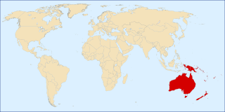
The following outline is provided as an overview and topical guide to Oceania.

The Manuʻa District is one of the three primary administrative divisions of American Samoa. The district comprises the Manuʻa Islands, which are located approximately 61 miles east of the main island, Tutuila. The Manuʻa District is considered to be a county-equivalent by the U.S. Census Bureau.
References
- 1 2 3 Alaska is composed of nineteen organized boroughs and the large Unorganized Borough, which for statistical purposes is divided into ten census areas. The census areas have no seat and no county-level government.
- ↑ "County Totals Dataset: Population, Population Change and Estimated Components of Population Change: April 1, 2010 to July 1, 2015". Archived from the original on July 8, 2016. Retrieved July 2, 2016.
- ↑ Administered by Hawaii Department of Health. Largest town is Kalaupapa, where most of the county's residents reside.
- 1 2 3 4 Borough of New York City, and as such has no county seat.
- ↑ https://www2.census.gov/geo/pdfs/reference/GARM/Ch4GARM.pdf States, Counties, and Statistically Equivalent Entities (Chapter 4). Census.gov. Retrieved August 31, 2019.
- 1 2 https://www.census.gov/library/reference/code-lists/ansi/ansi-codes-for-states.html U.S. Census Bureau. Census Bureau Code Lists. American National Standards Institute (ANSI) Codes for States. Retrieved August 31, 2019.