Moody County | |
|---|---|
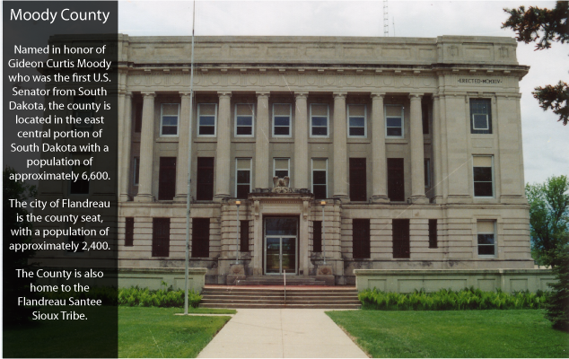
 The Moody County Courthouse in Flandreau | |
 Location within the U.S. state of South Dakota | |
 South Dakota's location within the U.S. | |
| Coordinates: 44°01′N96°40′W / 44.02°N 96.67°W | |
| Country | |
| State | |
| Founded | 1873 |
| Named after | Gideon C. Moody |
| Seat | Flandreau |
| Largest city | Flandreau |
| Area | |
• Total | 521 sq mi (1,350 km2) |
| • Land | 519 sq mi (1,340 km2) |
| • Water | 1.4 sq mi (4 km2) 0.3% |
| Population (2020) | |
• Total | 6,336 |
• Estimate (2023) | 6,529 |
| • Density | 12/sq mi (4.7/km2) |
| Time zone | UTC−6 (Central) |
| • Summer (DST) | UTC−5 (CDT) |
| Congressional district | At-large |
| Website | www |
Moody County is a county in the U.S. state of South Dakota, United States. The population was 6,336 at the 2020 census. [1] Its county seat is Flandreau. [2] The county is named for Gideon C. Moody. [3]
