Neasden is a suburban area in northwest London, England. It is located around the centre of the London Borough of Brent and is within the NW2 (Cricklewood) and NW10 (Willesden) postal districts. Neasden is near Wembley Stadium, the Welsh Harp, and Gladstone Park; the reservoir and River Brent marks its boundaries with Kingsbury and Wembley, while Gladstone Park and the Dudding Hill line separates it from Dollis Hill and Church End respectively. The A406 North Circular Road runs through the middle of Neasden; to the west is the Neasden Underground Depot, Brent Park retail area and the St Raphael's Estate; on the east is Neasden tube station, the large Neasden Temple, and former Neasden Power Station. The area is known as the place where Bob Marley lived after moving from Jamaica, living at a house in The Circle; the house was honoured with a blue plaque in 2012.
Subterranean London refers to a number of subterranean structures that lie beneath London. The city has been occupied by humans for two millennia. Over time, the capital has acquired a vast number of these structures and spaces, often as a result of war and conflict.

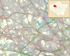
Dollis Hill is an area in northwest London, which consists of the streets surrounding the 35 hectares Gladstone Park. It is served by a London Underground station, Dollis Hill, on the Jubilee line, providing good links to central London. It is in the London Borough of Brent, close to Willesden Green, Neasden and Cricklewood, and is in the postal districts of NW2 and NW10

Down Street, also known as Down Street (Mayfair), is a disused station on the London Underground, located in Mayfair, west London. The Great Northern, Piccadilly and Brompton Railway opened it in 1907. It was latterly served by the Piccadilly line and was situated between Dover Street (now named Green Park) and Hyde Park Corner stations.
Brompton Road is a disused station on the Piccadilly line of the London Underground, located between Knightsbridge and South Kensington stations.

Kingsway telephone exchange was a Cold War-era hardened telephone exchange underneath High Holborn in London. Initially built as a deep-level air-raid shelter in the early 1940s, it was instead used as a government communications centre. In 1949 the General Post Office (GPO) took over the building, and in 1956 it became the UK termination point for TAT-1, the first transatlantic telephone cable. Closure of the facility began in the 1980s. It was built together with underground exchanges in Birmingham and Manchester, and was originally covered by a D-Notice.
A number of military citadels are known to have been constructed underground in central London, dating mostly from the Second World War and the Cold War. Unlike traditional above-ground citadels, these sites are primarily secure centres for defence coordination.

The Marsham Towers were three government buildings at the corner of Marsham Street and Great Peter Street in Westminster, London. They served as the headquarters of the Department of the Environment.

RAF Daws Hill was a Ministry of Defence site, located near High Wycombe and Flackwell Heath, in Buckinghamshire, England, close to the M40 motorway.

The Churchill War Rooms is a museum in London and one of the five branches of the Imperial War Museum. The museum comprises the Cabinet War Rooms, a historic underground complex that housed a British government command centre throughout the Second World War, and the Churchill Museum, a biographical museum exploring the life of British statesman Winston Churchill.

The Post Office Research Station was first established as a separate section of the General Post Office in 1909.

The Hack Green Secret Nuclear Bunker is a former government-owned nuclear bunker located at Hack Green, Cheshire, England.

RAF Rudloe Manor, formerly RAF Box, was a Royal Air Force station north-east of Bath, England, between the settlements of Box and Corsham, in Wiltshire. It was one of several military installations in the area and covered three dispersed sites. Parts of the site are now used by Defence Digital within the MoD Corsham complex; other areas are vacant and some have been sold, including the 17th-century manor house, Rudloe Manor.
Regional seats of government or RSGs were the best known aspect of Britain's civil defence preparations against nuclear war. In fact, however, naming conventions changed over the years as strategies in Whitehall changed.

The Kelvedon Hatch Secret Nuclear Bunker at Kelvedon Hatch, in the Borough of Brentwood in the English county of Essex, is a large underground bunker maintained during the Cold War as a potential regional government headquarters. Since being decommissioned in 1992, the bunker has been open to the public as a tourist attraction, with a museum focusing on its Cold War history.

Barnton Quarry is a disused stone quarry in Corstorphine Hill, Clermiston, Edinburgh, Scotland. The site was later used as a military command centre, and is now being converted into a museum.
Oxgate Admiralty Citadel is the name given to a military bunker constructed between 1937 and 1940, for the Admiralty, on the corner of Edgware Road and Oxgate Lane, in north London.
HMS Badger was a shore establishment of the Royal Navy on the east coast of the United Kingdom. She was commissioned on 13 September 1939 was the flagship of the headquarters of the Flag Officer in Charge (FOIC), Harwich who was responsible to Commander-in-Chief, The Nore, and was decommissioned on 21 October 1946, although the Operations Room remained as the Emergency Port Control for the Harwich area. The site was Parkeston Quay, now Harwich International Port, and the bunker lies under Hamilton House, currently an occupational health centre, close to the entrance to Harwich International Port, a few miles west of Harwich.

Royal Air Force Holmpton or more simply RAF Holmpton is a former Royal Air Force Cold War era nuclear bunker that was built in the 1950s as an early warning radar station as part of the ROTOR Radar Defence Programme. Located just south of the village of Holmpton, in the East Riding of Yorkshire, England, RAF Holmpton remained a part of the Defence Estate right up to 8 December 2014 when it was sold into private ownership after 62 years of military service.
Royal Air Force Portland or more simply RAF Portland is a former Royal Air Force and ROTOR radar station on the Isle of Portland, Dorset, England. Located close to the Verne Citadel and East Cliff, the station was established in the 1950s as part of a nationwide air defence radar system built by the British Government during the Cold War. The station became a scheduled monument in 2004 and is now the site of the community farm, Fancy's Family Farm.